|
|
|
|
|
| M7 A7 | Ipswich Motorway, Ipswich Road, Clem Jones Tunnel & East-West Arterial Road (M7 / A7) - Construction Photos |
Statistics:
Route Numbering:


General Information:
M7 / A7 is a significant route connecting the western and inner suburbs of Brisbane with Brisbane Airport. Between Gailes and Rocklea, the route is freeway standard, with the rest of the route being suburban arterial road quality. The route also features 2 freeway standard tunnels: Clem Jones Tunnel and Airport Link Tunnel.
Originally called the North-South Bypass Tunnel 2, the Clem Jones Tunnel (M7) links five existing major motorways and arterial roads on the north and south sides of the Brisbane River. The 6.8 kilometre tollway includes twin, 2–lane 4.8 kilometre tunnels. 3
Tolls are collected through a fully electronic tolling system that identifies motorists using the tunnel via an electronic tag fitted inside their vehicle or by taking a photograph of their number plate. 3
The route is named after Brisbane’s longest serving Lord Mayor, Clem Jone. He was responsible for Brisbane’s first town plan and established infrastructure such as sewerage, water and sealed road networks. He built new roads and developed city gardens, sporting fields and swimming pools. 3
Clem Jones passed away in 2007, aged 89. 3
Multiplexes along the route include:
History:
| Gailes to Hendra | Hendra to Gailes | |||
| Preview: | Description: | Preview: | Description: | |
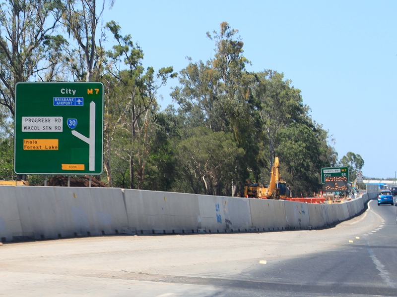 |
Advance Directional Sign: AD sign with temporary patches on Ipswich Mwy (M7) approaching Progress Rd (SR30) and Wacol Station Rd interchange at Wacol, November 2009. Image © Rob Tilley |
 |
Project Sign: Project sign on Ipswich Mwy (M7) at Darra, August 2009. Image © Rob Tilley |
|
 |
Distance Sign: Temporary reassurance directional sign at Wacol, November 2009. Image © Rob Tilley |
 |
Centenary Highway: ID sign on Ipswich Mwy (M7) at Centenary Hwy (M5) interchange at Darra, August 2009. Image © Rob Tilley |
|
 |
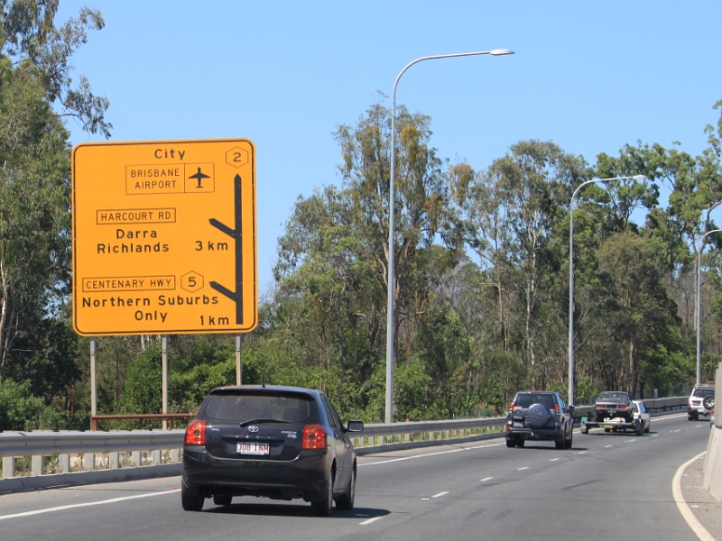
Wacol Station Road & Progress Road: Ipswich Mwy (M7) at the interchange with Wacol Stn Rd and Progress Rd (SR30) at Wacol, November 2009. Image © Rob Tilley |
 |
Worksite Warning Sign: Special worksite warning sign on Ipswich Mwy (M7) near Centenary Hwy (M5) interchange at Darra, August 2009. Image © Rob Tilley |
|
 |
Granard Road Interchange: Inbound on Ipswich Mwy (then Metroad 2), at the construction zone for the Granard Rd (Metroad 2) interchange at Rocklea, October 2005. Image © Paul Rands |
 |
Airport Link Tunnel Construction: the construction zone for the Airport Link Tunnel (M7) interchange from Stafford Rd (Metroad 5) at Kedron, October 2005. Image © Paul Rands |
|
 |
Granard Road Interchange: Inbound on Ipswich Mwy (then Metroad 2), at the construction zone for the Granard Rd (Metroad 2) interchange at Rocklea, October 2005. Image © Paul Rands |
|||
 |
Advance Directional Sign: AD sign with incorrect Metroad shields at Wacol for the Centenary Hwy (M5) and Harcourt Rd interchanges, November 2009. Image © Rob Tilley |
|||
 |
Distance Sign: Temporary reassurance directional sign at Wacol, November 2009. Image © Rob Tilley |
|||
 |
Centernary Highway: ID signs at the interchange with Centenary Hwy (M5) at Darra, November 2009. Image © Rob Tilley |
|||
1 Transport & Main Roads, Queensland state-controlled roads and region maps, Metropolitan Region: east
2 Leighton Contractors, Clem Jones Tunnel
3 River City Motorway, About The CLEM7
4 Tyler Bullock
5 Transport and Main Roads, from corresondence from April 2012
6 Queensland Times, Motorway speed limit cut to 90kmh, 9 December 2004
7 Queensland Government, Ministerial Media Statements, New Airport Flyover Open to Motorists A Year Early, 4 November 2010,
8 Queensland Government, Ministerial Media Statements, Demolition begins on old Gateway Motorway Overpass, 2 June 2010.
9 Queensland Government, Ministerial Media Statements, New Airport Flyover Open, 8 November 2010.
10 Queensland Government, Ministerial Media Statements, New intersection opens ahead of schedule, 30 May 2011.
Last updated: 05-Feb-2019 22:40
This site © Paul Rands. All rights reserved. Some portions © (copyright) by their respective and credited owners. Permission must be obtained before using any images from this site. For details, please email by clicking here.