|
|
|
|
|
| M5 A5 | Legacy Way, Western Freeway & Centenary Highway (M5 / A5) - Springfield to Purga |
Statistics:
Route Numbering:
General Information:
The Centenary Highway is a limited access road in the western suburbs of Brisbane. The M5 section of the route is 21 kilometres in length and starts at Springfield Central at the interchange with Augusta Parkway and Sinnathamby Boulevard to eventually join up with the Western Freeway. West of the interchange, the Centenary Highway is numbered A5 to the interchange with the Cunningham Highway (NH15) and Ipswich-Boonah Road (SR93), a distance of 18 km.
History:
| Springfield to Purga | Purga to Springfield | |||
| Preview: | Description: | Preview: | Description: | |
 |
Westbound at Spring mountain: Centenary Hwy (A5) as it head west through Spring Mountain, August 2009. Image © Rob Tilley |
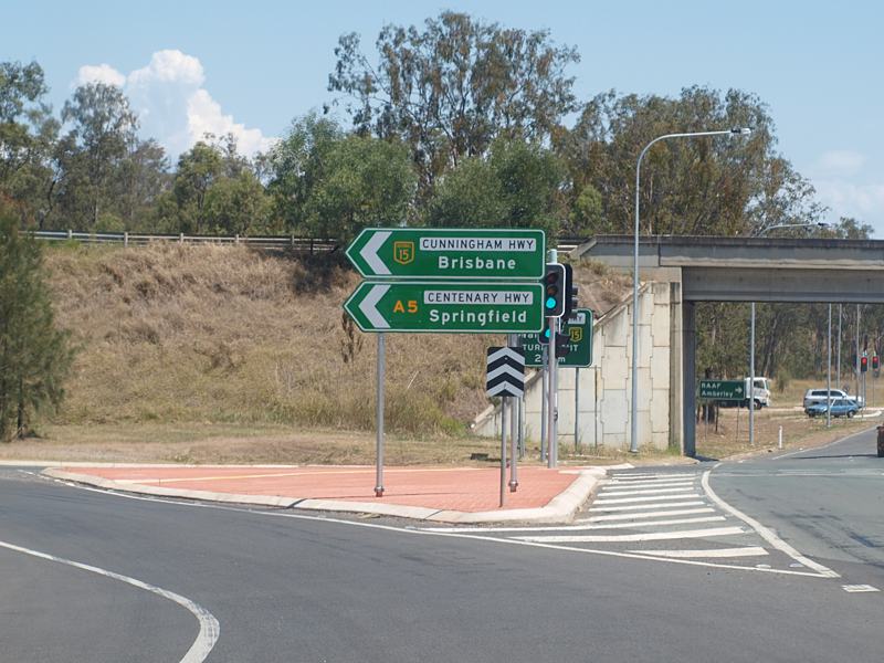 |
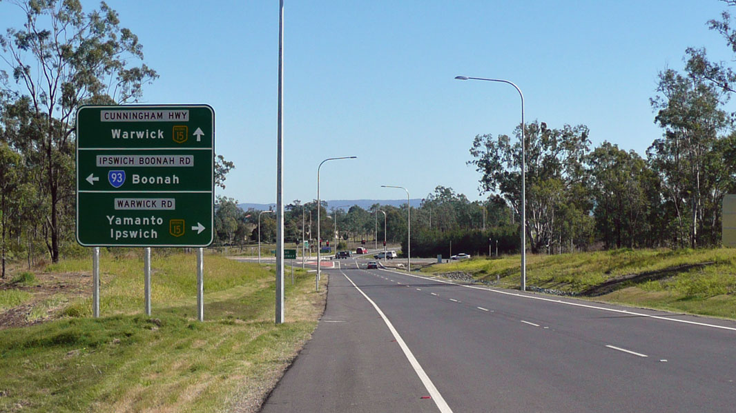
Intersection Directional Sign : ID sign assembly at the interchange with Warwick Rd, Ipswich-Boonah Rd (SR93) and Cunningham Hwy (NH15 / M15) at Yamanto, October 2009. Image © Rob Tilley |
|
 |
Advance Directional sign: AD sign at White Rock, August 2009. This roundabout had no connecting roads when this photo was taken. Note the incorrect Metroad shield on the route number. Image © Rob Tilley |
 |
Advance Directional Sign: AD sign on Centenary Hwy (A5) at Yamanto approaching the ramp to Cunningham Hwy (M15 (former NH15)), October 2009. Image © Rob Tilley |
|
 |
Intersection Directional Sign: ID sign at the roundabout in White Rock, August 2009. This roundabout had no connecting roads when this photo was taken. Note the incorrect Metroad shield on the route number. Image © Rob Tilley |
 |
Advance Directional Sign: AD sign at Deebing Heights approaching South Deebing Ck Rd roundabout, October 2009. Image © Rob Tilley |
|
 |
Westbound at South Ripley: Centenary Hwy (A5) as it passes through South Ripley, August 2009. Image © Rob Tilley |
 |
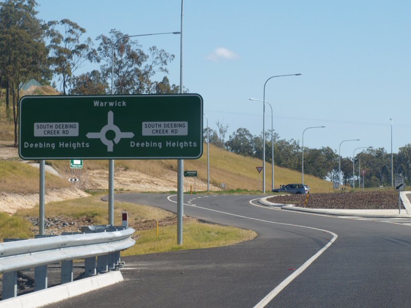
South Deebing Creek Road: Intersection directional sign at the roundabout with Centenary Hwy (A5) and South Deebing Ck Rd at Deebing Heights, October 2009. Image © Rob Tilley |
|
 |
Advance Directional Sign: AD sign approaching the roundabout with Ripley Road in South Ripley, August 2009. Note the incorrect Metroad shield on the route number. Image © Rob Tilley |
 |
South Deebing Creek Road: Intersection directional sign at the roundabout with Centenary Hwy (A5) and South Deebing Ck Rd at Deebing Heights, October 2009. Image © Rob Tilley |
|
 |
Intersection Directional Sign: Southbound ID sign on Ripley Road, adjacent to the roundabout with Centenary Hwy (A5), August 2009. Image © Rob Tilley |
 |
Advance Directional Sign: AD sign approaching the roundabout with Ripley Rd at Ripley, October 2009. Image © Rob Tilley |
|
 |
ID Sign: Intersection directional sign at South Ripley on the western side of the roundabout with Ripley Rd, August 2009. Note the incorrect Metroad shield on the route number. Image © Rob Tilley |
 |
Ripley Road: ID sign at the Ripley Rd roundabout at Ripley, October 2009. Image © Rob Tilley |
|
 |
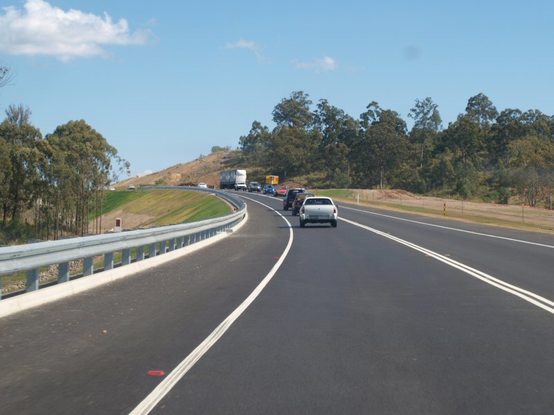
Westbound at South Ripley: Centenary Hwy (A5) as it passes through South Ripley, August 2009. Image © Rob Tilley |
 |
Ripley Road: ID sign at the Ripley Rd roundabout at Ripley, October 2009. Image © Rob Tilley |
|
 |
Westbound at Deebing Heights: Centenary Hwy (A5) approaching Deebing Creek at Deebing Heights, August 2009. Image © Rob Tilley |
 |
Advance Directional Sign: AD sign on Centenary Hwy (A5) approaching a roundabout built for a future subdivision at White Rock, October 2009. Image © Rob Tilley |
|
 |
Intersection Directional Sign: ID sign approaching South Deebing Creek Road in Deebing Heights, August 2009. Note the missing route number. Image © Rob Tilley |
 |
Blank Sign: Blank ID sign on Centenary Hwy (A5) at a roundabout built for access to a future subdivision at White Rock, October 2009. Image © Rob Tilley |
|
 |
Intersection Directional Sign: Southbound ID sign on South Deebing Creek Road in Deebing Heights, adjacent to the roundabout with Centenary Hwy (A5), August 2009. Image © Rob Tilley |
 |
Intersection Directional Sign: ID sign on Centenary Hwy (A5) at a roundabout built for access to a future subdivision at White Rock, October 2009. Image © Rob Tilley |
|
 |
ID Sign: Intersection directional sign at South Ripley on the western side of the roundabout with Ripley Rd, August 2009. Note the missing route number. Image © Rob Tilley |
 |
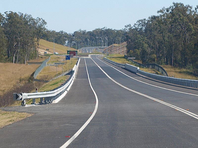
Woogaroo Creek: Centenary Hwy (A5) as it approaches Woogaroo Ck at Redbank Plains, October 2009. Image © Rob Tilley |
|
 |
Purga Split: At Purga, the Centenary Hwy (A5) splits into a divided road as it approaches the interchange with Ipswich-Boonah Rd (SR93) and Cunningham Hwy (NH15), August 2009. Image © Rob Tilley |
 |
Advance Directional Sign: AD sign showing incorrect Metroad A5 shield approaching Augusta Parkway at Spring Mountain, October 2009. Image © Rob Tilley |
|
 |
Supplemental Advance Directional Sign: Supplemental AD sign at Springfield Lakes approaching the interchange with Springfield-Greenbank Arterial Road, June 2009. Image © Michael Greenslade |
 |
Supplemental Advance Directional Sign: Supplemental AD sign approaching Augusta Parkway at Spring Mountain, October 2009. Image © Rob Tilley |
|
 |
Intersection Directional Sign: ID sign assembly at Purga at the interchange with Ipswich-Boonah Road / Cunningham Highway, August 2009. Image © Rob Tilley |
 |
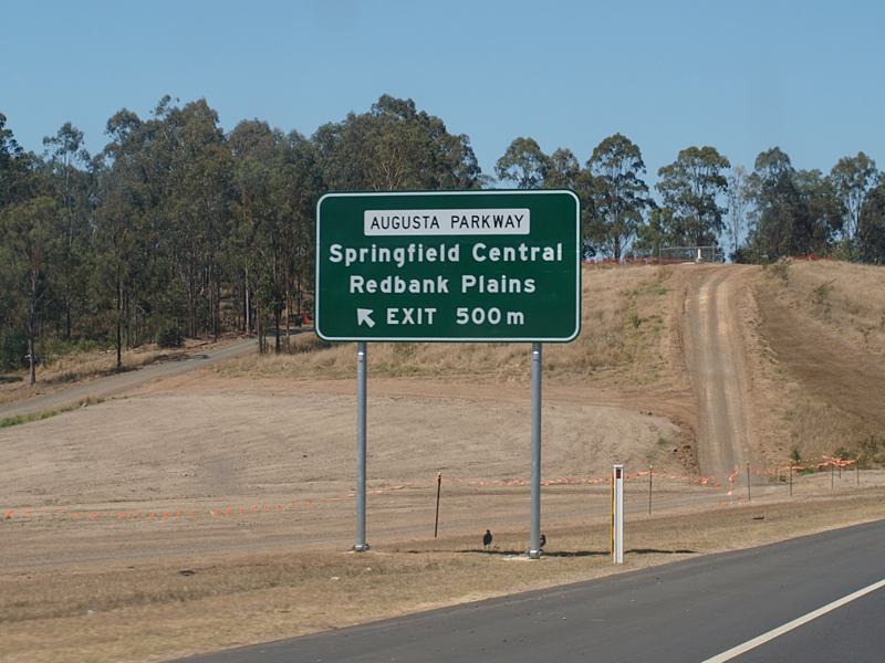
Augusta Parkway: Centenary Hwy (A5) at the Augusta Pkwy interchage at Spring Mtns, October 2009. Image © Rob Tilley |
|
 |
Intersection Directional Sign: ID sign at Purga at the interchange with Ipswich-Boonah Road, August 2009. Image © Rob Tilley |
|||
| Click here for the continuation of A5 between Darra and Springfield | ||||
1 Queensland Department of Transport and Main Roads, Centenary Highway Extension: Springfield to Yamanto Web Site
Last updated: 05-Feb-2019 22:56
This site © Paul Rands. All rights reserved. Some portions © (copyright) by their respective and credited owners. Permission must be obtained before using any images from this site. For details, please email by clicking here.