|
|
|
|
|
| M3 A3 | Pacific Motorway, Coronation Drive, Hale Street, Inner City Bypass, Bowen Bridge Road, Lutwyche Road, Gympie Road & Gympie Arterial Road (M3 / A3) - Greenslopes to Brisbane |
Statistics:
Route Numbering:


General Information:
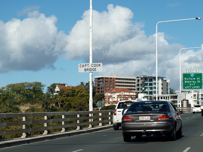
The Pacific Motorway once had 2 names, the bridges and interchanges in the Brisbane CBD was called the Riverside Expressway and the freeway south of the CBD was known as the South East Freeway. The South East Freeway and Riverside Expressway were two of the early projects to be completed from the Wilbur Smith "Brisbane Transportation Study", which was published in 1965 and made recommendations covering sixteen years to 1981. 2The Captain Cook Bridge is the third crossing of the Brisbane River. It crosses at the South Brisbane Reach of the river, and links Gardens Point to Woolloongabba. It carries four lanes of traffic in either direction.
History:
| Greenslopes to Brisbane | Brisbane to Greenslopes | |||
| Preview: | Description: | Preview: | Description: | |
 |
Clem Jones Tunnel Interchange: Pacific Mwy (M3) at the Clem Jones Tunnel Interchange at Woolloongabba, June 2012. Image © Justin Cozart |
 |
Parking Zone Sign: Default parking zone limit sign on Hale St (M3) at Petrie Terrace, March 2012. Note the sign refers to Lang Park, which was renamed to Suncorp Stadium in 1994. Image © Paul Rands |
|
 |
Advance Directional Sign: AD sign approaching Stanley St (SR41) interchange at Woolloongabba, March 2010. Image © Rob Tilley |
 |
Intersection
Directional Sign: ID sign on Musgrave Rd (SR31), Brisbane approaching Hale St (M3), June 2009. Image © Rob Tilley |
|
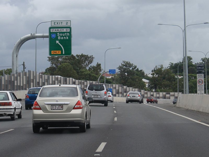 |
Advance Directional Sign: AD sign approaching Stanley St (SR41) interchange at Woolloongabba, March 2010. Image © Rob Tilley |
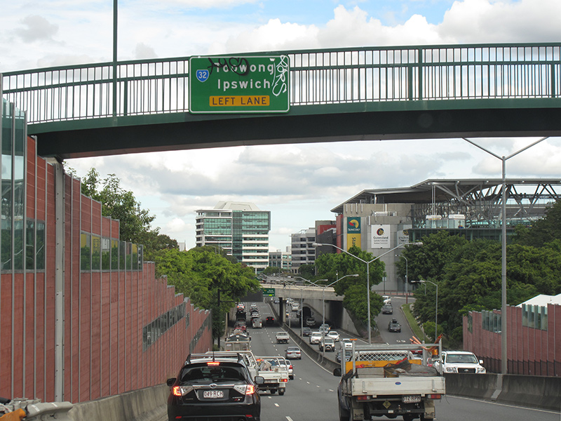 |
Advance
Directional Sign: AD sign in Brisbane, approaching Milton Rd (SR32), June 2012. Image © Justin Cozart |
|
 |
Stanley Street Interchange: Pacific Mwy (M3) at the Stanley St (SR41) interchange in Woolloongabba, June 2012. Image © Justin Cozart |
 |
Advance
Directional Sign: AD signs on the Caxton St bridge in Brisbane, approaching Milton Rd (SR32), March 2013. Click here for a photo of this area by Rob Tilley from June 2009. The sign alterations are a result of the Clem 7 tunnel roadworks. Image © Paul Rands |
|
 |
Dangerous Goods Sign: Dangerous goods prohibition sign for the CBD, Woolloongabba, June 2012. Image © Justin Cozart |
 |
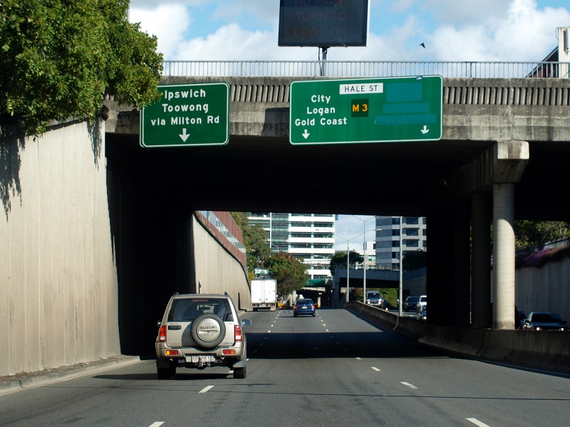
Milton Road: Hale St (M3) at the Milton Rd (SR32) interchange at Petrie Terrace, March 2012. Image © Paul Rands |
|
 |
Advance
Directional Signs: AD signs over the lanes of the Captain Cook Bridge, over the Brisbane River, Brisbane CBD, February 2009. Image © Rob Tilley |
 |
Advance Directional Sign: AD sign on the off ramp to Milton Rd (SR32) at Petrie Terrace, March 2012. Image © Paul Rands |
|
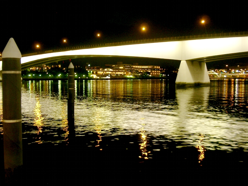 |
Captain
Cook Bridge: Night view of the Captain Cook Bridge from the Brisbane River, looking northeast, July 2004. Image © Paul Rands |
 |
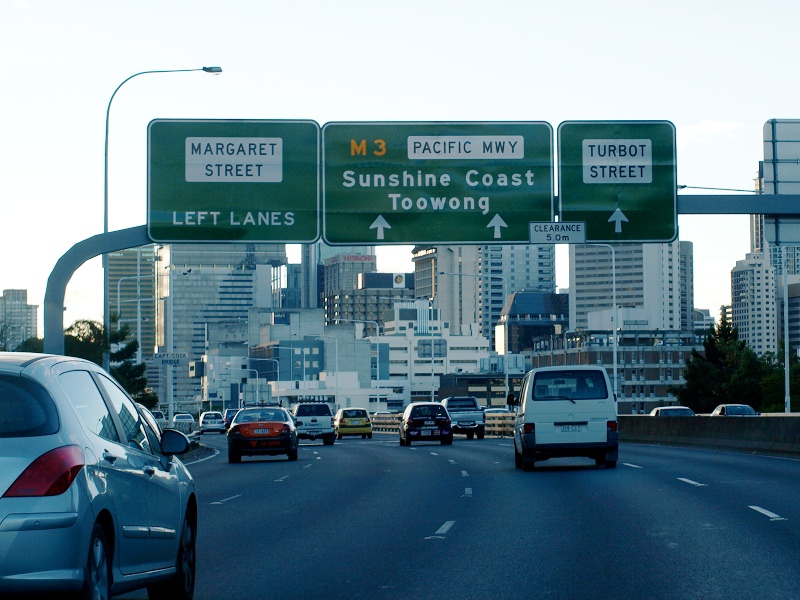
Advance
Directional Sign: AD signs on the Milton Rd (SR32) bridge in Brisbane, approaching Coronation Dr (SR33 / M3), June 2009. The sign alterations are a result of the Clem 7 tunnel roadworks. Image © Rob Tilley |
|
 |
Advance
Directional Sign: AD sign on the Pacific Motorway (formerly Riverside Expressway) for the Margaret Street interchange, February 2009. Image © Rob Tilley |
 |
Advance
Directional Sign: AD sign on Coronation Dr (M3) approaching Eagle Tce in Brisbane, June 2009. Image © Rob Tilley |
|
 |
Pacific
Motorway Northbound: Looking northbound along the Pacific Mwy (formerly Riverside Expwy) in Brisbane, from the Victoria Bridge (which carries Melbourne St), March 2006. Image © Paul Rands |
 |
Intersection
Directional Signs: Signs near Makerston Street, over the lanes for North Quay and Pacific Motorway (former Riverside Expressway) in Brisbane, June 2009. Image © Rob Tilley |
|
 |
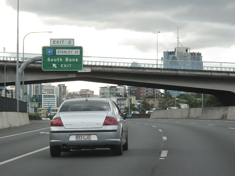
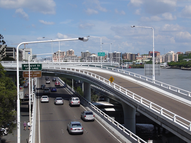
Margaret
Street Exit: M3 at the Margaret St interchange, June 2012. Click here for a photo of this area by Rob Tilley from February 2009. Image © Justin Cozart |
 |
North
Quay and Pacific Motorway Access: Southbound through the Brisbane CBD near Tank Street, with North Quay on the left of the traffic island, and access to the Pacific Motorway on the right hand side, June 2009. Image © Rob Tilley |
|
 |
Advance
Directional Sign: AD sign for the Elizabeth St interchange, June 2012. Image © Justin Cozart |
 |
Victoria
Bridge: Looking south towards Victoria Bridge (which carries Melbourne St traffic), March 2006. Image © Paul Rands |
|
 |
Elizabeth
Street Exit: M3 at the Elizabeth St interchange in Brisbane CBD, June 2012. Image © Justin Cozart |
 |
Advance
Directional Sign: Older style AD sign for the Elizabeth St off ramp on the Pacific Mwy (former Riverside Expwy), Brisbane, June 2009. Image © Rob Tilley |
|
 |
Freeway
Green Advance Directional Sign: Very old AD sign on George Street in Brisbane approaching Ann Street, which has an interchange with the Pacific Motorway (formerly Riverside Expressway), September 2007. This sign has since been replaced. Image © Paul Rands |
 |
Elizabeth
Street Off Ramp: Pacific Mwy as it passes through the interchange with Elizabeth St in the Brisbane CBD, June 2009. Image © Rob Tilley |
|
 |
Intersection
Directional Sign: ID sign over the lanes on Ann Street in Brisbane, May 2009. Image © Darren Hodges |
 |
Advance
Directional Sign: AD sign for the Margaret St exit. This sign replaced this one, taken in March 2009. Image © Rob Tilley |
|
 |
Freeway
Green Prohibition Sign: Very old freeway green sign indicating types of traffic not allowed on the Pacific Mwy, located on the interchange with Ann St in Brisbane, March 2006. Image © Paul Rands |
 |
Advance
Directional Sign: Pacific Mwy southbound over the Captain Cook Bridge, over the Brisbane River and AD sign for Vulture St / Stanley St (SR41) interchange, June 2009. Image © Rob Tilley |
|
 |
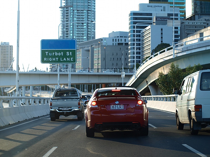
Advance
Directional Sign: AD sign approaching the Turbot St interchange in Brisbane, June 2012. Click here for a photo of the previous sign by Rob Tilley from February 2009. The empty blue panel used to show the direction to the airport, on the previous sign, was removed as quicker access can be gained using the Gateway Mwy (M1). Image © Justin Cozart |
 |
Captain
Cook Bridge: Name plate on the Captain Cook Bridge over the Brisbane River, June 2009. Image © Rob Tilley |
|
 |
Turbot
Street Exit: Turbot St interchange in Brisbane, June 2012. Click here for a photo of the previous sign by Rob Tilley from February 2009. The empty blue panel used to show the direction to the airport, on the previous sign, was removed as quicker access can be gained using the Gateway Mwy (M1). Image © Justin Cozart |
 |
Supplemental
AD sign: Supplemental advance directional sign approaching the Vulture St / Stanley St interchange (SR41), at Kangaroo Point, June 2009. Image © Rob Tilley |
|
 |
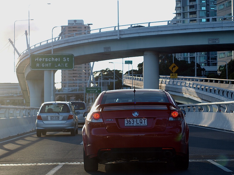
Advance
Directional Sign: AD sign for the Herschel Street exit in Brisbane, June 2012. Click here for a photo of the previous sign by Rob Tilley from February 2009. Image © Justin Cozart |
 |
Vulture
St / Stanley St Interchange: ID sign over the lanes of the Pacific Mwy in Kangaroo Point at the Vulture St & Stanley St (SR41) interchange, June 2009. Image © Rob Tilley |
|
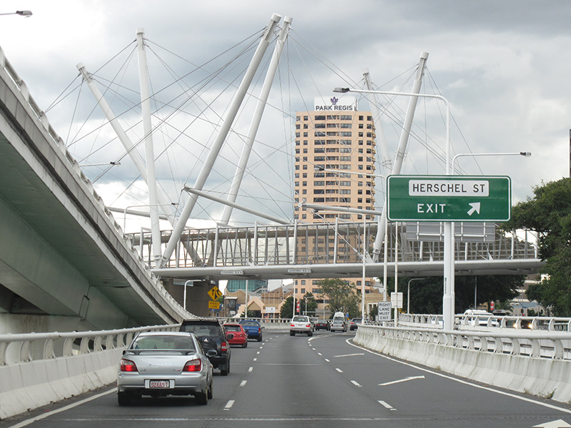 |
Herschel
Street Exit: Pacific Mwy as it passes through the Herschel St interchange in Brisbane CBD, June 2012. Click here for a photo of the previous sign by Rob Tilley from February 2009. Image © Justin Cozart |
 |
Vulture
Street and Stanley Street Interchange: Pacific Mwy, southbound at Kangaroo Point, through the Vulture St & Stanley St (SR41) interchange, June 2009. Image © Rob Tilley |
|
 |
Freeway
Green End of Motorway Sign: Older freeway green coloured End of Motorway sign, near the Herschel St exit in Brisbane, June 2012. Image © Justin Cozart |
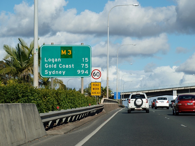 |
Freeway
Green RD Sign: Freeway green distance sign at Woolloongabba, near Hawthorne St overpass, June 2009. Image © Rob Tilley |
|
 |
Old
End of Expressway Sign: Possibly an original End of Expressway sign from the 1970s at the northern end of the Pacific Mwy (former Riverside Expwy) in Brisbane, February 2009. M3 continues as Coronation Drive at this point. Image © Rob Tilley |
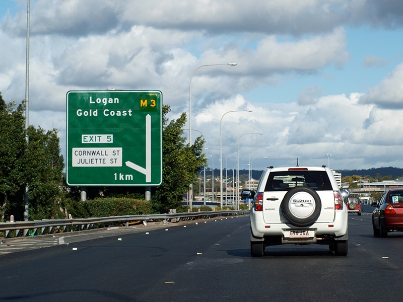 |
Advance
Directional Sign: Southbound AD sign at Woolloongabba approaching Cornwall and Juliette Streets, June 2009. Image © Rob Tilley |
|
 |
Advance
Directional Sign: AD signs on the William Jolly Bridge on Coronation Dr (M3) in Brisbane, February 2009. Image © Rob Tilley |
 |
Supplemental Advance
Directional Sign: Supplemental AD sign at Woolloongabba approaching Cornwall and Juliette Streets, March 2010. Image © Rob Tilley |
|
 |
Coronation
Drive / Hale Street Split: Intersection directional assembly over the lanes of Coronation Dr as it becomes SR33. M3 veers right, onto Hale St. Brisbane, June 2012. Image © Justin Cozart |
 |
Supplemental
Advance Directional Sign: Southbound supplemental AD sign at Woolloongabba approaching Cornwall and Juliette Streets, June 2009. Image © Rob Tilley |
|
 |
Intersection
Directional Sign: Southbound ID sign at Woolloongabba at the Cornwall and Juliette Streets interchange, March 2010. Click here for a photo of the sign this one replaced from June 2009. Image © Rob Tilley |
|||
 |
Advance Directional
Sign : AD sign on the Cornwall St and Juliette St interchange approaching Marquis St at Woolloongabba, August 2009. Note the SR15 shield, SR15 should be coverplated with A7. Image © Rob Tilley |
|||
 |
Cornwall Street
& Marquis Street: Intersection directional sign at the interchange with Cornwall St and Marquis St in Woolloongabba, August 2009. Image © Rob Tilley |
|||
 |
Advance Directional
Sign : AD sign at Greenslopes on Marquis St approaching Juliette St, August 2009. Image © Rob Tilley |
|||
 |
Juliette Street: Looking south at the Juliette St interchange at Greenslopes, August 2009. Image © Rob Tilley |
|||
| Click
here for the continuation of M3 / A3 between Brisbane and Aspley Click here for the continuation of M3 between Greenslopes and Eight Mile Plains |
||||
1 State
Road Network of Queensland Map, 30 June 2008
2 Queensland Roads, March 2009
3 The 200 km City Web Site
4 Queensland
Roads, Edition No. 4, Sept 07
5 Redcliffe City Library
6 Queensland State Archives, 1972 Cabinet Minutes
7 Queensland State Archives, 1975 Cabinet Minutes Historian's Report
8 Queensland State Archives, 1976 Cabinet Minutes
9 Brisbane
City Council Annual
Report 06-07
10 Busway Website History Web Page
11 Michael Greenslade
Last updated: 07-Feb-2019 21:39
This site © Paul Rands. All rights reserved. Some portions © (copyright) by their respective and credited owners. Permission must be obtained before using any images from this site. For details, please email by clicking here.