|
|
|
|
|
| M2 A2 | Gateway Motorway, Logan Motorway, Ipswich Motorway, Warrego Highway, Landsborough Highway & Barkly Highway (M2/A2) - Winton to Northern Territory Border |
Statistics:
Route Numbering:


General Information:
M/A2 is the main link from Brisbane to the northern territory. It varies from motorway standard in the Brisbane metropolitain area, to dual carriageway rural highway standard between Brisbane and Toowoomba, and rural highway standard beyond Toowoomba. The route is the only sealed link between Flinders Highway and Capricorn Highway apart from Gregory Development Road between Emerald and Charters Towers.
The Landsborough Highway runs through vast tracts of land that was once occupied by William Landsborough, an Australian explorer of the 19th century. The Barkly Highway is the only major route connecting Queensland and the Northern Territory.
The route features ALT-A2, an alternate route via the town centre of Charleville. ALT-A2 is formed by Warrego Hwy and Mitchell Hwy. Charleville is important town in the southern centre of Queensland. Through traffic follows A2 via Landsborough Highway from Morve to Augathellla.
Multiplexes along the route include:
History:
| Winton to NT Border | NT Border to Winton | |||
| Preview: | Description: | Preview: | Description: | |
 |
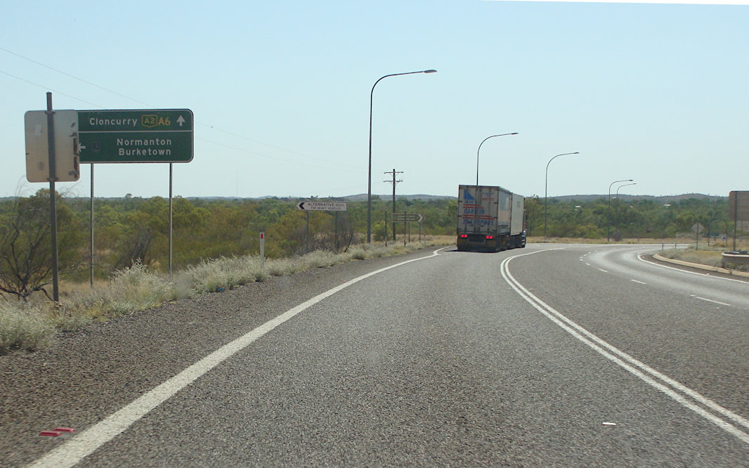
Touring Route Signage: Sign at Cloncurry approaching Burke Dev Rd (NR83) indicating which route numbers to follow for touring routes, June 2018. Image © Dean Sherry |
 |
QLD / NT Border: Barkly Hwy as it crosses from Northern Territory into Queensland at Camooweal, November 2016. NH66 changes to A2 at this location. Image © Paul Rands |
|
 |
Advance Directional Sign: AD sign at Cloncurry approaching Burke Dev Rd (NR83), June 2018. The NR83 duplex starts here. Image © Dean Sherry |
 |
Reassurance Directional Sign: Distance sign after crossing the border at Camooweal, November 2016. Image © Paul Rands |
|
 |
Reassurance Directional Sign: Distance sign at Cloncurry, June 2018. Image © Dean Sherry |
 |
Road Conditions Sign: Electronic road conditions sign at Camooweal, November 2016. Image © Paul Rands |
|
 |
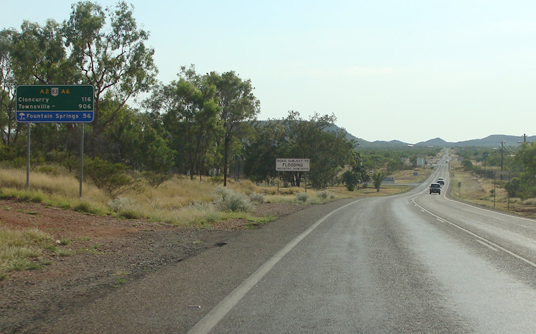
Touring Route Signage: Sign at Cloncurry indicating which route number to follow for touring routes, June 2018. Image © Dean Sherry |
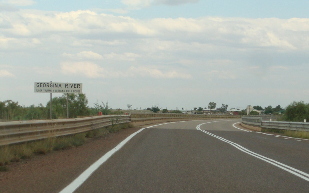 |
Georgina River / Ilaga Thuwani: Barkly Hwy (A2) as it crosses Georgina River / Ilaga Thuwani at Camooweal, November 2016. Image © Paul Rands |
|
 |
Advance Directional Sign: AD sign at Cloncurry approaching Cloncurry-Duchess Rd, June 2018. Note the missing NR83 shield. Image © Dean Sherry |
 |
Camooweal: Barkly Hwy (A2) as it passes through the town of Camooweal, November 2016. Image © Paul Rands |
|
 |
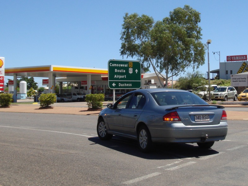
Cloncurry-Duchess Road: Corner of Barkly Hwy (A2 / NR83) and Cloncurry-Duchess Rd at Cloncurry, June 2018. Image © Dean Sherry |
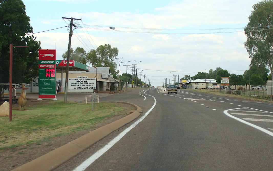 |
Camooweal: Barkly Hwy (A2) as it passes through the town of Camooweal, November 2016. Image © Paul Rands |
|
 |
Reassurance Directional Sign: Distance sign at Cloncurry, June 2018. Note the missing NR83 shield. Image © Dean Sherry |
 |
Advance Directional Sign: AD sign at Camooweal approachng Gregory Downs-Camooweal Rd (SR76), November 2016. Note the missing route number. Image © Paul Rands |
|
 |
Advance Directional Sign: AD sign at Mt Isa approaching Lake Julius Rd, June 2018. Image © Dean Sherry |
 |
regory Downs-Camooweal Road: Corner of Barkly Hwy (A2) and regory Downs-Camooweal Rd (SR76) at Camooweal, November 2016. Image © Paul Rands |
|
 |
Touring Route Signage: Sign at Mt Isa indicating which route number to follow for touring routes, June 2018. Image © Dean Sherry |
 |
Advance Directional Sign: AD sign at Gunpowder approaching Thorntonia-Yelvertoft Rd, November 2016. Image © Paul Rands |
|
 |
Advance Directional Sign: AD sign on Barkly Hwy (A2 / NR83) approaching Marian St (former Barkly Hwy alignment) in Mt Isa, March 2012. Image © Paul Rands |
 |
Intersection Directional Sign: Poorly designed ID sign facing the WW2 Airstrip rest area at Gunpowder, November 2016. Image © Paul Rands |
|
 |
Advance Directional Sign: AD sign on Barkly Hwy (A2 / NR83) approaching Marian St (former Barkly Hwy alignment) in Mt Isa, November 2016. Image © Paul Rands |
 |
Entering Mount Isa: Barkly Hwy (A2) as it enters the town of Mt Isa, November 2016. Image © Paul Rands |
|
 |
Advance Directional Sign: AD sign on Barkly Hwy (A2 / NR83) near Simpson St, approaching Camooweal St in Mt Isa, March 2012. Image © Paul Rands |
 |
Advance Directional Sign: AD sign on Barkly Hwy (A2) approaching Diamantina Development Rd (NR83) at Mt Isa, March 2012. Image © Paul Rands |
|
 |
Advance Directional Sign: AD sign without route numbers approaching Camooweal St in Mt Isa, March 2012. Image © Paul Rands |
 |
Advance Directional Sign: AD sign on Barkly Hwy (A2) approaching Diamantina Development Rd (NR83) at Mt Isa, March 2012. The NR83 duplex begins here. Image © Paul Rands |
|
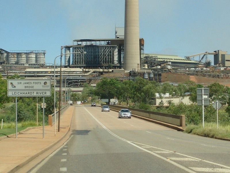 |
Leichhardt River: Barkly Hwy (A2 / NR83) as it crosses Leichhardt River via Sir James Foots Bridge in Mt Isa, March 2012. Image © Paul Rands |
 |
Leichhardt River: Barkly Hwy (A2 / NR83) as it crosses Leichhardt River via Sir James Foots Bridge in Mt Isa, March 2012. Image © Paul Rands |
|
 |
Advance Directional Sign: AD sign on Barkly Hwy (A2) approaching Diamantina Development Rd (NR83) at Mt Isa, March 2012. The NR83 duplex ends here. Image © Paul Rands |
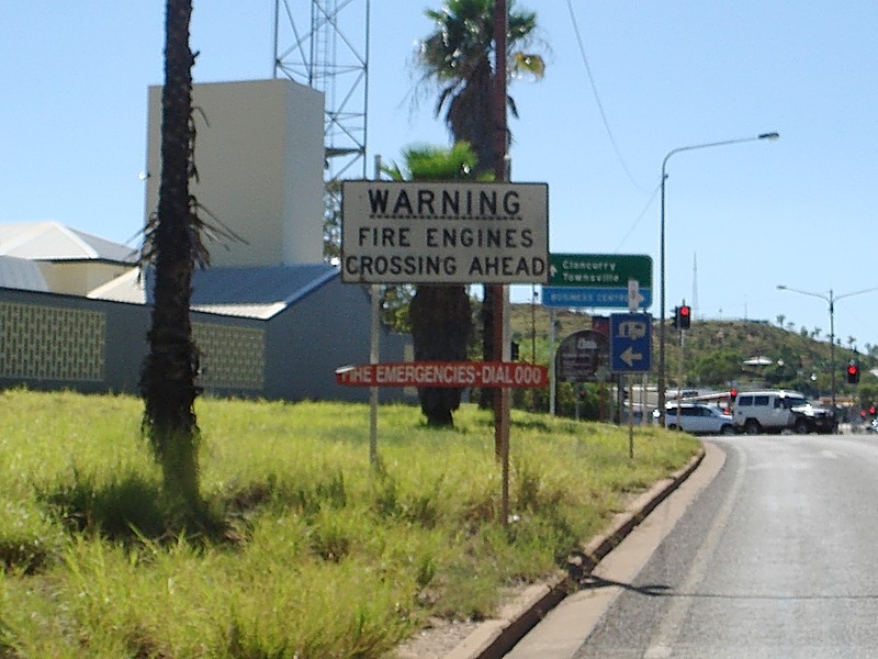 |
Fire Engines Sign: Old fire engines crossing sign in Mt Isa near West St, March 2012. Image © Paul Rands |
|
 |
Advance Directional Sign: AD sign at Mt Isa approaching George Fisher Mine, June 2018. Image © Dean Sherry |
 |
Advance Directional Sign: AD sign without route numbers approaching West St in Mt Isa, March 2012. Image © Paul Rands |
|
 |
Thorntonia-Yelvertoft Road: Corner of Barkly Hwy (A2) and Thorntonia-Yelvertoft Rd at Yelvertoft, June 2018. Image © Dean Sherry |
 |
Advance Directional Sign: AD sign approaching Duchess St in Mt Isa, March 2012. Despite A6 being shown, it does not run through Mt Isa. Image © Paul Rands |
|
 |
Advance Directional Sign: AD sign without route numbers approaching Camooweal St in Mt Isa, March 2012. Image © Paul Rands |
|||
 |
Reassurance Directional Sign: Distance sign at Pioneer (Mt Isa), November 2016. Image © Paul Rands |
|||
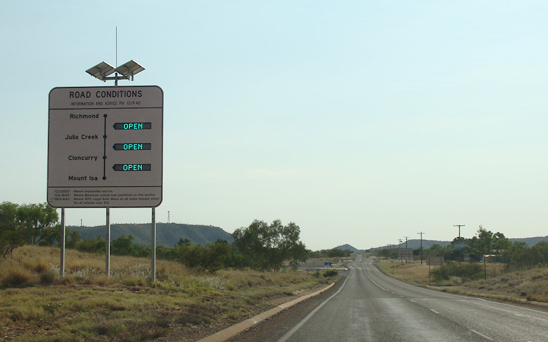 |
Road Conditions Sign: Electronic road conditions sign at Pioneer, November 2016. Image © Paul Rands |
|||
 |
Mary Kathleen: Barkly Hwy (A2 / NR83) as it passes through the Mary Kathleen area near Cloncurry, November 2016. Image © Paul Rands |
|||
 |
Mary Kathleen: Landsborough Hwy (A2 / NR83) as it passes through the Mary Kathleen area near Cloncurry, November 2016. Image © Paul Rands |
|||
 |
Advance Directional Sign: AD sign approaching Mary Kathleen Access Rd, November 2016. Image © Paul Rands |
|||
 |
Mary Kathleen Access Road: Corner of Barkly Hwy (A2 / NR83) and Mary Kathleen Access Rd at the former town of Mary Kathleen near Cloncurry, November 2016. Image © Paul Rands |
|||
 |
Cloncurry-Duchess Road: Corner of Barkly Hwy (A2 / NR83) and Cloncurry-Duchess Rd at Cloncurry, November 2016. Image © Paul Rands |
|||
 |
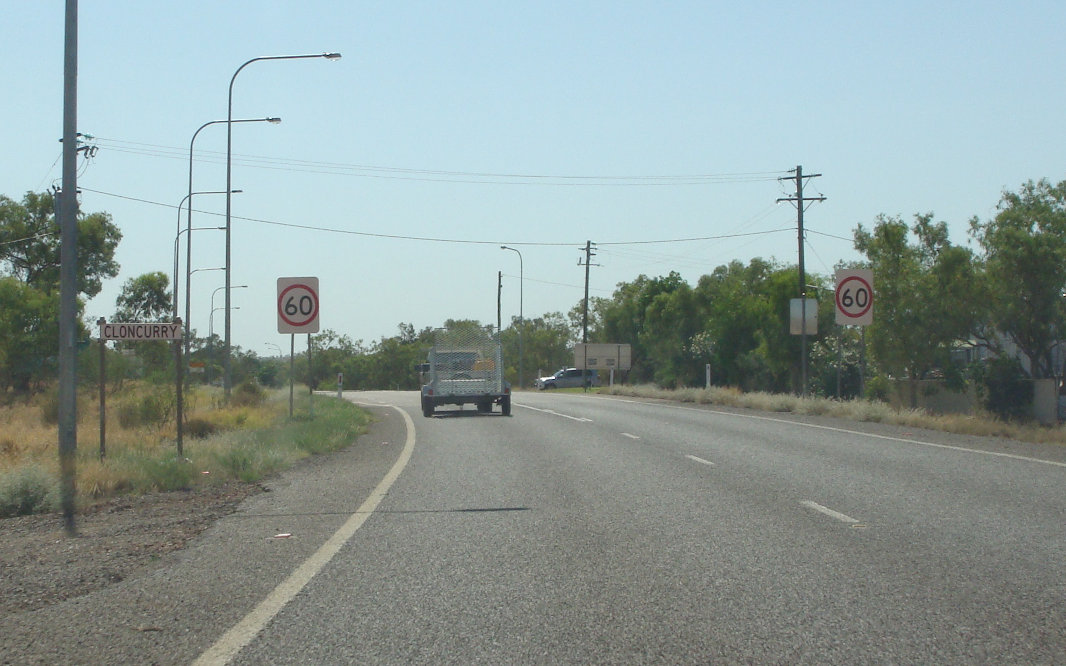
Services Sign: Services sign at Cloncurry, November 2016. Image © Paul Rands |
|||
 |
Heavy Vehicle Detour Sign: Custom heavy vehicle detour sign approaching Burke Development Rd (NR83) at Cloncurry, November 2016. Image © Paul Rands |
|||
 |
Advance Directional Sign: Advance Directional sign approaching Burke Development Rd (NR83) at Cloncurry, November 2016. Despite A6 being shown, it does not run through this location. Image © Paul Rands |
|||
 |
Burke Developmental Road: Corner of Barkly Hwy (A2) and Burke Dev Rd (NR83) at Cloncurry, June 2018. Click here for a photo of this location by Paul Rands from November 2016. The NR83 duplex ends here and A2 becomes Flinders Hwy at this location. Image © Dean Sherry |
|||
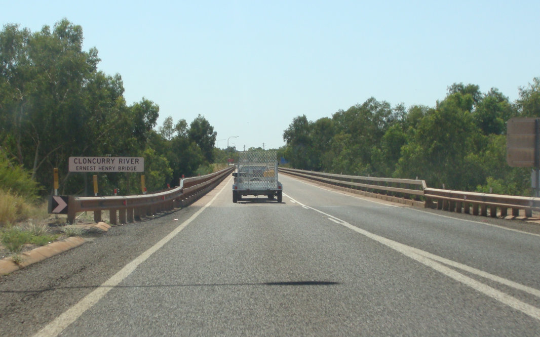 |
Cloncurry River: Flinders Hwy (A2) as it crosses Cloncurry River at Cloncurry, November 2016. Image © Paul Rands |
|||
 |
Cloncurry: Flinders Hwy (A2) as it enters the town of Cloncurry, November 2016. Image © Paul Rands |
|||
 |
Cloncurry River: Flinders Hwy (A2) as it crosses Cloncurry River at Cloncurry, November 2016. Image © Paul Rands |
|||
 |
Cloncurry: Flinders Hwy (A2) as it passes through the town of Cloncurry, November 2016. Image © Paul Rands |
|||
 |
Cloncurry: Flinders Hwy (A2) as it passes through the town of Cloncurry, November 2016. Image © Paul Rands |
|||
 |
Advance Directional Sign: AD sign at Cloncurry approaching Andrew Daniels Dr and Roundoak Rd, November 2016. Image © Paul Rands |
|||
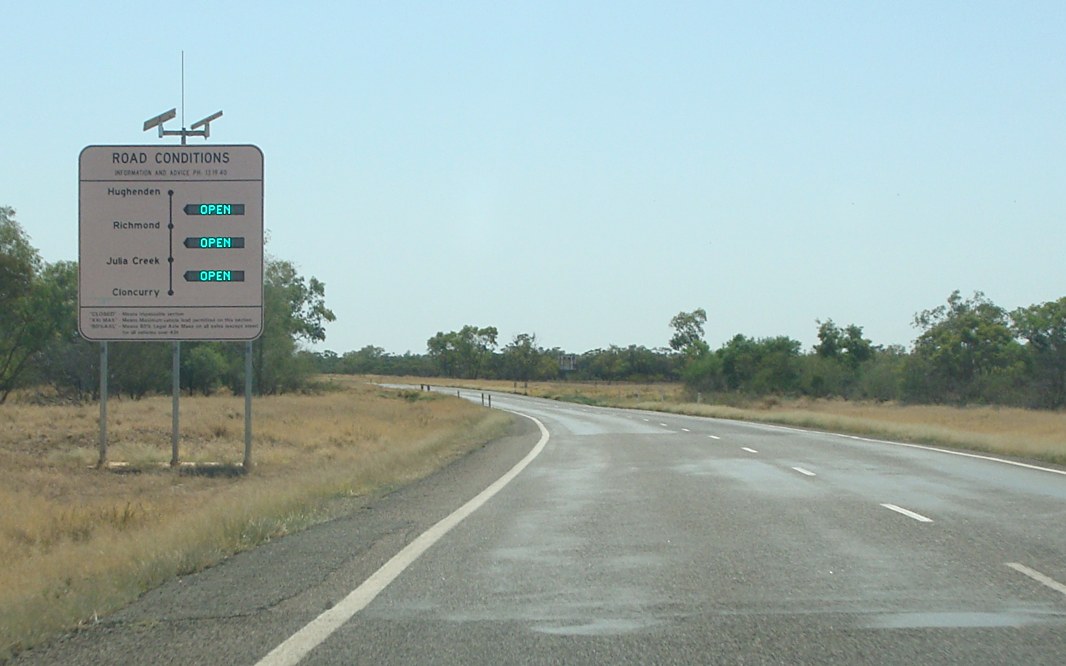 |
Road Conditions Sign: Electronic road conditions sign at Cloncurry, November 2016. Image © Paul Rands |
|||
 |
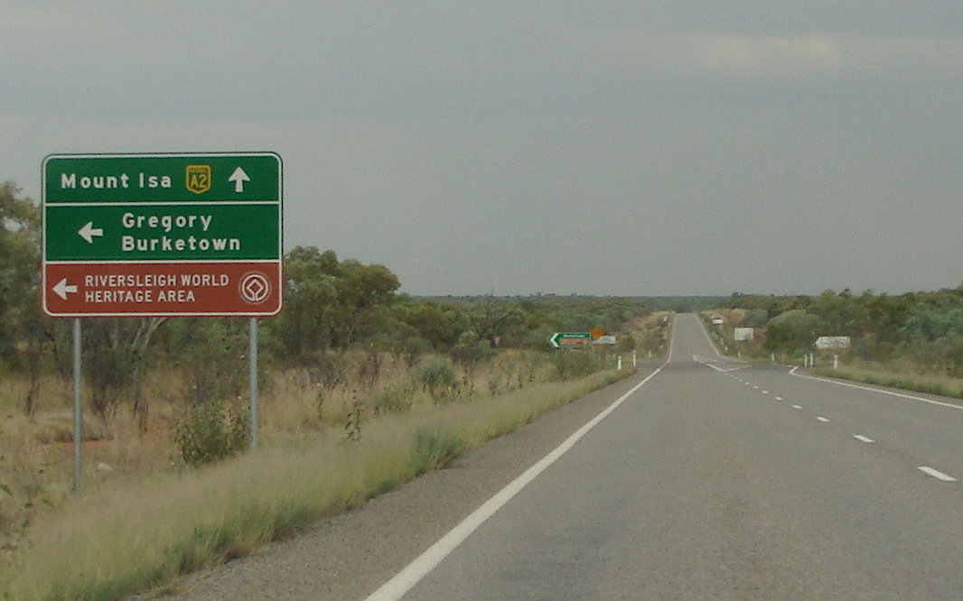
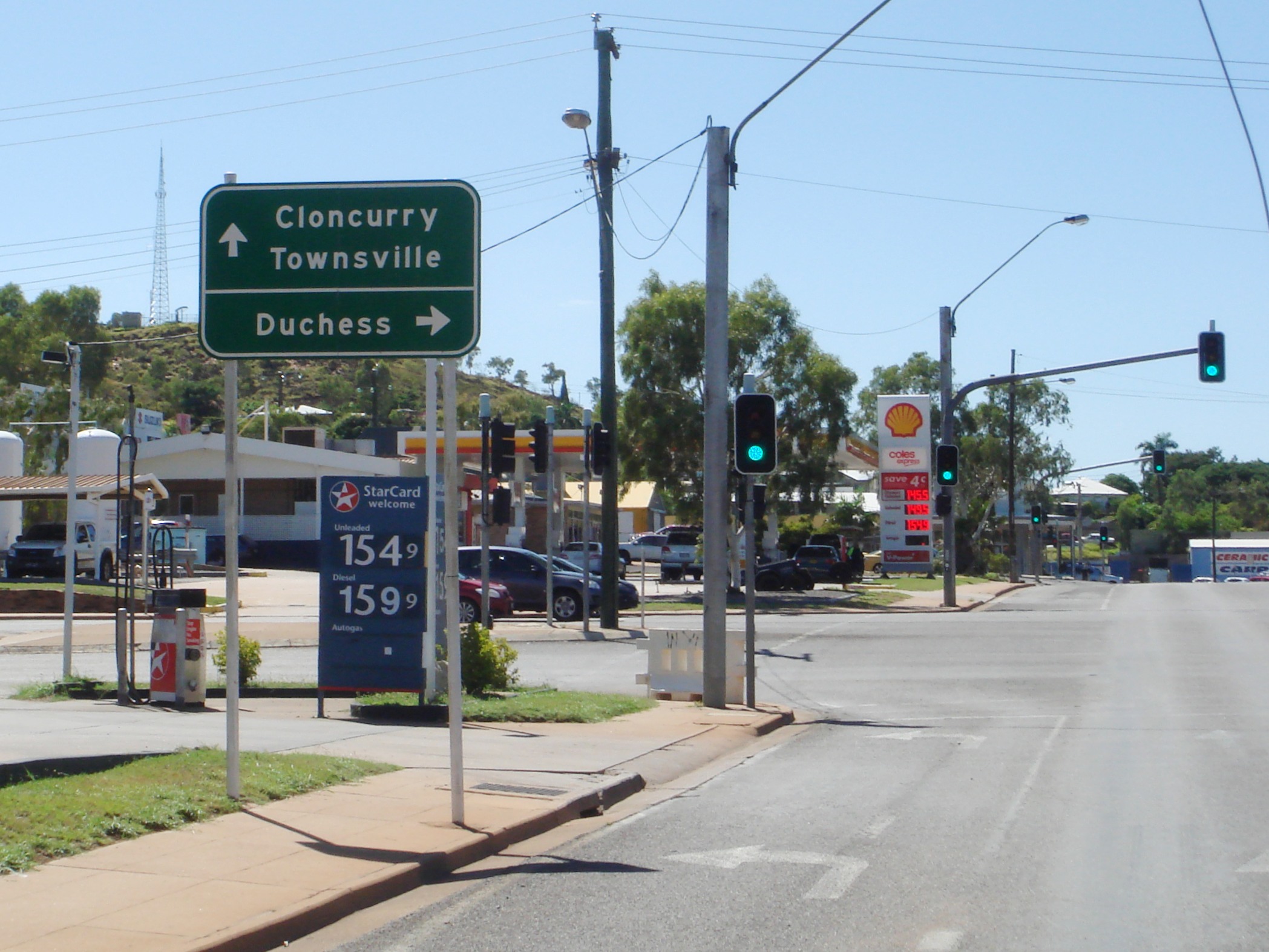
Advance Directional Sign: AD sign at Cloncurry approaching Flinders Hwy (A6) and Landsborough Hwy (A2), November 2016. Image © Paul Rands |
|||
 |
Flinders Highway & Landsborough Highway: Corner of Flinders Hwy (A6) and Landsborough Hwy (A2) at Cloncurry, November 2016. Flinders Hwy becomes A6 and A2 turns right and becomes Landsborough Hwy at this location. Image © Paul Rands |
|||
 |
Reassurance Directional Sign: Distance sign on Landsborough Hwy (A2) at Cloncurry, November 2016. Image © Paul Rands |
|||
 |
Toolebuc-McKinlay Road: Corner of Landsborough Hwy (A2) and Toolebuc-McKinlay Rd at McKinlay, November 2016. Image © Paul Rands |
|||
 |
Reassurance Directional Sign: Distance sign at McKinlay, November 2016. Image © Paul Rands |
|||
 |
Reassurance Directional Sign: Distance sign at Kynuna, November 2016. Image © Paul Rands |
|||
 |
Advance Directional Sign: AD sign at Kynuna approaching Julia Ck-Kynuna Rd (SR84), November 2016. Note the missing route number. Image © Paul Rands |
|||
 |
Advance Directional Sign: AD sign at Corfield approaching Richmond-Winton Rd, November 2016. Image © Paul Rands |
|||
 |
Advance Directional Sign: AD sign at Corfield approaching Kennedy Dev Rd (SR62), November 2016. Note the missing route number. Image © Paul Rands |
|||
 |
Kennedy Development Road: Corner of Landsborough Hwy (A2) and Kennedy Dev Rd (SR62) at Corfield, November 2016. Note the missing route number. Image © Paul Rands |
|||
| Click here for the continution of A2 between Longreach and Winton Click here for the continuation of the route as NH66 in Northern Territory |
||||
1 The State Road Network Map, 30
June 2008
2 Bureau of Infrastructure, Transport and Regional Economics, Over $400 million
for Queensland Roads, 13 May 2003
3 Queensland Roads, Edition No 5 (Barkly Highway Report), March 2008
4 Ministerial
Media Statements, Completing
the Barkly Highway Upgrade, 4 April 2006
5 QMR, Strategic Tourism Routes Revision 12
Last updated: 07-Jul-2020 17:35
This site © Paul Rands. All rights reserved. Some portions © (copyright) by their respective and credited owners. Permission must be obtained before using any images from this site. For details, please email by clicking here.