|
|
|
|
|

|
Menangle Street, Picton Road, Mt Ousley Road & Old Princes Highway (State Route 88) - Fairy Meadow to Wilton (Decommissioned) |
Statistics:
Route Numbering:


General Information:
State Route 88 is a signficant route connecting Wollongong and Port Kembla with the Hume Highway. It consists of a mix of single and divided sections. Some sections have overtaking lanes.
The eastern section of the corridor across the Illawarra escarpment has an undulating road environment with numerous curves. In contrast, beyond the escarpment, the middle and western sections of the corridor are mostly in bushland and a water catchment, with agriculture in the west. This terrain is relatively flat and the road alignment largely straight. A large number of heavy vehicles use Picton Road to access commercial and industrial areas within the Illawarra region. 2
Multiplexes along the route include:
History:
| Fairy Meadow to Wilton | Wilton to Fairy Meadow | |||
| Preview: | Description: | Preview: | Description: | |
 |
Advance Directional Sign: AD sign at Fairy Meadow approaching Mt Ousley Rd (SR88) and the unnumbered section of Princes Hwy, May 2012. Image © Paul Rands |
 |
Advance Directional Sign: AD sign approaching Mt Keira Rd in the Cataract locality, September 2010. Image © Paul Rands |
|
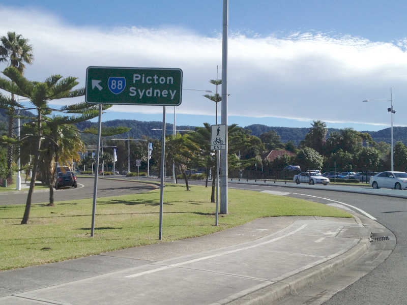 |
Intersection Directional Sign: ID sign at the roundabout with Mt Ousley Rd (SR88) and Princes Hwy in Fairy Meadow, May 2012. Image © Paul Rands |
 |
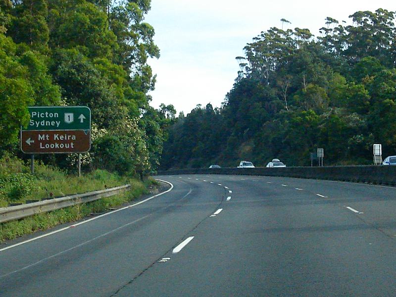
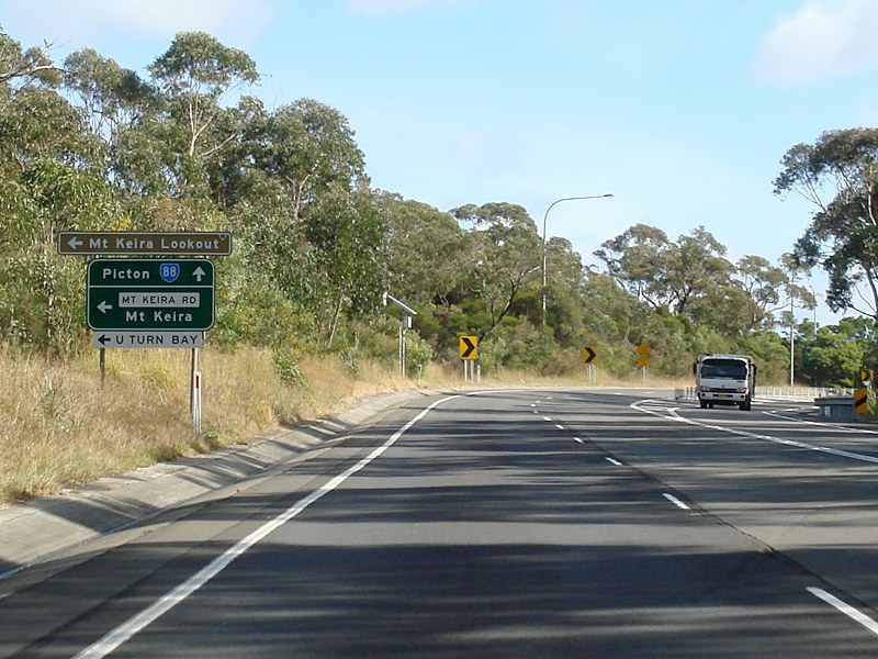
Mount Keira Road: Corner of Picton Rd (SR88) and Mt Keira Rd at Cataract, September 2010. Image © Paul Rands |
|
 |
Advance Directional Sign: AD sign on Mt Ousley Rd (SR88) at Mt Ousley approaching Mt Ousley Rd (SR88 / NR1) and Southern Fwy (NR1), May 2012. Note the missing SR88 shield for the right hand turn. Image © Paul Rands |
 |
Advance Directional Sign: AD sign approaching the Mt Ousley Rd (NR1) interchange, September 2010. Click here for a photo from December 2008 of the previous sign. Note the missing SR88 shield. Image © Paul Rands |
|
 |
Mt Ousley Road & Southern Freeway: ID sign on Mt Ousley Rd (SR88) at Mt Ousley at the junction with Mt Ousley Rd (SR88 / NR1) and Southern Fwy (NR1), May 2012. Image © Paul Rands |
 |
Advance Directional Sign: AD sign at Cataract approaching the Mt Ousley Rd (NR1) interchange, December 2012. Image © Paul Rands |
|
 |
Mt Ousley Road & Southern Freeway: ID sign on Mt Ousley Rd (SR88) at Mt Ousley at the junction with Mt Ousley Rd (SR88 / NR1) and Southern Fwy (NR1), May 2012. Note the missing SR88 shield for the right hand turn. Image © Paul Rands |
 |
Advance Directional Sign: AD sign at the Mt Ousley Rd (NR1) interchange, September 2010. Click here for a photo from April 2006 of the previous sign. Note the missing SR88 shield. Image © Paul Rands |
|
 |
Distance Sign: RD sign at Mt Pleasant, December 2008. Note the missing SR88 shield. Image © Paul Rands |
 |
Mount Ousley Road Interchange: Picton Rd (SR88) at the Mt Ousley Rd (NR1) interchange, September 2010. NR1 ramp is to the left and SR88 goes straight ahead to duplex with NR1 along Mt Ousley Rd. Click here for a photo from December 2008 of the previous sign. Note the missing SR88 shield. Image © Paul Rands |
|
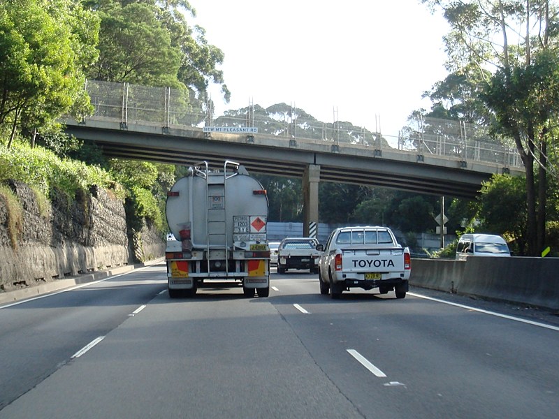 |
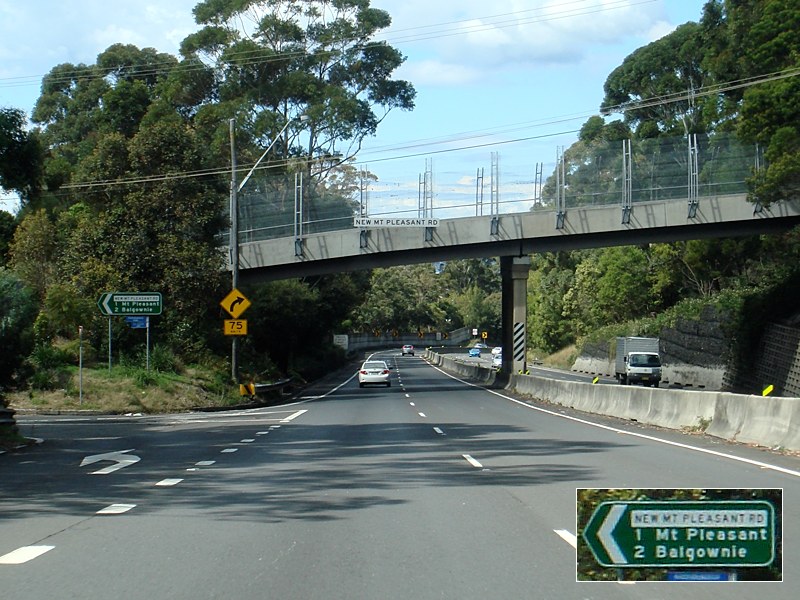
New Mount Pleasant Road: Mt Ousley Rd (SR88 / NR1) as it passes under New Mount Pleasant Rd at Mt Pleasant, June 2010. Image © Paul Rands |
 |
Steep Grade Sign: Sign showing distances of steep grade along Mt Ousley Rd, April 2006. Image © Paul Rands |
|
 |
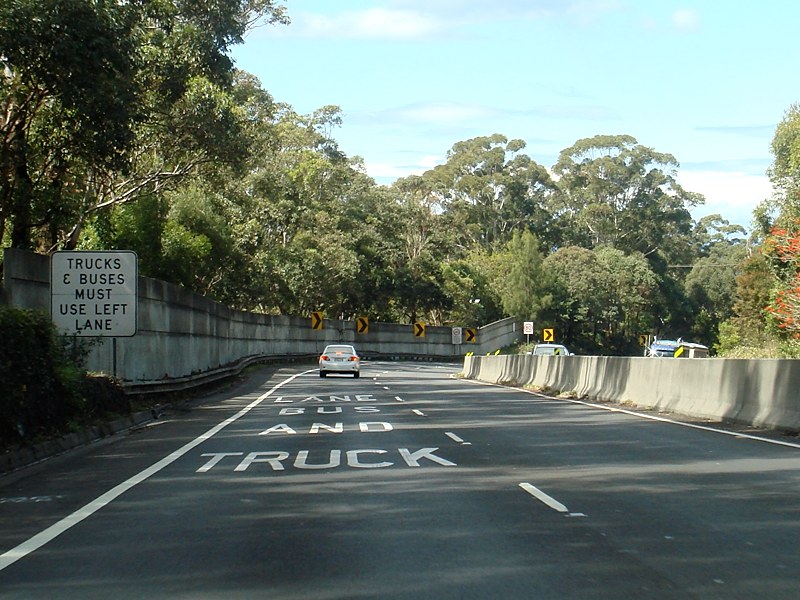
Trucks & Buses Sign: Sign at Mt Pleasant enforcing trucks and buses to use the 2 left lanes, June 2010. Image © Paul Rands |
 |
Long Steep Descent: Sign warning of long steep descent along Mt Ousley Rd, September 2010. Click here for a photo from April 2006 of the previous sign. Image © Paul Rands |
|
 |
Advance Directional Sign: AD sign on Mt Ousley Rd (SR88 / NR1) in the Cataract locality approaching Clive Bissell Dr, December 2008. Note the missing SR88 shield. Image © Paul Rands |
 |
Distance Sign: RD sign on Mt Ousley Rd (SR88 / NR1) above the suburb of Tarrawanna, December 2008. Note the missing SR88 shield. Image © Paul Rands |
|
 |
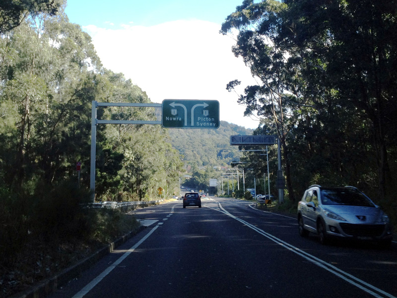
Advance Directional Sign: AD sign on Mt Ousley Rd (SR88 / NR1) in the Cataract locality approaching Picton Rd (SR88), June 2010. Click here for a photo from December 2008 of the previous sign. Image © Paul Rands |
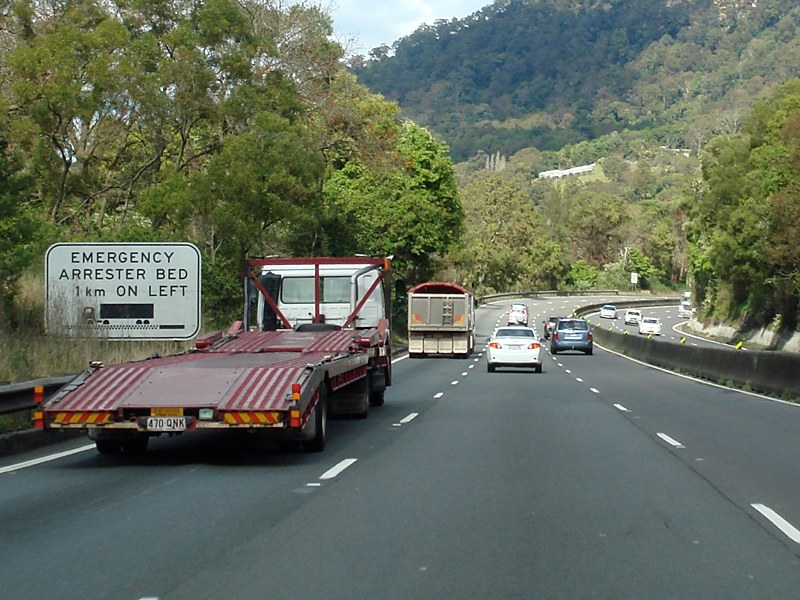 |
Emergency Stopping Bed Sign: Sign showing distance to emergency stopping bed at Mt Pleasant, September 2010. Image © Paul Rands |
|
 |
Picton Road: Corner of Mt Ousley Rd (NR1) and Picton Rd (SR88, June 2010. Click here for a photo from December 2008 of the previous sign. SR88 turns left at this junction. Image © Paul Rands |
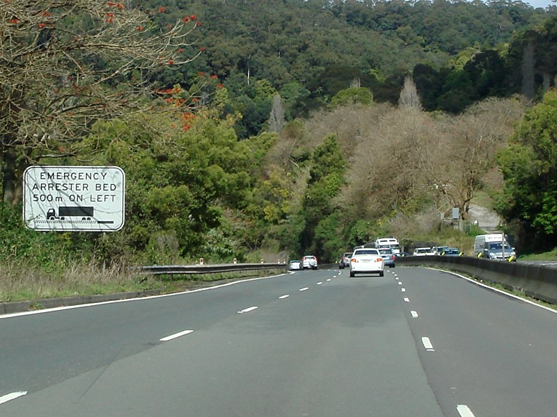 |
Emergency Stopping Bed Sign: Sign showing distance to emergency stopping bed at Mt Pleasant, September 2010. Image © Paul Rands |
|
 |
Distance Sign: RD sign after the Mt Ousley Rd junction, June 2010. Image © Paul Rands |
 |
Variable Message Signs: Collection of VMS at Mt Pleasant, September 2010. Image © Paul Rands |
|
 |
Advance Directional Sign: AD sign approaching Mt Keira Rd in the Cataract locality, June 2010. Image © Paul Rands |
 |
Emergency Stopping Bed: Mt Ousley Rd (SR88 / NR1) at the emergency stopping bed at Mt Pleasant, September 2010. Image © Paul Rands |
|
 |
Mount Keira Road: Corner of Picton Rd (SR88) and Mt Keira Rd at Cataract, June 2010. Image © Paul Rands |
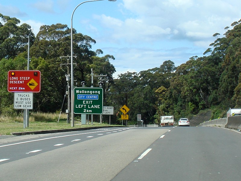 |
Long Steep Descent: Sign warning of long steep descent along Mt Ousley Rd at Mt Pleasant, September 2010. Click here and here for a photo from April 2006 of the previous signs. Image © Paul Rands |
|
 |
Distance Sign: RD sign after the Mt Keira Rd junction, June 2010. Click here for a photo from January 2006 of the previous sign. Image © Paul Rands |
 |
New Mount Pleasant Road: Mt Ousley Rd (SR88 / NR1) as it passes under New Mount Pleasant Rd at Mt Pleasant, September 2010. Image © Paul Rands |
|
 |
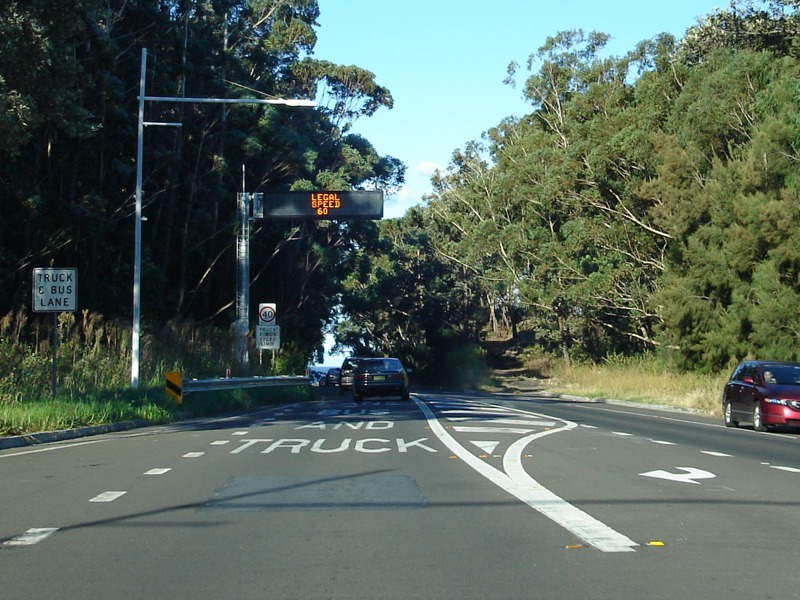
Trucks & Buses Sign: Sign at Mt Pleasant enforcing trucks and buses to use the left lane, September 2010. Image © Paul Rands |
|||
 |
Low Clearance Sign: Sign at Mt Ousley showing detour route for high vehicles. This sign is related to the bridge height of University Av at North Wollongong on Southern Fwy (NR1), September 2010. Image © Paul Rands |
|||
 |
Drive Quietly Sign: Sign at Mt Ousley requesting heavy vehicle drivers to drive quietly through the residential area behind the sign, April 2006 Image © Paul Rands |
|||
 |
Advance Directional Sign: AD sign approaching the split between Mt Ousley Rd (SR88) and Southern Fwy (NR1), September 2010. Click here for a photo from April 2006 of the previous sign. Image © Paul Rands |
|||
 |
Services Sign: Services sign approaching the split between Mt Ousley Rd (SR88) and Southern Fwy (NR1), September 2010. Image © Paul Rands |
|||
 |
Advance Directional Sign: AD sign approaching the split between Mt Ousley Rd (SR88) and Southern Fwy (NR1), September 2010. December 2008. Image © Paul Rands |
|||
 |
Low Clearance Sign: Sign at Mt Ousley showing detour route for high vehicles. This sign is related to the bridge height of University Av at North Wollongong on Southern Fwy (NR1), September 2010. Image © Paul Rands |
|||
 |
Intersection Directional Sign: ID sign at the split between Mt Ousley Rd (SR88) and Southern Fwy (NR1) at Mt Ousley, April 2006. Image © Paul Rands |
|||
 |
Speed check & Variable Message Sign: Sign for speed checks and for traffic conditions messages, Mt Ousley, April 2006. Image © Paul Rands |
|||
 |
Gaynor Avenue: Mt Ousley Rd (SR88) at the Gaynor Av roundabout, April 2006. Image © Paul Rands |
|||
 |
Advance Directional Sign: AD sign at Fairy Meadow approaching Old Princes Hwy, April 2006. SR88 turns right at this roundabout. Image © Paul Rands |
|||
 |
Advance Directional Sign: AD sign at Fairy Meadow approaching the interchange with Memorial Dr (SR60 and unnumbered sections) and Princes Hwy (Flinders St) (SR60), April 2006. Image © Paul Rands |
|||
 |
End State Route 88: Eastern terminus of State Route 88, the interchange with Memorial Dr (SR60 and unnumbered sections) and Princes Hwy (Flinders St) (SR60), April 2006. Image © Paul Rands |
|||
| Click here for the continuation of SR88 between Wilton and Picton | ||||
1 Roads & Traffic Authority, Schedule of Classified Roads and State & Regional Roads, 31 January 2011
2 Roads & Traffic Authority, Projects, Picton Road Corridor Strategy, April 2011
3 Department of Main Roads, The Roadmakers, A History of Main Roads in New South Wales, ISBN 0 7240 0439 4
Last updated: 21:1:49 20/3/2016.
This site © Paul Rands. All rights reserved. Some portions © (copyright) by their respective and credited owners. Permission must be obtained before using any images from this site. For details, please email by clicking here.