|
|
|
|
|
 |
Moss Vale Road, Nowra Road, Illawarra Highway, Argyle Street, Funston Street, Station Street, Mittagong Road, Bowral Road and Old Hume Highway (State Route 79) - Bomaderry to Fitzroy Falls (Decommissioned) |
Statistics:
Route Numbering:


General Information:
State Route 79 is an important connector route linking the NSW Southern Highlands with the Shoalhaven Coast.
The route is a single carriageway with 1 lane in each direction for most of it's length, with the exception of the Old Hume Highway segment. Sections of the route are steep and windy as the route traverses the steep coastal escarpment. The route features several mountain passes including Cambewarra Mountain and Barrengarry Mountain.
Another feature of the route is Hampden Bridge at Kangaroo Valley, which is a suspension bridge built between 1895 and 1898. The bridge is the second major suspension bridge in NSW, and now the only surviving timber decked vehicular suspension bridge constructed in the nineteenth century. The bridge has the Kangaroo River running beneath it. The main span length is 77 metres, sandstone tower height of 16.8 metres and height above water also of 16.8 metres. The main cables of the bridge consist on each side of fourteen 36mm diameter wire ropes, each with a specified tensile strength of 79.6 tonnes. The bridge is signposted for a maximum truck load of 42.5 tonnes, with no more than one truck to be on the bridge at a time, and is lanemarked to only provide a single lane. Hampden Bridge was built to replace the timber truss bridge of 1875 to 1879, which was in a state of decay by 1893. 2
Multiplexes along the route include:
History:
| Preview: | Description: |
 |
Intersection Directional Sign: ID sign at the roundabout with Cambewarra Rd and Princes Hwy (NR1) at Bomaderry, December 2006. Image © Paul Rands |
 |
Distance Sign: Tourist Drive 7 reassurance directional sign, Bomaderry, December 2006. Image © Paul Rands |
 |
Distance Sign: Tourist Drive 8 reassurance directional sign, Bomaderry, December 2006. Image © Paul Rands |
 |
Distance Sign: State Route 79 reassurance directional sign, Bomaderry, December 2006. Image © Paul Rands |
 |
Alphanumeric Advance Directional Sign: AD sign with B73 alphanumeric shield approaching Main Rd at Cambewarra Village, June 2010. Image © Paul Mech |
 |
Cambewarra Mountain: Moss Vale Rd as it makes its way up Cambewarra Mountain, December 2006. Image © Paul Rands |
 |
Cambewarra Mountain: Moss Vale Rd as it makes its way up Cambewarra Mountain, December 2006. Image © Paul Rands |
 |
Cambewarra Mountain: Moss Vale Rd as it makes its way up Cambewarra Mountain, December 2006. Image © Paul Rands |
 |
Cambewarra Mountain: Moss Vale Rd as it makes its way up Cambewarra Mountain, December 2006. Image © Paul Rands |
 |
Cambewarra Mountain: Moss Vale Rd as it makes its way up Cambewarra Mountain, December 2006. Image © Paul Rands |
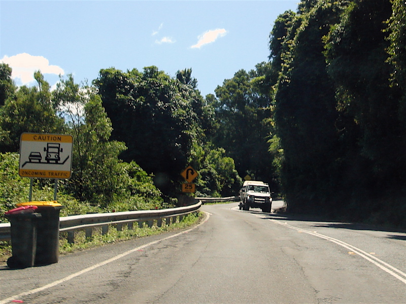 |
Oncoming Traffic Warning Sign: Sign on Cambewarra Mtn warning of oncoming traffic, as the road narrows, December 2006. Image © Paul Rands |
 |
Leebold Hill Road & Cambewarra Lookout Road Junction: Moss Vale Rd at the intersection with Leebold Hill Rd and Cambewarra Lookout Rd at Beaumont, December 2006. Image © Paul Rands |
 |
Distance Sign: RD sign with unusual right hand side placement, after the junction with Leebold Hill Rd and Cambewarra Lookout Rd at Beaumont, December 2006. Image © Paul Rands |
 |
Kangaroo Valley: Moss Vale Rd as it enters the outskirts of Kangaroo Valley, December 2006. Image © Paul Rands |
 |
Advance Directional Sign: Advance directional sign approaching Berry Mountain Rd (TD7) at Kangaroo Valley. The TD7 multiplex ends at this junction, December 2006. Image © Paul Rands |
 |
Berry Mountain Road: Corner of Moss Vale Rd (SR79 / TD8) and Berry Mtn Rd (TD7) at Kangaroo Valley, December 2006. Image © Paul Rands |
 |
Distance Sign: Reassurance directional sign after the Berry Mountain Road intersection at Kangaroo Valley, December 2006. Image © Paul Rands |
 |
Entering Kangaroo Valley Town Centre: Moss Vale Road as it enters the town centre of Kangaroo Valley, December 2006. Image © Paul Rands |
 |
Kangaroo Valley Town Centre: Moss Vale Road as it passes through the town centre of Kangaroo Valley, December 2006. Image © Paul Rands |
 |
Load Limit Sign: Custom load limit sign at Kangaroo Valley approaching Hampden Bridge over Kangaroo River, December 2006. Image © Paul Rands |
 |
Hampden bridge: Moss Vale Road as it approaches Hampden Bridge in Kangaroo Valley, December 2006. Image © Paul Rands |
 |
Hampden bridge: Moss Vale Road as it approaches Hampden Bridge in Kangaroo Valley, December 2006. Image © Paul Rands |
 |
Hampden bridge: Moss Vale Road as it approaches Hampden Bridge in Kangaroo Valley, December 2006. Image © Paul Rands |
 |
Distance Sign: RD sign on Moss Vale Road at Barrengarry, December 2006. Image © Paul Rands |
 |
Barrengarry Area: Moss Vale Rd as it passes through Barrengarry, December 2006. Image © Paul Rands |
 |
Barrengarry Area: Moss Vale Rd with Barrengarry Mountain in the distance, December 2006. Image © Paul Rands |
 |
Barrengarry Mountain: Moss Vale Rd as it makes its way up Barrengarry Mountain, December 2006. Image © Paul Rands |
 |
Barrengarry Mountain: Moss Vale Rd as it makes its way up Barrengarry Mountain, December 2006. Image © Paul Rands |
 |
Barrengarry Mountain: Moss Vale Rd as it makes its way up Barrengarry Mountain, December 2006. Image © Paul Rands |
| Click here for the continuation of SR79 between Fitzroy Falls and Aylmerton | |
1 Roads and Traffic Authority, Schedule of Classified Roads (and unclassified Regional Roads),
25 February 2008
2 Roads and Traffic Authority, Heritage & Conservation Register, Hampden Bridge
3 Roads and Traffic Authority, Road activity update – Southern NSW, January 2003
Last updated: 17-Dec-2019 0:55
This site © Paul Rands. All rights reserved. Some portions © (copyright) by their respective and credited owners. Permission must be obtained before using any images from this site. For details, please email by clicking here.