|
|
|
|
|

|
Appin Road, Narellan Road, Bridge Street, Putty Road, Thomas Street, Ryan Avenue, John Street, Queen Street, Campbell Street (State Route 69) - Campbelltown to Maddens Plains (Bulli Tops) (Decommissioned) |
Statistics:
Route Numbering:

General Information:
State Route 69 is one of the more unusual routes in the NSW state route system. It's split into 2 sections. The northern section consists mainly of undivided single carriageway road. The southern section is mostly the same except around the Campbelltown area where it's generally 4-lane and 6-lane divided arterial road.
Both sections service residential, commercial and agricultural areas, but also pass through national park and state forests.
The northern section is quite windy in parts and is an alternate route from Sydney to the Hunter Valley but generally sees a lower volume of traffic than the southern section which connects the southwestern outskirts of Sydney with the city of Wollongong.
Multiplexes along the route include:
History:
| Maddens Plains (Bulli Tops) to Campbelltown | Campbelltown to Maddens Plains (Bulli Tops) | |||
| Preview: | Description: | Preview: | Description: | |
 |
Advance Directional Sign: AD sign on the Princes Hwy (SR60) ramp at Bulli Tops as it joins the ramp with Appin Rd (SR69). June 2006. Image © Paul Rands |
 |
Intersection Directional Sign: ID sign at Hume Hwy (NH31 / Metroad 5) and Narellan Rd (Metroad 9) interchange at Campbelltown, January 2010. Image © Paul Rands |
|
 |
Advance Directional Sign: AD sign on the Princes Hwy (SR60) ramp at Bulli Tops as it joins the ramp with Appin Rd (SR69). June 2006. Image © Paul Rands |
 |
Advance Directional Sign: AD sign approaching the entrance to the TAFE College and University of Western Sydney at Campbelltown, April 2006. Image © Paul Rands |
|
 |
Old Princes Highway / Appin Road: Ramp to Old Princes Hwy and Appin Rd (SR69) at Bulli Tops, June 2006. Image © Paul Rands |
 |
Distance Sign: Reassurance directional sign at Campbelltown, April 2006. Image © Paul Rands |
|
 |
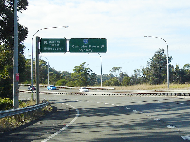
Intersection Directional Sign: ID sign facing Old Princes Hwy (former SR60) at Maddens Plains (Bulli Tops), December 2005. Image © Paul Rands |
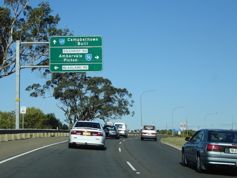 |
Advance Directional Sign: AD sign on Narellan Rd (SR69) approaching Blaxland Rd and also Gilchrist Dr (SR56) at Campbelltown, April 2006. The SR56 duplex starts at this junction. Image © Paul Rands |
|
 |
Intersection Directional Sign: ID sign with alphanumeric route number at Appin facing Baden Powell Dr, August 2009. Image © Richard Wardle |
 |
Old and Current Alignments: Narellan Rd at Campbelltown with old alignment to left of shot. Prior to construction of the overpass on the current alignment, traffic would cross the railway line via a level crossing, April 2006. Image © Paul Rands |
|
 |
Load Limits Sign: Load limits sign on Appin Rd (SR69) approaching Wilton Rd in Appin, June 2006. Image © Paul Rands |
 |
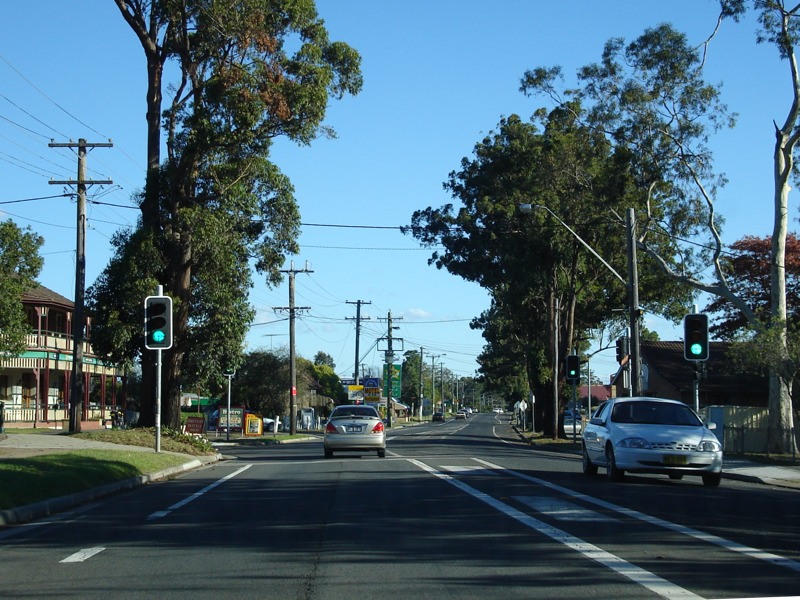
Kellicar Road: Corner of Narellan Rd (SR69) and Kellicar Rd at Campbelltown, April 2006. Image © Paul Rands |
|
 |
Intersection Directional Sign: ID sign assembly at the junction with Wilton Rd in Appin, June 2006. SR69 turns right here. Image © Paul Rands |
 |
Advance Directional Sign: AD sign at Campbelltown approaching Moore-Oxley St (SR56), The Parkway and Appin Rd (SR56), April 2006. The SR56 duplex ends at this junction. Image © Paul Rands |
|
 |
Advance Directional Sign: AD sign on Appin Rd (SR69) at Campbelltown approaching Moore-Oxley Street (SR56), Narellan Rd (SR69 / SR56) and The Parkway, June 2006. Image © Paul Rands |
 |
Advance Directional Sign: AD sign on Moore-Oxley Street (SR56) at Campbelltown approaching Appin Rd (SR69), Narellan Rd (SR69 / SR56) and The Parkway, November 2013. Image © Paul Rands |
|
 |
Supplemental Advance Directional Sign: Supplemental AD sign on Appin Rd (SR69) at Campbelltown approaching Moore-Oxley Street (SR56), Narellan Rd (SR69 / SR56) and The Parkway, June 2006. Image © Paul Rands |
 |
Distance Sign: RD sign on Appin Rd (SR69) at Campbelltown, April 2006. Image © Paul Rands |
|
 |
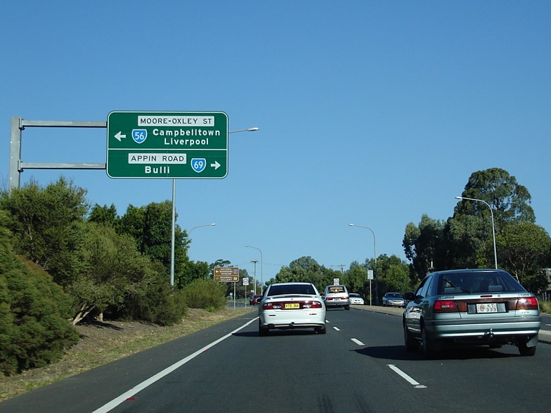
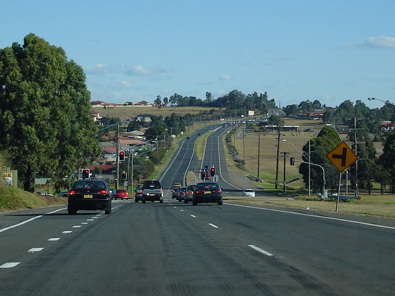
Narellan Road, The Parkway & Moore-Oxley Street: Corner of Appin Rd (SR69), Narellan Rd (SR69 / SR56), Moore-Oxley St (SR56) and The Parkway at Campbelltown, June 2006. Image © Paul Rands |
 |
Therry Road: Appin Rd (SR69) at the Therry Rd junction in Campbelltown, April 2006. Image © Paul Rands |
|
 |
Advance Directional Sign: AD sign on Narellan Rd (SR69) approaching Blaxland Rd and Gilchrist Dr (SR56) at Campbelltown, November 2013. Image © Paul Rands |
 |
Woodland Road: Appin Rd (SR69) at the junction with Woodland Dr at Ambarvale, April 2006. Image © Paul Rands |
|
 |
Headlights Sign: Sign urging motorists to use their headlights in the daytime, at the beginning of a section of Appin Rd notorious for crashes, April 2006. Image © Paul Rands |
|||
 |
Hume & Hovell Monument: Stone outside explorer Hamilton Hume's home at Gilead paying tribute to the exploration work he and fellow explorer William Hovell carried out, April 2006. Image © Paul Rands |
|||
 |
Rixon Road: Appin Rd (SR69) as it enters the town of Appin, near Rixon Rd, April 2006. Image © Paul Rands |
|||
 |
Appin Town Centre: Appin Rd (SR69) in the town centre of Appin near Market St, April 2006. Image © Paul Rands |
|||
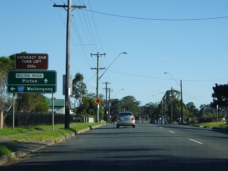 |
Advance Directional Sign: AD sign at Appin approaching Wilton Rd in Appin. SR69 turns left at this junction, April 2006. Image © Paul Rands |
|||
 |
Appin Road: Appin Rd (SR69) as it leaves the Appin town centre, April 2006. Image © Paul Rands |
|||
 |
Georges River: Appin Rd (SR69) as it crosses Georges River via Kings Falls Bridge at Appin, April 2006. Image © Paul Rands |
|||
 |
Advance Directional Sign: AD sign at Appin approaching Baden Powell Dr, April 2006. Image © Paul Rands |
|||
 |
Distance Sign: Tourism based RD sign near Maddens Plains, April 2006. Image © Paul Rands |
|||
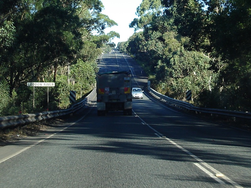 |
Loddon River: Appin Rd (SR69) as it crosses Loddon River at Maddens Plains, April 2006. Image © Paul Rands |
|||
 |
Fog Sign: Sign indicating hazard lights can be used during foggy conditions on moving vehicles, Maddens Plains, April 2006. Image © Paul Rands |
|||
 |
Advance Directional Sign: AD sign with end SR69 approaching the interchange with Southern Fwy (NR1) and Old Princes Hwy (former SR60) at Maddens Plains (Bulli Tops). This sign is a direct remake of an old black AD sign, April 2006. Image © Paul Rands |
|||
 |
Southern Freeway & Old Princes Highway: The southern terminus of the southern segment of SR69 at Bulli Tops, at the interchange with Southern Fwy (NR1) and Old Princes Hwy, April 2006. Image © Paul Rands |
|||
| Click here for State Route 69 between Singleton and Windsor | ||||
1 Roads & Traffic Authority, Schedule of Classified Roads and State & Regional Roads, 31 January 2011
2 Roads & Traffic Authority, Signposting Guidelines
Last updated: 26-Feb-2017 14:17
This site © Paul Rands. All rights reserved. Some portions © (copyright) by their respective and credited owners. Permission must be obtained before using any images from this site. For details, please email by clicking here.