|
|
|
|
|
 |
Delhi Road, Millwood Avenue, Fullers Road, Boundary Street, Babbage Road & Warringah Road (State Route 29) (Decommissioned) |
Statistics:
Route Numbering:


General Information:
State Route 29 is an suburban arterial road linking Sydney's Northern Beaches with the city of Chatswood, Pacific Highway and the Hills Motorway. It's a mix of divided and undivided roadway, and passes through commercial and residential zones as well as some bushland.
The route features the spectacular Roseville Bridge over Middle Harbour and Fullers Bridge over the Lane Cove River. SR29 also acts as a small bypass of the Chatswood CBD, skirting it on the western and northern sides.
Multiplexes along the route include:
History:

| North Ryde to Dee Why | Dee Why To North Ryde | |||
| Preview: | Description: | Preview: | Description: | |
 |
Intersection Directional Sign: ID sign assembly at the junction with Epping Rd at North Ryde, November 2010. Image © Rob Tilley |
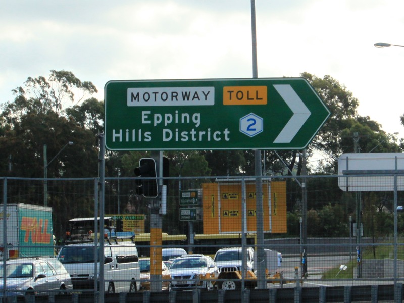 |
Intersection Directional Sign: ID sign at the Hills Mwy (Metroad 2) interchange at North Ryde, November 2010. Image © Rob Tilley |
|
 |
Intersection Directional Sign: ID signs facing Hills Mwy (Metroad 2) interchange at Macquarie Park, November 2010. Image © Rob Tilley |
 |
Intersection Directional Sign: ID sign assembly at the junction with Epping Rd at North Ryde, November 2010. Image © Rob Tilley |
|
1 Roads and Traffic Authority, Schedule of Classified Roads and State & Regional Roads, 31 January 2011
2 New South Wales Office of Environment & Heritage, Heritage Database, Fullers Bridge Over Lane Cove River
3 POIDB.com, Roseville Bridge - Killarney Heights NSW
4 Flickr, Highplains68, Roseville bridge construction The bridge was designed by Donald Maclurcan, who passed away in 1999.
5 State Library of New South Wales, Manuscripts, Oral History & Pictures, Collection Record Details, Donald Maclurcan papers, 1953-1982
6 Roads & Maritime Services, Pinch Point & Congestion Initiatives
Last updated: 17-Dec-2019 0:55
This site © Paul Rands. All rights reserved. Some portions © (copyright) by their respective and credited owners. Permission must be obtained before using any images from this site. For details, please email by clicking here.