|
|
|
|
|
 |
Oxley Highway (National Route 34) - Tamworth to Bendemeer (Decommissioned) |
Statistics:
Route Numbering:


General Information:
National Route 34 is a rural highway that connects the coast with western New South Wales. It features several important towns along the route, and also crosses the Great Dividing Range.
The route is mostly single carriageway and undivided, except around Port Macquarie, Moonbi and Tamworth. At its eastern end, the route is quite windy because of the difficult terrain created by the Great Dividing Range, beyond Moonbi, the route generally passes through fairly flat terrain, except in the Coonabarabran area.
The Oxley Highway is named after explorer John Oxley, who was the first European to explore much of inland New South Wales in 1818. He crossed the southern end of the northern tableland and camped on the Apsley River in 1818 near the present Walcha.
Multiplexes along the route include:
History:
Click here for the former alignment at Bendemeer
Click here for the former alignment at Moonbi
Click here for the former alignment at Kootingal
Click here for the former alignment at Tintinhull
| Tamworth to Bendemeer | Bendemeer to Tamworth | |||
| Preview: | Description: | Preview: | Description: | |
 |
Dampier Street: Corner of Oxley Hwy (NR34) and Dampier St West Tamworth, August 2011. Image © Paul Rands |
 |
Trailblazer: Sign goof on the corner of the New England Hwy and Oxley Hwy Bendemeer. NH34 doesn't exist and NR34 doesn't end here either, it's duplexed with NH15 from here through to Tamworth, May 2006. Image © Paul Rands |
|
 |
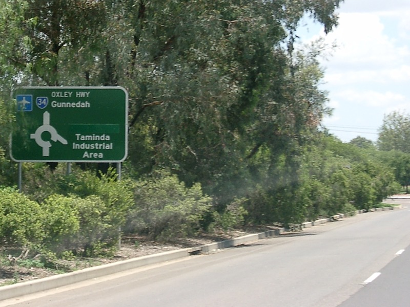
Advance Directional Sign: AD sign at West Tamworth approaching Gunnedah Rd and Edith St, August 2011. Image © Paul Rands |
 |
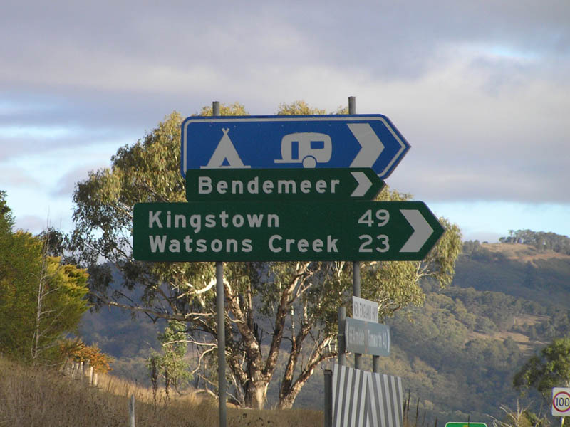
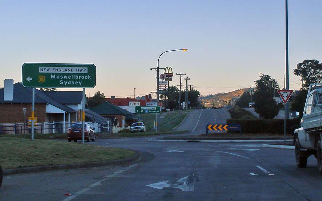
Advance Directional Sign: AD sign approaching Oxley Hwy (NR34) at Bendemeer. May 2005. There should be an NR34 shield next to the NH15, as NR34 duplexes the route from this intersection to Tamworth's town centre. Image © Rob Tilley |
|
 |
Gunnedah Road & Edith Street: Corner of Oxley Hwy (NR34), Gunnedah Rd and Edith St, West Tamworth, August 2011. Gunnedah Rd is a former NR34 alignment. Image © Paul Rands |
 |
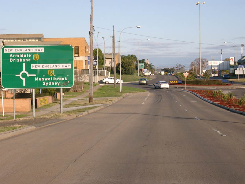
Oxley Hwy ID Sign Assembly: Sign assembly on the corner of New England Hwy and Oxley Hwy in Bendemeer. May 2005. Image © Rob Tilley |
|
 |
Gunnedah Road & Edith Street: Corner of Oxley Hwy (NR34), Gunnedah Rd and Edith St, West Tamworth, August 2011. Gunnedah Rd is a former NR34 alignment. Image © Paul Rands |
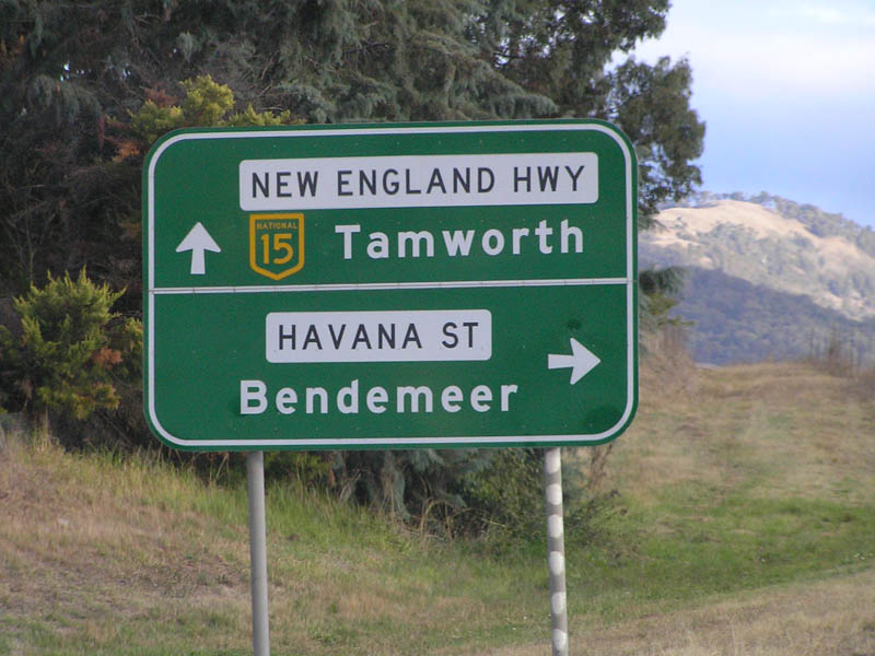 |
Advance Directional Sign: Southbound AD sign approaching Havana Street in Bendemeer, May 2005. This sign should have an NR34 shield alongside the NH15 shield. Image © Rob Tilley |
|
 |
Supplemental Advance Directional Sign: Supplemental AD sign at West Tamworth approaching Duri Rd (TD25), August 2011. Image © Paul Rands |
 |
Intersection Directional Sign: Southbound intersection directional sign at the intersection with Havana Street in Bendemeer, May 2005. Image © Rob Tilley |
|
 |
Advance Directional Sign: AD sign at West Tamworth approaching Duri Rd (TD25), August 2011. Image © Paul Rands |
 |
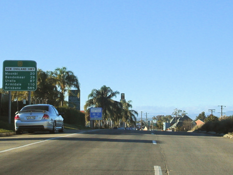
Distance Sign: Southbound RD sign as you leave the town of Bendemeer. May 2005. This sign should have an NR34 shield alongside the NH15 shield. Image © Rob Tilley |
|
 |
Duri Road: Corner of Oxley Highway (NR34) and Duri Road (TD25) at West Tamworth, August 2011. Image © Paul Rands |
 |
Safe-T-Cam: Approaching the Safe-T-Cam in Bendemeer, March 2004. Image © Paul Rands |
|
 |
Reassurance Directional Sign: Distance sign at West Tamworth, August 2011. Note the incorrect State Route shield. Image © Paul Rands |
 |
Second Moonbi Hill: The New England Hwy as it makes its way down Second Moonbi Hill, September 2005. Image © Paul Rands |
|
 |
Advance Directional Sign: AD sign at West Tamworth approaching Mahony Av, August 2011. Image © Paul Rands |
 |
Second Moonbi Hill: The New England Hwy as it makes its way down Second Moonbi Hill, September 2005. Image © Paul Rands |
|
 |
Peel River: Oxley Hwy (NR34) crossing Peel River at West Tamworth, December 2002. Image © Michael Greenslade |
 |
Moonbi Town Centre: Southbound as the New England Hwy makes its way through Moonbi near Thomas St, September 2005. Image © Paul Rands |
|
 |
Bridge Street: Northbound along Oxley Hwy (Bridge St) (NR34) at West Tamworth. This is reportedly Tamworth's busiest street, August 2005. Image © Paul Rands |
 |
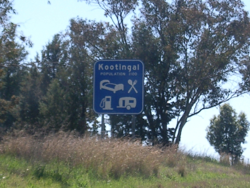
Chelmsford Street: Corner of Oxley Hwy (NR34 / NH15) and Chelmsford St at Kootingal, August 2011. Image © Paul Rands |
|
 |
Denison Street: Corner of Oxley Hwy (NR34) and Denison St, West Tamworth, August 2011. Image © Paul Rands |
 |
Sandy Road & Porcupine Lane: Corner of Oxley Hwy (NR34 / NH15) and Sandy Rd & Porcupine Ln at Kootingal, August 2011. Image © Paul Rands |
|
 |
Advance Directional Sign: AD sign at West Tamworth approaching Ebsworth St (former New England Hwy), August 2005. Image © Paul Rands |
 |
Chaffey Lane & Tintinhull Road: Corner of Oxley Hwy (NR34 / NH15) and Chaffey Ln & Tintinhull Rd at Tintinhull, August 2011. Image © Paul Rands |
|
 |
Ebsworth Street: Corner of Oxley Hwy (NR34) and Ebsworth St, West Tamworth, August 2011. Image © Paul Rands |
 |
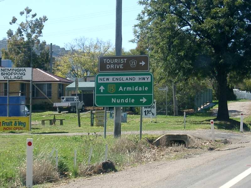
Entering Nemingha: Oxley Hwy (NR34 / NH15) as it enters the town of Nemingha, August 2011. Image © Paul Rands |
|
 |
Peel River: Oxley Hwy (Bridge St) (NR34) as it crosses Peel River at West Tamworth, August 2005. Image © Paul Rands |
 |
Advance Directional Sign: AD sign approaching Nundle Rd (TD23) and Railway St at Nemingha, August 2011. Image © Paul Rands |
|
 |
Kable Avenue: Corner of Oxley Hwy (Brisbane St) (NR34) and Kable Av (formerly Lower St) in Tamworth CBD, August 2005. Image © Paul Rands |
 |
Nundle Road & Railway Street: Corner of Oxley Hwy (NR34 / NH15) and Nundle Rd (TD23) and Railway St at Nemingha, August 2011. Image © Paul Rands |
|
 |
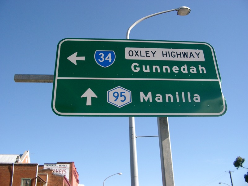
Advance Directional Sign: AD sign approaching Brisbane St and Marius St (SR95 and NR34) in Tamworth CBD, February 2004. Note the SR shields in place of NR and NH shields and a Metroad shield in place of an SR shield. Image © Paul Rands |
 |
Distance Sign: Southbound RD sign after the Nundle Roadjunction at Nemingha, May 2005. Image © Rob Tilley |
|
 |
Intersection Directional Sign: ID sign assembly at the junction of Brisbane St and Marius St (SR95 and NR34) at Tamworth, September 2004. NR34 turns right at this junction. Image © Paul Rands |
 |
Entering Tamworth: Oxley Hwy (NR34 / NH15) as it enters the town of Tamworth, August 2011. Image © Paul Rands |
|
 |
Intersection Directional Sign: ID sign assembly at the junction of Brisbane St and Marius St (SR95 and NR34) at Tamworth, September 2004. NR34 turns right at this junction. Image © Paul Rands |
 |
Advance Directional Sign: AD sign approaching the intersection with Murray Street in Tamworth. NR34 splits off here and goes straight (also former New England Highway). NH15 turns left at this junction. August 2011. Click here for a photo of this location from October 2005. Image © Paul Rands |
|
 |
Distance Signs: 2 distance signs with non-matching distances. The far right sign is also showing an SR shield instead of an NR shield. Tamworth, May 2004. Image © Paul Rands |
 |
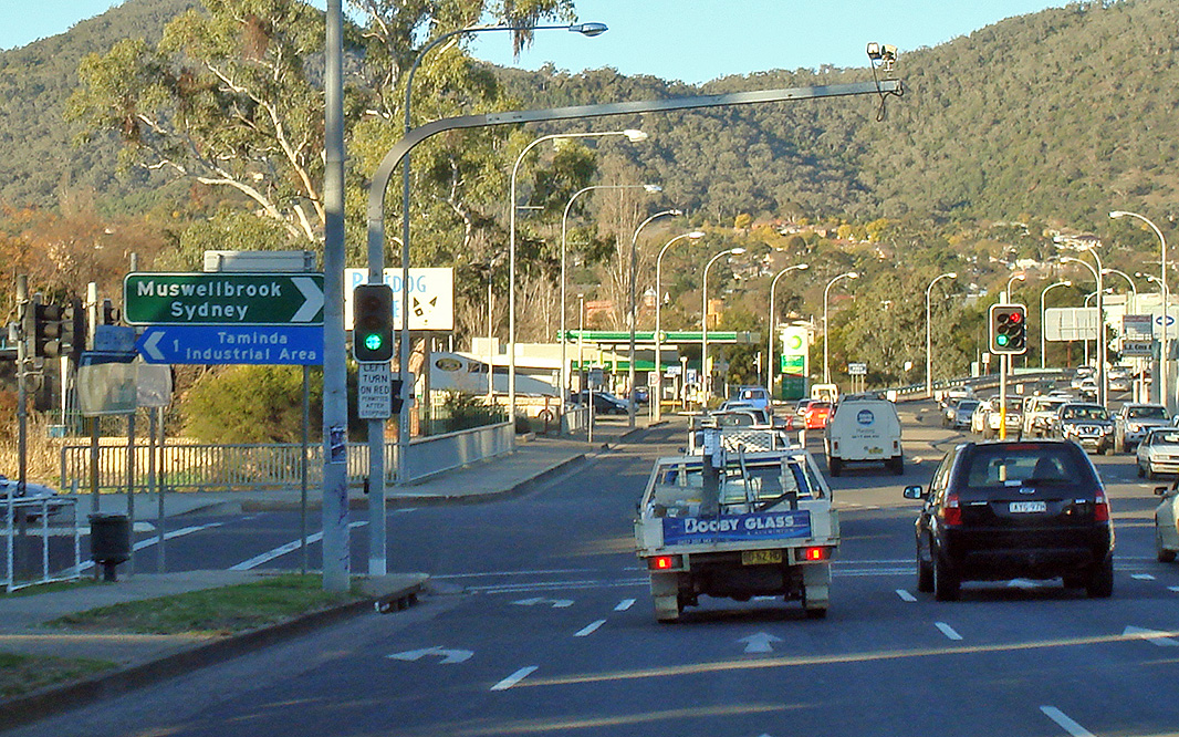
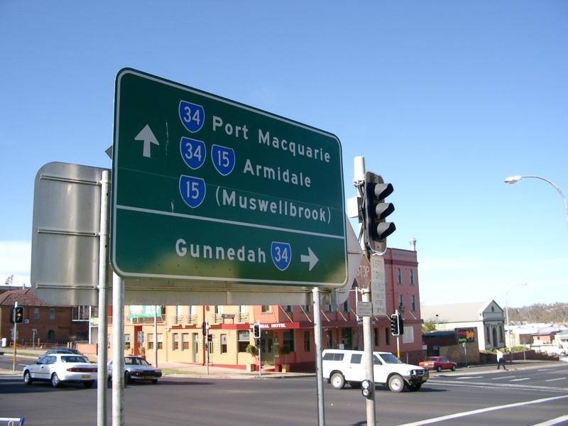
Murray Street & New England Highway: Corner of Oxley Hwy (NR34), New England Hwy (NH15) and Murray St at Tamworth, August 2011. The NH15 duplex ends here. Image © Paul Rands |
|
 |
Intersection Directional Sign: ID sign on Marius St (Oxley Hwy (NR34)), approaching the roundabout with Murray St (New England Hwy (NH15)) in Tamworth, August 2008. This section of NR34, was once a part of NH15. The straight ahead leg on the sign should show both NH15 and NR34 shields. Image © Paul Rands |
 |
White Street: Corner of Oxley Hwy (NR34) and White St, Tamworth, August 2011. Image © Paul Rands |
|
 |
Intersection Directional Sign: ID sign on the Murray Street roundabout in Tamworth, August 2008. This sign is missing an NR34 shield, as the duplex with the Oxley Hwy (NR34) starts here. Image © Paul Rands |
|
Advance Directional Sign: AD sign at Tamworth, approaching Brisbane St (unnumbered and NR34) and Marius St (SR95), August 2011. Click here for a photo of this location by Paul Rands from September 2004. Note the incorrect State Route and Metroad shields. Click here for a photo of this location by Paul Rands from March 2004. Image © Paul Rands |
|
 |
Distance Sign: RD sign after the Murray Street roundabout in Tamworth, August 2008. This sign is missing an NR34 shield, as the duplex with the Oxley Hwy runs along here, July 2007. Image © Paul Rands |
 |
Intersection Directional Sign: ID sign at the junction of Brisbane St and Marius St (SR95 and NR34) at Tamworth, September 2004. NR34 turns left at this junction. Image © Paul Rands |
|
 |
Services Sign: AD sign for the Tamworth Rest Area in East Tamworth. July 2007. Image © Paul Rands |
 |
Intersection Directional Sign: ID sign at the junction of Brisbane St and Marius St (SR95 and NR34) at Tamworth, September 2004. NR34 turns left at this junction. Image © Paul Rands |
|
 |
East Tamworth: Oxley Hwy (NR34) as it leaves East Tamworth, October 2004. Image © Paul Rands |
 |
Intersection Directional Sign: ID sign facing Marius St (SR95) at Tamworth, at the junction with Brisbane St and Oxley Hwy (Brisbane St) (NR34), September 2004. Image © Paul Rands |
|
 |
AD Sign: Advance directional sign for Nundle Road (TD23) in Nemingha, September 2004. This sign should also show NR34, as it is duplexed along this section of the New England Hwy. Image © Paul Rands |
 |
Intersection Directional Sign: AD sign acting as an ID sign facing Marius St (SR95) at Tamworth, at the junction with Brisbane St and Oxley Hwy (Brisbane St) (NR34), September 2004. Image © Paul Rands |
|
 |
Nundle Road Intersection: Travelling through the intersection with Nundle Road in Nemingha. July 2007. Image © Paul Rands |
 |
Kable Avenue: Corner of Oxley Hwy (NR34) (Brisbane St & Bridge St) and Kable Av in Tamworth, December 2004. The bridge over Peel River is in the distance. Image © Paul Rands |
|
 |
Distance Sign: RD sign as you leave the town of Nemingha, September 2004. This sign should also show NR34, as it is duplexed along this section of the New England Hwy. Image © Paul Rands |
 |
Advance Directional Sign: AD sign at West Tamworth approaching Ebsworth St (former New England Hwy), December 2004. Image © Paul Rands |
|
 |
Services Sign: Services sign as you approach the town of Kootingal. July 2007. Click here for a photo from September 2004 of the previous sign. Image © Paul Rands |
 |
Advance Directional Sign: AD sign approaching Mahoney Av in West Tamworth, December 2004. Image © Paul Rands |
|
 |
Entering Moonbi: New England Hwy as it enters the town of Moonbi, July 2007. Image © Paul Rands |
 |
Advance Directional Sign: AD sign with incorrect SR shield at Coledale approaching Edith St and Gunnedah Rd, December 2004. Image © Paul Rands |
|
 |
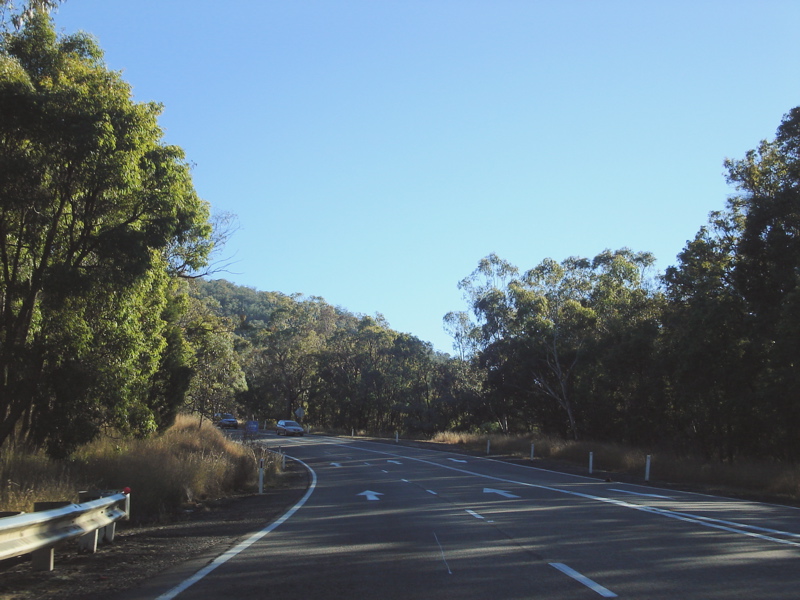
Divided Road Ahead Sign: Divided Road Ahead 1 km sign as you leave the town of Moonbi. The sign indicates the dual carriageway over First Moonbi Hill, which opened to traffic during the 1970s, July 2007. Image © Paul Rands |
 |
Gunnedah Road & Edith Street: Intersection directional sign with incorrect SR shield on the Edith St & Gunnedah Rd roundabout at Coledale, December 2004. Image © Paul Rands |
|
 |
Divided Road Ahead Sign: Divided Road Ahead sign as you approach the dual carriageway over First Moonbi Hill, which opened to traffic during the 1970s, July 2007. Image © Paul Rands |
 |
Distance Sign: Reassurance directional sign as Oxley Hwy (NR34) leaves the outskirts of Tamworth at Coledale, March 2004. Image © Paul Rands |
|
 |
First Moonbi Hill: New England Hwy as it makes its way up First Moonbi Hill, July 2007. Image © Paul Rands |
|||
 |
First Moonbi Hill: New England Hwy as it makes its way up First Moonbi Hill, July 2007. Image © Paul Rands |
|||
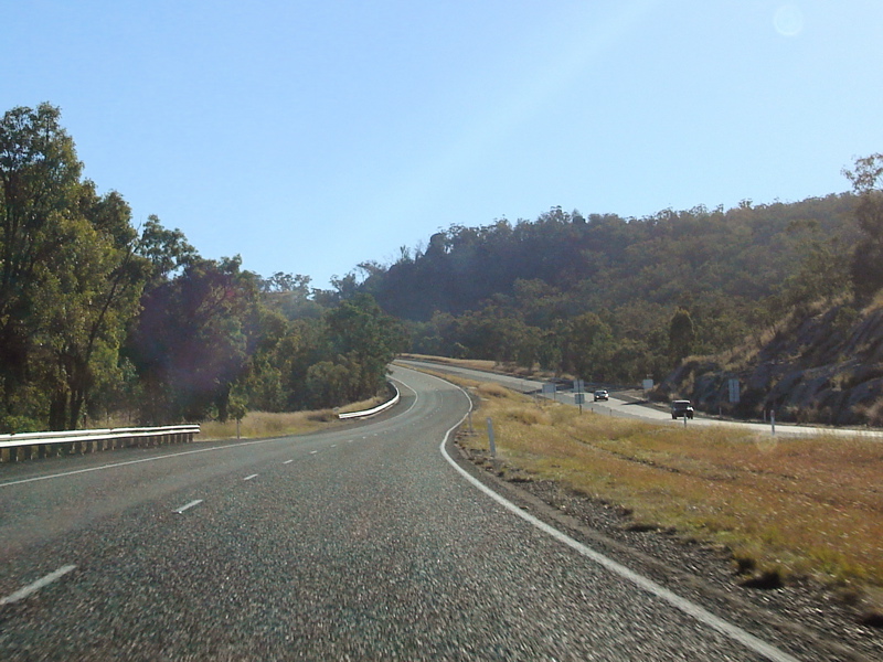 |
First Moonbi Hill: New England Hwy as it makes its way up First Moonbi Hill, July 2007. Image © Paul Rands |
|||
 |
Advance Directional Sign: AD sign for the Moonbi Lookout intersection, which utilises part of a former highway alignment, at Moonbi. July 2007. Image © Paul Rands |
|||
 |
End Divided Road: Approaching the end of the dual carriageways over Moonbi Hill, as you get closer to Second Moonbi Hill, September 2004. Image © Paul Rands |
|||
 |
Second Moonbi Hill: Heading up Second Moonbi Hill. July 2007. Image © Paul Rands |
|||
 |
Services Sign: Services sign indicating travel times to the next 2 rest areas, Bendemeer. July 2007. Image © Paul Rands |
|||
 |
Bendemeer: New England Hwy as it enters into the Bendemeer area, September 2004. Image © Paul Rands |
|||
 |
McDonald River: The New England Hwy as it passes over the McDonald River at Bendemeer, via the TA Perry Bridge, July 2007. Image © Paul Rands |
|||
 |
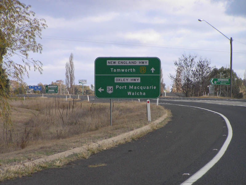
Distance Sign: Eastbound in the town of Bendemeer, September 2004. Image © Paul Rands |
|||
| Click here for the continuation of NR34 between Bendemeer and Wauchope Click here for the continuation of NR34 between Coonabarabran and Tamworth |
||||
1 Roads and Traffic Authority, Schedule of Classified Roads and State & Regional Roads, 31 January 2011
2 Department of Main Roads, Historical Roads of New South Wales, Oxley Highway, Extract from March 1953 issue of "Main Roads" journal.
3 Department of Main Roads, The Roadmakers, A History of Main Roads in New South Wales, ISBN 0 7240 0439 4
Last updated: 19-Oct-2021 0:31
This site © Paul Rands. All rights reserved. Some portions © (copyright) by their respective and credited owners. Permission must be obtained before using any images from this site. For details, please email by clicking here.