Road Photos & Information: New South Wales
 |
|
Pacific Highway, New England Highway, John Renshaw Drive, Southern Freeway, Mount Ousley Road & Princes Highway (National Route 1) (Decommissioned) - Former Alignment: Gerringong to South Nowra |
Statistics:
- Length: 1149 km
- Southern section: 481 km (Gerringong to South Nowra: 39 km)
- Northern Terminus:
- Southern section: Princes Highway (Metroad 1) at Waterfall
- Southern Terminus:
- Southern section: Princes Highway (A1) at New South Wales / Victoria border
- Miscellaneous: Continues as Princes Highway (A1) in Victoria
- Suburbs, Towns & Localities Along The Route:
- Southern section: Gerringong, Berry, Bomaderry and Nowra
Route Numbering:
- Former:
- Road Authority Internal Classification: SH1 (Yallah to NSW-Vic Border) 1
- Decommissioned: 2013
General Information:
National Route 1 forms part of the main coastal route between Victoria and Queensland. The route features a mix of rural highway, arterial and freeway design standards. The route forms part of what is collectively known as Highway 1. It is Australia's coastal highway joining all mainland's state capitals and coastal towns circumnavigating the entire Australian continent. It is also the longest numbered highway in the world, covering more than 14 500 km.
In New South Wales, National Route 1 was truncated by National Highway 1 between Beresfield and Wahroonga, by Metroad 1 between Wahroonga and Waterfall and by M1 at Tweed Heads West.
Southern Section:
The southern section of National Route 1 is formed by 2 separate sections of the Southern Freeway, linked by dual carriageway Mt Ousley Road. At the end of southern segment of the Southern Freeway, National Route continues as Princes Highway. The route from Kiama to Sydney is a mix of divided road and freeway, the majority of the route from Gerringong to the Victorian border is undivided rural highway standard and undivided urban arterial within some towns, with some dual carriageway sections sporadically placed between Bomaderry and tourist areas immediately south of Nowra.
The Princes Highway was formed from a string of roads linking Sydney to the Illawarra, which later was renumbered from National Route 1 to Metroad 1 in the Sydney area during the 1990s.
The Princes Highway section of NR1 formed a coastal route from Yallah, in Wollongong's southern suburbs to Melbourne and into South Australia. The route is a mix of urban arterial road, dual carriageway and also rural highway.
History:
Princes Highway:
- 1881: construction of the Nowra Bridge over the Shoalhaven River.
- 7 June 1926: the Princes Highway comes under a federal and state government £ for £ funding scheme, thus recognizing the importance of the highway as major route.
- 1930s: Reinforced concrete bridge built along Princes Highway over Tullian Creek at Meroo Meadow 2
- 1932: On the Princes Highway, North and Kinghorn streets, Nowra (1-2 miles), were tar-surfaced. 3
- October 1936: Completion of a deviation between Kiama and Berry, known as the Broughton Creek and Butchers Hill Deviation. Work started on Gerringong Deviation to eliminate the level crossing over the South Coast railway line. 4
- 1937: Planting and landscaping program started along Princes Highway. 4
- 1938: Completion of the Princes Highway deviation at Gerringong. Addition of footway to bridge over Shoalhaven River at Nowra. 5
- 1939: by the middle of the year, 300 miles (or 50% of the then highway) had been paved with bitumous surface.
- 1955: Work commenced on reconstruction of the junction of Princes Highway and Toolijooa Road at Toolijooa. Work included better approaches to crest and increased visibility at the intersection. 6
- 1956: Bitumen surfacing on Princes Hwy between Sydney and Eden totalling 305 miles out of 321 miles. Completion of junction upgrade with Princes Hwy and Toolijooa Rd at Toolijooa. Completion of a reinforced concrete bridge over Broughton Mill Creek at Berry. Length 250 ft. 7
- 1957: Reconstruction of the junction with Bolong Road at Bomaderry, including acceleration and deceleration lanes on the Highway, resulting in improved visability. 8
- 1966: The intersection of the highway with Fern Street at Gerringong, was improved. Widening of the cutting south of Broughton Creek Bridge, at Berry. 9
- 1969: Completion of the widening of the pavement and improvement of the grade between Bomaderry Creek and Shoalhaven River on the northern approach to Nowra. 9
- 1970: Reconstruction was commenced of the southern approach to the bridge at Abernethys Creek at Bomaderry to improve alignment and grading. Construction started on a climbing lane for northbound traffic on Mortons Hill to the north of the junction with Bolong Road at Bomaderry. 10
- 1971: Completion of the reconstruction of approaches to the bridge at Abernethy's Creek at Bomaderry on improved alignment and grading and also completed construction of a climbing lane for northbound traffic on Morton's Hill, north of the junction with Bolong Road. Replacement of footway decking on the bridge over Shoalhaven River at Nowra. 11
- 1974: Work was started on a four span prestressed concrete bridge over Jaspers Creek, at Jaspers Brush, north of Nowra. The structure is 43 metres long, provides two traffic lanes and replaced two timber bridges 15 metres and 8 metres long. 12
- 1981: Duplication of Nowra Bridge.
- 1 November 2011: Construction starts on the upgrade of the Princes Highway at South Nowra. 99 The upgrade is between Kinghorne Street and Forest Road at South Nowra. The upgrade involves upgrading 6.3 kilometres of the Princes Highway to four lanes. 13
- August 2012: Work begins on the Gerringong Upgrade of the Princes Highway. The upgrade will upgrade includes 7.5 kilometres of upgraded highway and include two new interchanges with access to Gerringong and Gerroa. 14
- November 2012: Work started on Princes Hwy upgrade between Gerringong and Toolooja. 15
This page concentrates on the former National Route 1 alignment between Gerringong and South Nowra
 |
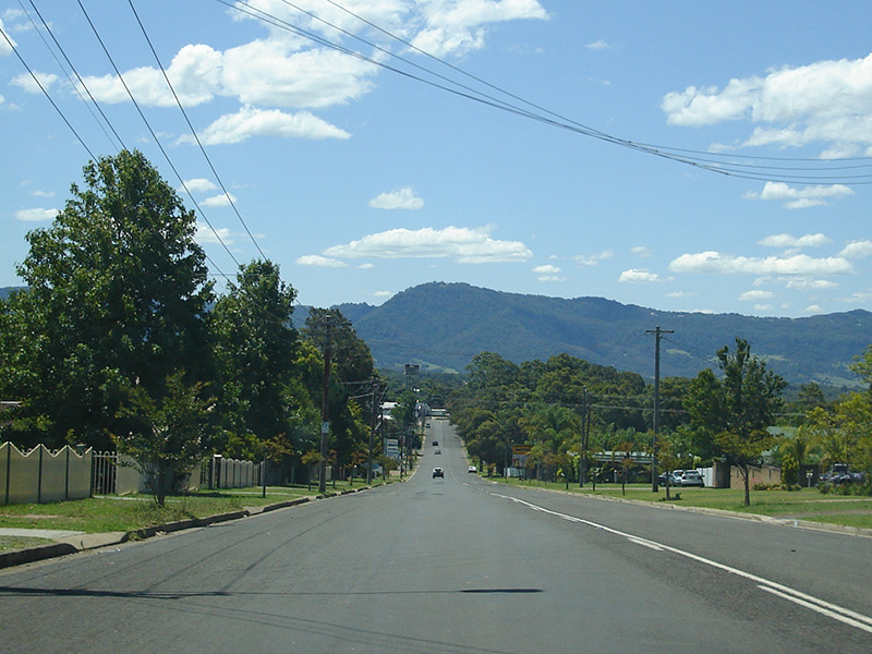
Kinghorne Street:
Kinghorne Street (former Princes Hwy) as it passes through Nowra, December 2006.
Image © Paul Rands
|
 |
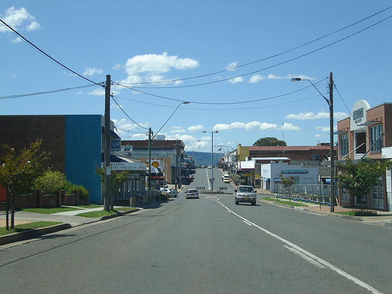
Nowra Town Centre:
Kinghorne Street (former Princes Hwy) as it passes through the Nowra town centre, December 2006.
Image © Paul Rands
|
1 Roads and Traffic Authority, Schedule of Classified Roads and State & Regional Roads, 31 January 2011
2 Main Roads Board, Annual Report, 1929-30
3 Main Roads Board Annual Report, 1932
4 Department of Main Roads, Annual Report, 1936-37
5 Department of Main Roads, Annual Report, 1937-38
6 Department of Main Roads, Annual Report, 1954-55
7 Department of Main Roads, Annual Report, 1955-56
8 Department of Main Roads, Annual Report, 1956-57
9 Department of Main Roads, Annual Report, 1965-66
9 Department of Main Roads, Annual Report, 1968-69
10 Department of Main Roads, Annual Report, 1969-70
11 Department of Main Roads, Annual Report, 1970-71
12 Department of Main Roads, Annual Report, 1973-74
13 Roads and Maritime Services, Projects, Princes Highway Upgrade, South Nowra
14 Roads and Maritime Services, Projects, Princes Highway Upgrade, Gerringong Upgrade
15 Roads and Maritime Services, Gerringong Upgrade, Community Update, November 2012
Last updated: 20:22:40 30/1/2018
This site ©
Paul Rands. All rights reserved. Some portions © (copyright) by their respective and credited owners. Permission must be obtained before using any images from this site. For details, please email by clicking here.