|
|
|
|
|
 |
Pacific Highway, New England Highway, John Renshaw Drive, Southern Freeway, Mount Ousley Road & Princes Highway (National Route 1) (Decommissioned) - Karuah to Beresfield |
Statistics:
Route Numbering:

General Information:
National Route 1 forms part of the main coastal route between Victoria and Queensland. The route features a mix of rural highway, arterial and freeway design standards. The route forms part of what is collectively known as Highway 1. It is Australia's coastal highway joining all mainland's state capitals and coastal towns circumnavigating the entire Australian continent. It is also the longest numbered highway in the world, covering more than 14 500 km.
In New South Wales, National Route 1 was truncated by National Highway 1 between Beresfield and Wahroonga, by Metroad 1 between Wahroonga and Waterfall and by M1 at Tweed Heads West.
Northern Section:
The northern section of National Route 1 took in a small section of New England Highway and the rest was made up by the Pacific Highway. The route varies from dual carriageway arterial and highway standard, to motorway standard and the rest is generally undivided rural highway conditions. The Pacific Highway is very well trafficked, and as a result notorious for a large amount of road trauma within the state. These crashes have resulted in more than 50% of the route being divided since the late 1980s.
The Pacific Highway section of NR1 runs between Brunswick Heads and Hexham, and also between Wahroonga and the Gore Hill Freeway at Artarmon. The northern section between Brunswick Heads and Hexham is a mix of dual carriageway, rural highway and urban arterial roadway. The southern section between Wahroonga and Artarmon is urban arterial standard and passes through one of Sydney's more affluent areas.
The highway traces its origins back to an early settler, George Peat, who owned the land between the Hawkesbury River and Mooney Mooney Creek. To provide access to his property, Peat began a ferry service across the Hawkesbury River in 1844 and surveyed, then constructed a road between Hornsby and Kariong in 1854. After his death in 1870, the ferry service was abandoned and the road fell into disrepair, finally closing to all traffic in 1899, following the completion of the Sydney-Newcastle railway.
Demand for a route between Sydney and Newcastle dates back to the early 20th century. When the only access was via the sea or via a long route through the town of Wiseman's Ferry. In the 1920s, the then Main Roads Board undertook a series of surveys to form an easier and more reliable route north from Sydney. In 1928 construction began on upgrading the old road and converting it to a modern standard, plus creating a new route north, utilising some of the abandoned Peat's Ferry Rd, while improving the horizontal and vertical alignments. In May 1930 the ferry service across the Hawkesbury River was re-established to service the new road until such times that a bridge became necessary. June 1930 marked the completion of the concrete surfacing.
During the time of the Hornsby to Gosford construction, improvements were made to roads between Gosford to Newcastle as part of the link. On May 17 in 1929, the route was named as the Great Northern Highway. The work from Hornsby to Gosford cost almost £1 million, however it was money well spent, reducing the trip from Sydney to Newcastle from 9 hours to 4 ½ hours.
This road links the Pacific Highway and New England Highway with the Pacific Motorway between Beresfield and Tarro, west of Hexham, and consists entirely of dual carriageway. The road is named after the Hon. J. B. Renshaw, M.L.A., who, during the 1950s, was Minister for Local Government and Minister for Highways.
History:
Pacific Highway:
New England Highway:
John Renshaw Drive:
Click here for the former National Route 1 alignment between Karuah and Beresfield.
Click here for historic photos of Pacific Highway between Karuah and Beresfield.
| Karuah to Beresfield | Beresfield to Karuah | |||
| Preview: | Description: | Preview: | Description: | |
 |
Services Sign: Services sign at Twelve Mile Creek, approaching Twelve Mile Creek Rest Area, July 2013. Image © Paul Rands |
 |
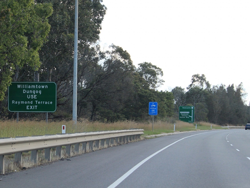
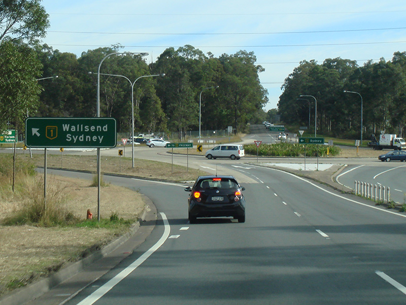
Intersection Directional Sign: ID sign at Beresfield at the roundabout with Sydney-Newcastle Fwy (NH1), John Renshaw Dr (B68 (former SR132) and NR1) and Weakleys Dr, July 2013. This is the beginning of the northern NR1 section. Image © Paul Rands |
|
 |
Safe-T-Cam Signage: Sign at Twelve Mile Creek approaching the Safe-T-Cam site and heavy vehicle inspection station, July 2013. Image © Paul Rands |
 |
Reassurance Directional Sign: Distance sign at Beresfield, July 2013. Image © Paul Rands |
|
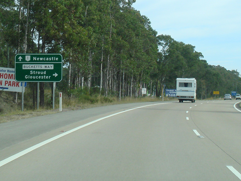 |
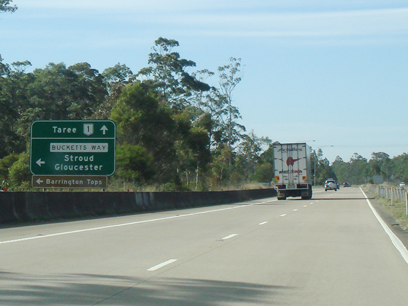
Advance Directional Sign: AD sign at Twelve Mile Ck, approaching Bucketts Way (TD2) (former Pacific Hwy alignment), July 2013. Click here for a photo of this location by Rob Tilley from November 2010. Image © Paul Rands |
 |
Advance Directional Sign: AD sign at Beresfield approaching New England Hwy (A43 (former NH15)), July 2013. Image © Paul Rands |
|
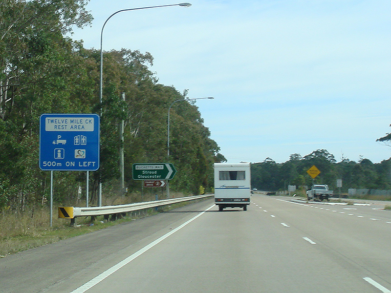 |
Services Sign: Services sign at Twelve Mile Creek, approaching Twelve Mile Creek Rest Area, July 2013. Image © Paul Rands |
 |
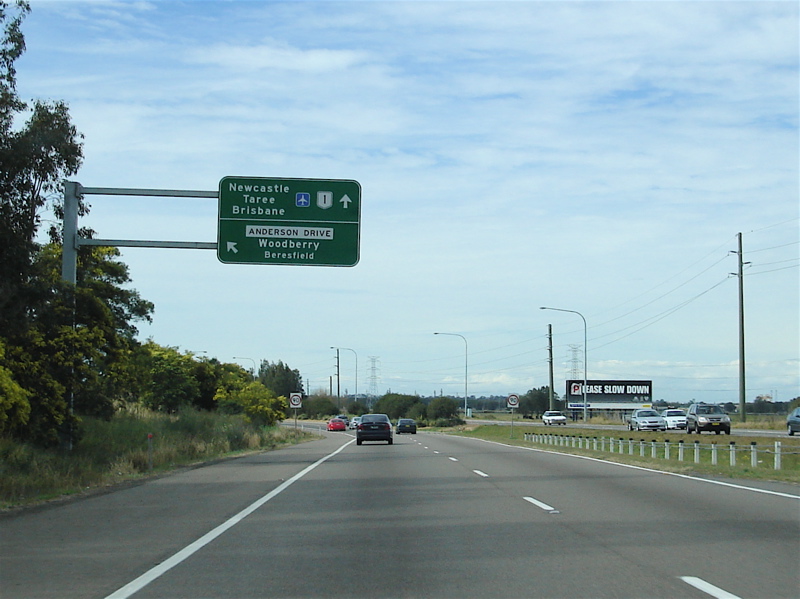
New England Highway: John Renshaw Dr (NR1) at the New England Hwy (A43) interchange at Beresfield, July 2013. Image © Paul Rands |
|
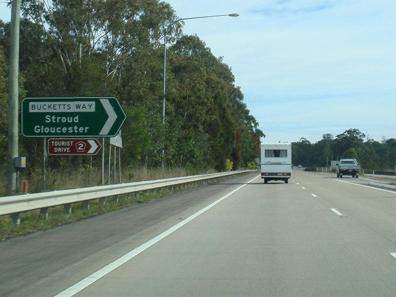 |
Bucketts Way: Corner of Pacific Hwy (NR1) and Bucketts Way (TD2) at Twelve Mile Creek, July 2013. Image © Paul Rands |
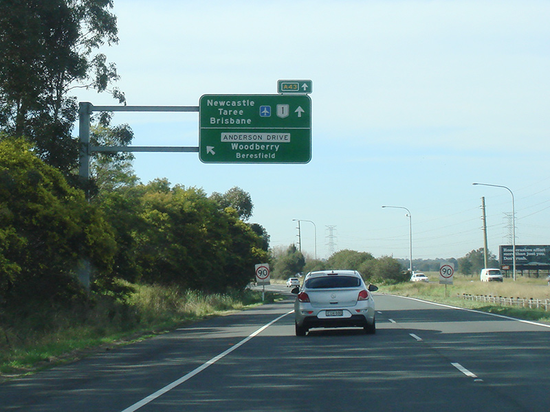 |
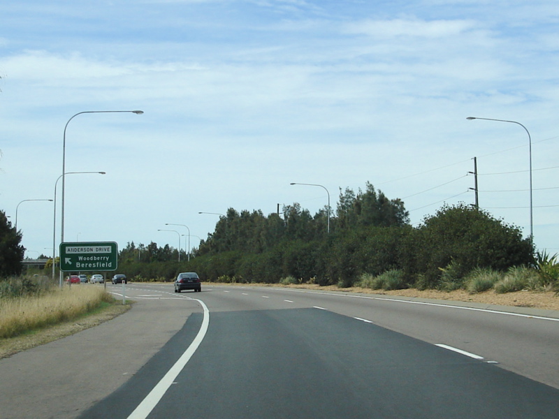
Advance Directional Sign: AD sign approaching Anderson Dr at Tarro, July 2013. Click here for a photo of this location by Paul Rands from August 2007. Image © Paul Rands |
|
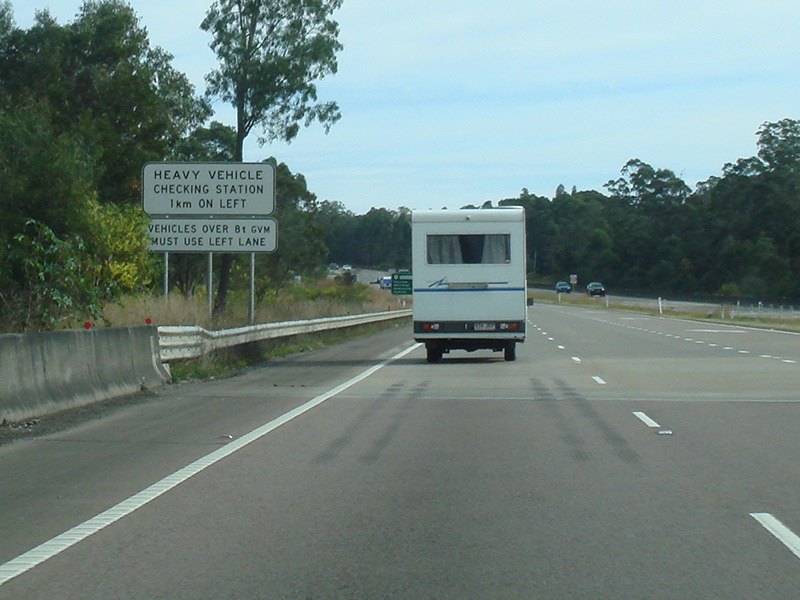 |
Heavy Vehicle Inspection Station Signage: Sign approaching heavy vehicle inspection station at Twelve Mile Ck, July 2013. Image © Paul Rands |
 |
Anderson Drive: New England Hwy (NR1) at Anderson Dr interchange, Tarro, July 2013. Click here for a photo of this location by Paul Rands from August 2007. Image © Paul Rands |
|
 |
Reassurance Directional Sign: Distance sign at Twelve Mile Creek, July 2013. Image © Paul Rands |
 |
Anderson Drive: New England Hwy (NR1) at Anderson Dr interchange, Tarro, July 2013. Click here for a photo of this location by Paul Rands from August 2007. Image © Paul Rands |
|
 |
Heavy Vehicle Inspection Station Signage: Sign approaching heavy vehicle inspection station at Twelve Mile Ck, July 2013. Image © Paul Rands |
 |
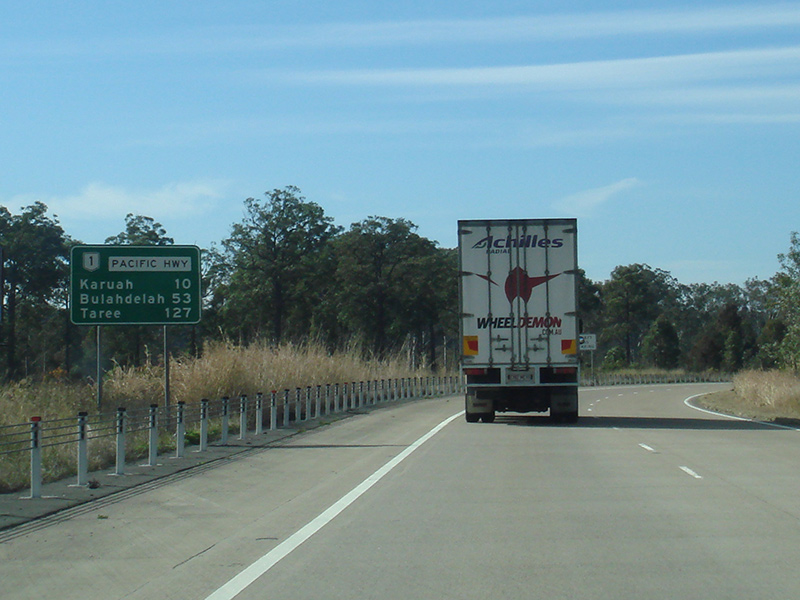
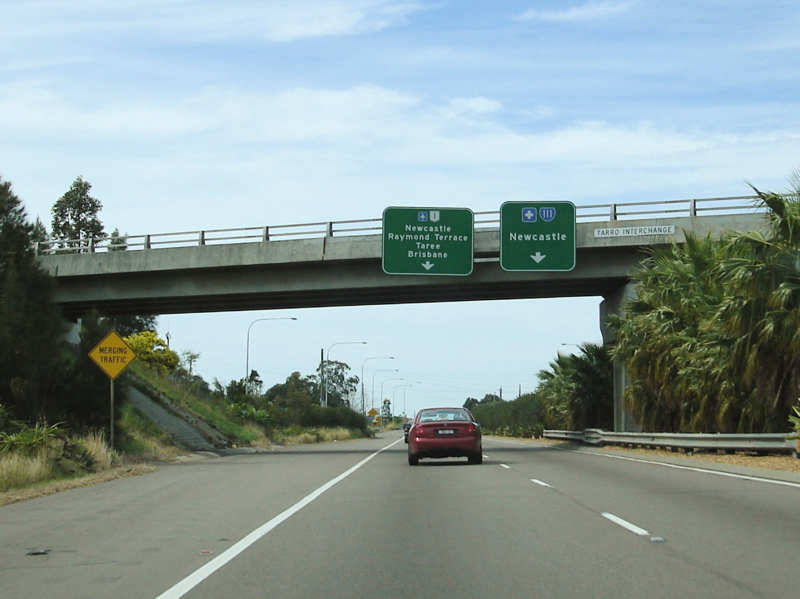
Advance Directional Sign: AD sign at Hexham approaching Pacific Hwy (SR111 and NR1), August 2011. Image © Paul Rands |
|
 |
Heavy Vehicle Inspection Station Signage: Sign approaching heavy vehicle inspection station at Twelve Mile Ck, July 2013. Image © Paul Rands |
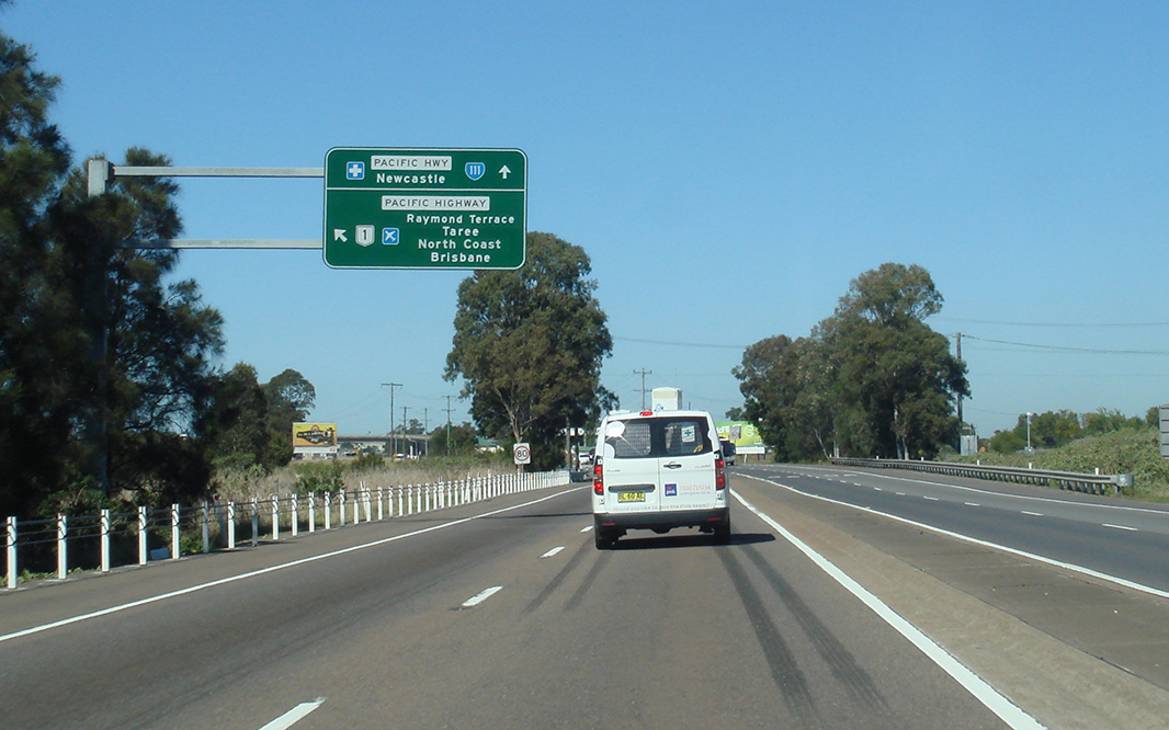 |
Advance Directional Sign: AD sign at Hexham approaching Pacific Hwy (SR111 and NR1), August 2011. Image © Paul Rands |
|
 |
Heavy Vehicle Checking Station: Pacific Hwy (NR1) at the Heavy Vehicle Checking Station at Twelve Mile Creek, July 2013. Image © Paul Rands |
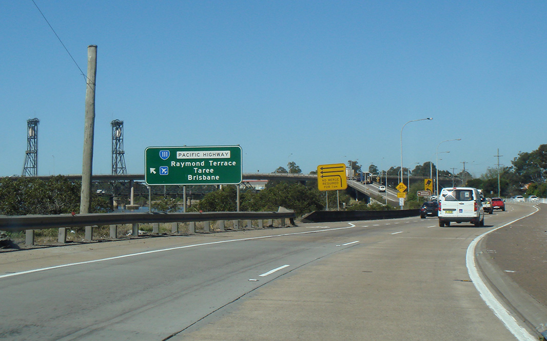 |
Advance Directional Sign: AD sign at Hexham approaching Pacific Hwy (SR111 and NR1), August 2011. Note the incorrect SR111 shield Image © Paul Rands |
|
 |
Heavy Vehicle Checking Station: Pacific Hwy (NR1) at the Heavy Vehicle Checking Station at Twelve Mile Creek, July 2013. Image © Paul Rands |
 |
Advance Directional Sign: AD sign at Hexham approaching Pacific Hwy (SR111 and NR1), July 2013. Click here for a photo of this location by Paul Rands from August 2007. Image © Paul Rands |
|
 |
Heavy Vehicle Checking Station: Pacific Hwy (NR1) at the Heavy Vehicle Checking Station at Twelve Mile Creek, July 2013. Image © Paul Rands |
 |
Pacific Highway Junction: New England Hwy at the junction with Pacific Hwy at Hexham, August 2008. Image © Paul Rands |
|
 |
Emergency Phones Sign: Special emergency phones sign near the catchment to Grahamstown Dam at Twelve Mile Creek, July 2013. Image © Paul Rands |
 |
Suuplemental Advance Directional Sign: Supplemental AD sign at Hexham approaching Pacific Hwy (SR111 and NR1), August 2011. Image © Paul Rands |
|
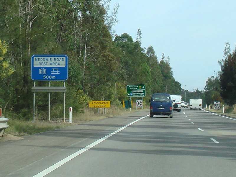 |
Services Sign: Services sign at Twelve Mile Creek, approaching Medowie Rest Area, July 2013. Image © Paul Rands |
 |
Hexham Bridge Approach: Ramp onto Hexham Bridge over Hunter River at Hexham, July 2013. Image © Paul Rands |
|
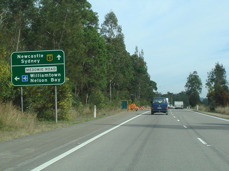 |
Advance Directional Sign: AD sign at Twelve Mile Ck approaching Medowie Rd, July 2013. Click here for a photo of this location by Rob Tilley from November 2010. Image © Paul Rands |
 |
Hexham Bridge: Hexham Bridge over Hunter River at Hexham, November 2010. Image © Rob Tilley |
|
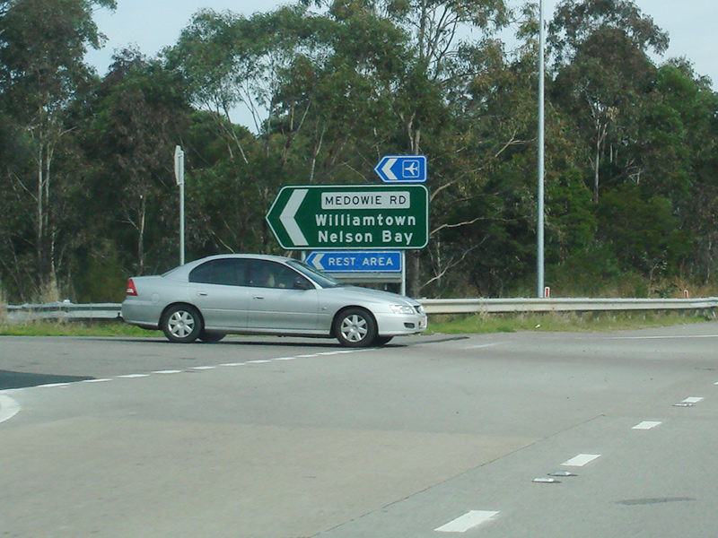 |
Medowie Road: Corner of Pacific Hwy (NR1) and Medowie Rd at Twelve Mile Ck, July 2013. Click here for a photo of this location by Rob Tilley from November 2010. Image © Paul Rands |
 |
Pacific Highway Junction: New England Hwy at the junction with Pacific Hwy at Hexham, August 2008. Image © Paul Rands |
|
 |
Intersection Directional Sign: Fingerboard at the junction with Italia Rd, Twelve Mile Ck, November 2010. Image © Rob Tilley |
 |
Advance Directional Sign: AD sign at Tomago approaching Tomago Rd, July 2013. Image © Paul Rands |
|
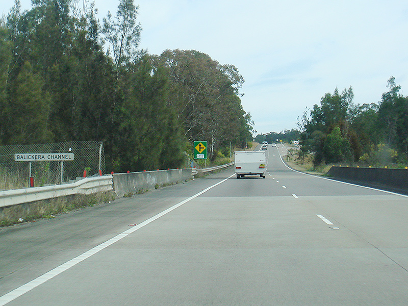 |
Balickera Channel: Pacific Hwy (NR1) as it crosses Balickera Channel at Balickera, July 2013. Image © Paul Rands |
 |
Reassurance Directional Sign: Tourism based distance sign at Tomago, July 2013. Image © Paul Rands |
|
 |
Supplemental Advance Directional Sign: Supplemental AD sign at Balickera, approaching Richardsons Rd, July 2013. Image © Paul Rands |
 |
Tomago Road: Corner of Pacific Hwy (NR1) and Tomago Rd in Tomago, July 2013. Image © Paul Rands |
|
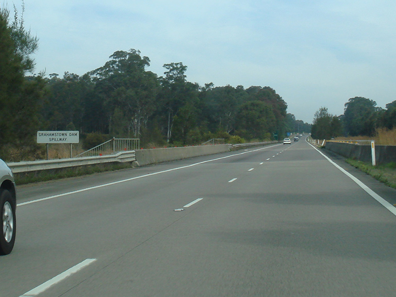 |
Grahamstown Dam Slipway: Pacific Hwy (NR1) at Raymond Terrace as it crosses the Grahamstown Dam Slipway, July 2013. Image © Paul Rands |
 |
Rest Area Reassurance Directional Sign: Services based distance sign at Tomago, August 2008. Image © Paul Rands |
|
 |
Supplemental Advance Directional Sign: Supplemental AD sign at Raymond Terrace, approaching Richardsons Rd, November 2010. Image © Rob Tilley |
 |
Reassurance Directional Sign: Distance sign at Tomago, 2009. |
|
 |
Services Sign: Services sign at Raymond Terrace, approaching Richardsons Rd, July 2013. Image © Paul Rands |
 |
Supplemental Advance Directional Sign: Supplemental AD sign at Heatherbrae approaching Masonite Rd, July 2013. Image © Paul Rands |
|
 |
Supplemental Advance Directional Sign: Supplemental AD sign at Raymond Terrace, approaching Richardsons Rd, November 2010. Image © Rob Tilley |
 |
Supplemental Advance Directional Sign: Supplemental AD sign at Heatherbrae approaching Masonite Rd, 2009. |
|
 |
Advance Directional Sign: AD sign at Raymond Terrace, approaching Richardsons Rd, July 2013. Image © Paul Rands |
 |
Supplemental Advance Directional Sign: Supplemental AD sign at Heatherbrae approaching Masonite Rd, August 2008. Image © Paul Rands |
|
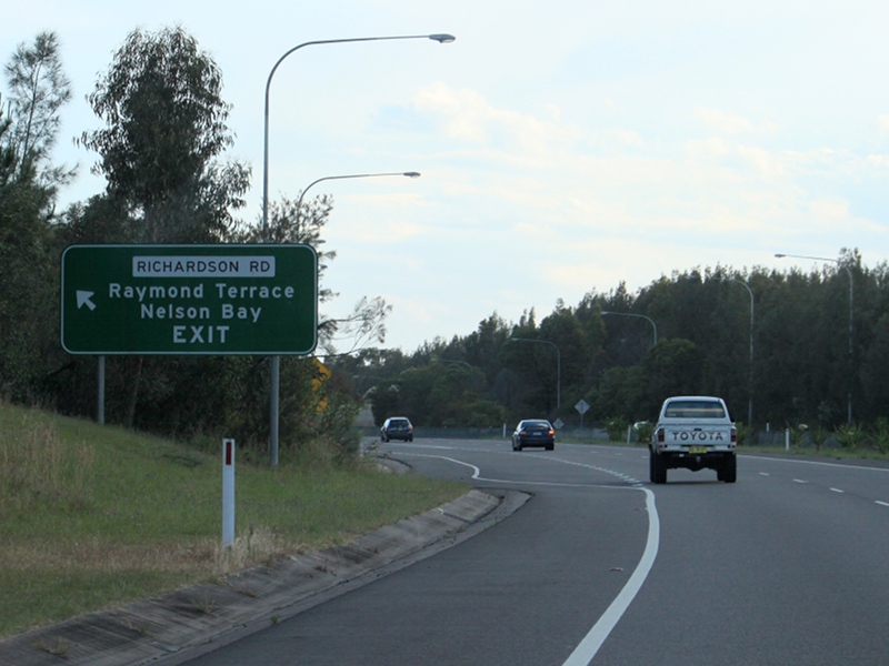 |
Richardsons Road: Pacific Hwy (NR1) at the Richardson Rd interchange, Raymond Terrace, November 2010. Image © Rob Tilley |
 |
Roundabout Warning Signs: Special roundabout warning signs approaching Masonite Rd at Heatherbrae, August 2008. Image © Paul Rands |
|
 |
Reassurance Directional Sign: Distance sign at Raymond Terrace, November 2010. Image © Rob Tilley |
 |
Advance Directional Sign: AD sign at Heatherbrae approaching Masonite Rd, July 2013. Image © Paul Rands |
|
 |
Entering Heatherbrae: Pacific Hwy (NR1) as it enters the town of Heatherbrae, July 2013. Image © Paul Rands |
 |
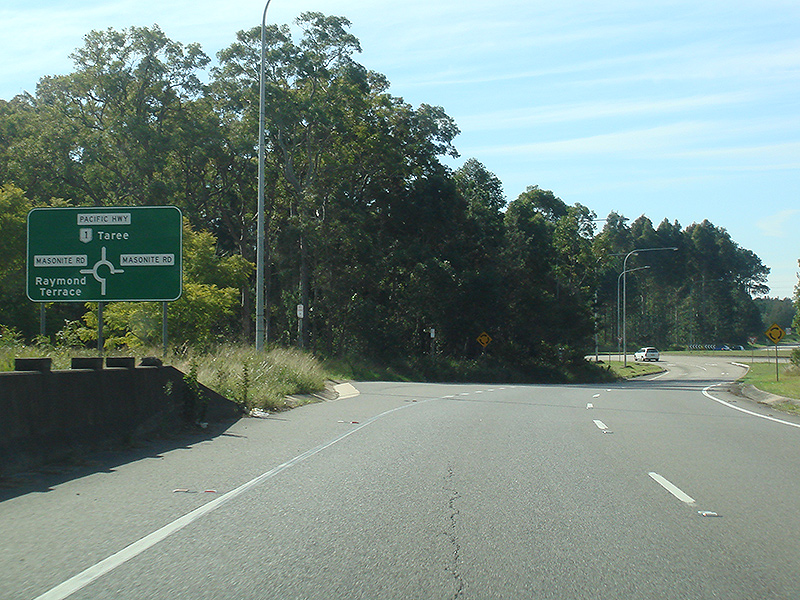
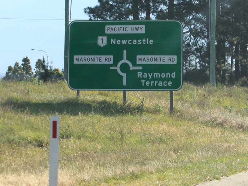
Intersection Directional Sign: ID sign on Masonite Rd intersection at Heatherbrae, July 2013. Image © Paul Rands |
|
 |
Advance Directional Sign: AD sign approaching Masonite Rd at Heatherbrae, July 2013. Click here for a photo of this location by Rob Tilley from November 2010. Image © Paul Rands |
 |
Reassurance Directional Sign: Distance sign at Raymond Terrace, July 2013. Image © Paul Rands |
|
 |
Flashing Warning Sign: Flashing warning sign approaching Masonite Rd at Heatherbrae, July 2013. Image © Paul Rands |
 |
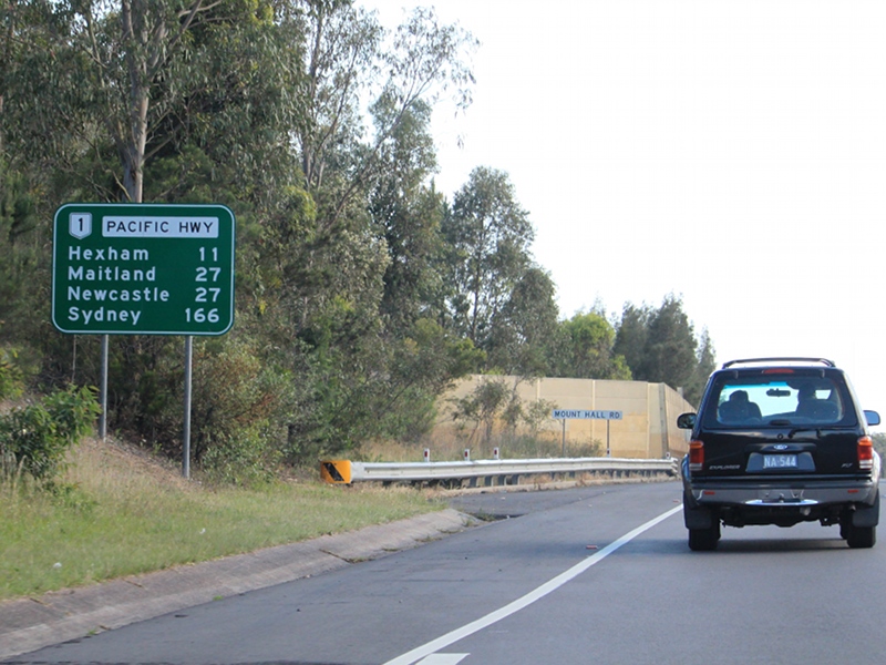
Mount Hall Road: Pacific Hwy (NR1) as it passes over Mt Hall Rd at Raymond Terrace, July 2013. Image © Paul Rands |
|
 |
Intersection Directional Sign: ID sign assembly on the roundabout with Masonite Rd at Heatherbrae, July 2013. Image © Paul Rands |
 |
Grahamstown Canal: Pacific Hwy (NR1) as it crosses Grahamstown Canal at Raymond Terrace, August 2008. Image © Paul Rands |
|
 |
Reassurance Directional Sign: Distance sign at Heatherbrae, November 2010. Image © Rob Tilley |
 |
Advance Directional Sign: AD sign at Raymond Terrace, approaching Richardsons Rd, August 2008. Image © Paul Rands |
|
 |
Supplemental Advance Directional Sign: Supplemental AD sign at Heatherbrae for Pacific Hwy (SR111) and New England Hwy (NR1 / NH15), November 2010. Image © Rob Tilley |
 |
Richardsons Road: Pacific Hwy (NR1) at the Richardsons Rd interchange at Raymond Terrace, August 2008. Image © Paul Rands |
|
 |
Advance Directional Sign: AD sign at Tomago for Tomago Rd, July 2013. Image © Paul Rands |
 |
Advance Directional Sign: AD sign at Raymond Terrace, on the off ramp to Richardsons Rd, August 2008. Image © Paul Rands |
|
 |
Tomago Road: Pacific Hwy (NR1) at Tomago Rd, Tomago, July 2013. Image © Paul Rands |
 |
Intersection Directional Sign: ID sign at Raymond Terrace, on the off ramp to Richardsons Rd, August 2008. Image © Paul Rands |
|
 |
Supplemental Advance Directional Sign: Supplemental AD sign at Tomago for Pacific Hwy (SR111) and New England Hwy (NR1 / NH15), July 2013. Click here for a photo of this location by Rob Tilley from November 2010. Image © Paul Rands |
 |
Advance Directional Sign: AD sign at Raymond Terrace,on Richardsons Rd approaching Pacific Hwy (NR1), 2009. Image © Jamie Scuglia |
|
 |
Supplemental Advance Directional Sign: Supplemental AD sign at Tomago for Pacific Hwy (SR111) and New England Hwy (NR1 / NH15), November 2010. Image © Rob Tilley |
 |
Reassurance Directional Sign: Distance sign at Raymond Terrace, July 2013. Image © Paul Rands |
|
 |
Overheight Warning Sign: Overheight warning sign at Tomago approaching Hexham Bridge over Hunter River, July 2013. Image © Paul Rands |
 |
Emergency Phones Sign: Special emergency phones sign near the catchment to Grahamstown Dam at Ferodale, July 2013. Image © Paul Rands |
|
 |
Reassurance Directional Sign: Distance sign at Tomago, with Hexham Bridge in the distance, November 2010. Image © Rob Tilley |
 |
Italia Road: Corner of Pacific Hwy (NR1) and Italia Rd at Balickera, July 2013. Image © Paul Rands |
|
 |
Reassurance Directional Sign: Tourism based distance sign at Toamgo, with Hexham Bridge in the distance, November 2010. Image © Rob Tilley |
 |
Balickera Channel: Pacific Hwy (NR1) as it crosses Balickera Channel at Balickera, July 2013. Image © Paul Rands |
|
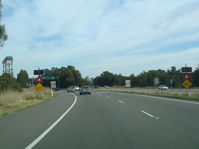 |
Opening Bridge Warning Signs: Opening bridge warning signs at Tomago approaching Hexham Bridge over Hunter River,, July 2013. Image © Paul Rands |
 |
Advance Directional Sign: AD sign for Twelve Mile Hill Rest Area at Balickera, July 2013. Image © Paul Rands |
|
 |
Advance Directional Sign: Supplemental AD sign at Tomago for Pacific Hwy (A43) and New England Hwy (NR1 / A43), July 2013. Click here for a photo of this location by Rob Tilley from November 2010. Image © Paul Rands |
 |
Advance Directional Sign: AD sign at Balickera, approaching Medowie Rd, July 2013. Image © Paul Rands |
|
 |
Hexham Bridge: Pacific Hwy (NR1) at Tomago as it crosses Hunter River via Hexham Bridge, July 2013. Image © Paul Rands |
 |
Medowie Road: Corner of Pacific Hwy (NR1) and Medowie Rd at Balickera, July 2013. Image © Paul Rands |
|
 |
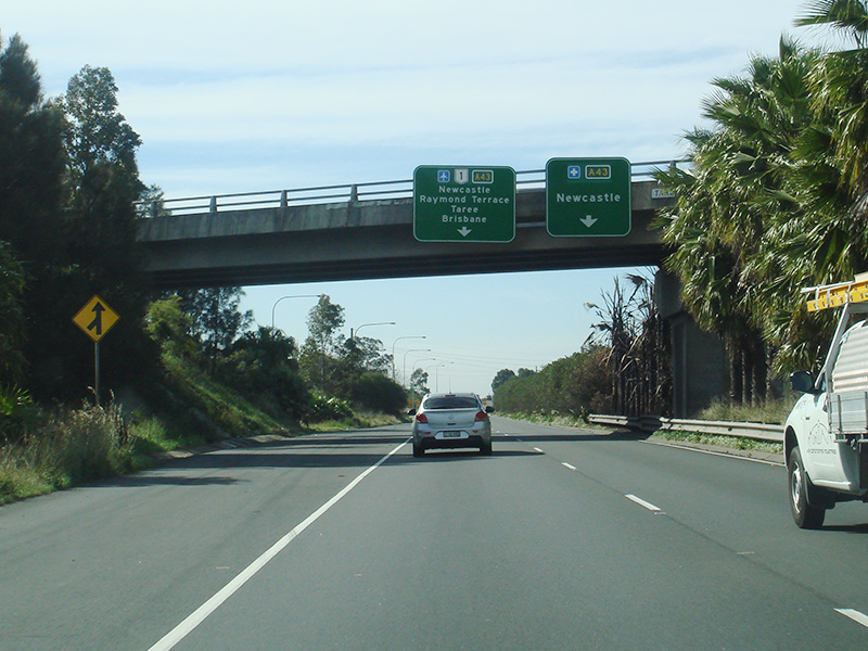
Intersection Directional Sign: ID sign at Hexham approaching Pacific Hwy (A43) and New England Hwy (NR1 / A43), July 2013. Click here for a photo of this location by Rob Tilley from November 2010. Image © Paul Rands |
 |
Advance Directional Sign: AD sign for Twelve Mile Hill Rest Area at Balickera, July 2013. Image © Paul Rands |
|
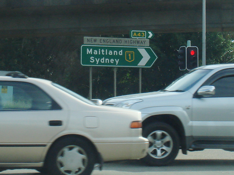 |
Intersection Directional Sign: ID sign at Hexham approaching Pacific Hwy (A43) and New England Hwy (NR1 / A43), July 2013. Click here for a photo of this location by Rob Tilley from November 2010. Image © Paul Rands |
 |
Supplemental Advance Directional Sign: Supplemental AD sign at Twelve Mile Creek, approaching Bucketts Way (TD2), July 2013. Image © Paul Rands |
|
 |
Reassurance Directional Sign: Distance sign at Hexham, November 2010. Image © Rob Tilley |
 |
Advance Directional Sign: AD sign at Twelve Mile Creek, approaching Bucketts Way (TD2), July 2013. Image © Paul Rands |
|
 |
Supplemental Advance Directional Sign: Supplemental AD sign approaching Anderson Dr (former New England Hwy alignment) at Tarro, November 2010. Image © Rob Tilley |
 |
Bucketts Way: Corner of Pacific Hwy (NR1) and Bucketts Way (TD2) at Twelve Mile Ck, July 2013. Image © Paul Rands |
|
 |
Advance Directional Sign: AD sign approaching Anderson Dr (former New England Hwy alignment) at Tarro, November 2010. Image © Rob Tilley |
 |
Reassurance Directional Sign: Distance sign at Twelve Mile Creek, July 2013. Image © Paul Rands |
|
 |
Anderson Drive: New England Hwy (NR1 / A43) at the Anderson Dr interchange in Tarro, November 2010. Image © Rob Tilley |
|||
 |
Advance Directional Sign: AD sign at Tarro approaching John Renshaw Dr (NR1), November 2010. Image © Rob Tilley |
|||
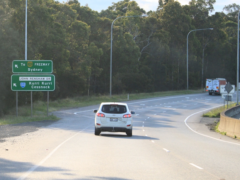 |
John Renshaw Drive Interchange: New England Hwy (NR1 / A43) at the interchange with John Renshaw Dr (NR1) and New England Hwy (A43 (former NH15)), November 2010. Image © Rob Tilley |
|||
 |
Supplemental Advance Directional Sign: Supplemental AD sign at Beresfield approaching Sydney-Newcastle Fwy (NR1), Weakleys Dr and John Renshaw Dr (B68), July 2013. Image © Paul Rands |
|||
 |
Advance Directional Sign: AD sign at Beresfield approaching Sydney-Newcastle Fwy (NR1), Weakleys Dr and John Renshaw Dr (B68), July 2013. Image © Paul Rands |
|||
 |
Sydney-Newcastle Freeway, Weakleys Drive & John Renshaw Drive: John Renshaw Dr (NR1) at Beresfield approaching Sydney-Newcastle Fwy (NR1), Weakleys Dr and John Renshaw Dr (B68), July 2013. This is the southern terminus of the northern section of National Route 1. Image © Paul Rands |
|||
 |
Sydney-Newcastle Freeway, Weakleys Drive & John Renshaw Drive: John Renshaw Dr (NR1) at Beresfield approaching Sydney-Newcastle Fwy (NR1), Weakleys Dr and John Renshaw Dr (B68), July 2013. This is the southern terminus of the northern section of National Route 1. Image © Paul Rands |
|||
 |
Sydney-Newcastle Freeway, Weakleys Drive & John Renshaw Drive: John Renshaw Dr (NR1) at Beresfield approaching Sydney-Newcastle Fwy (NR1), Weakleys Dr and John Renshaw Dr (B68), July 2013. This is the southern terminus of the northern section of National Route 1. Image © Paul Rands |
|||
| Click here for the continuation of the route as National Highway 1 (Sydney-Newcastle Freeway) Click here for the continuation of National Route 1 between Bulahdelah and Karuah Click here for Metroad 1 between through the Sydney region Click here for National Route 1 between Waterfall (Sydney) and Gwynneville (Wollongong) |
||||
1 Roads and Traffic Authority, Schedule of Classified Roads and State & Regional Roads, 31 January 2011
2 Main Roads Board, Annual Report, 1930-31
3 RTA Thematic History, 2nd Edition, 2006
4 Department of Main Roads, Annual Report, 1946-47
5 Department of Main Roads, Annual Report, 1951-52
6 Department of Main Roads, Annual Report, 1952-53
7 Department of Main Roads, Annual Report, 1955-56
8 Department of Main Roads, Annual Report, 1957-58
9 Department of Main Roads, Annual Report, 1959-60
10 Department of Main Roads, Annual Report, 1960-61
11 Department of Main Roads, Annual Report, 1961-62
12 Department of Main Roads, Annual Report, 1963-64
13 Department of Main Roads, Annual Report, 1964-65
14 Department of Main Roads, Annual Report, 1965-66
15 Department of Main Roads, Annual Report, 1966-67
16 Department of Main Roads, Annual Report, 1967-68
17 Department of Main Roads, Annual Report, 1970-71
18 Department of Main Roads, Annual Report, 1973-74
19 Department of Main Roads, Annual Report, 1977-78
20 Roads and Maritime Services, Projects, Pacific Highway Upgrade, Hexham to Port Macquarie, Completed Projects, Raymond Terrace Bypass
21 Roads and Maritime Services, Project Fact Sheet, Bangalow Bypass
22 Roads and Maritime Services, Projects, Pacific Highway Upgrade, Hexham to Port Macquarie, Completed Projects, Taree Bypass
23 Roads and Maritime Services, Projects, Pacific Highway Upgrade, Port Macquarie to Coffs Harbour, Completed Projects, Eungai Deviation
24 Roads and Maritime Services, Projects, Pacific Highway Upgrade, Hexham to Port Macquarie, Completed Projects, Raymond Terrace to Karuah
25 Roads and Maritime Services, Projects, Pacific Highway Upgrade, Hexham to Port Macquarie, Completed Projects, Raymond Terrace to Karuah
Last updated: 12-Sep-2020 12:03
This site © Paul Rands. All rights reserved. Some portions © (copyright) by their respective and credited owners. Permission must be obtained before using any images from this site. For details, please email by clicking here.