|
|
|
|
|
 |
Pacific Highway, New England Highway, John Renshaw Drive, Southern Freeway, Mount Ousley Road & Princes Highway (National Route 1) (Decommissioned): Queensland Border to Brunswick Heads |
Statistics:
Route Numbering:
General Information:
National Route 1 forms part of the main coastal route between Victoria and Queensland. The route features a mix of rural highway, arterial and freeway design standards. The route forms part of what is collectively known as Highway 1. It is Australia's coastal highway joining all mainland's state capitals and coastal towns circumnavigating the entire Australian continent. It is also the longest numbered highway in the world, covering more than 14 500 km.
In New South Wales, National Route 1 was truncated by National Highway 1 between Beresfield and Wahroonga, by Metroad 1 between Wahroonga and Waterfall and by M1 at Tweed Heads West.
Northern Section:
The northern section of National Route 1 took in a small section of New England Highway and the rest was made up by the Pacific Highway. The route varies from dual carriageway arterial and highway standard, to motorway standard and the rest is generally undivided rural highway conditions. The Pacific Highway is very well trafficked, and as a result notorious for a large amount of road trauma within the state. These crashes have resulted in more than 50% of the route being divided since the late 1980s.
The Pacific Highway section of NR1 runs between Brunswick Heads and Hexham, and also between Wahroonga and the Gore Hill Freeway at Artarmon. The northern section between Brunswick Heads and Hexham is a mix of dual carriageway, rural highway and urban arterial roadway. The southern section between Wahroonga and Artarmon is urban arterial standard and passes through one of Sydney's more affluent areas.
The highway traces its origins back to an early settler, George Peat, who owned the land between the Hawkesbury River and Mooney Mooney Creek. To provide access to his property, Peat began a ferry service across the Hawkesbury River in 1844 and surveyed, then constructed a road between Hornsby and Kariong in 1854. After his death in 1870, the ferry service was abandoned and the road fell into disrepair, finally closing to all traffic in 1899, following the completion of the Sydney-Newcastle railway.
Demand for a route between Sydney and Newcastle dates back to the early 20th century. When the only access was via the sea or via a long route through the town of Wiseman's Ferry. In the 1920s, the then Main Roads Board undertook a series of surveys to form an easier and more reliable route north from Sydney. In 1928 construction began on upgrading the old road and converting it to a modern standard, plus creating a new route north, utilising some of the abandoned Peat's Ferry Rd, while improving the horizontal and vertical alignments. In May 1930 the ferry service across the Hawkesbury River was re-established to service the new road until such times that a bridge became necessary. June 1930 marked the completion of the concrete surfacing.
During the time of the Hornsby to Gosford construction, improvements were made to roads between Gosford to Newcastle as part of the link. On May 17 in 1929, the route was named as the Great Northern Highway. The work from Hornsby to Gosford cost almost £1 million, however it was money well spent, reducing the trip from Sydney to Newcastle from 9 hours to 4 ½ hours.
History:
Pacific Highway:
Click here for photos of the former alignment between the QLD Border and Brunswick Heads
Click here for historic photos of NR1 between the QLD Border and Brunswick Heads
Click here for construction photos between the QLD Border and Brunswick Heads
| Queensland Border to Brunswick Heads | Brunswick heads to Queensland Border | |||
| Preview: | Description: | Preview: | Description: | |
 |
NSW-QLD Border: Pacific Hwy (NR1) as it crosses the NSW-QLD border at Tweed Heads, July 2007. This section of road became Gold Coast Hwy (SR2) when the Tugun Bypass opened in June 2008. Image © Paul Rands |
 |
Advance Directional Sign: AD sign at Billinudgel approaching Brunswick Valley Way (TD40), December 2009. Image © Rob Tilley |
|
 |
Fuel Sign: Sign indicating distance to next fuel, Tweed Heads, July 2007. This section of road became Gold Coast Hwy (SR2) when the Tugun Bypass opened in June 2008 and this sign has since been removed. Image © Paul Rands |
 |
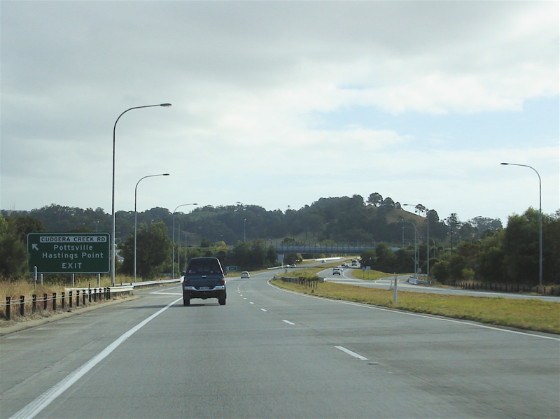
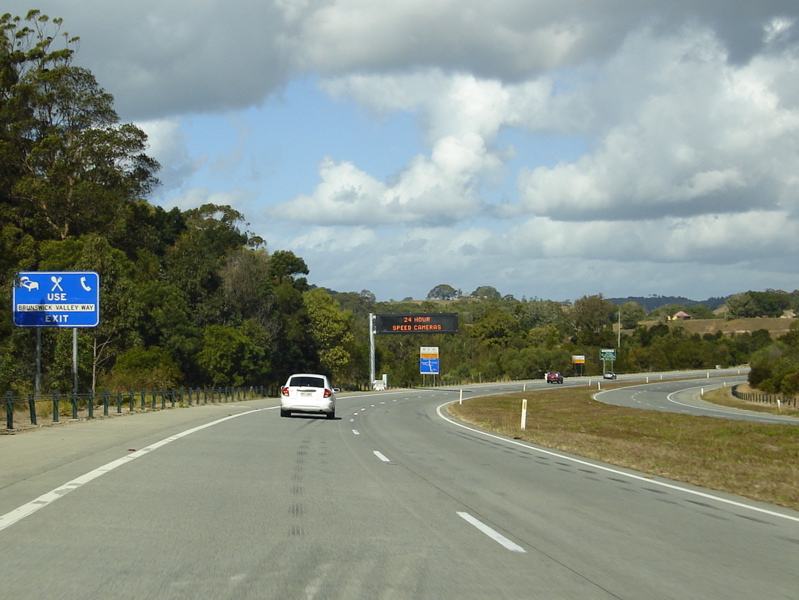
Brunswick Valley Way: Pacific Hwy (NR1) at the Brunswick Valley Way (TD40) interchange, Billinudgel, December 2009. Image © Rob Tilley |
|
 |
Reassurance Directional Sign: Tourism-based distance sign at Tweed Heads, July 2007. This section of road became Gold Coast Hwy (SR2) when the Tugun Bypass opened in June 2008. Image © Paul Rands |
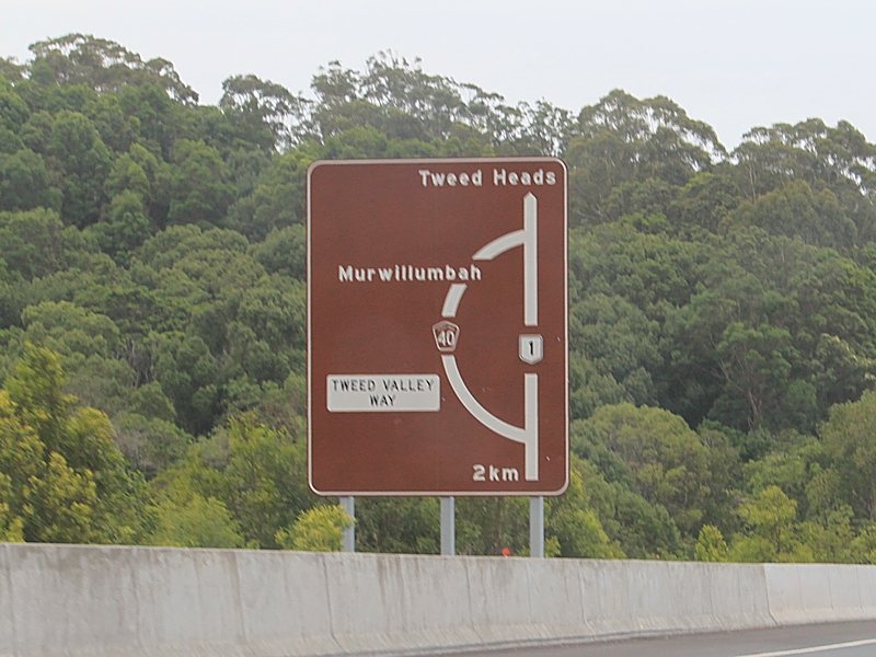 |
Advance Directional Sign: AD sign at Billinudgel approaching Tweed Valley Way (TD40), December 2009. Image © Rob Tilley |
|
 |
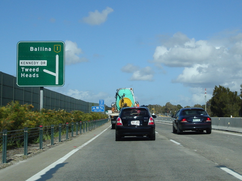
Advance Directional Sign: AD sign at Tweed Heads approaching Kennedy Dr, May 2005. Click here for a photo by Paul Rands of this location from July 2007. This section of road became Gold Coast Hwy (SR2) when the Tugun Bypass opened in June 2008 and this sign has since been removed. Image © Rob Tilley |
 |
Advance Directional Sign: AD sign at Billinudgel approaching Wilfred St, December 2009. Image © Rob Tilley |
|
 |
Reassurance Directional Sign: Distance sign at Tweed Heads, December 2009. This section of road became Gold Coast Hwy (SR2) when the Tugun Bypass opened in June 2008 and this sign has since been removed. Image © Rob Tilley |
 |
Supplemental Advance Directional Sign: Supplemental AD sign at Billinudgel approaching Tweed Valley Way (TD40), December 2009. Image © Rob Tilley |
|
 |
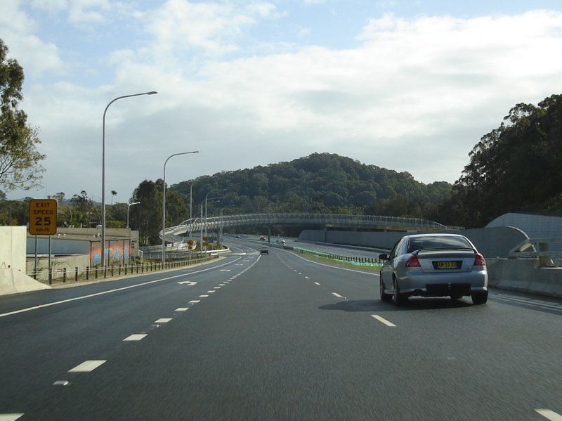
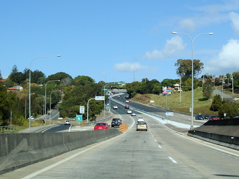
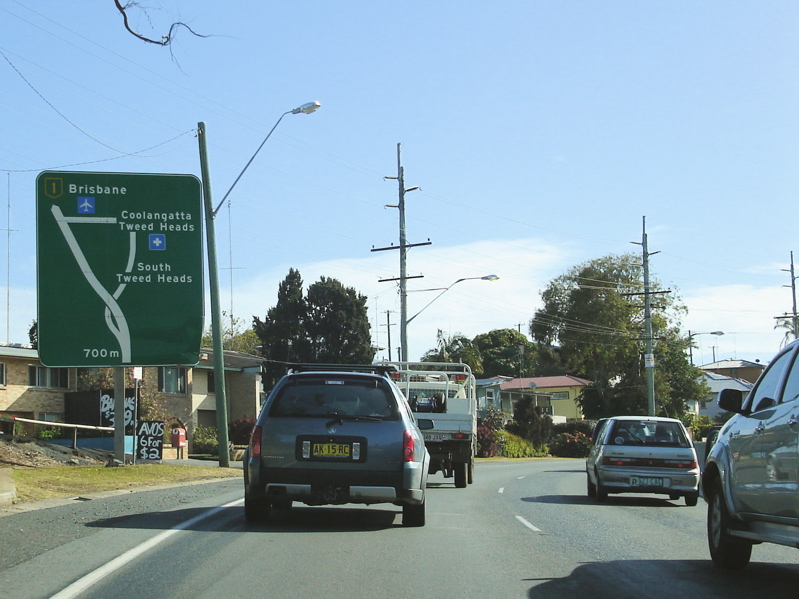
Start National Route 1: Overlooking Pacific Hwy (NR1) at South Tweed Heads from the Gold Coast Hwy (SR2) interchange, 2008. Image © Jamie Scuglia |
 |
Wilfred Street: Corner of Pacific Hwy (NR1) and Wilfred St at Billinudgel, July 2007. Image © Paul Rands |
|
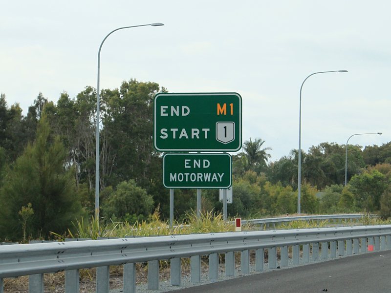 |
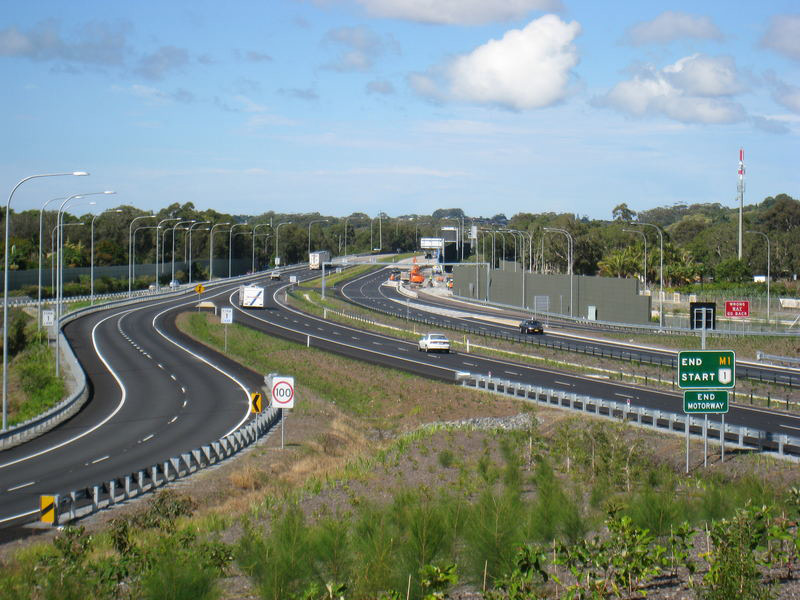
End M1 / Start NR1: Sign at the southern end of the Tugun Bypass (M1) at the interchange with Gold Coast Hwy (SR2) at South Tweed Heads showing the route number change from M1 to NR1, November 2010. Image © Rob Tilley |
 |
Wilfred Street: Corner of Pacific Hwy (NR1) and Wilfred St at Billinudgel, July 2007. Image © Paul Rands |
|
 |
Advance Directional Sign: AD sign at South Tweed Heads approaching Minjungbal Dr, July 2007. Minjungbal Dr is a former Pacific Hwy alignment. Image © Paul Rands |
 |
Wilfred Street: Corner of Pacific Hwy (NR1) and Wilfred St at Billinudgel, July 2007. Image © Paul Rands |
|
 |
Minjungbal Drive: Pacific Hwy (NR1) at South Tweed Heads at the interchange with Minjungbal Dr, December 2009. Image © Rob Tilley |
 |
Wilfred Street: Corner of Pacific Hwy (NR1) and Wilfred St at Billinudgel, July 2007. Note the alphanumeric sign. Image © Paul Rands |
|
 |
Minjungbal Drive: Pacific Hwy (NR1) at South Tweed Heads at the interchange with Minjungbal Dr, July 2007. This section of road was completely rebuilt when the Banora Point Upgrade opened in September 2012. Image © Paul Rands |
 |
Intersection Directional Sign: ID sign on Wilfred Street at Billinudgel, July 2007. Image © Paul Rands |
|
 |
Supplemental Advance Directional Sign: Supplemental AD sign at Banora Point approaching Laura St, December 2009. This section of road became Sexton Hill Drive when the Banora Point Upgrade opened in September 2012 and this sign has since been removed. Image © Rob Tilley |
 |
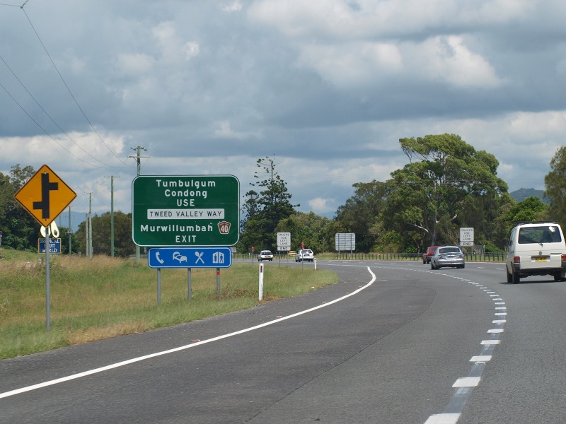
Advance Directional Sign: AD sign at Billinudgel approaching Tweed Valley Way & Brunswick Valley Way (TD40), December 2009. Click here for a photo by David Whiteman of this location from March 2003. Image © Rob Tilley |
|
 |
Advance Directional Sign: AD sign at Banora Point approaching Laura St, July 2007. This section of road became Sexton Hill Drive when the Banora Point Upgrade opened in September 2012 and this sign has since been removed. Image © Paul Rands |
 |
Tweed Valley Way & Brunswick valley Way: Pacific Hwy (NR1) at Billinudgel at the interchange with Tweed Valley Way & Brunswick Valley Way (TD40), July 2007. Click here for a photo by David Whiteman of this location from March 2003. Image © Paul Rands |
|
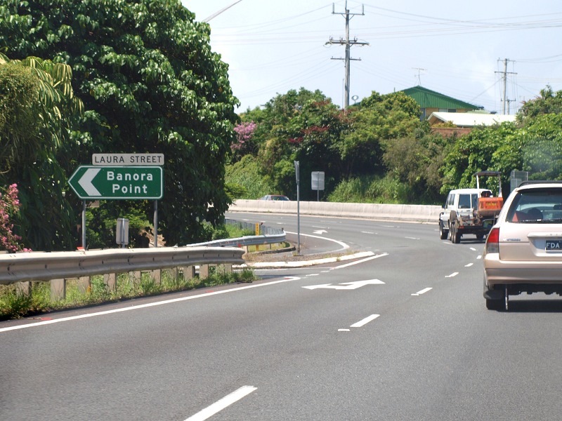 |
Laura Street: Corner of Pacific Hwy (NR1) and Laura St, Banora Point, February 2009. This section of road became Sexton Hill Drive when the Banora Point Upgrade opened in September 2012. Image © Rob Tilley |
 |
Advance Directional Sign: AD sign on the interchange with Tweed Valley Way & Brunswick Valley Way (TD40) at Billinudgel, July 2007. Image © Paul Rands |
|
 |
Advance Directional Sign: AD sign approaching Terranora Rd at Banora Point, February 2009. This section of road became Sexton Hill Drive when the Banora Point Upgrade opened in September 2012. Image © Rob Tilley |
 |
Tweed Valley Way & Brunswick valley Way: Pacific Hwy (NR1) at Billinudgel at the interchange with Tweed Valley Way & Brunswick Valley Way (TD40), July 2007. Image © Paul Rands |
|
 |
Advance Directional Sign: AD sign near Terranora Rd at Banora Point approaching Barneys Point Rd interchange, July 2007. This section of road became Sexton Hill Drive when the Banora Point Upgrade opened in September 2012. Image © Paul Rands |
 |
Distance Sign: Rest area reassurance directional sign at Billinudgel, July 2007. Image © Paul Rands |
|
 |
Barneys Point Road: Pacific Hwy (NR1) at the Barneys Point Rd interchange at Banora Point, July 2007. This section of road became Sexton Hill Drive when the Banora Point Upgrade opened in September 2012. Image © Paul Rands |
 |
Distance Sign: Reassurance directional sign at Yelgun, December 2009. Image © Rob Tilley |
|
 |
Barneys Point Road: Pacific Hwy (NR1) at the Barneys Point Rd interchange at Banora Point, December 2009. This section of road became Sexton Hill Drive when the Banora Point Upgrade opened in September 2012. Image © Rob Tilley |
 |
Distance Sign & Wildlife Crossing: Reassurance directional sign and wildlife crossing at Yelgun, July 2007. Image © Paul Rands |
|
 |
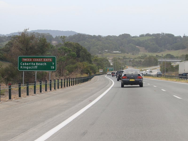
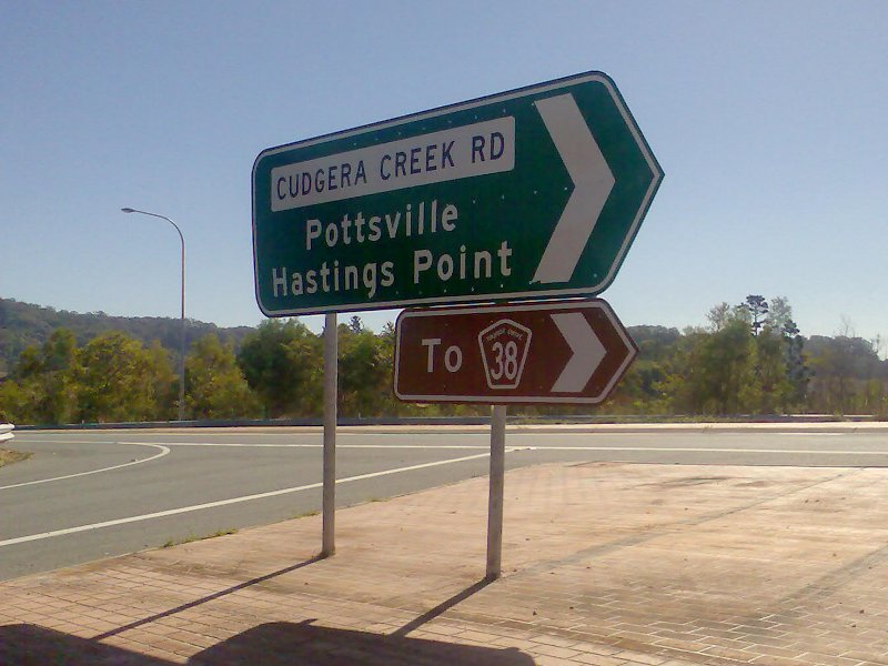
Advance Directional Sign: AD sign at Banora Point near Barneys Point Rd interchange approaching Tweed Coast Way (Fingal Rd) (TD38), July 2007. Click here for a photo by Rob Tilley from December 2009 of a close up of the sign. Significant changes to this section of road have occurred since the completion of the Banora Point Upgrade in September 2012. Image © Paul Rands |
 |
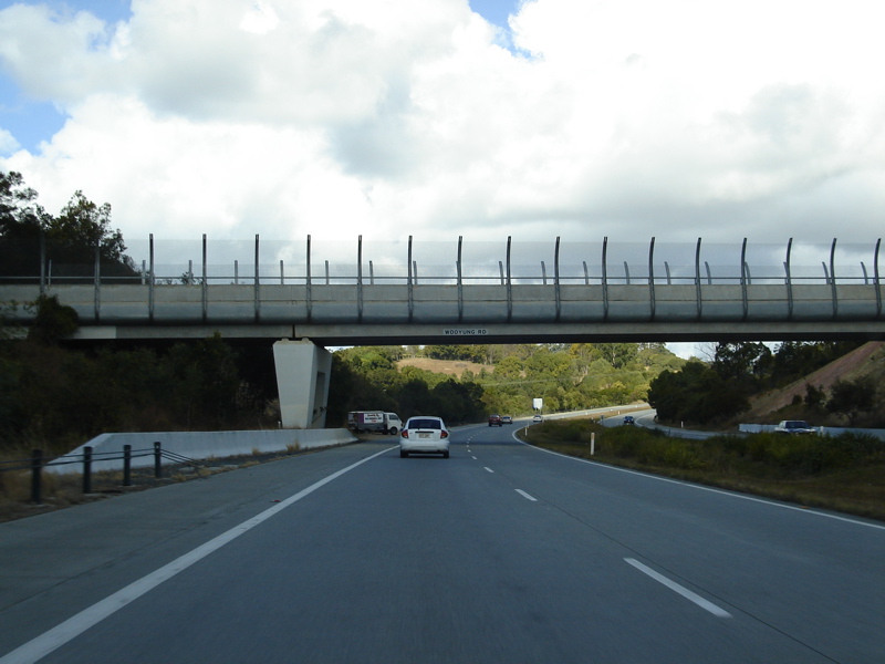
Wooyung Road: Pacific Hwy (NR1) as it passes under Wooyung Rd at Yelgun, July 2007. Image © Paul Rands |
|
 |
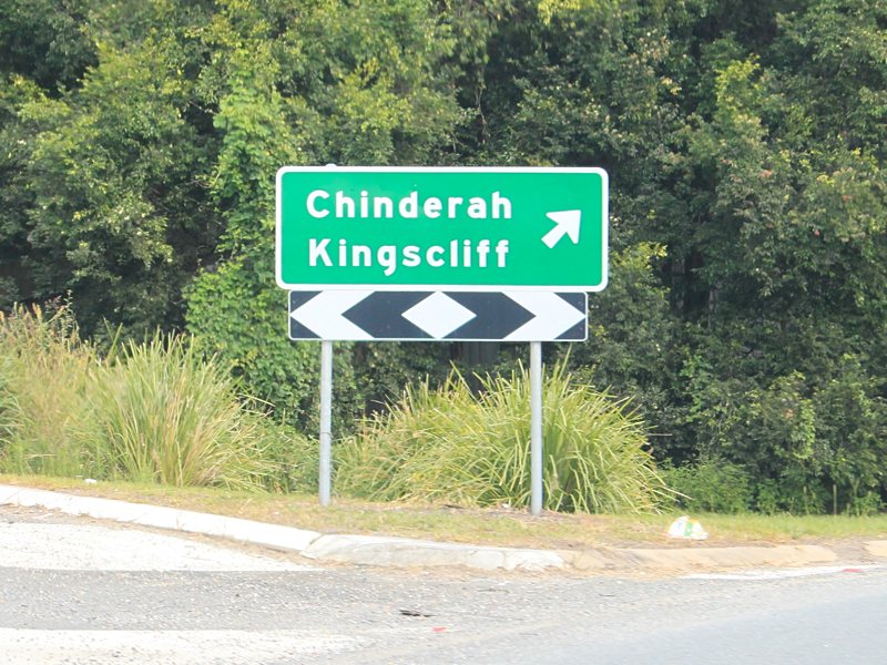
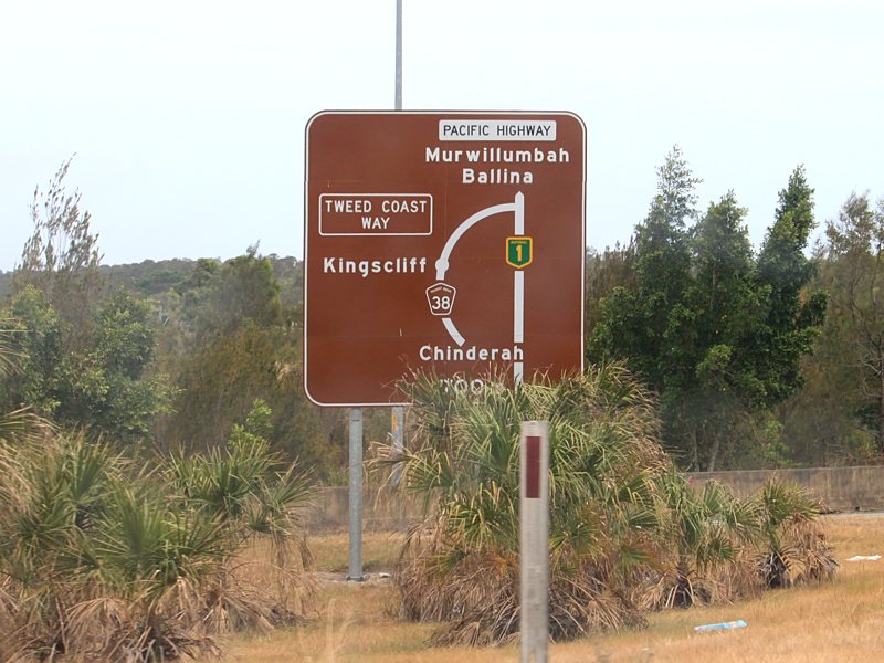
Advance Directional Sign: AD sign at Chinderah approaching Tweed Coast Way (Fingal Rd) (TD38), December 2009. Image © Rob Tilley |
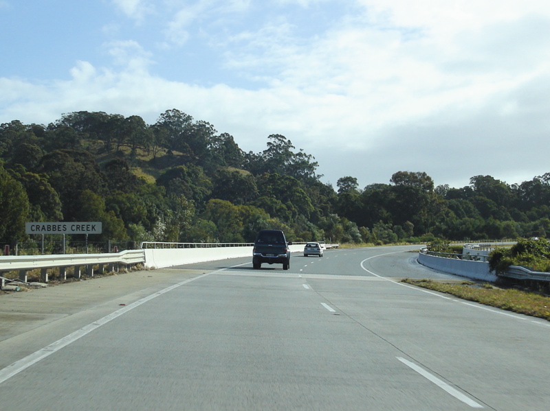 |
Crabbes Creek: Pacific Hwy (NR1) as it crosses Crabbes Creek at Crabbes Creek, July 2007. Image © Paul Rands |
|
 |
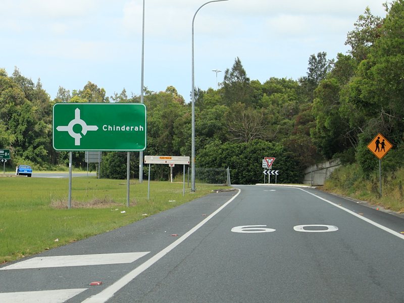
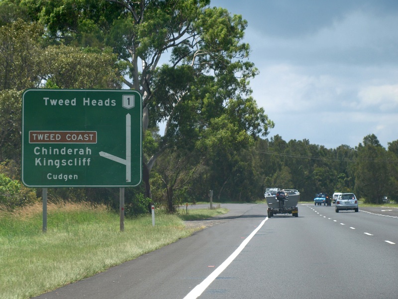
Tweed Coast Way: Pacific Hwy (NR1) at the Tweed Coast Way (Fingal Rd) (TD38) interchange at Chinderah, December 2009. Image © Rob Tilley |
 |
Hulls Road: Pacific Hwy (NR1) as it passes under Hulls Rd at Crabbes Creek, July 2007. Image © Paul Rands |
|
 |
Tweed Coast Way: Pacific Hwy (NR1) at the Tweed Coast Way (Fingal Rd) (TD38) interchange at Chinderah, December 2009. Image © Rob Tilley |
 |
Pottsville-Mooball Road: Pacific Hwy (NR1) as it passes under Pottsville-Mooball Rd at Sleepy Hollow, July 2007. Image © Paul Rands |
|
 |
Advance Directional Sign: AD sign at Chinderah approaching Tweed Coast Rd, December 2009. Click here for a photo by Paul Rands of this location from July 2007. |
 |
Advance Directional Sign: AD sign at Sleepy Hollow approaching the northbound Sleepy Hollow rest area, March 2007. Image © David Whiteman |
|
 |
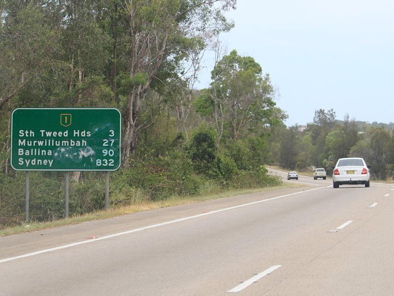
Reassurance Directional Sign: Distance sign near Wommin Bay Road at Chinderah, May 2005. Image © Rob Tilley |
 |
Sheens Creek: Pacific Hwy (NR1) as it passes over Sheens Ck at Sleepy Hollow, July 2007. Image © Paul Rands |
|
 |
Supplemental Advance Directional Sign: Supplemental AD sign at Chinderah, approaching Tweed Coast Rd, November 2010. Click here for a photo of this location by Paul Rands from July 2007. Image © Rob Tilley |
 |
Wildlife Crossing: Pacific Hwy (NR1) at Cudgera Creek as it passes under a wildlife crossing, July 2007. Image © Paul Rands |
|
 |
Tweed Coast Road: Pacific Hwy (NR1) at the Tweed Coast Rd interchange at Chinderah, November 2010. Click here for a photo by Paul Rands of this location from July 2007. Image © Rob Tilley |
 |
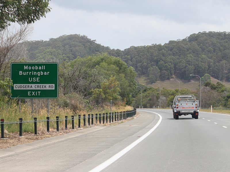
Advance Directional Sign: AD sign at Cudgera Creek, approaching Cudgera Creek Rd, August 2004. Image © Paul Rands |
|
 |
Tweed Coast Road Interchange: Signage on the Tweed Coast Rd interchange at Chinderah, November 2010. Image © Rob Tilley |
 |
Distance Sign: Reassurance directional sign at Cudgera Creek, December 2009. Image © Rob Tilley |
|
 |
Tweed Coast Road Interchange: Signage on the Tweed Coast Rd interchange at Chinderah, November 2010. Image © Rob Tilley |
 |
Cudgera Creek Road: Pacific Hwy (NR1) at the Cudgera Creek Rd interchange at Cudgera Creek, July 2007. Image © Paul Rands |
|
 |
Tweed Coast Road Interchange: Signage on the Tweed Coast Rd interchange at Chinderah, February 2009. Image © Rob Tilley |
 |
Intersection Directional Sign: ID sign on the interchange with Cudgera Ck Rd at Cudgera Creek Rd, August 2007. Image © Paul Rands |
|
 |
Tweed Coast Road Interchange: Signage on the Tweed Coast Rd interchange at Chinderah, November 2010. Image © Rob Tilley |
 |
Reassurance Directional Sign: Distance sign at Cudgera Creek, December 2009. Image © Rob Tilley |
|
 |
Advance Directional Sign: AD sign at Chinderah approaching the roundabout on the interchange with Tweed Coast Rd and Chinderah Rd, November 2010. Image © Rob Tilley |
 |
Kanes Road: Pacific Hwy (NR1) as it passes under Kanes Rd at Cudgera Creek, August 2004. Image © Paul Rands |
|
 |
intersection Directional Sign: ID sign at Chinderah on the roundabout on the interchange with Tweed Coast Rd and Chinderah Rd, February 2009. Image © Rob Tilley |
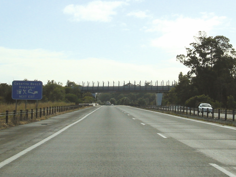 |
Services Sign: Services sign at Bogangar, approaching Clothiers Creek Rd interchange, July 2007. Image © Paul Rands |
|
 |
intersection Directional Sign: ID sign at Chinderah on the roundabout on the interchange with Tweed Coast Rd and Chinderah Rd, February 2009. Image © Rob Tilley |
 |
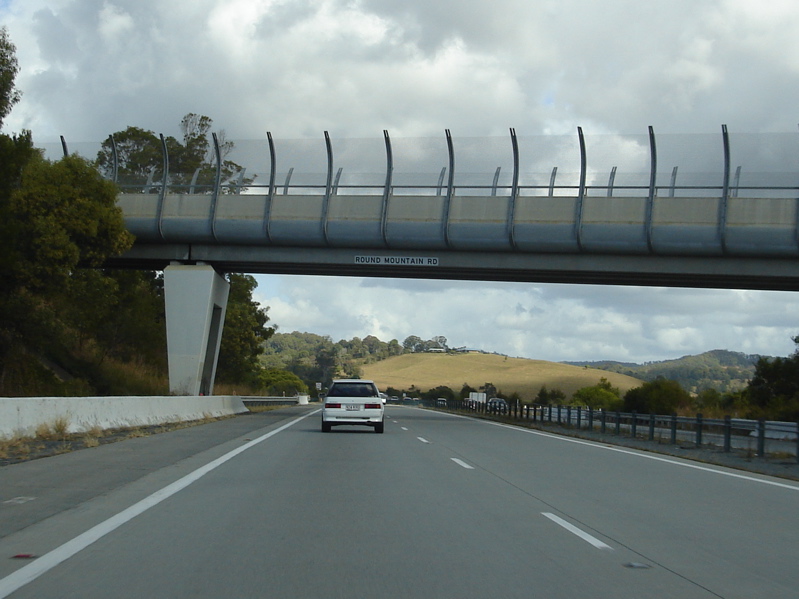
Round Mountain Road: Pacific Hwy (NR1) as it passes under Round Mountain Rd at Bogangar, July 2007. Image © Paul Rands |
|
 |
intersection Directional Sign: ID sign at Chinderah on the roundabout on the interchange with Tweed Coast Rd and Chinderah Rd, November 2010. Image © Rob Tilley |
 |
Advance Directional Sign: AD sign at Bogangar approaching Clothiers Creek Rd, December 2009. Image © Rob Tilley |
|
 |
intersection Directional Sign: ID sign at Chinderah on the corner of Chinderah Bay Dr (former Pacific Hwy) and Chinderah Rd, February 2009. Image © Rob Tilley |
 |
Clothiers Creek Road: Pacific Hwy (NR1) at the Clothiers Creek Rd interchange at at Bogangar, July 2007. Image © Paul Rands |
|
 |
Advance Directional Sign: AD sign at Chinderah approaching Tweed Valley Way (TD40), July 2007. Image © Paul Rands |
 |
Distance Sign: Reassurance directional sign at Bogangar, July 2007. Image © Paul Rands |
|
 |
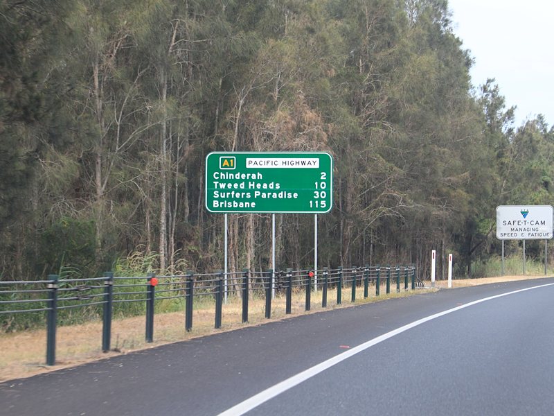
Safe-T-Cam: Pacific Hwy (NR1) at the Chinderah Safe-T-Cam site, July 2007. The Safe-T-Cam system checks on heavy vehicles. Image © Paul Rands |
 |
Environ Road: Pacific Hwy (NR1) as it passes under Environ Rd at Duranbah, July 2007. Image © Paul Rands |
|
 |
Heavy Vehicle Inspection Station: Pacific Hwy (NR1) at the heavy vehicle inspection station at Chinderah, July 2007. Image © Paul Rands |
 |
Road Tunnel 1km: Sign at Duranbah, indicating distance to the Cudgen Road Tunnel, July 2007. The twin 134-metre-long (440 ft) tunnels are illuminated inside and accommodate for northbound traffic in one tunnel and southbound traffic in the other tunnel. The tunnels pass under the Cudgen Road and the Condong Range. 30 Image © Paul Rands |
|
 |
Heavy Vehicle Inspection Station: Pacific Hwy (NR1) at the heavy vehicle inspection station at Chinderah, June 2006. Image © David Whiteman |
 |
Supplemental Advance Directional Sign: Supplemental AD sign at Chinderah approaching Tweed Valley Way (TD40), December 2009. Image © Rob Tilley |
|
 |
Supplemental Advance Directional Sign: Supplemental AD sign at Chinderah approaching Tweed Valley Way (TD40), February 2009. Image © Rob Tilley |
 |
Supplemental Advance Directional Sign: Supplemental AD sign at Chinderah approaching Tweed Valley Way (TD40), December 2009. Image © Rob Tilley |
|
 |
Supplemental Advance Directional Sign: Supplemental AD sign at Chinderah approaching Tweed Valley Way (TD40), November 2010. Image © Rob Tilley |
 |
Advance Directional Sign: AD sign at Chinderah approaching Tweed Valley Way (TD40), December 2009. Image © Rob Tilley |
|
 |
Advance Directional Sign: AD sign at Chinderah approaching Tweed Valley Way (TD40), November 2010. Image © Rob Tilley |
 |
Tweed Valley Way: Pacific Hwy (NR1) at the Tweed Valley Way (TD40) interchange, December 2009. Image © Rob Tilley |
|
 |
Tweed Valley Way: Pacific Hwy (NR1) at the Tweed Valley Way (TD40) interchange, November 2010. Tweed Valley Way is a former Pacific Hwy alignment. Image © Rob Tilley |
 |
Advance Directional Sign: AD sign at Chinderah approaching the Chinderah Rd & Tweed Coast Way interchange, February 2009. Image © Rob Tilley |
|
 |
Reassurance Directional Sign: Distance sign at Cudgen, July 2007. Image © Paul Rands |
 |
Reassurance Directional Sign: Distance sign with alphanumeric route number at Chinderah, December 2009. Click here for a photo by Rob Tilley of this location from February 2009. Image © Rob Tilley |
|
 |
Road Tunnel 1km: Sign at Stotts Creek, indicating distance to the Cudgen Road Tunnel, July 2007. The twin 134-metre-long (440 ft) tunnels are illuminated inside and accommodate for northbound traffic in one tunnel and southbound traffic in the other tunnel. The tunnels pass under the Cudgen Road and the Condong Range. 30 Image © Paul Rands |
 |
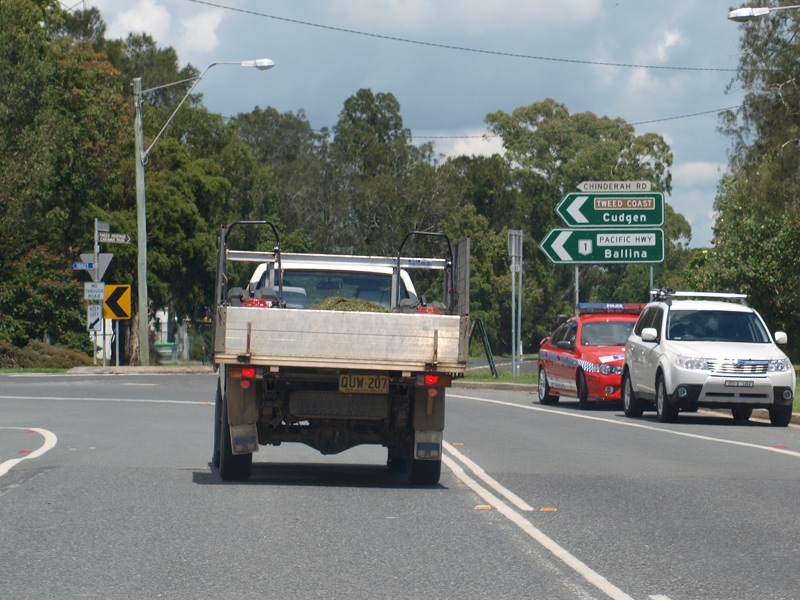
Chinderah Road & Tweed Coast Way: Pacific Hwy (NR1) at the Chinderah Rd and Tweed Coast Way interchange, December 2009. Image © Rob Tilley |
|
 |
Cudgen Road Tunnel: Pacific Hwy (NR1) at Stotts Creek at the Cudgen Tunnel, July 2007. Image © Paul Rands |
 |
Advance Directional Sign: AD sign at Chinderah approaching Waugh St, February 2009. Image © Rob Tilley |
|
 |
Cudgen Road Tunnel: Pacific Hwy (NR1) at Stotts Creek at the Cudgen Tunnel, July 2007. Image © Paul Rands |
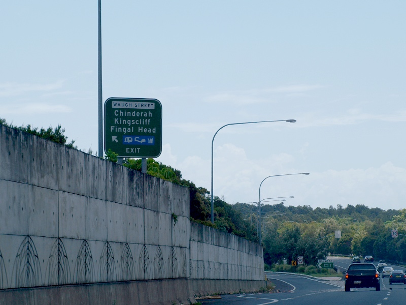 |
Waugh Street: Pacific Hwy (NR1) at the Waugh St interchange, Chinderah, February 2009. Image © Rob Tilley |
|
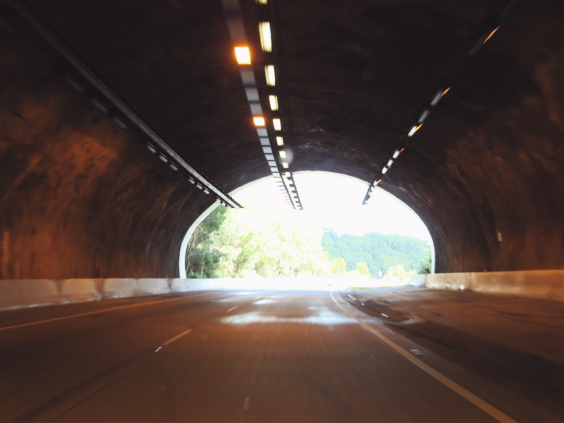 |
Cudgen Road Tunnel: Pacific Hwy (NR1) at Stotts Creek inside the Cudgen Tunnel, July 2007. Image © Paul Rands |
 |
Waugh Street: Pacific Hwy (NR1) at the Waugh St interchange, Chinderah, December 2009. Image © Rob Tilley |
|
 |
Environ Road: Pacific Hwy (NR1) passing under Environ Rd at Duranbah, July 2007. Image © Paul Rands |
 |
Distance Sign: Reassurance directional sign at Chinderah, December 2009. Image © Rob Tilley |
|
 |
Services Sign: Services sign at Duranbah approaching Clothiers Creek Rd, July 2007. Image © Paul Rands |
|
Advance Directional Sign: Ad sign at Chinderah approaching Barneys Point Rd interchange, July 2007. Image © Paul Rands |
|
 |
Advance Directional Sign: AD sign at Clothiers Creek approaching Clothiers Creek Rd, July 2007. Image © Paul Rands |
 |
Barneys Point Road: Pacific Hwy (NR1) at the Barneys Point Rd interchange at Banora Point, July 2007. Image © Paul Rands |
|
 |
Distance Sign: Reassurance directional sign near Clothiers Creek Rd at Clothiers Creek, November 2010. Image © Rob Tilley |
 |
Barneys Point Road: Pacific Hwy (NR1) at the Barneys Point Rd interchange at Banora Point, December 2009. Image © Rob Tilley |
|
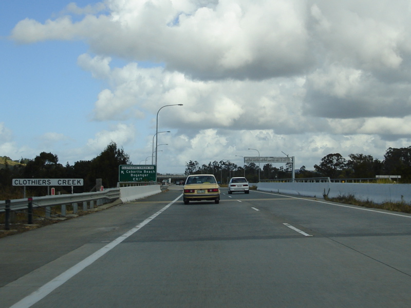 |
Clothiers Creek Road: Pacific Hwy (NR1) at the Clothiers Creek Rd interchange, Clothiers Creek, July 2007. Image © Paul Rands |
 |
Flashing Traffic Signals Ahead Sign: Unusual all text flashing traffic signals warning sign at Banora Point, approaching Terranora Rd, July 2007. This section of road became Sexton Hill Drive when the Banora Point Upgrade opened in September 2012. Image © Paul Rands |
|
 |
Clothiers Creek Road: Pacific Hwy (NR1) at the Clothiers Creek Rd interchange, Clothiers Creek, December 2009. Image © Rob Tilley |
 |
Advance Directional Sign: AD sign at Banora Point approaching Terranora Rd, July 2007. This section of road became Sexton Hill Drive when the Banora Point Upgrade opened in September 2012. Image © Paul Rands |
|
 |
Clothiers Creek Road: Pacific Hwy (NR1) at the Clothiers Creek Rd interchange, Clothiers Creek, July 2007. Image © Paul Rands |
 |
Terranora Road: Corner of Pacific Hwy (NR1) and Terranora Rd at Banora Point, February 2009. This section of road became Sexton Hill Drive when the Banora Point Upgrade opened in September 2012. Image © Rob Tilley |
|
 |
Reassurance Directional Sign: Distance sign at Cudgera Creek, December 2009. Image © Rob Tilley |
 |
Advance Directional Sign: AD sign at Banora Point approaching Minjungbal Dr & Darlington Rd, July 2007. This section of road became Sexton Hill Drive when the Banora Point Upgrade opened in September 2012. Image © Paul Rands |
|
 |
Road Mountain Road: Pacific Hwy (NR1) as it passes under Round Mountain Rd at Bogangar, July 2007. Image © Paul Rands |
 |
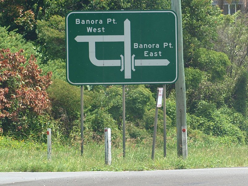
Supplemental Advance Directional Sign: Supplemental AD sign approaching Minjungbal Dr & Darlington Dr as Pacific Hwy (NR1) crosses Sexton Hill at Banora Point, December 2009. This section of road became Sexton Hill Drive when the Banora Point Upgrade opened in September 2012. Image © Rob Tilley |
|
 |
Advance Directional Sign: AD sign at Cudgera Creek approaching Cudgera Creek Rd, December 2009. Image © Rob Tilley |
 |
Supplemental Advance Directional Sign: Supplemental AD sign approaching Minjungbal Dr & Darlington Dr at Banora Point, December 2009. This section of road became Sexton Hill Drive when the Banora Point Upgrade opened in September 2012. Image © Rob Tilley |
|
 |
Supplemental Advance Directional Sign: Supplemental AD sign at Cudgera Creek approaching Cudgera Creek Rd, December 2009. Image © Rob Tilley |
 |
Advance Directional Sign: AD sign as Pacific Hwy (NR1) approaching Darlington Dr at Banora Point, February 2009. This section of road became Sexton Hill Drive when the Banora Point Upgrade opened in September 2012. Image © Rob Tilley |
|
 |
Cudgera Creek Road: Pacific Hwy (NR1) at the Cudgera Creek Rd interchange, Cudgera Creek, July 2007. Image © Paul Rands |
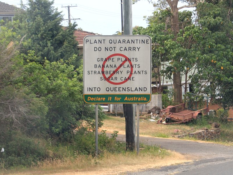 |
Quarantine Sign: Quarantine sign near Darlington Dr at Banora Point, December 2009. This section of road became Sexton Hill Drive when the Banora Point Upgrade opened in September 2012. Image © Rob Tilley |
|
 |
Cudgera Creek Road: Pacific Hwy (NR1) at the Cudgera Creek Rd interchange, Cudgera Creek, July 2007. Image © Paul Rands |
 |
Supplemental Advance Directional Sign: Supplemental AD sign approaching Darlington Dr at Banora Point, February 2009. This section of road became Sexton Hill Drive when the Banora Point Upgrade opened in September 2012. Image © Rob Tilley |
|
 |
Advance Directional Sign: AD sign on the Cudgera Ck Rd interchange in Cudgera Creek, August 2007. Image © Paul Rands |
 |
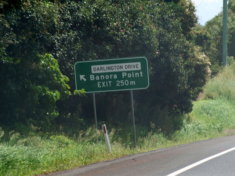
Darlington Drive & Minjungbal Drive: Pacific Hwy (NR1) at the Darlington Dr & Minjungbal Dr interchange at Banora Point, December 2009. This section of road became Sexton Hill Drive when the Banora Point Upgrade opened in September 2012. Image © Rob Tilley |
|
 |
Intersection Directional Sign: ID sign on the Cudgera Ck Rd interchange in Cudgera Creek, July 2007. Image © Paul Rands |
 |
Darlington Drive & Minjungbal Drive: Pacific Hwy (NR1) at the Darlington Dr & Minjungbal Dr interchange at Banora Point, February 2009. This section of road became Sexton Hill Drive when the Banora Point Upgrade opened in September 2012. Image © Rob Tilley |
|
 |
Reassurance Directional Sign: Distance sign at Cudgera Creek, July 2007. Image © Paul Rands |
 |
Darlington Drive & Minjungbal Drive: Pacific Hwy (NR1) at the Darlington Dr & Minjungbal Dr interchange at Banora Point, December 2009. This section of road became Sexton Hill Drive when the Banora Point Upgrade opened in September 2012. Image © Rob Tilley |
|
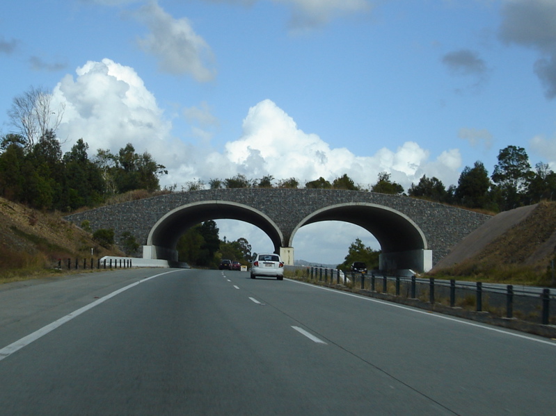 |
Wildlife Crossing: Pacific Hwy (NR1) as it passes under a wildlife crossing at Sleepy Hollow, July 2007. Image © Paul Rands |
 |
Distance Sign: Reassurance directional sign at Banora Point, on the Darlington Dr on ramp to Pacific Hwy (NR1), December 2009. This ramp and this sign has since been removed. Image © Rob Tilley |
|
 |
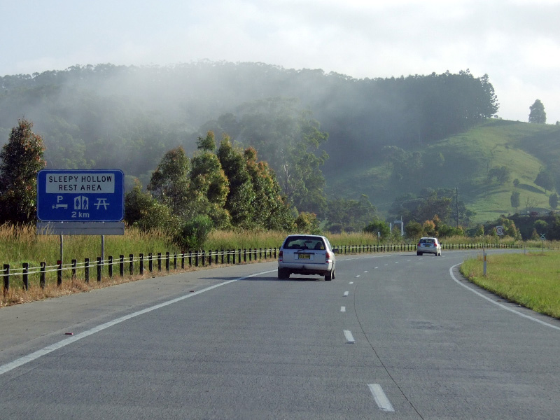
Reassurance Directional Sign: Rest area distance sign at Sleepy Hollow, July 2007. Image © Paul Rands |
 |
Distance Sign: Reassurance directional sign with incorrect route shield at Tweed Heads South, February 2009. This section of road became Sexton Hill Drive when the Banora Point Upgrade opened in September 2012 and this sign has since been removed. Image © Rob Tilley |
|
 |
Reassurance Directional Sign: Rest area distance sign at Sleepy Hollow, July 2007. Image © Paul Rands |
 |
Advance Directional Sign: AD sign at Tweed Heads South approaching Kennedy Dr, Gold Coast Hwy (SR2) (former Pacific Hwy) and Pacific Mwy (M1) (Tugun Bypass), February 2009. Image © Rob Tilley |
|
 |
Pottsville-Mooball Road: Pacific Hwy (NR1) as it passes under Pottsville-Mooball Rd at Pottsville, July 2007. Image © Paul Rands |
 |
Advance Directional Sign: AD sign at Tweed Heads South approaching Kennedy Dr, Gold Coast Hwy (SR2) (former Pacific Hwy) and Pacific Mwy (Tugun Bypass) (M1), February 2009. Click here for a photo by Paul Rands of this location from July 2007 (prior to the opening of Tugun Bypass). Image © Rob Tilley |
|
 |
Burringbar Creek: Pacific Hwy (NR1) as it passes over Burringbar Ck at Pottsville, July 2007. Image © Paul Rands |
 |
Kennedy Drive: Pacific Hwy (NR1) at the Kennedy Dr interchange at Tweed Heads West, February 2009. Image © Rob Tilley |
|
 |
Wooyung Road: Pacific Hwy (NR1) as it passes under Wooyung Rd at Crabbes Creek, July 2007. Image © Paul Rands |
 |
Advance Directional Sign: AD sign at Tweed Heads West approaching Gold Coast Hwy (SR2) (former Pacific Hwy) and Pacific Mwy (Tugun Bypass) (M1), February 2009. Image © Rob Tilley |
|
 |
Advance Directional Sign: AD sign near the Tweed Valley Way (TD40) (former Pacific Hwy) at Yelgun, approaching the Tweed Valley Way & Brunswick Valley Way (TD40) interchange, July 2007. Image © Paul Rands |
 |
Changeable Sign: Changeable sign before Gold Coast Hwy (SR2) interchange at Tweed Heads West, February 2009. Image © Rob Tilley |
|
 |
Wildlife Crossing: Pacific Hwy (NR1) as it passes under a wildlife crossing at Yelgun, December 2009. Image © Rob Tilley |
 |
Gold Coast Highway: Pacific Hwy (NR1) at the interchange with Gold Coast Hwy (SR2) and Pacific Mwy (Tugun Bypass) (M1) at Tweed Heads West, February 2009. Image © Rob Tilley |
|
 |
Services Sign: Services sign at Yelgun, approaching the Tweed Valley Way & Brunswick Valley Way (TD40) interchange, July 2007. Image © Paul Rands |
 |
End NR1 / Start M1: Sign indicating the end of National Route 1 and the start of M1 at the interchange with Gold Coast Hwy (SR2) and Pacific Mwy (Tugun Bypass) (M1) at Tweed Heads West, February 2009. Image © Rob Tilley |
|
 |
Supplemental Advance Directional Sign: Supplemental AD sign at Yelgun, approaching the Tweed Valley Way & Brunswick Valley Way (TD40) interchange, July 2007. Image © Paul Rands |
|||
 |
Advance Directional Sign: AD sign at Yelgun, approaching the Tweed Valley Way & Brunswick Valley Way (TD40) interchange, July 2007. Image © Paul Rands |
|||
 |
Brunswick Valley Way: Pacific Hwy (NR1) at the Brunswick Valley Way (TD40) interchange at Billinudgel, July 2007. Image © Paul Rands |
|||
 |
Advance Directional Sign: AD sign on the off ramp to Brunswick Valley Way (TD40) at Billinudgel, December 2009. Image © Rob Tilley |
|||
 |
Reassurance Directional Sign: Distance sign at Billinudgel, December 2009. Click here for a photo by Paul Rands of this location from July 2007. Image © Rob Tilley |
|||
 |
Reassurance Directional Sign: Rest area distance sign at Billinudgel, July 2007. Image © Paul Rands |
|||
 |
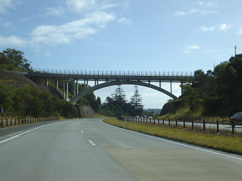
Pedestrian Bridge: Pacific Hwy (NR1) as it passes under the pedestrian bridge at Billinudgel, July 2007. Image © Paul Rands |
|||
 |
Billinudgel: Pacific Hwy (NR1) with Brunswick Valley Way (TD40) (former Pacific Hwy) to the left, July 2007. Image © Paul Rands |
|||
|
Click here for the continuation of National Route 1 in Queensland Click here for the continuation of National Route 1 between Brunswick Heads and Ballina |
||||
1 Roads and Traffic Authority, Schedule of Classified Roads and State & Regional Roads, 31 January 2011
2 Main Roads Board, Annual Report, 1926-27
3 Main Roads Board, Annual Report, 1929-30
4 Main Roads Board, Annual Report, 1930-31
5 Department of Main Roads, Annual Report, 1932-33
6 Department of Main Roads, Annual Report, 1933-34
7 Department of Main Roads, Annual Report, 1934-35
8 Department of Main Roads, Annual Report, 1936-37
9 RTA Thematic History, 2nd Edition, 2006
10 Department of Main Roads, Annual Report, 1946-47
11 Department of Main Roads, Annual Report, 1949-50
12 Department of Main Roads, Annual Report, 1951-52
13 Department of Main Roads, Annual Report, 1952-53
14 Department of Main Roads, Annual Report, 1955-56
15 Department of Main Roads, Annual Report, 1961-62
16 Department of Main Roads, Annual Report, 1962-63
17 Department of Main Roads, Annual Report, 1966-67
18 Department of Main Roads, Annual Report, 1969-70
19 Department of Main Roads, Annual Report, 1971-72
20 Department of Main Roads, Annual Report, 1974-75
21 Department of Main Roads, Annual Report, 1976-77
22 Department of Main Roads, Annual Report, 1977-78
23 Roads and Maritime Services, Project Fact Sheet, Chinderah Bypass
24 Roads and Maritime Services, Yelgun to Chinderah Freeway Official Opening Brochure
25 Transport and Main Roads (Queensland), Projects, Tugun Bypass Project
26 Roads and Maritime Services, Projects, Pacific Highway Upgrade, Ballina to Tweed Heads, Completed Projects, Brunswick Heads to Yelgun
27 Roads and Maritime Services, Projects, Pacific Highway Upgrade, Ballina to Tweed Heads, Completed Projects, Tugun Bypass
28 Roads and Maritime Services, Pacific Highway upgrade Monthly achievement report, May 2012
29 Roads and Maritime Services, Projects, Pacific Highway Upgrade, Ballina To Tweed Heads, Banora Point.
30 Australasian Tunnelling Society, Yelgun Bypass - Cudgen Road Tunnel
Last updated: 18-Dec-2019 12:19
This site © Paul Rands. All rights reserved. Some portions © (copyright) by their respective and credited owners. Permission must be obtained before using any images from this site. For details, please email by clicking here.