|
|
|
|
|
 |
Newell Highway (National Highway 39) - Dubbo to Gilgandra (Decommissioned) |
Statistics:
Route Numbering:


General Information:
The Newell Highway is the longest highway in NSW, stretching from the Victorian border at Tocumwal to the Queensland border. It's the economic backbone for freight and livestock transporters, tourism operators, caravanners and holiday makers, emergency services, government, media and business owners. 2
The majority of the route is undivided roadway, with various overtaking sections where required.
The Newell Highway is named after HH Newell. He was the first commissioner for Main Roads in New South Wales. He passed away in 1941. 3 Prior to his appointment to the newly formed Main Roads Board on March 9, 1925, he was the District Engineer at the Wollongong branch of the Department of Public Works. 4
Multiplexes along the route include:
History:
Click here for the former alignment between Dubbo and Gilgandra
| Dubbo to Gilgandra | Gilgranda to Dubbo | |||
| Preview: | Description: | Preview: | Description: | |
 |
Supplemental Advance Directional Sign: Supplemental AD sign at Dubbo approaching Obley Rd, November 2010. Image © Rob Tilley |
 |
Intersection Directional Sign: ID sign at the junction with Back Bearbung Rd at Gilgandra, July 2007. Image © Ryan Nicholls |
|
 |
Advance Directional Sign: AD sign at Dubbo approaching Obley Rd, November 2010. Image © Rob Tilley |
 |
Advance Directional Sign: AD sign approaching Castlereagh Hwy (SR86) at Gilgandra, May 2005. Image © Rob Tilley |
|
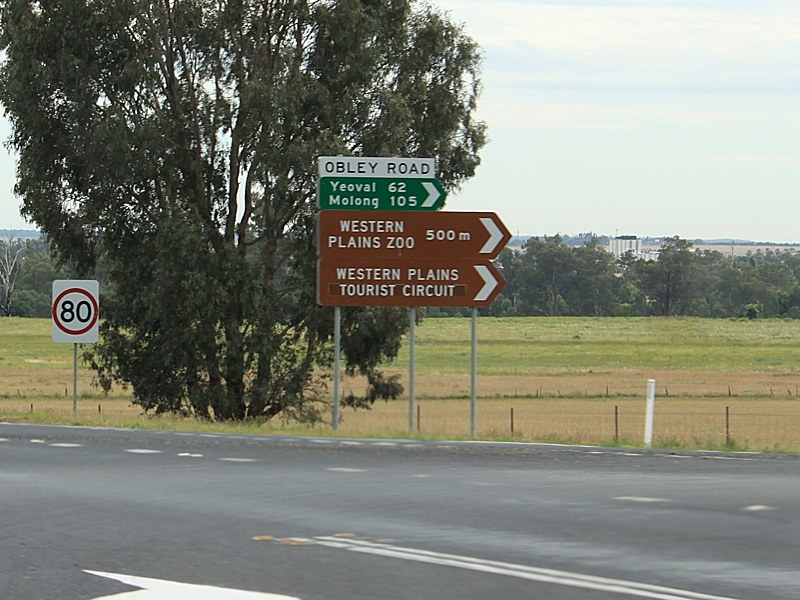 |
Obley Road: Newell Hwy (NH39) at the junction with Obley Rd at Dubbo, November 2010. Image © Rob Tilley |
 |
Castlereagh Highway: Intersection directional sign in Gilgandra facing the junction with Castlereagh Hwy (SR86), May 2005. Image © Rob Tilley |
|
 |
Entering Dubbo: Newell Hwy (NH39) as it enters Dubbo, November 2010. Image © Rob Tilley |
 |
Castlereagh River: Newell Hwy (NR34 / NH39) as it crosses Castlereagh River at Gilgandra, January 2003. Image © Michael Greenslade |
|
 |
Intersection Directional Sign: ID sign at the junction with Minore Rd, November 2010. Image © Rob Tilley |
 |
Advance Directional Sign: AD sign in Gilgandra approaching Oxley Hwy (NR34) and Castlereagh Hwy (NR55), May 2005. Image © Rob Tilley |
|
 |
Supplemental Advance Directional Sign: Supplemental AD sign in Dubbo used to help motorists to negotiate a fairly complicated urban area, November 2010. Click here for a photo by Rob Tilley from April 2005 of the previous sign. Image © Rob Tilley |
 |
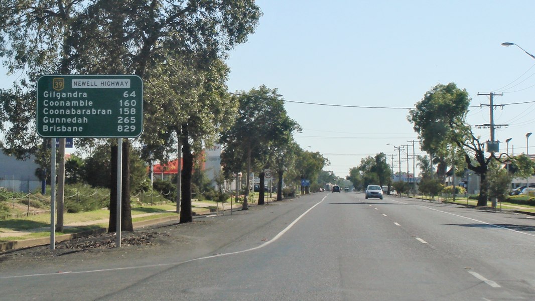
Distance Sign: RD sign as Newell Hwy (NH39) as it leaves Gilgandra, May 2005. Image © Rob Tilley |
|
 |
Advance Directional Sign: AD sign approaching the roundabout with Mitchell Hwy (NR32) at Dubbo, November 2010. Click here for a photo by Rob Tilley from April 2005 of the previous sign. Image © Rob Tilley |
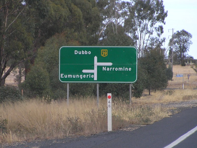 |
Advance Directional Sign: AD sign at Eumungerie approaching Narromine-Eumungerie Rd and Mogriguy Rd, May 2005. Image © Rob Tilley |
|
 |
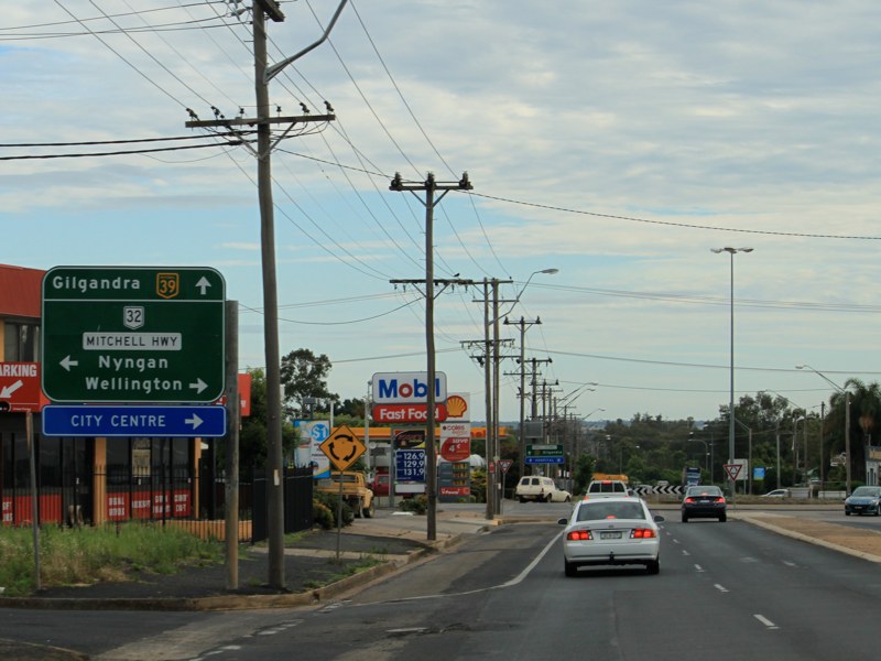
Intersection Directional Sign: ID sign at the roundabout with Mitchell Hwy (NR32) at Dubbo,, November 2010. Click here for a photo by Rob Tilley from April 2005 of the previous sign. Image © Rob Tilley |
 |
Distance Sign: RD sign near Eumungerie, May 2005. Image © Rob Tilley |
|
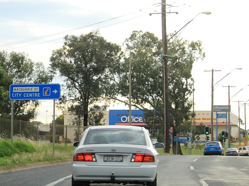 |
Advance Directional Sign: AD sign approaching Macquarie St in Dubbo, November 2010. Image © Rob Tilley |
 |
Advance Directional Sign: AD sign approaching Burraway Rd and Mogriguy Rd in Brocklehurst, May 2005. Image © Rob Tilley |
|
 |
Macquarie Street: Newell Hwy (NH39) at the junction with Macquarie St in Dubbo, November 2010. Image © Rob Tilley |
 |
Supplemental Advance Directional Sign: Supplemental AD sign in Dubbo used to help motorists to negotiate a fairly complicated urban area, May 2005. Image © Rob Tilley |
|
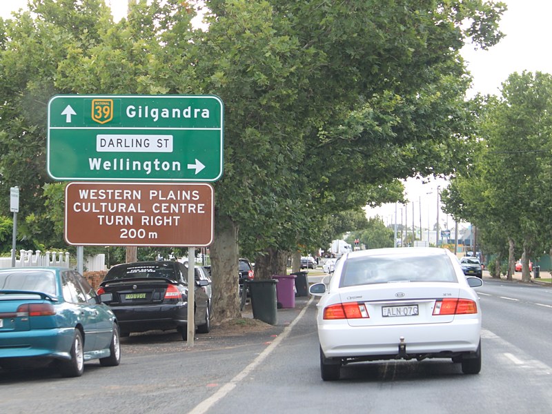 |
Advance Directional Sign: AD sign in Dubbo approaching Darling St, November 2010. Click here for a photo by Rob Tilley from April 2005 of the previous sign. Darling St is a former NR39 alignment. Image © Rob Tilley |
 |
Advance Directional Sign: AD sign approaching Golden Hwy (SR84) in Dubbo, May 2005. NH39 turns right at this junction. Image © Rob Tilley |
|
 |
Intersection Directional Sign: ID sign on the Darling St roundabout in Dubbo, November 2010. Image © Rob Tilley |
 |
Intersection Directional Sign: ID sign assembly, with black sign, at the junction with Golden Hwy (SR84) in Dubbo, May 2005. NH39 turns right at this junction. Image © Rob Tilley |
|
 |
Advance Directional Sign: AD sign in Dubbo on Darling St approaching Newell Hwy (NH39), January 2004. |
 |
Advance Directional Sign: AD sign approaching Darling St in Dubbo, October 2011. Darling St is a former NR39 alignment. Click here for a photo by Rob Tilley from May 2005 of the previous sign. Image © Paul Rands |
|
 |
Intersection Directional Sign: ID sign on the Darling St roundabout in Dubbo, November 2010. Image © Rob Tilley |
 |
Intersection Directional Sign: ID sign at the roundabout with Darling St in Dubbo, October 2011. Darling St is a former NR39 alignment. Click here for a photo by Rob Tilley from May 2005 of the previous sign. Image © Paul Rands |
|
 |
Advance Directional Sign: AD sign approaching Golden Hwy (SR84) in Dubbo, November 2010. Click here for a photo by Rob Tilley from April 2005 of the previous sign. NH39 turns left at this junction Image © Rob Tilley |
 |
Advance Directional Sign: AD sign approaching Macquarie St, Dubbo, October 2011. Image © Paul Rands |
|
 |
Golden Highway: Newell Hwy (NH39) at the junction with Golden Hwy (SR84) in Dubbo, November 2010. Click here for a photo by Rob Tilley from April 2005 of the previous sign. Image © Rob Tilley |
 |
Intersection Directional Sign: ID sign assembly at Macquarie St, Dubbo, October 2011. Image © Paul Rands |
|
 |
Distance Sign: Reassurance directional sign within the Dubbo CBD after the Golden Hwy (SR84) junction, April 2012. Click here for a photo from July 2006 of the original installation of sign. Image © Paul Rands |
 |
Advance Directional Sign: AD sign approaching Mitchell Hwy (NR32) at Dubbo, October 2011. Image © Paul Rands |
|
 |
Distance Sign: RD sign as the Newell Hwy (NH39) as it leaves Dubbo, April 2012. Click here for a photo of this location from November 2010. |
 |
Intersection Directional Sign: ID sign at the Mitchell Hwy (NR32) roundabout at Dubbo, October 2011. Image © Paul Rands |
|
 |
Road Trains Sign: Sign showing road train restrictions as the Newell Hwy (NH39) enters Brocklehurst, July 2006. Image © Paul Rands |
 |
Intersection Directional Sign: ID sign at the roundabout with Mitchell Hwy (NR32) in Dubbo, October 2011. Click here for a photo by Rob Tilley from May 2005 of the previous sign. Image © Paul Rands |
|
 |
Advance Directional Sign : ID style sign as an AD sign approaching Troy Bridge Rd and Boothenbard Rd at Dubbo, April 2012. Image © Paul Rands |
 |
Reassurance Directional Sign: RD sign at Dubbo, October 2011. Image © Paul Rands |
|
 |
Talbragar River: Newell Hwy (NH39) as it crosses Talbragar River at Brocklehurst, April 2012. Image © Paul Rands |
 |
Minore Road: Newell Hwy (NH39) at Minore Rd, Dubbo, November 2011. Image © Paul Rands |
|
 |
Approaching Heavy Vehicle Inspection Station: Advance directional sign approaching the heavy vehicle inspection station at Brocklehurst, July 2006. Image © Paul Rands |
 |
Reassurance Directional Sign: Distance sign at Dubbo, December 2012. Image © Michael Greenslade |
|
 |
Talbragar River overflow Channel 1: Newell Hwy (NH39) as it crosses Talbragar River overflow Channel 1 at Brocklehurst, April 2012. Image © Paul Rands |
 |
Advance Directional Sign: AD sign approaching Obley Rd, Dubbo, November 2011. Image © Paul Rands |
|
 |
Advance Directional Sign : Advance directional sign approaching the heavy vehicle inspection station at Brocklehurst, April 2012. Image © Paul Rands |
 |
Obley Road: ID sign assembly at Obley Rd, Dubbo, November 2011. Image © Paul Rands |
|
 |
Talbragar River overflow Channel 2: Newell Hwy (NH39) as it crosses Talbragar River overflow Channel 2 at Brocklehurst, April 2012. Image © Paul Rands |
 |
Distance Sign: Tourism based RD sign on the outskirts of Dubbo, November 2011. Image © Paul Rands |
|
 |
Heavy Vehicle Inspection Station: Newell Hwy (NH39) at Brocklehurst at the entrance to the heavy vehicle inspection station, July 2006. Image © Paul Rands |
|||
 |
Entering Brocklehurst: Newell Hwy (NH39) as it enters the Brocklehurst town centre, April 2012. Image © Paul Rands |
|||
 |
Advance Directional Sign: AD sign approaching Burraway Rd and Mogriguy Rd in Brocklehurst, April 2012. Click here for a photo of this location from November 2010. Image © Rob Tilley |
|||
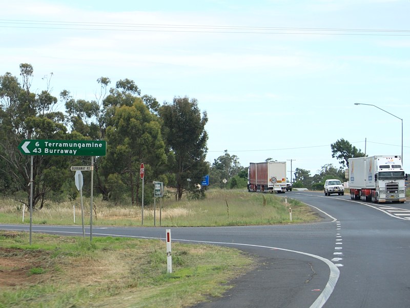 |
Burraway Road & Mogriguy Road: Newell Hwy (NH39) at the junction with Burraway Rd and Mogriguy Rd at Brocklehurst, November 2010. Image © Rob Tilley |
|||
 |
Burraway Road & Mogriguy Road : ID signs at the junction Burraway Rd and Mogriguy Rd at Brocklehurst, April 2012. Image © Paul Rands |
|||
 |
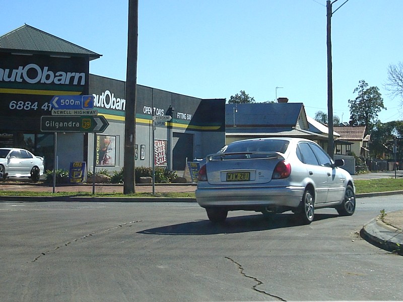
Advance Directional Sign: AD sign at Eumungerie approaching Narromine-Eumungerie Rd and Mogriguy Rd, April 2012. Click here for a photo of this location from July 2006. |
|||
 |
Narromine-Eumungerie Road & Mogriguy Road: ID sign at Eumungerie at the junction with Narromine-Eumungerie Rd and Mogriguy Rd, November 2010. Image © Rob Tilley |
|||
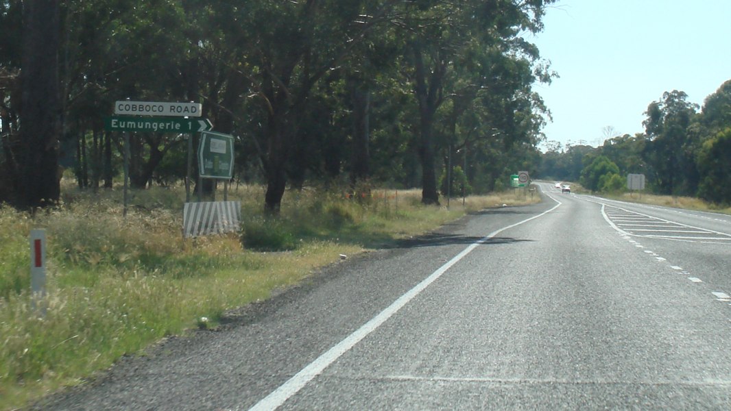 |
Cobboco Road: Intersection directional sign assembly at the junction with Cobboco Rd in Eumungerie, April 2012. |
|||
 |
Distance Sign: RD sign near Eumungerie, November 2010. Click here for a photo by Rob Tilley from July 2007 of the previous sign. Image © Rob Tilley |
|||
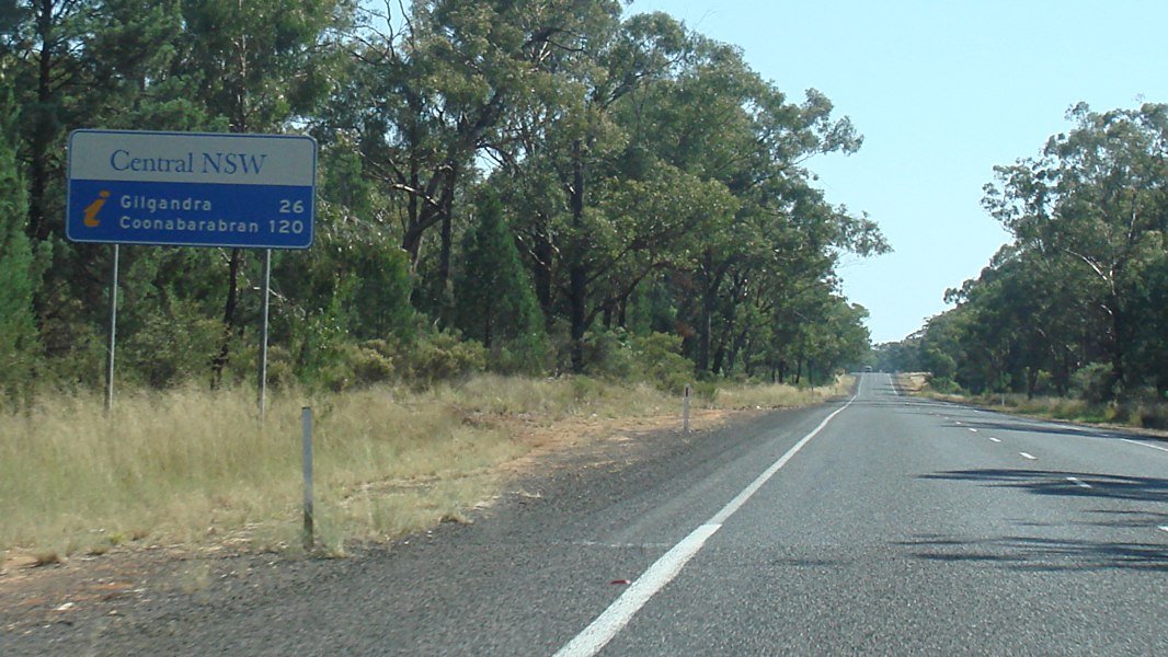 |
Distance Sign: Tourism based RD sign near Eumungerie, April 2012. Click here for a photo by Rob Tilley from July 2007 of the original installation of this sign. Image © Paul Rands |
|||
 |
Mialla Road: Intersection directional sign at the Mialla Rd junction in Balladoran, April 2012. Click here for a photo of this location from November 2010. Image © Rob Tilley |
|||
 |
Services Sign: Services sign urging motorists to take a break in Gilgandra, July 2006. Image © Paul Rands |
|||
 |
Entering Gilgandra: Newell Hwy (NH39) as it enters the town of Gilgandra, July 2006. Image © Paul Rands |
|||
 |
Entering Gilgandra: Newell Hwy (NH39) as it enters the town of Gilgandra, November 2010. Image © Rob Tilley |
|||
 |
End Road Train Route: Sign marking the end of the road train route in Gilgandra, July 2006. Image © Paul Rands |
|||
 |
Intersection Directional Sign: ID sign marking the beginning of the local tourist drive in Gilgandra, November 2010. Image © Rob Tilley |
|||
 |
Willie Street: Non-standard intersection directional sign at the junction with Willie St in Gilgandra, November 2010. Image © Rob Tilley |
|||
 |
Advance Directional Sign: AD sign in Gilgandra approaching Oxley Hwy (NR34) and Castlereagh Hwy (NR55), April 2012. Click here for a photo of this location by Rob Tilley from April 2005. Click here for a photo of this location by Michael Greenslade. Image © Paul Rands |
|||
 |
Oxley Highway & Castlereagh Highway: Intersection directional sign at the junction with Oxley Hwy (NR34) and Castlereagh Hwy (NR55) in Gilgandra, November 2010. Click here for a photo of this location by Rob Tilley from April 2005. Image © Rob Tilley |
|||
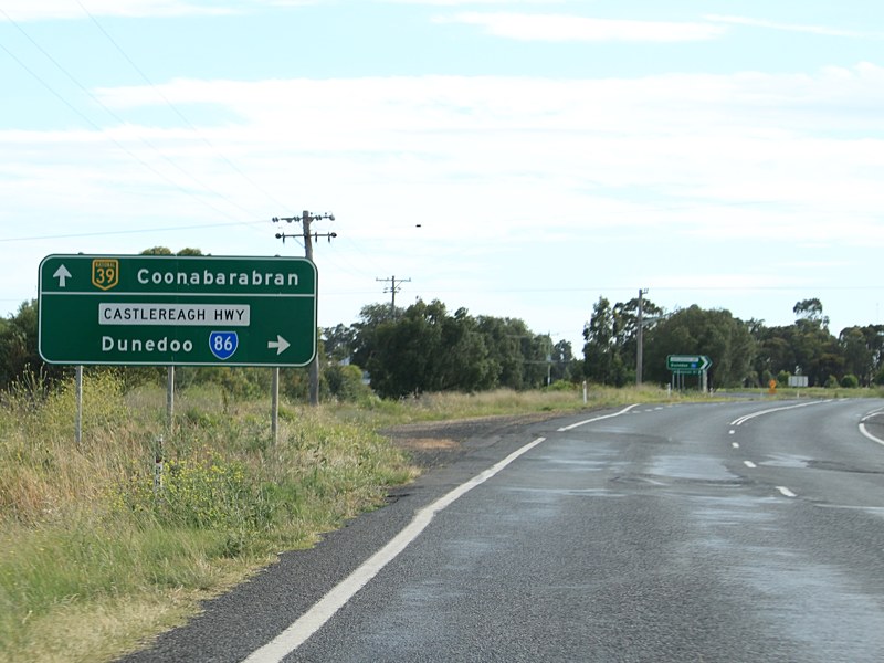 |
Advance Directional Sign: AD sign approaching Castlereagh Hwy (SR86) at Gilgandra, November 2010. Click here for a photo by Jamie Scuglia from October 2004 of the previous sign. Image © Rob Tilley |
|||
 |
Castlereagh Highway: Intersection directional sign in Gilgandra at the junction with Castlereagh Hwy (SR86), November 2010. Click here for a photo by Rob Tilley from April 2005 of the previous sign. Image © Rob Tilley |
|||
 |
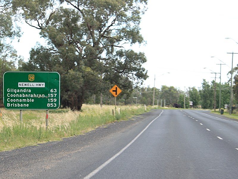
Distance Sign: RD sign as the Newell Hwy (NH39) as it leaves Gilgandra, after the Castlereagh Hwy (SR86) junction, November 2010. Click here for a photo by Rob Tilley from April 2005 of the previous sign. Image © Rob Tilley |
|||
 |
Intersection Directional Sign: ID sign acting as an AD sign near the junction with Back Bearbung Rd at Gilgandra, November 2010. Image © Rob Tilley |
|||
 |
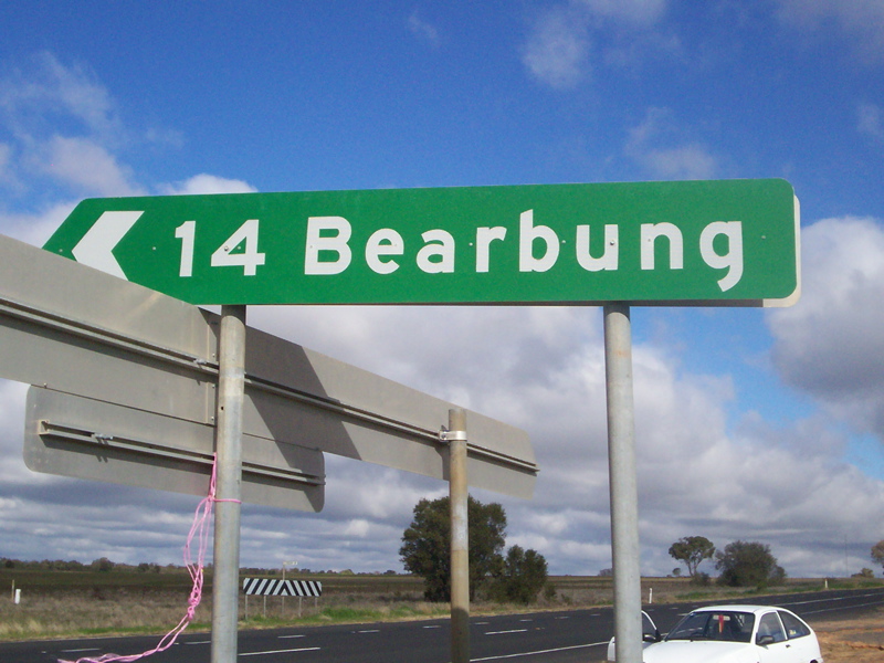
Intersection Directional Sign: ID sign at the junction with Back Bearbung Rd at Gilgandra, November 2010. Image © Rob Tilley |
|||
| Click here for the continuation of National Highway 39 between Gilgandra and Coonabarabran Click here for continuation of National Highway 39 between Forbes and Dubbo |
||||
1 Roads and Traffic Authority, Schedule of Classified Roads and State & Regional Roads, 31 January 2011
2 Roads and Traffic Authority, Road Projects, Western Region, Newell Highway
3 Department of Main Roads, Main Roads of New South Wales brochure
4 Department of Main Roads, The Roadmakers, A History of Main Roads in New South Wales, ISBN0 7240 0439 4
5 Roads & Traffic Authority, Rules & Regulations, Newell Highway Reduced Speed Limit
Last updated: 18-Oct-2021 11:57
This site © Paul Rands. All rights reserved. Some portions © (copyright) by their respective and credited owners. Permission must be obtained before using any images from this site. For details, please email by clicking here.