|
|
|
|
|
 |
Newell Highway (National Highway 39) - Narrandera to Wyalong (Decommissioned) |
Statistics:
Route Numbering:


General Information:
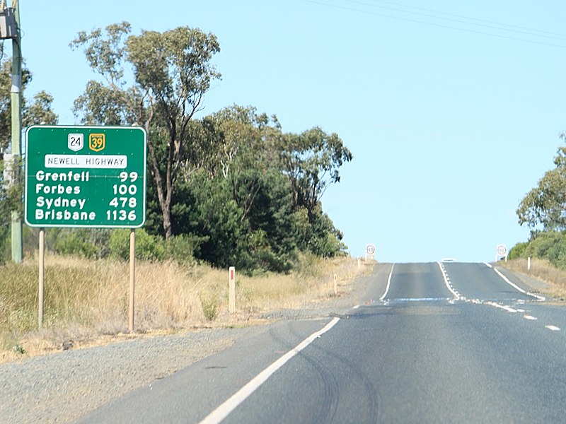
The Newell Highway is the longest highway in NSW, stretching from the Victorian border at Tocumwal to the Queensland border. It's the economic backbone for freight and livestock transporters, tourism operators, caravanners and holiday makers, emergency services, government, media and business owners. 2
The majority of the route is undivided roadway, with various overtaking sections where required.
The Newell Highway is named after HH Newell. He was the first commissioner for Main Roads in New South Wales. He passed away in 1941. 3 Prior to his appointment to the newly formed Main Roads Board on March 9, 1925, he was the District Engineer at the Wollongong branch of the Department of Public Works. 4
Multiplexes along the route include:
History:
Click here for the former alignment between Narrandera and Wyalong
| Narrandera to Wyalong | Wyalong to Narrandera | |||
| Preview: | Description: | Preview: | Description: | |
 |
Entering Grong Grong: The Newell Hwy (NH39) as it enters the town of Grong Grong, November 2010. Image © Rob Tilley |
 |
Distance Sign: RD sign Wyalong after the junction with Goldfields Way (SR85), May 2005. Image © Rob Tilley |
|
 |
Approaching Junee Street & Ganmain Road: Warning signs approaching the complex junction with Junee St and Ganmain Rd at Grong Grong, November 2010. Image © Rob Tilley |
 |
Advance Directional Sign: AD sign approaching Copeland St at Wyalong, May 2005. Image © Rob Tilley |
|
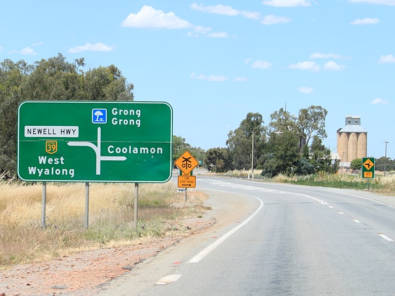 |
Advance Directional Sign: AD sign approaching the complex junction with Junee St and Ganmain Rd at Grong Grong, November 2010. Image © Rob Tilley |
 |
Advance Directional Sign: AD sign in West Wyalong CBD approaching Mid Western Hwy (NR24), April 2005. The NR24 duplex ends at this junction. Image © Rob Tilley |
|
 |
Advance Directional Sign: AD sign approaching Ganmain Rd at Grong Grong, November 2010. Image © Rob Tilley |
 |
Mid Western Highway: Newell Hwy (NH39) at the junction with Mid Western Hwy (NR24) at West Wyalong, April 2005. Image © Rob Tilley |
|
 |
Ganmain Road: Intersection directional sign at the junction with Ganmain Rd at Grong Grong, November 2010. Image © Rob Tilley |
 |
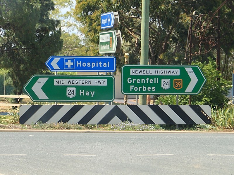
Intersection Directional Sign: ID sign on Newell Hwy (NH39) at the junction with Mid Western Hwy (NR24) at West Wyalon, November 2010. Image © Rob Tilley |
|
 |
Distance Sign: RD sign as Newell Hwy (NH39) leaves Grong Grong, November 2010. Image © Rob Tilley |
 |
Advance Directional Sign: AD sign on Newell Hwy (NH39) at West Wyalong approaching Talimba Rd, May 2005. Image © Rob Tilley |
|
 |
Cowabbie Road: Intersection directional sign the junction with Cowabbie Rd in Grong Grong, November 2010. Image © Rob Tilley |
 |
Talimba Road: Intersection directional sign at West Wyalong at the junction with Talimba Rd. NH39 turns left at this junction, May 2005. Image © Rob Tilley |
|
 |
Advance Directional Sign: AD sign on Newell Hwy (NH39) at Ardlethan approaching Wagga Wagga Rd, November 2010. Image © Rob Tilley |
 |
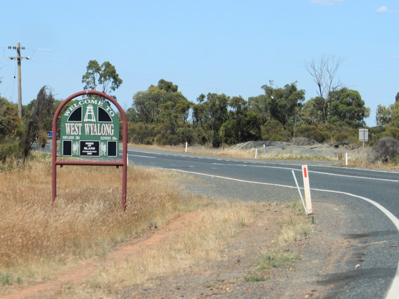
Distance Sign: RD sign as you leave West Wyalong, January 2004. |
|
 |
Distance Sign: RD sign at Ardlethan after the Wagga Wagga Rd intersection, November 2010. Image © Rob Tilley |
 |
Distance Sign: Tourism based RD sign at Mirrool, May 2005. Image © Rob Tilley |
|
 |
Services Sign: Services sign approaching the Ardlethan town centre, November 2010. Image © Rob Tilley |
 |
Distance Sign: RD sign at Mirrool, May 2005. Image © Rob Tilley |
|
 |
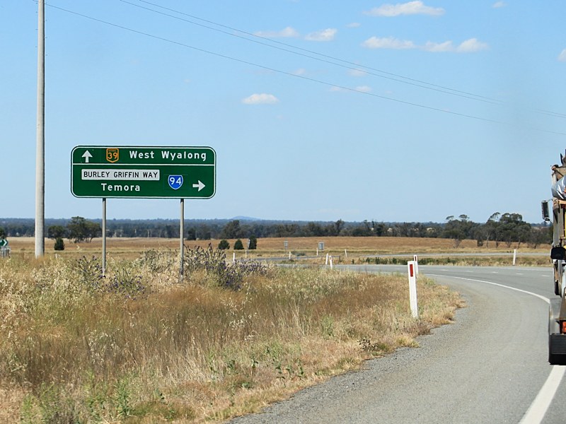
Advance Directional Sign: AD sign at Ardlethan approaching Burley Griffin Way (SR94), November 2010. Burley Griffin Way is named after Walter Burley Griffin, who with his wife Marion Mahony, drew up the original plans for the national capital, Canberra. Image © Rob Tilley |
 |
Advance Directional Sign: AD sign approaching Burley Griffin Way (SR94) at Ardlethan, May 2005. Image © Rob Tilley |
|
 |
Burley Griffin Way: Intersection directional sign assembly at the junction with Burley Griffin Way (SR94) at Ardlethan, November 2010. This is where the SR94 duplex begins. Image © Rob Tilley |
 |
Burley Griffin Way: Intersection directional sign assembly at the junction with Burley Griffin Way (SR94) at Ardlethan, May 2005. The SR94 duplex ends at this intersection. Image © Rob Tilley |
|
 |
Distance Sign: Reassurance directional sign as you leave Ardlethan, November 2010. Image © Rob Tilley |
 |
Distance Sign: Reassurance directional sign as you leave Ardlethan, May 2005. Image © Rob Tilley |
|
 |
Beckom Road: Intersection directional sign at the junction with Beckom Rd in Beckom, November 2010. Image © Rob Tilley |
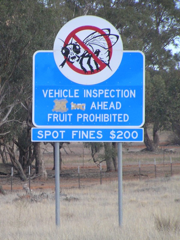 |
Fruit Fly Inspection Sign: Sign at Ardlethan for the fruit fly inspection station near Cowabbie, May 2005. Image © Rob Tilley |
|
 |
Advance Directional Sign: AD sign approaching Burley Griffin Way (SR94) at Beckom, November 2010. Image © Rob Tilley |
 |
Advance Directional Sign: AD sign approaching the complex junction with Junee St and Ganmain Rd at Grong Grong, May 2005. Image © Rob Tilley |
|
 |
Burley Griffin Way: Intersection directional sign assembly at the junction with Burley Griffin Way (SR94) at Ardlethan, November 2010. Despite the indication on the ID sign facing Burley Griffin Way, the SR94 duplex ends at this intersection. Image © Rob Tilley |
 |
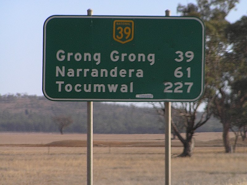
Distance Sign: RD sign as you leave Grong Grong, May 2005. Image © Rob Tilley |
|
 |
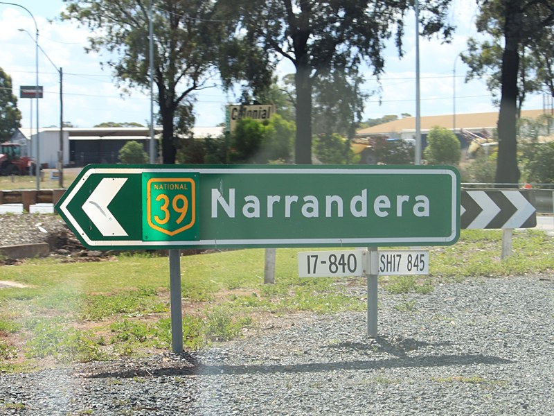
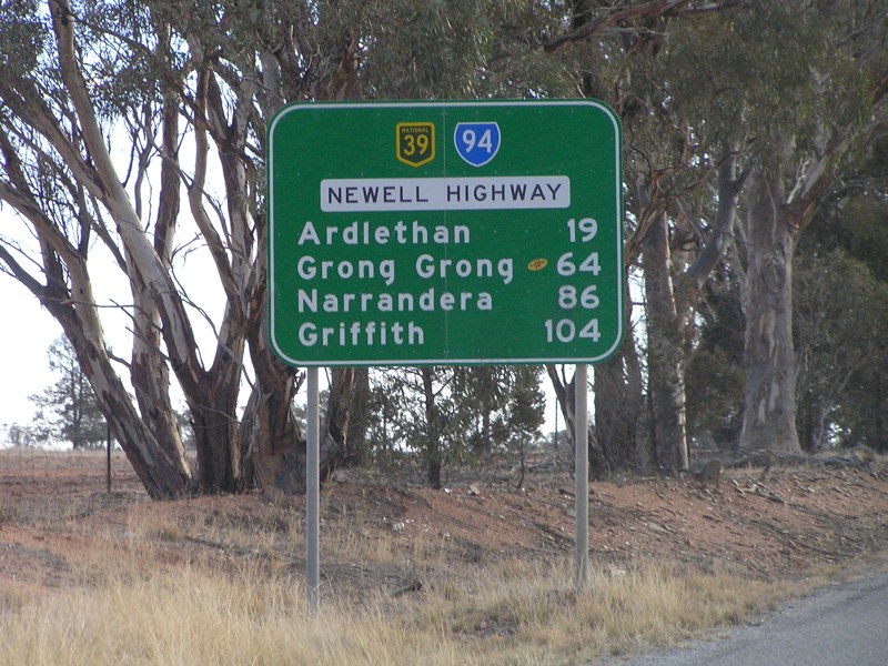
Distance Sign: RD sign at Mirrool after the junction with Burley Griffin Way (SR94), November 2010. Click here for a photo of the previous sign from April 2005. Image © Rob Tilley |
|||
 |
Distance Sign: Tourism based RD sign at Mirrool, November 2010. Image © Rob Tilley |
|||
 |
Intersection Directional Sign: ID sign at Ariah Park at the junction with Ariah Park Rd, November 2010. Image © Rob Tilley |
|||
 |
Mandamah Forest Road: Intersection directional sign at the junction with Mandamah Forest Rd in Ariah Park, November 2010. Image © Rob Tilley |
|||
 |
Approaching Talimba Road: Warning signs as you approach Talimba Rd at West Wyalong, November 2010. Image © Rob Tilley |
|||
 |
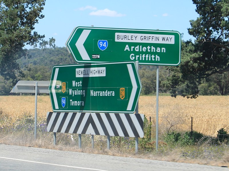
Advance Directional Sign: AD sign on Newell Hwy (NH39) at West Wyalong approaching Talimba Rd, November 2010. NH39 turns right at this junction. Image © Rob Tilley |
|||
 |
Approaching Talimba Road: Warning signs as you approach Talimba Rd at West Wyalong, November 2010. Image © Rob Tilley |
|||
 |
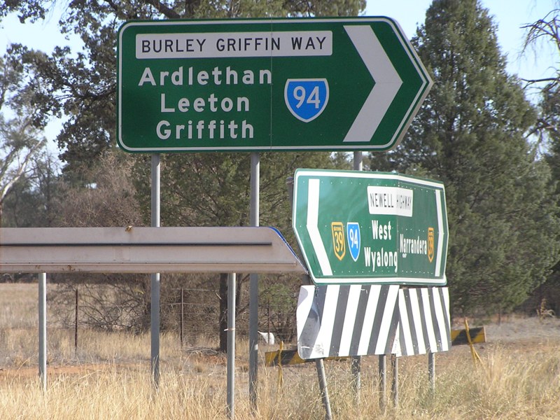
Talimba Road: Intersection directional sign at West Wyalong at the junction with Talimba Rd, April 2005. NH39 turns right at this junction. Note the height of the hazard sign, it's so it's visible to traffic approaching the junction as they pass over a crest. Image © Rob Tilley |
|||
 |
Entering West Wyalong: Newell Hwy (NH39) as it enter West Wyalong, November 2010. Image © Rob Tilley |
|||
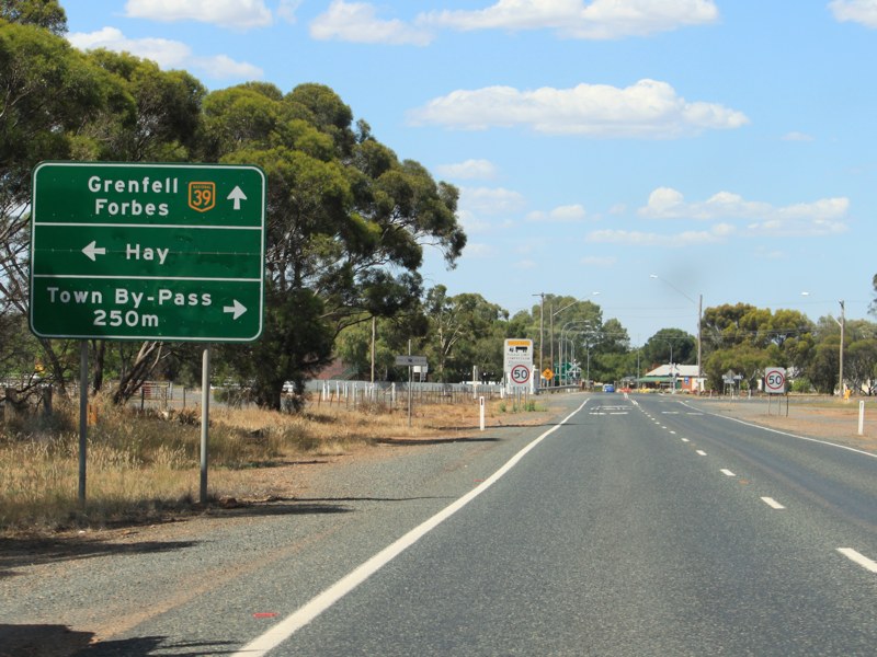 |
Advance Directional Sign: AD sign approaching Town Bypass Rd at West Wyalong, November 2010. Image © Rob Tilley |
|||
 |
Advance Directional Sign: AD sign in West Wyalong CBD approaching Mid Western Hwy (NR24), April 2005. The NR24 duplex begins at this junction. Image © Rob Tilley |
|||
 |
Mid Western Highway: Newell Hwy (NH39) at the junction with Mid Western Hwy (NR24) at West Wyalong, November 2010. Image © Rob Tilley |
|||
 |
Distance Sign: RD sign at West Wyalong after the Mid Western Hwy (NR24) junction, April 2005. Image © Rob Tilley |
|||
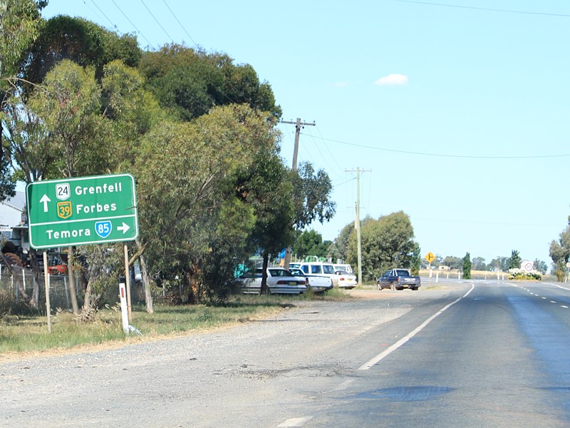 |
Advance Directional Sign: AD sign at Wyalong approaching Goldfields Way (SR85), November 2010. Image © Rob Tilley |
|||
 |
Goldfields Way: Obscured intersection directional sign at the Goldfields Way (SR85) intersection in Wyalong, November 2010. Image © Rob Tilley |
|||
 |
Distance Sign: RD sign as you leave Wyalong, November 2010. Image © Rob Tilley |
|||
 |
Quandialla Road: Intersection directional sign assembly at the Quandialla Rd junction near Wyalong, November 2010. Image © Rob Tilley |
|||
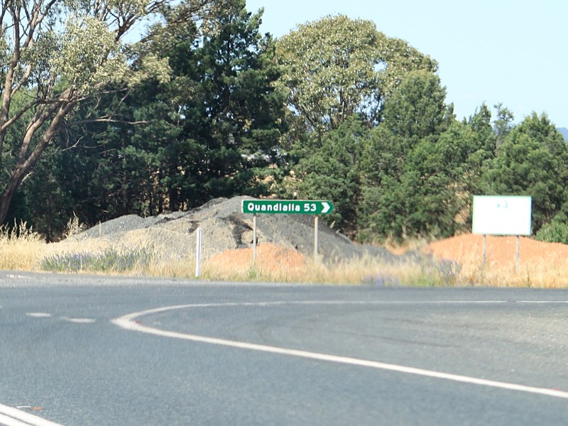 |
Quandialla Road: Intersection directional sign assembly at the Quandialla Rd junction near Wyalong, November 2010. Image © Rob Tilley |
|||
Click here for the continuation of National Highway 39 between Wyalong and Forbes |
||||
1 Roads and Traffic Authority, Schedule of Classified Roads and State & Regional Roads, 31 January 2011
2 Roads and Traffic Authority, Road Projects, Western Region, Newell Highway
3 Department of Main Roads, Main Roads of New South Wales brochure
4 Department of Main Roads, The Roadmakers, A History of Main Roads in New South Wales, ISBN0 7240 0439 4
5 Minister for Infrastructure, Transport,
Regional Development and Local Government, Media Release, Work Underway On Newell Highway Blackspots, 16 November 2009.
6 Roads & Traffic Authority, Rules & Regulations, Newell Highway Reduced Speed Limit
Last updated: 07-Sep-2020 21:12
This site © Paul Rands. All rights reserved. Some portions © (copyright) by their respective and credited owners. Permission must be obtained before using any images from this site. For details, please email by clicking here.