|
|
|
|
|
 |
Newell Highway (National Highway 39) - Jerilderie to Narrandera (Decommissioned) |
Statistics:
Route Numbering:


General Information:
The Newell Highway is the longest highway in NSW, stretching from the Victorian border at Tocumwal to the Queensland border. It's the economic backbone for freight and livestock transporters, tourism operators, caravanners and holiday makers, emergency services, government, media and business owners. 2
The majority of the route is undivided roadway, with various overtaking sections where required.
The Newell Highway is named after HH Newell. He was the first commissioner for Main Roads in New South Wales. He passed away in 1941. 3 Prior to his appointment to the newly formed Main Roads Board on March 9, 1925, he was the District Engineer at the Wollongong branch of the Department of Public Works. 4
Multiplexes along the route include:
History:
| Jerilderie to Narrandera | Narrandera to Jerilderie | |||
| Preview: | Description: | Preview: | Description: | |
 |
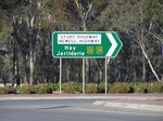
Advance Directional Sign: Diagrammatic AD sign at Bundure for Kidman Way (SR87), November 2010. Note the incorrect SR52 shield. Image © Rob Tilley |
 |
Entering Narrandera: Newell Hwy (NH39) as it enters the town of Narrandera, May 2005. Image © Rob Tilley |
|
 |
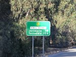
Distance Sign: Tourism based RD sign with distances to towns with tourist information. Bundure approaching Kidman Way (SR87), November 2010. Image © Rob Tilley |
 |
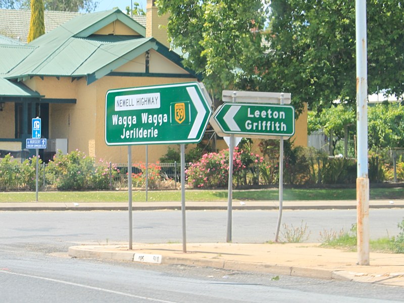
Whitton Street: Intersection directional sign at Whitten St in Narranderra. NH39 turns left at this junction. May 2005. Image © Rob Tilley |
|
 |
Supplemental Advance Directional Sign: Supplemental AD sign approaching Kidman Way (SR87) at Bundure, November 2010. Image © Rob Tilley |
 |
Irrigation Way & Audley Street: Intersection directional sign at the junction with Irrigation Way & Audley St in Narradera, April 2005. Image © Rob Tilley |
|
 |
Advance Directional Sign: AD sign approaching Kidman Way (SR87) at Bundure, November 2010. Image © Rob Tilley |
 |
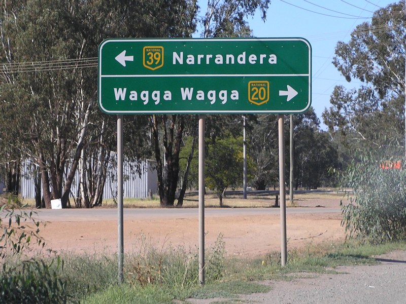
Advance Directional Sign: AD sign approaching Sturt Hwy (NH20) at Gillenbah, May 2005. The NH20 duplex begins at this junction. Image © Rob Tilley |
|
 |
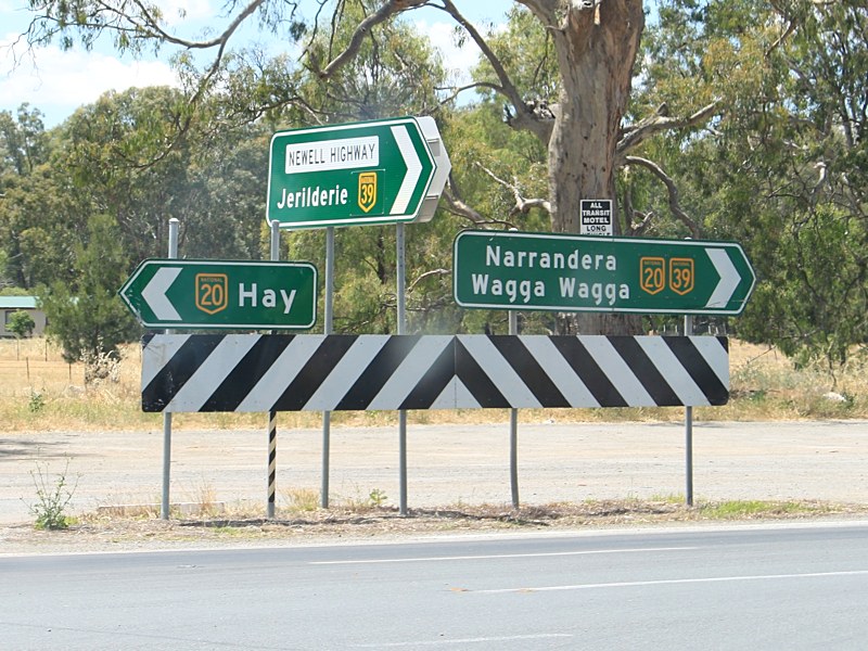
Kidman Way: Intersection directional sign assembly at the Kidman Way (SR87) junction at Bundure, November 2010. Image © Rob Tilley |
 |
Sturt Highway: Corner of Newell Hwy (NH39) and Sturt Hwy (NH20) at Gillenbah, May 2005. The NH20 duplex begins at this junction. Image © Rob Tilley |
|
 |
Distance Sign: Reassurance directional sign at Bundure after the Kidman Way (SR87) junction, November 2010. Image © Rob Tilley |
 |
Advance Directional Sign: AD sign approaching Sturt Hwy (NH20) at Gillenbah, May 2005. The NH20 duplex ends at this junction. Image © Rob Tilley |
|
 |
Colombo Road: Intersection directional sign at the Colombo Rd junction at Bundure, November 2010. Image © Rob Tilley |
 |
Distance Sign: RD sign as you leave Gillenbah, May 2005. Image © Rob Tilley |
|
 |
Athole Road & Coonong Road: Intersection directional sign at the junction with Athole Rd and Coonong Rd in Morundah, November 2010. Image © Rob Tilley |
 |
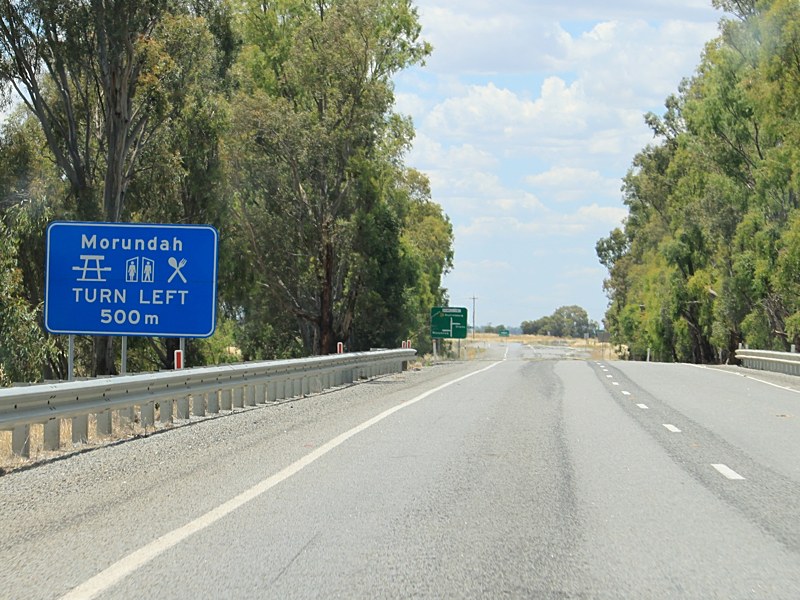
Advance Directional Sign: AD sign approaching Browley St and Urana-Morundah Rd at Morundah, May 2005. Image © Rob Tilley |
|
 |
Railway Overpass: Newell Hwy (NH39) at Morundah as it crosses over the disused railway line, November 2010. Image © Rob Tilley |
 |
Distance Sign: RD sign as you leave Morundah, May 2005. Image © Rob Tilley |
|
 |
Services Sign: Services sign at Morundah approaching the junction with Browley St, November 2010. Image © Rob Tilley |
 |
Bundure Area: Newell Hwy (NH39) as it passes through the Bundure area, May 2005. Image © Rob Tilley |
|
 |
Advance Directional Sign: AD sign approaching Browley St and Urana-Morundah Rd at Morundah, November 2010. Image © Rob Tilley |
 |
Distance Sign: RD sign in the Bundure area, May 2005. Image © Rob Tilley |
|
 |
Browley Street: Corner of Newell Hwy (NH39) and Browley St in Morundah, November 2010. Image © Rob Tilley |
|||
 |
Urana-Morundah Road: Corner of Newell Hwy (NH39) and Urana-Morundah Rd at Morundah, November 2010. Image © Rob Tilley |
|||
 |
Distance Sign: RD sign as you leave Morundah, November 2010. Image © Rob Tilley |
|||
 |
Advance Directional Sign: AD sign approaching Sturt Hwy (NH20) at Gillenbah, November 2010. The NH20 duplex begins at this junction. Image © Rob Tilley |
|||
 |
Sturt Highway: Corner of Newell Hwy (NH39) and Sturt Hwy (NH20) at Gillenbah, November 2010. The NH20 duplex begins at this junction. Image © Rob Tilley |
|||
 |
Advance Directional Sign: AD sign approaching Sturt Hwy (NH20) at Gillenbah, November 2010. Click here for a photo from April 2005 of the previous version of this sign. Image © Rob Tilley |
|||
 |
Sturt Highway: Corner of Newell Hwy (NH39) and Sturt Hwy (NH20) at Gillenbah, November 2010. Click here for a photo from April 2005 of this junction. The NH20 duplex ends at this junction. Image © Rob Tilley |
|||
 |
Entering Narrandera: Newell Hwy (NH39) as it enters the town of Narrandera, November 2010. Image © Rob Tilley |
|||
 |
Supplemental Advance Directional Sign: Supplemental AD sign at Narrandera approaching Irrigation Way and Audley St, November 2010. Image © Rob Tilley |
|||
 |
Services Sign: Services sign approaching Larmer St Narranderie, November 2010. Image © Rob Tilley |
|||
 |
Advance Directional Sign: AD sign at Narrandera approaching Irrigation Way and Audley St, November 2010. Click here for a photo from April 2005 of the previous version of this sign. Image © Rob Tilley |
|||
 |
Irrigation Way & Audley Street: Intersection directional signs at the junction with Irrigation Way & Audley St in Narradera, November 2010. Image © Rob Tilley |
|||
 |
Irrigation Way & Audley Street: Intersection directional sign at the junction with Irrigation Way & Audley St in Narradera, November 2010. Image © Rob Tilley |
|||
 |
Whitton Street: Intersection directional sign at Whitten St in Narranderra, November 2010. NH39 turns right at this junction. Image © Rob Tilley |
|||
 |
Narranderra-Barellan Road: Newell Hwy (NH39) at the junction with Narrandera-Barellan Rd in Narrandera, November 2010. Image © Rob Tilley |
|||
 |
Distance Sign: RD sign as Newell Hwy (NH39) leaves Narrandera, November 2010. Image © Rob Tilley |
|||
| Click here the continuation of National Highway 39 between Narrandera and Wyalong Click here for the continuation of National Highway 39 between the Victorian Border and Jerilderie |
||||
1 Roads and Traffic Authority, Schedule of Classified Roads and State & Regional Roads, 31 January 2011
2 Roads and Traffic Authority, Road Projects, Western Region, Newell Highway
3 Department of Main Roads, Main Roads of New South Wales brochure
4 Department of Main Roads, The Roadmakers, A History of Main Roads in New South Wales, ISBN0 7240 0439 4
5 Roads & Traffic Authority, Rules & Regulations, Newell Highway Reduced Speed Limit
Last updated: 17-Dec-2019 0:55
This site © Paul Rands. All rights reserved. Some portions © (copyright) by their respective and credited owners. Permission must be obtained before using any images from this site. For details, please email by clicking here.