|
|
|
|
|
 |
New England Highway (National Highway 15) - Murrurundi to Tamworth - Former Alignment - Willow Tree (Decommissioned) |
Statistics:
Route Numbering:

Background:
This segment of highway featured the last single-lane bridge on the highway and was replaced during the 1960s as part of a larger project.
The former route takes in a section of Merriwa Road, a section of Boambil Creek Road and the length of Murrurundi Road at Willow Tree to Kankool.
| Northbound | Southbound | |||
| Preview: | Description: | Preview: | Description: | |
 |
Timber Sign: Timber sign for the bridge over Boambil Ck on Murrurundi Road, WIllow Tree. November 2005. Image © Paul Rands |
 |
Black Intersection Directional Sign: Old council installed black ID sign on Boambil Creek Road, pointing to the former highway alignment (Murrurundi Road) at Willow Tree. November 2005. Image © Paul Rands |
|
 |
Black Intersection Directional Sign: Old council black ID sign facing Boambil Creek Road at Willow Tree. November 2005. Image © Paul Rands |
 |
Old Alignment: Murrurundi Road, the former highway alignment, south of Glenyalla Road, November 2005. Note the old yellow pavement markings. Image © Paul Rands |
|
 |
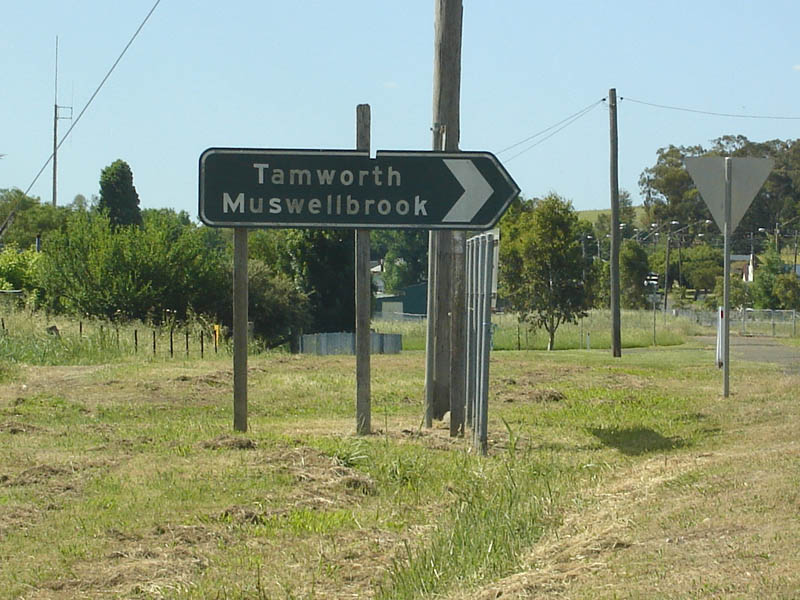
Distance Sign: RD sign on Merriwa Road at Willow Tree. This section of Merriwa Road was once part of the New England Highway. November 2005. Image © Paul Rands |
|||
 |
Black Intersection Directional Sign: Black ID sign on the corner of Merriwa Road and Ogden Street in Willow Tree. Until the recnstruction of the highway, it used to go straight through at this junction over the railway via a level crossing, November 2005. Image © Paul Rands |
|||
Last updated: 08 Nov 2019 01:09
This site © Paul Rands. All rights reserved. Some portions © (copyright) by their respective and credited owners. Permission must be obtained before using any images from this site. For details, please email by clicking here.