|
|
|
|
|
 |
Pennant Hills Road (Cumberland Highway) (Metroad 7) (Decommissioned) |
Statistics:
Route Numbering:

General Information:
Metroad 7 is a shadow of its former self, originally formed from several roads to make the Cumberland Hwy, Metroad 7 used to run from Liverpool to Wahroonga, until the opening of Westlink M7 in December 2005.
The current form of Metroad 7 now takes in only Pennant Hills Road through some of Sydney's wealthier suburbs taking traffic from south and western Sydney to the northern coast of New South Wales by connecting with the Sydney-Newcastle Freeway (National Highway 1, and former F3).
The route consists of 6 lane dual carriageway, passing through commercial and residential areas.
History:
Click here for photos of the former Metroad 7 alignment and signage.

| Carlingford to Wahroonga | Wahroonga to Carlingford | |||
| Preview: | Description: | Preview: | Description: | |
 |
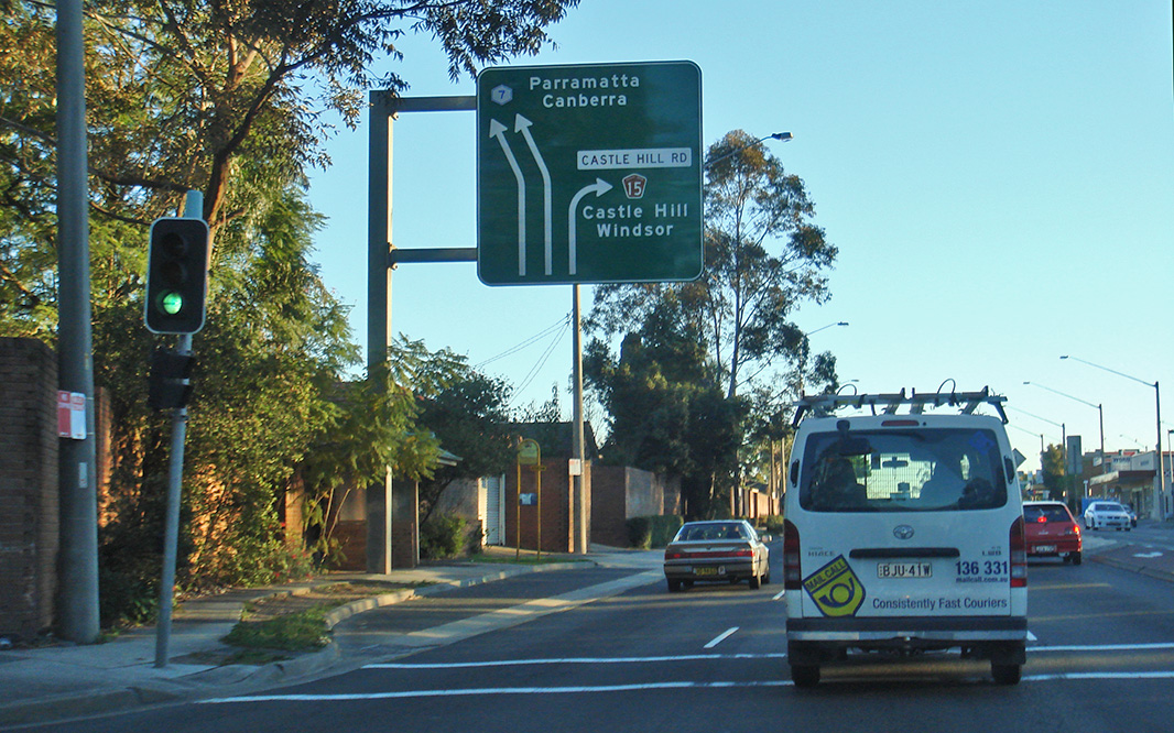
Castle Hill Road Supplemental AD Sign: Approaching the intersection with Castle Hill Road at West Pennant Hills, northbound. September 2007. Image © Paul Rands |
 |
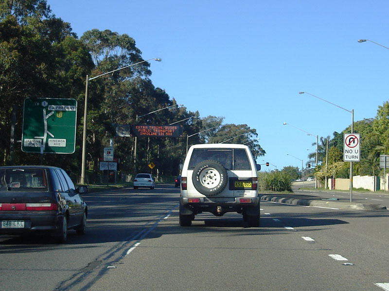
Distance Sign: Southbound RD sign near Hinemoa Av at Normanhurst. August 2011. Click here for a photo of this location by Paul Rands from September 2007. Image © Paul Rands |
|
 |
Advance Directional Sign: AD sign for Castle Hill Road at West Pennant Hills. October 2005. Image © Paul Rands |
 |
Osborn Road Intersection: Southbound outside Loreto Catholic College at Normanhurst. September 2007. Image © Paul Rands |
|
 |
Castle Hill Road Junction: Entering Thompson's Corner at West Pennant Hills. September 2007. Image © Paul Rands |
 |
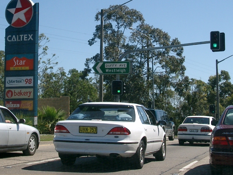
Approaching Duffy Av: Southbound through Thornleigh as you approach the intersection with Duffy Av, September 2007. Image © Paul Rands |
|
 |
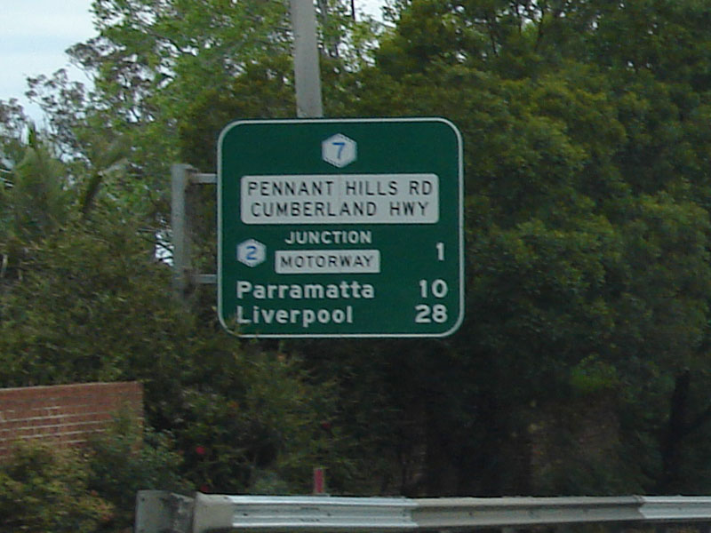
Distance Sign: Distance sign located just after Thompson's Corner at West Pennant Hills. October 2005. Image © Paul Rands |
 |
Comenarra Parkway Intersection: Looking southbound at the intersection with the Comenarra Parkway at Thornleigh. September 2007. Image © Paul Rands |
|
 |
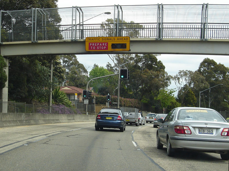
Approaching Beecroft Road: Footbridge near Mt St Benedicts Catholic Girls College as you approach the intersection with Beecroft Road at Pennant Hills, July 2006. Image © Paul Rands |
 |
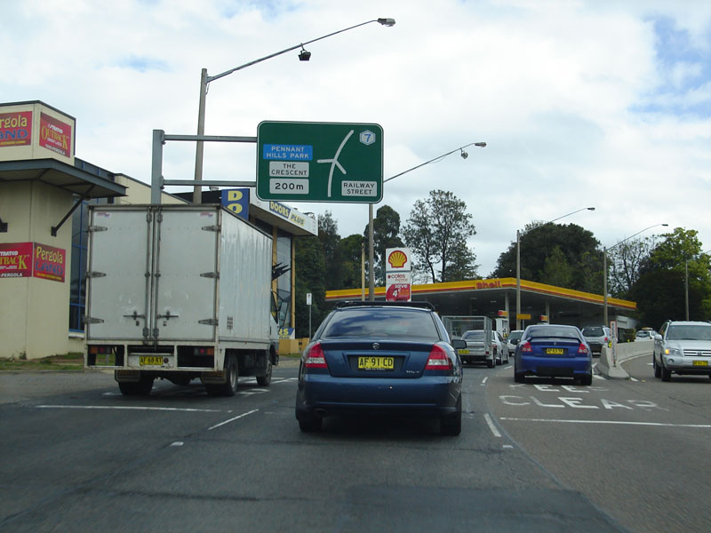
Advance Directional Sign: Southbound advance directional sign for the intersection with The Crescent and Railway Street at Pennant Hills, August 2011. Click here for a photo of this location by Paul Rands from September 2007. Image © Paul Rands |
|
 |
Beecroft Road AD Sign: Image © Paul Rands |
 |
The Crescent: Image © Paul Rands |
|
 |
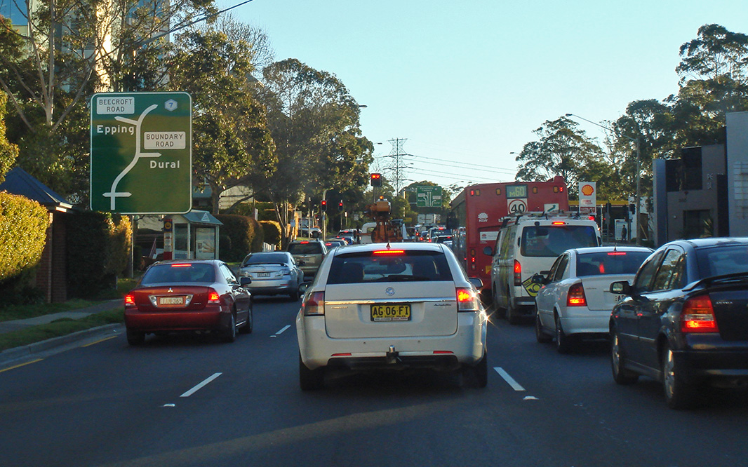
Boundary Road AD Sign: Heading northbound at Pennant Hills approaching the Boundary Road turn off. September 2007. Image © Paul Rands |
 |
Advance Directional Sign: Southbound at Pennant Hills near Trebor Street, approaching Boundary Road and Beecroft Road. August 2011. Click here for a photo of this location by Paul Rands from September 2007. Image © Paul Rands |
|
 |
Boundary Road Intersection: Heading northbound at Pennant Hills at the Boundary Road turn off. October 2005. Image © Paul Rands |
 |
Boundary Road Intersection: Southbound as you pass through the intersection with Boundary Road, with supplemental AD sign pointing to the Hills Motorway. September 2007. Image © Paul Rands |
|
 |
Advance Directional Sign: Northbound through the Pennant Hills shopping strip as you approach the intersection with Yarrara Road and The Crescent. October 2005. Image © Paul Rands |
 |
Beecroft Road Junction: Approaching the Beecroft Road intersection at Pennant Hills. September 2007. Image © Paul Rands |
|
 |
Duffy Avenue Intersection: Looking north at the intersection with Pennant Hills Road and Duffy Avenue at Thornleigh. October 2005. Image © Paul Rands |
 |
Distance Sign: Southbound RD sign near Beecroft Road at Pennant Hills. September 2007. Image © Paul Rands |
|
 |
AD Sign: Advance directional sign approaching Redgrave Road at Normanhurst, September 2007. Image © Paul Rands |
 |
Advance Directional Sign: Southbound AD sign approaching Cardinal Av and Castle Hill Rd intersections at West Pennant Hills. August 2011. Click here for a photo of this location by Paul Rands from September 2007. Image © Paul Rands |
|
 |
Reassurance Sign: Sign indicating change in route number, looking north near Buckingham Avenue at Normanhurst. October 2005. Image © Paul Rands |
 |
AD Sign: Southbound AD sign approaching Castle Hill Road (TD15) at West Pennant Hills. August 2011. Click here for a photo of this location by Paul Rands from September 2007. Image © Paul Rands |
|
 |
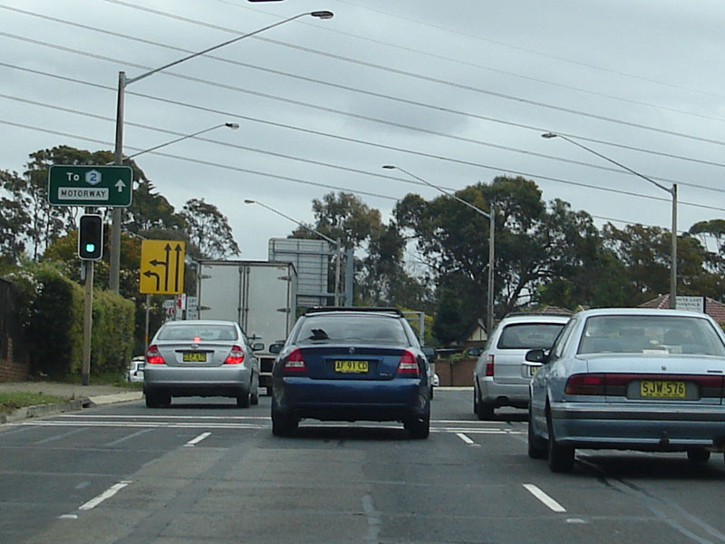
Advance Directional Sign: Looking north on Pennant Hills Road at Wahroonga as you approach the intersection with Sydney-Newcastle Freeway (NH1), September 2007. Image © Paul Rands |
 |
Supplemental AD Sign: Southbound advance directional sign approaching the Castle Hill Road intersection in West Pennant Hills. August 2011. Click here for a photo of this location by Paul Rands from September 2007. Image © Paul Rands |
|
 |
Intersection Directional Sign: This is another old gantry with newer signage, this used to have old 'Freeway Green' signage at one stage but has been updated at some point. Corner of the Sydney-Newcastle Freeway and Pennant Hills Road - the terminus of National Highway 1, State Route 83 and Metroad 7. September 2007 at Wahroonga. Image © Paul Rands |
 |
Distance Sign: RD sign located after the Castle Hill Road intersection (Thompson's Corner) at West Pennant Hills. September 2007. Image © Paul Rands |
|
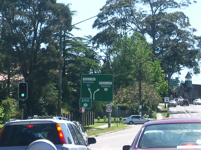 |
End Metroad 7: Sign officially marking the end of Metroad 7, just after the intersection with the Sydney-Newcastle Fwy (NH1) and approaching Pacific Highway (Metroad 1) at Wahroonga. October 2005. Image © Paul Rands |
 |
Advance Directional Sign: AD sign approaching the interchange with the Hills Motorway (Metroad 2 / M7) at West Pennant Hills. September 2007. Image © Paul Rands |
|
 |
Hills Motorway Interchange: Southbound at the interchange for the Hills Motorway at West Pennant Hills. August 2011. Image © Paul Rands |
|||
| Click here for the continuation of Pennant Hills Road (Cumberland Highway) as Metroad 6 | ||||
Last updated: 15-Sep-2020 23:33
This site © Paul Rands. All rights reserved. Some portions © (copyright) by their respective and credited owners. Permission must be obtained before using any images from this site. For details, please email by clicking here.