|
|
|
|
|

|
Western Distributor, The Crescent, City West Link, Dobroyd Parade, Wattle Street, Parramatta Road & Western Motorway (Metroad 4) - St Clair to Lapstone (Decommissioned) |
Statistics:
Route Numbering:


General Information:
Metroad 4 is the main route between the Blue Mountains and Sydney's western suburbs and Sydney's CBD. Except within the inner western suburbs of Sydney, the route parallels and in some cases uses one Australia's earliest road routes, Parramatta Road / Great Western Highway.
Road conditions vary from freeway standard through to suburban arterial. With a minimum of 2 lanes in each direction.
The route is duplexed with State Route 40 from Rozelle to Pyrmont.
Planning began for the Western Expressway in 1947, as the County of Cumberland Planning Scheme (CCPS) was being drawn up, which included a corridor from the City of Sydney at Glebe to the Gt Western Hwy at Lapstone, passing through Glebe, Haberfield, and Five Dock before joining the current route at Concord. This corridor was reserved in 1951. 1
The first section of the M4 Motorway was from Prospect to Penrith, completed by the NSW Government in the early 1970's. Various stages of the second section from Concord to Parramatta were completed during the 80's, with a missing link of approximately 10 km between Mays Hill, near Parramatta, and Prospect to connect these two sections. 1
In 1989 the NSW Government invited proposals from private enterprise to fund and construct the missing section of roadway, and upgrading a further 11 km of the F4 Freeway. Statewide Roads Limited (SWR) won the right over a 20 year period to finance and build, and then operate and maintain the Motorway, after which the Motorway reverts back to Government control at no cost. 2
The opening of the M4 Western Motorway in May 1992 included 21 major bridge structures, and the upgrade and widening of 11 kilometres of existing expressway at a cost of $245 million. The completion of this section provided uninterrupted motorway conditions between Concord and Lapstone on the foothills of the Blue Mountains. Between 1996 to 1998 an upgrade and widening of the M4 Western Motorway to 3 lanes each way from Parramatta to Penrith was completed. 2
History:
Click here for historic photos between St Clair and Glenbrook
| St Clair to Lapstone | Lapstone to St Clair | |||
| Preview: | Description: | Preview: | Description: | |
 |
Distance Sign: RD sign at St Clair after the Roper Rd / Erskine Pk Rd interchange, April 2010. Image © Paul Rands |
 |
Advance Directional Sign: AD sign on Governors Dr at Lapstone approaching the interchange with Western Mwy (Metoad 4), April 2010. Click here for a photo of the old sign from December 2004. Image © Paul Rands |
|
 |
Bennett Road: Western Mwy (Metroad 4) as it passes under Bennett Rd at St Clair, April 2010. Image © Paul Rands |
 |
Western Motorway Interchange: Governors Dr as it passes under Great Western Hwy (NR32) to join Western Mwy (Metroad 4) at Lapstone, April 2010. Image © Paul Rands |
|
 |
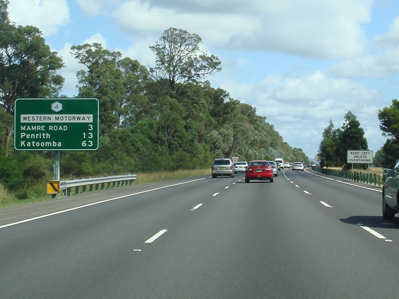
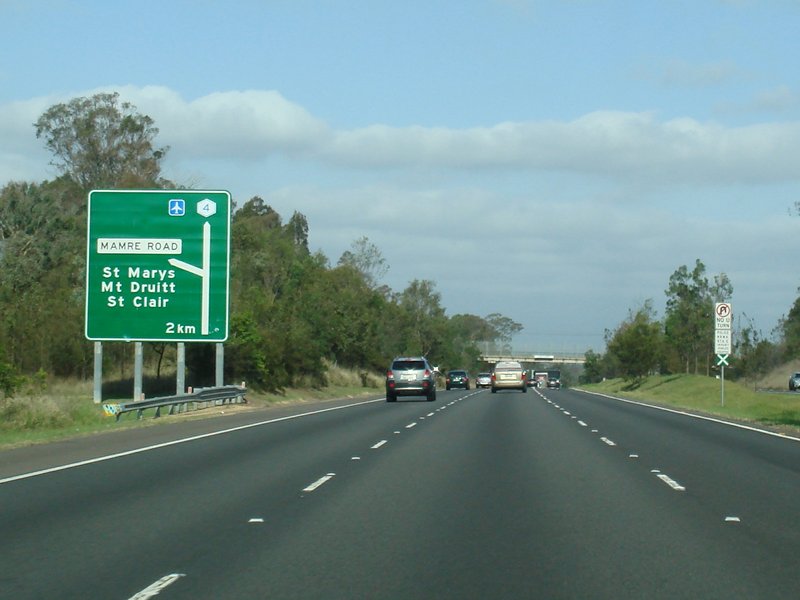
Advance Directional Sign: AD sign approaching Mamre Rd, St Clair, November 2010. Click here for a photo of this location from April 2010. Image © Rob Tilley |
 |
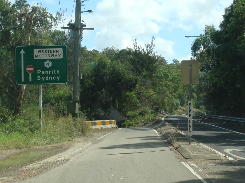
Start Metroad 4: End of NR32 and the beginning of Metroad 4, Glenbrook, April 2010. Image © Paul Rands |
|
 |
Mamre road: Intersection directional sign at the Mamre Rd interchange at St Clair, November 2010. Click here for a photo of this location from April 2010. Image © Rob Tilley |
 |
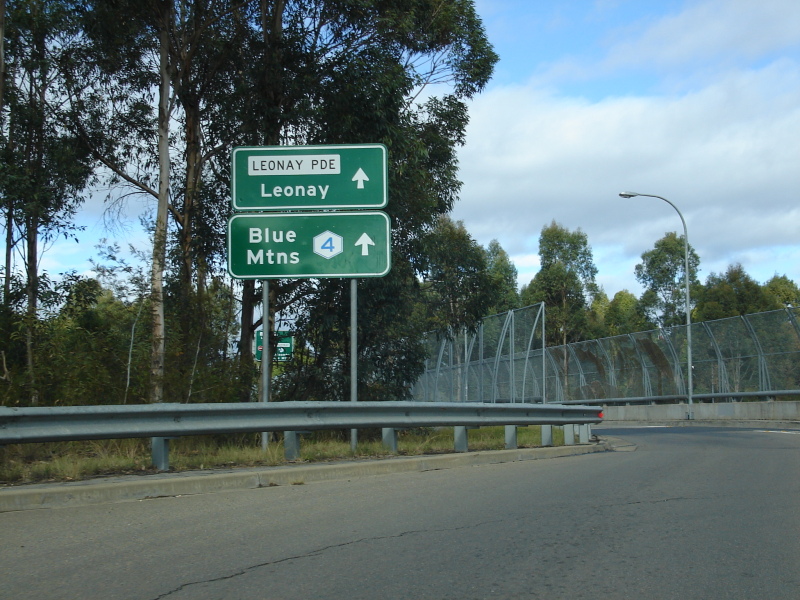
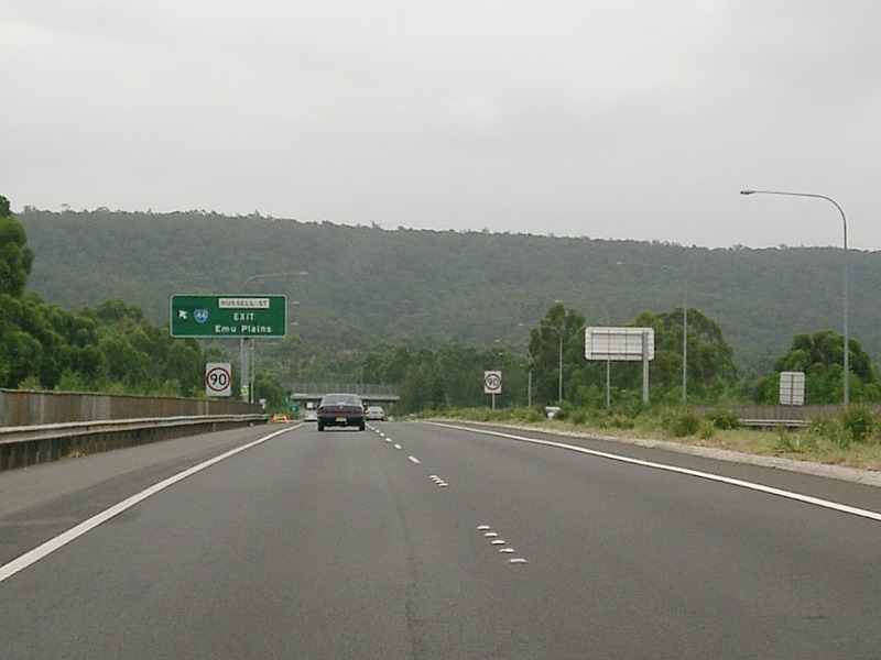
Advance Directional Sign: AD sign at Glenbrook approaching Russell St (SR44) and Leonay Pde, April 2010. Click here for a photo of the old sign from December 2004. Image © Paul Rands |
|
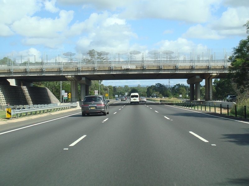 |
Mamre road: Mamre Rd interchange at St Clair, April 2010. Image © Paul Rands |
 |
Railway Overpass: Main western railway line as it crosses the Western Mwy (Metroad 4) at Glenbrook, April 2010. Click here for a photo of this area from December 2004. Image © Paul Rands |
|
 |
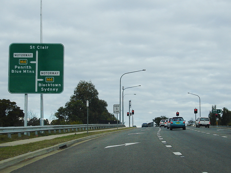
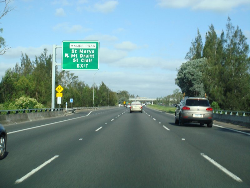
Advance Directional Sign: AD sign on Mamre Rd in St Marys approaching Hall St and Western Mwy (Metroad 4) interchange, June 2006. Image © Paul Rands |
 |
Welcome to Penrith Valley: Tourist sign welcoming visitors to the Penrith Valley, April 2010. Image © Paul Rands |
|
 |
Alphanumeric Advance Directional Sign: Alphanumeric AD sign on Mamre Rd in St Marys approaching Western Mwy (Metroad 4) interchange, June 2006. Image © Paul Rands |
 |
Welcome to Sydney: Tourist sign welcoming visitors to the Sydney area, April 2012. Click here for a photo of this location by Paul Rands from April 2010. Click here for a photo of this location by Paul Rands from December 2004. Image © Paul Rands |
|
 |
Mamre road: Intersection directional sign at the Mamre Rd interchange at St Clair, June 2006. Image © Paul Rands |
 |
Intersection Directional Sign: ID sign at the interchange with Russell St (SR44) and Leonay Pde at Leonay, April 2010. Image © Paul Rands |
|
 |
Road Safety Sign: Road safety sign on Western Mwy (Metroad 4) at Orchard Hills, April 2010. Image © Paul Rands |
 |
Russell Street / Leonay Parade: Interchange with Russell St (SR44) and Leonay Pde at Leonay, April 2010. Image © Paul Rands |
|
 |
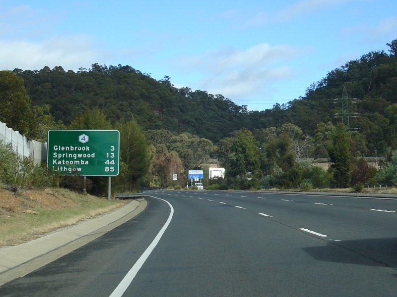
Distance Sign: RD sign at Orchard Hills, April 2010. Image © Paul Rands |
 |
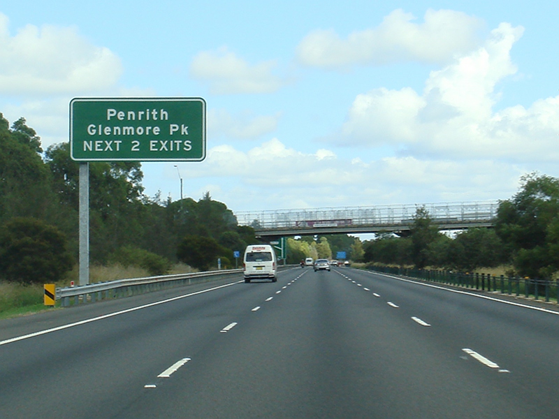
Supplemental Advance Directional Sign: Supplemental AD sign at Leonay, April 2010. Image © Paul Rands |
|
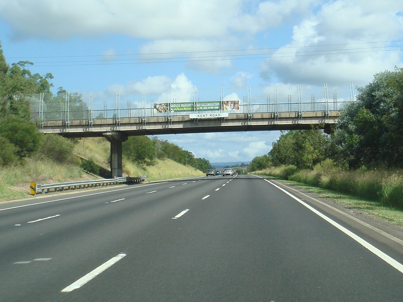 |
Kent Road: Western Mwy (Metroad 4) as it passes under Kent Rd in Orchard Hills, April 2010. Image © Paul Rands |
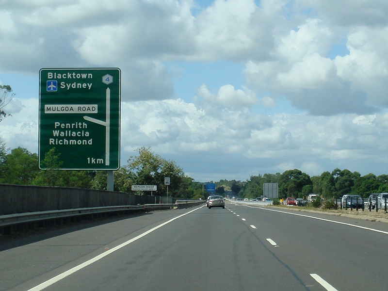 |
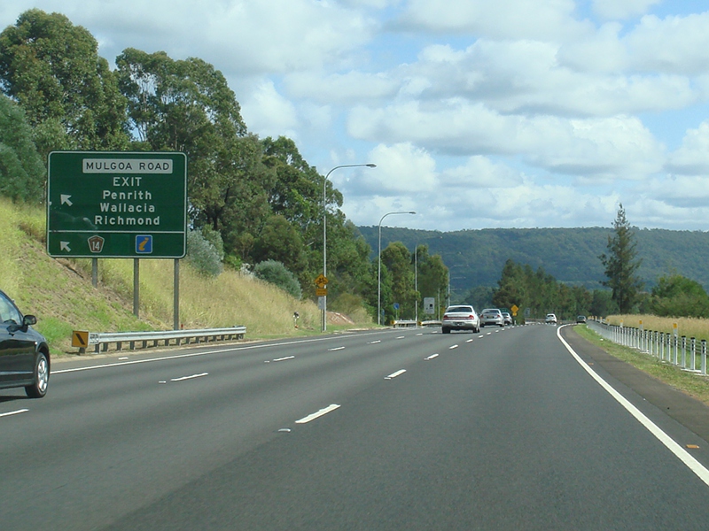
Advance Directional Sign: AD sign at Leonay for Mulgoa Rd interchange, April 2010. Image © Paul Rands |
|
 |
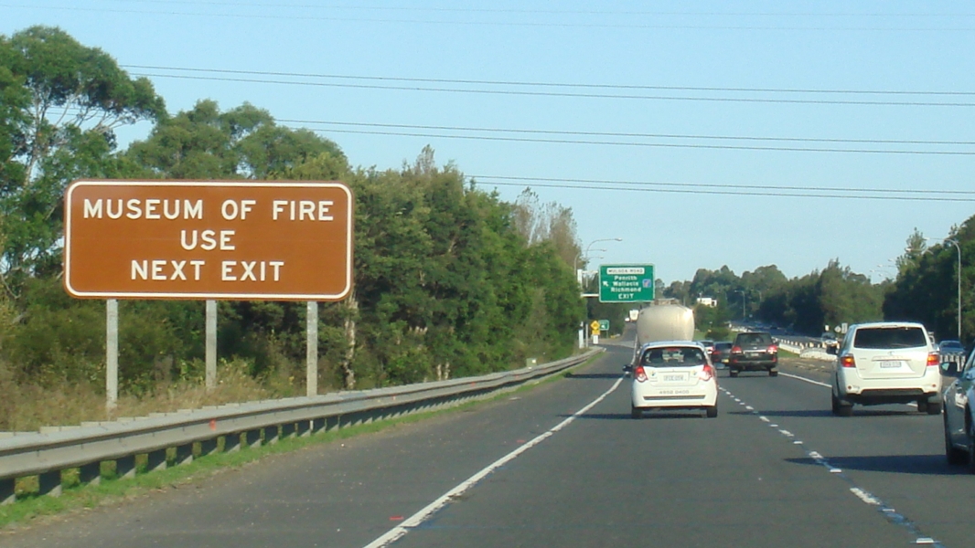
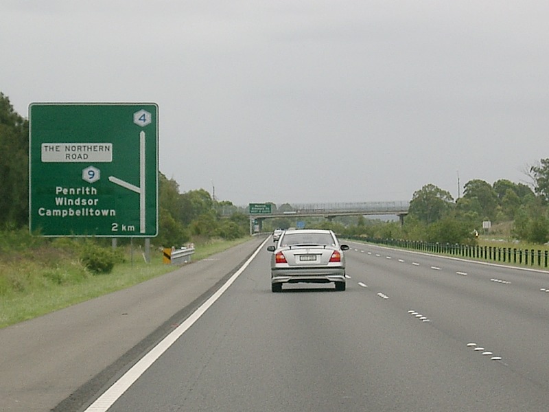
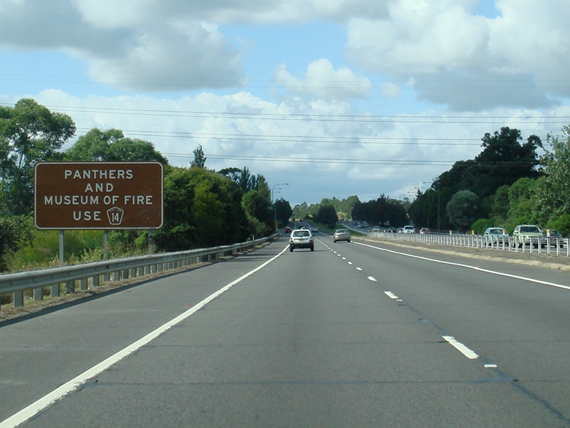
Supplemental Advance Directional Sign: Supplemental AD sign at Orchard Hills approaching The Northern Road (Metroad 9), April 2010. Image © Paul Rands |
 |
Nepean River: Western Mwy (Metroad 4) at Regentville as it crosses Nepean River via Penrith Valley Bridge, April 2010. Image © Paul Rands |
|
 |
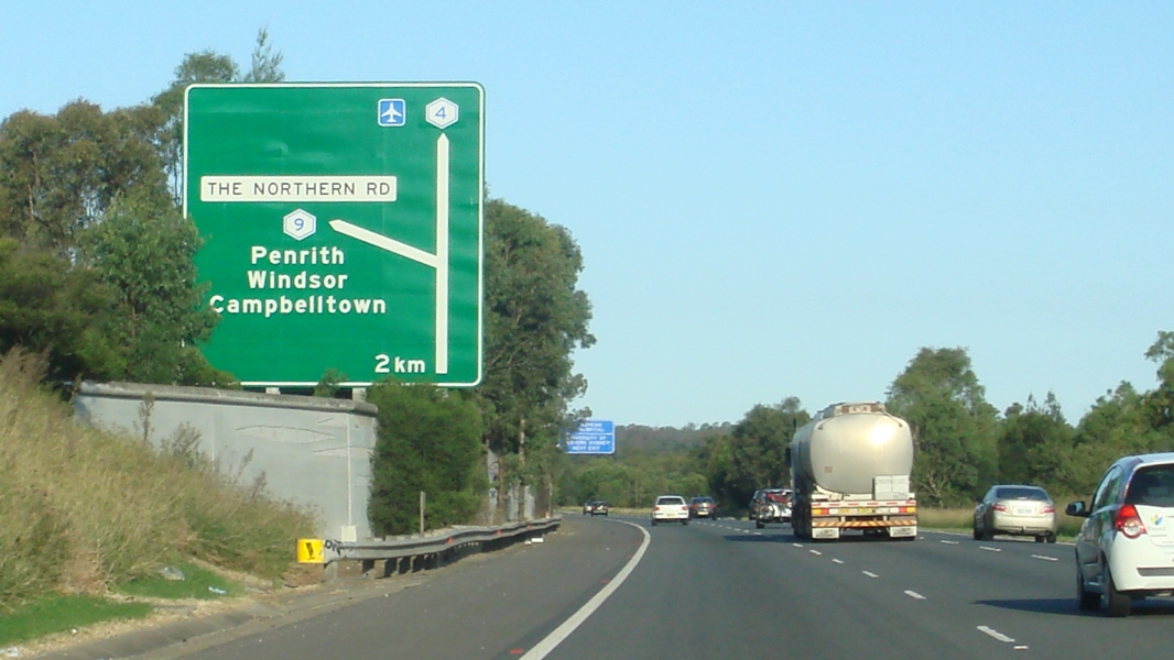
Advance Directional Sign: AD sign at Orchard Hills approaching The Northern Road (Metroad 9), November 2010. Click here for a photo from April 2010 of this sign with a Metroad 6 coverplate. Click here for a photo of the old sign from December 2004. Image © Rob Tilley |
 |
Penrith Valley Bridge: Western Mwy (Metroad 4) at Regentville as it crosses Nepean River via Penrith Valley Bridge, December 2004. Image © Paul Rands |
|
 |
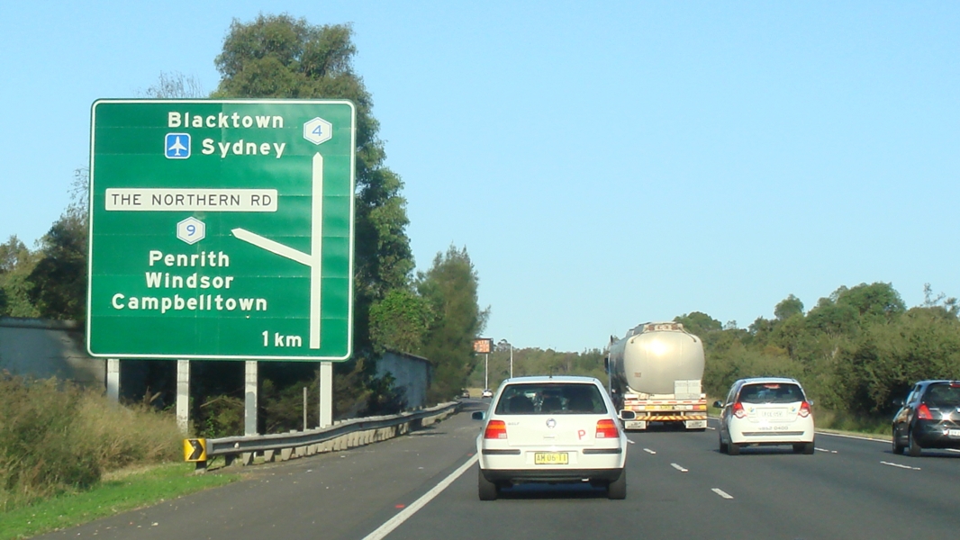
Supplemental Advance Directional Sign: Supplemental AD sign at Orchard Hills approaching The Northern Road (Metroad 9), April 2010. Image © Paul Rands |
 |
Supplemental Advance Directional Sign: Supplemental AD sign at Jamisontown for the interchange with The Northern Road (Metroad 9), April 2010. Image © Paul Rands |
|
 |
Kingswood Road: Western Mwy (Metroad 4) as it passes under Kingswood Rd at Orchard Hills, April 2010. Image © Paul Rands |
 |
Supplemental Advance Directional Sign: Supplemental AD sign at Jamisontown for the interchange with Mulgoa Rd, April 2012. Click here for a photo of this location by Paul Rands from April 2010. Image © Paul Rands |
|
 |
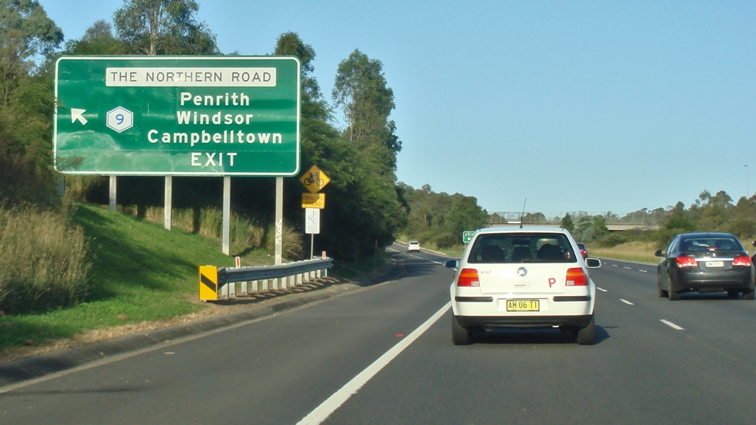
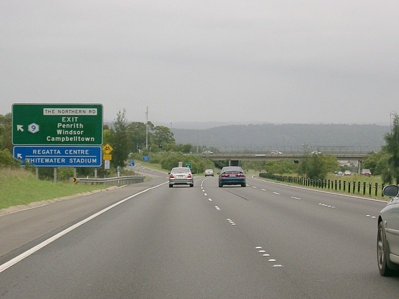
Advance Directional Sign: AD sign at Orchard Hills approaching The Northern Road (Metroad 9), April 2010. Image © Paul Rands |
 |
Mulgoa Road: Western Mwy (Metroad 4) at the interchange with Mulgoa Rd at Jamisontown, April 2012. Click here for a photo of this location by Paul Rands from April 2010. Image © Paul Rands |
|
 |
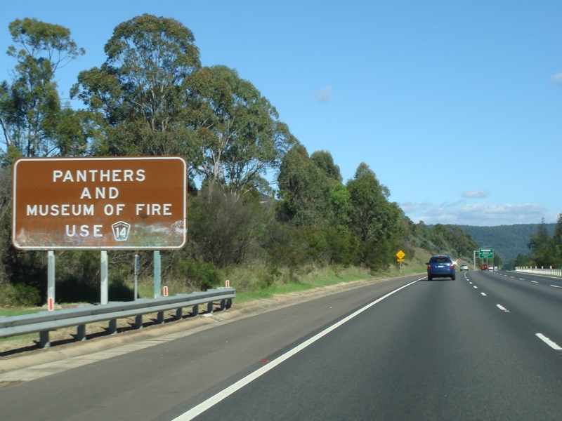
Supplemental Advance Directional Sign: Supplemental AD sign at Orchard Hills approaching The Northern Road (Metroad 9), November 2010. Image © Rob Tilley |
 |
Mulgoa Road : Western Mwy (Metroad 4) as it crosses over Mulgoa Rd at Jamisontown, April 2012. Image © Paul Rands |
|
 |
The Northern Road: Western Mwy (Metroad 4) at the interchange with The Northern Rd (Metroad 9), April 2010. Click here for a photo of the old sign from December 2004. Image © Paul Rands |
 |
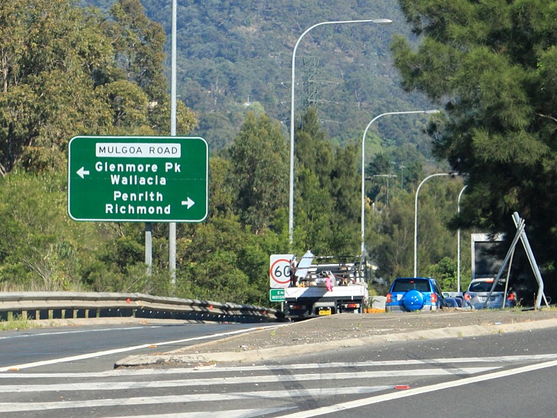
Mulgoa Road: AD sign on the off ramp from Western Mwy (Metroad 4) at the interchange with Mulgoa Rd at Jamisontown, April 2010. Image © Paul Rands |
|
 |
Advance Directional Sign: AD sign on the Northern Rd (Metroad 9) off ramp at Orchard Hills, November 2010. Image © Rob Tilley |
 |
Distance Sign: RD sign at Jamisontown after the Mulgoa Rd interchange, April 2012. Image © Paul Rands |
|
 |
The Northern Road: Western Mwy (Metroad 4) at the interchange with The Northern Rd (Metroad 9), April 2010. Image © Paul Rands |
 |
Advance Directional Sign: AD sign at Jamisontown for The Northern Rd (Metroad 9) interchange, April 2012. Click here for a photo of this location by Paul Rands from April 2010. Image © Paul Rands |
|
 |
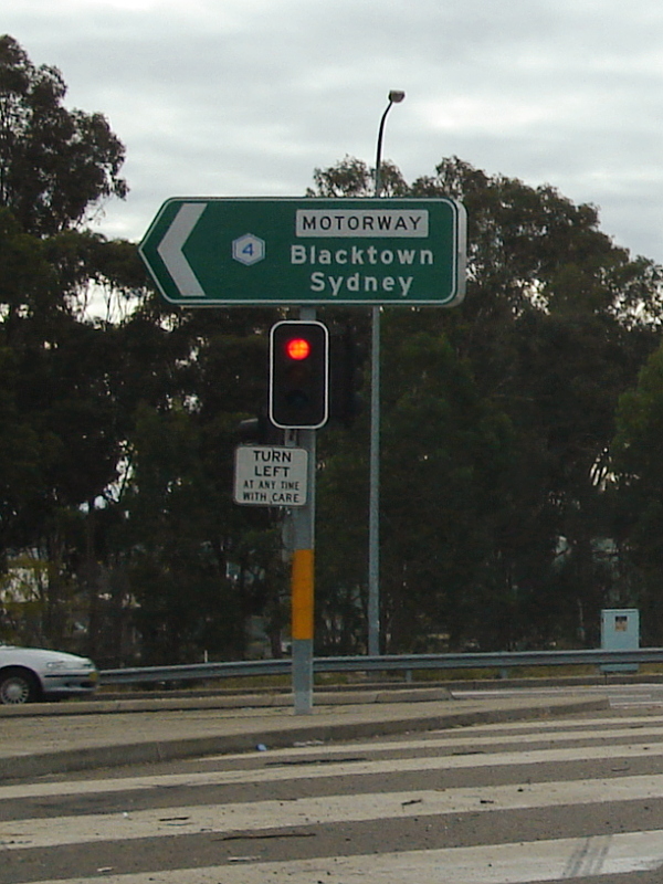
Intersection Directional Sign: ID sign on the on ramp from The Northern Rd (Metroad 9) onto Western Mwy (Metroad 4) at Glenmore Park, December 2012. Image © Paul Rands |
 |
Supplemental Advance Directional Sign: Supplemental AD sign at Jamisontown for The Northern Rd (Metroad 9) interchange, April 2012. Image © Paul Rands |
|
 |
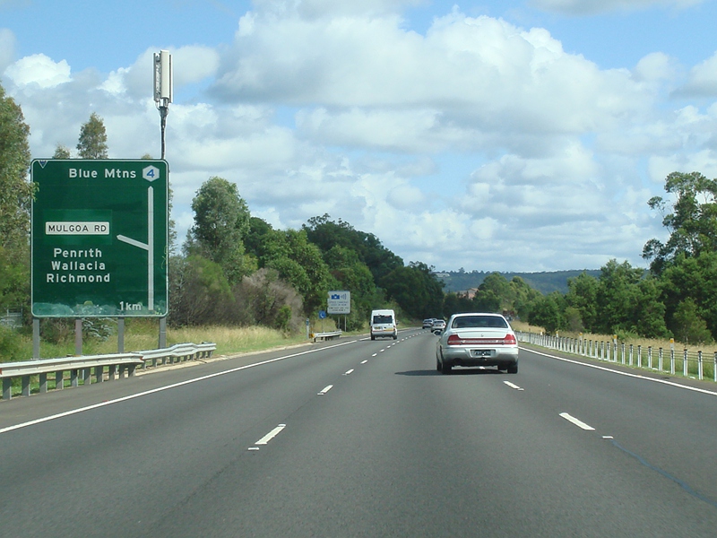
Advance Directional Sign: AD sign at Glenmore Park for the Mulgoa Rd interchange, April 2010. Click here for a photo of the old sign from December 2004. Image © Paul Rands |
 |
Supplemental Advance Directional Sign: Supplemental AD sign at Jamisontown for The Northern Rd (Metroad 9) interchange, April 2012. Image © Paul Rands |
|
 |
Advance Directional Sign: AD sign at Glenmore Park for the Mulgoa Rd interchange, November 2011. Click here for a photo from April 2010 of the previous sign. Image © Paul Rands |
 |
Advance Directional Sign: AD sign at South Penrith for The Northern Rd (Metroad 9) interchange, April 2012. Image © Paul Rands |
|
 |
Supplemental Advance Directional Sign: Supplemental AD sign at Glenmore Park for the Mulgoa Rd interchange, December 2012. Click here for a photo by Rob Tilley of this location from November 2011. Image © Paul Rands |
 |
The Northern Road: Western Mwy (Metroad 4) at the interchange with The Northern Rd (Metroad 9), April 2012. Image © Paul Rands |
|
 |
Mulgoa Road: Western Mwy (Metroad 4) at the Mulgoa Rd interchange at Regentville, November 2011. Click here for a photo from April 2010 of the previous sign. Image © Paul Rands |
 |
The Northern Road: Western Mwy (Metroad 4) at the interchange with The Northern Rd (Metroad 9), April 2010. Image © Paul Rands |
|
 |
Advance Directional Sign: AD sign on the off ramp to Mulgoa Rd at Regentville, November 2010. Image © Rob Tilley |
 |
Advance Directional Sign : AD sign on the off ramp to The Northern Rd (Metroad 9) at South Penrith, April 2012. Image © Paul Rands |
|
 |
Mulgoa Road: Western Mwy (Metroad 4) at the Mulgoa Rd interchange at Regentville, April 2010. Image © Paul Rands |
 |
Intersection Directional Signs : ID signs on the off ramp to The Northern Rd (Metroad 9) at South Penrith, April 2012. Image © Paul Rands |
|
 |
Nepean River: Western Mwy (Metroad 4) at Regentville as it crosses Nepean River via Penrith Valley Bridge, November 2011. Image © Paul Rands |
 |
Intersection Directional Sign: ID sign on the on ramp to Western Mwy (Metroad 4) from The Northern Rd (Metroad 9) at Orchard Hills, December 2012. Image © Paul Rands |
|
 |
Advance Directional Sign: AD sign at Regentville for the Russell St (SR44) / Leonay Pde interchange, November 2010. Click here for a photo of the old sign from December 2004. Image © Rob Tilley |
 |
Distance Sign: RD sign at Orchard Hills after the interchange with The Northern Rd (Metroad 9), December 2012. Click here for a photo of this location from April 2010. Image © Paul Rands |
|
 |
Russell Street / Leonay Parade: Interchange with Russell St (SR44) and Leonay Pde at Leonay, November 2011. Click here for a photo of the old sign from December 2004. Image © Paul Rands |
 |
Kingswood Road: Western Mwy (Metroad 4) as it passes under Kingswood Rd at Orchard Hills, April 2010. Image © Paul Rands |
|
 |
End Metroad 4 2km: Sign at the Russell St (SR44) / Leonay Pde interchange showing the end of Metroad 4 in 2km, November 2010. Image © Rob Tilley |
 |
Advance Directional Sign: AD sign at Claremont Meadows approaching Mamre Rd interchange, December 2012. Image © Paul Rands |
|
 |
Intersection Directional Sign: ID sign assembly at the interchange with Russell St (SR44) and Leonay Pde, July 2006. Image © Paul Rands |
 |
Kent Road: Western Mwy (Metroad 4) as it passes under Kent Rd at Claremont Meadows, April 2010. Image © Paul Rands |
|
 |
Advance Directional Sign: AD sign assembly at the interchange with Russell St (SR44) and Leonay Pde, July 2006. Image © Paul Rands |
 |
Advance Directional Sign: AD sign at Claremont Meadows for the Mamre Rd interchange, April 2010. Image © Paul Rands |
|
 |
End Motorway 1km: Now non-standard end motorway sign at Leonay, April 2010. Image © Paul Rands |
 |
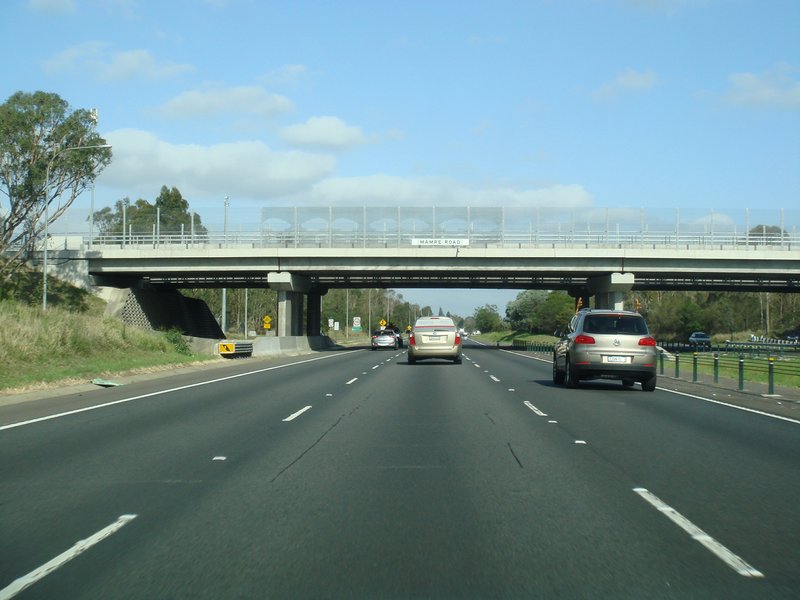
Mamre Road: Western Mwy (Metroad 4) at the interchange with Mamre Rd at St Marys, December 2012. Click here for a photo of this location from April 2010. Image © Paul Rands |
|
 |
Distance Sign: RD sign after at Leonay, November 2010. Click here for a photo of the previous sign from July 2006. Image © Rob Tilley |
 |
Mamre Road: Western Mwy (Metroad 4) at the interchange with Mamre Rd at St Marys, April 2010. Image © Paul Rands |
|
 |
Tourism Distance Sign: Tourist based RD sign at Leonay welcoming visitors to the Blue Mountains, November 2010. Image © Rob Tilley |
 |
Advance Directional Sign: AD sign on Mamre Rd at St Clair for the interchange with Western Mwy (Metroad 4), June 2006. Image © Paul Rands |
|
 |
Railway Overpass: Main western railway line as it crosses the Western Mwy (Metroad 4) at Leonay, July 2006. Image © Paul Rands |
 |
Mamre Road: Mamre Rd at St Clair at the interchange with Western Mwy (Metroad 4), December 2004. Image © Paul Rands |
|
 |
Advance Directional Sign: AD sign at Lapstone approaching Governors Dr and Great Western Hwy (NR32), April 2010. Image © Paul Rands |
 |
Mamre Road: Mamre Rd at St Marys at the interchange with Western Mwy (Metroad 4), June 2006. Bridge has since been duplicated. Image © Paul Rands |
|
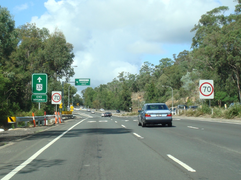 |
Trailblazer: Sign near the Governors Dr interchange at Lapstone indicating the end of Metroad 4 and the start of NR32, April 2010. Image © Paul Rands |
 |
Mamre Road: Mamre Rd at St Marys at the interchange with Western Mwy (Metroad 4), June 2006. Image © Paul Rands |
|
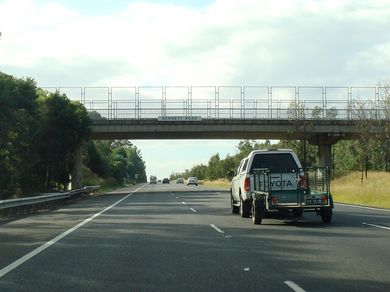 |
Bennett Road: Western Mwy (Metroad 4) as it passes under Bennett Rd in Colyton, April 2010. Image © Paul Rands |
|||
 |
Roper Road: Western Mwy (Metroad 4) as it passes under Roper Rd in Colyton, April 2010. Image © Paul Rands |
|||
|
Click here for Great Western Highway (National Route 32) Click here for the continuation of Metroad 4 between South Wentorthville and St Clair |
||||
1 Sam Laybutt (Ozroads)
2 Roads and Traffic Authority
Last updated: 19-Dec-2019 13:17
This site © Paul Rands. All rights reserved. Some portions © (copyright) by their respective and credited owners. Permission must be obtained before using any images from this site. For details, please email by clicking here.