|
|
|
|
|
| B71 | Mitchell Highway (B71) - Historic Photos |
Statistics:
Route Numbering:

General Information:
The Mitchell Highway, named after Major Thomas Mitchell, who was Surveyor-General of New South Wales in the 1820s and explored much of inland New South Wales and Victoria.
The route consists of typical NSW rural highway standard, undivided single carriageway.
History:
This page concentrates on historic photos of Mitchell Highway between Nyngan and the Queensland Border
| Preview: | Description: |
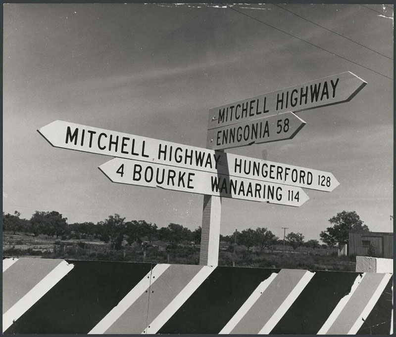 |
Fingerboard Assembly: Timber fingerboard assembly at North Bourke at the junction with Hungerford Rd, 1972. The Mitchell Hwy turns left at this intersection. Image from National Library of Australia, object number 141638998 |
1 NSW Government, Roads and Maritime Services, Schedule of Classified Roads and Unclassified Regional Roads, April 2017
2 Department of Main Roads, The Roadmakers, A History of Main Roads in New South Wales, ISBN 0 7240 0439 4
3 Western Herald, Mitchell Highway Bitumen Sealed Between Enngonia and Barringun, 1 Nov 1968
4 Western Herald, Construction of Mitchell Highway North of Bourke, 10 Oct 1969
Last updated: 21-Dec-2019 21:22
This site © Paul Rands. All rights reserved. Some portions © (copyright) by their respective and credited owners. Permission must be obtained before using any images from this site. For details, please email by clicking here.