|
|
|
|
|
| A48 | Illawarra highway (A48) - Robertson To Albion Park Rail |
Statistics:
Route Numbering:


General Information:
The Illawarra Highway is a key link in the state's road network, connecting the Illawarra with the Southern Highlands, the Hume Highway and via the Hume Highway: Melbourne and southwestern New South Wales.
Consisting mostly of single carriageway undivided road, the route traverses Macquarie Pass, which is a narrow and windy section of road built to climb the Illawarra Escarpment. The route primarily services small rural and semi-rural communities.
Multiplexes along the route include:
History:
| Robertson to Albion Park Rail | Albion Park Rail To Robertson | |||
| Preview: | Description: | Preview: | Description: | |
 |
Pearsons Lane: Corner of Illawarra Hwy (A48) and Pearsons Ln in Robertson, November 2013. Image © Paul Rands |
 |
Reassurance Directional Sign: Distance sign at Albion Park Rail after the Princes Mwy (M1) and Princes Hwy (A1) roundabout, December 2013. Image © Paul Rands |
|
 |
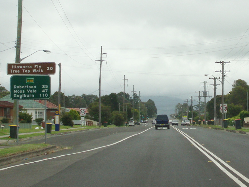
Distance Sign: Reassurance directional sign at Robertson, November 2013. Image © Paul Rands |
 |
Intersection Directional Sign: ID sign at the junction with Tongarra Rd (TD8) and Terry St at Albion Park, December 2013. A48 turns right at this junction. Image © Paul Rands |
|
 |
Approaching Level Crossing: Approaching the level crossing at Robertson, November 2013. Image © Paul Rands |
 |
Intersection Directional Sign: ID sign at the junction with Tongarra Rd (TD8) and Terry St at Albion Park, December 2013. A48 turns right at this junction. Image © Paul Rands |
|
 |
Level Crossing: Illawarra Hwy (A48) at the level crossing at Robertson, November 2013. Image © Paul Rands |
 |
Distance Sign: RD sign at Albion Park, December 2013. Image © Paul Rands |
|
 |
Advance Directional Sign: AD sign approaching Caalong St (Kangaloon Rd) (TD15) in Robertson, November 2013. The TD15 duplex ends at this junction. Image © Paul Rands |
 |
Macquarie Rivulet: Illawarra Hwy (A48) as it crosses Macquarie Rivulet at Tongarra, December 2013. Image © Paul Rands |
|
 |
Kangaloon Road: Corner of Illawarra Hwy (A48) and Kangaloon Rd (TD15) in Robertson, November 2013. Image © Paul Rands |
 |
8km Winding Road: Illawarra Highway (A48) approaching Macquarie Pass at Tongarra, December 2013. Image © Paul Rands |
|
 |
Advance Directional Sign: AD sign approaching Meryla St at Robertson, November 2013. Image © Paul Rands |
 |
Macquarie Pass: Illawarra Hwy (A48) at the start of Macquarie Pass at Tongarra, December 2013. Image © Paul Rands |
|
 |
Intersection
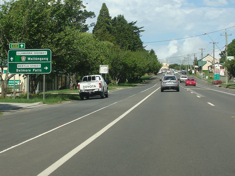
Directional Sign: ID sign at the Meryla St junction in Robertson, November 2013. Image © Paul Rands |
 |
Intersection
Directional Sign: ID sign at the Meryla St junction in Robertson, February 2013. Image © Paul Rands |
|
 |
Distance Sign: Reassurance directional sign at Robertson, November 2013. Image © Paul Rands |
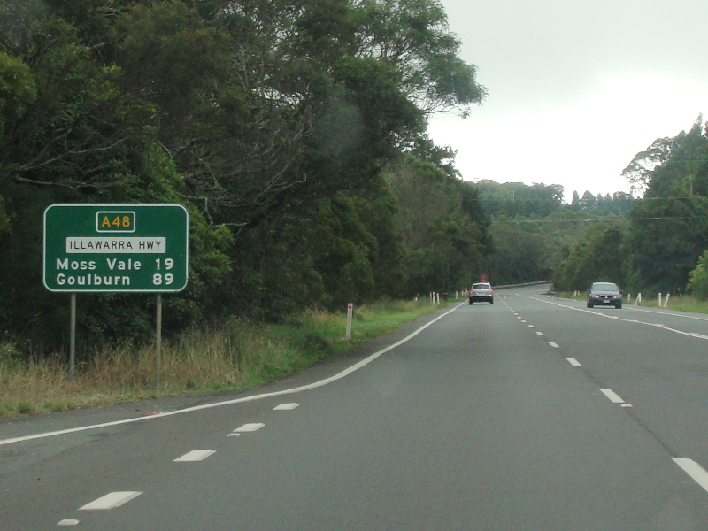 |
Distance Sign: Reassurance directional sign at Robertson, December 2013. Image © Paul Rands |
|
 |
Advance Directional Sign: AD sign approaching Jamberoo Mountain Rd (TD9) in Robertson, November 2013. SR80 has been decommissioned and shown here in error. Image © Paul Rands |
|||
 |
Supplemental Advance Directional Sign: Supplemental AD sign approaching Jamberoo Mountain Rd (TD9) in Robertson, November 2013. Image © Paul Rands |
|||
 |
Supplemental Advance Directional Sign: Supplemental AD sign approaching Jamberoo Mountain Rd (TD9) in Robertson, November 2013. Image © Paul Rands |
|||
 |
Prohibition Sign: Prohibition sign approaching Jamberoo Mountain Rd (TD9) at Robertson, November 2013. Image © Paul Rands |
|||
 |
Jamberoo Mountain Road: Corner of Illawarra Hwy (A48) and Jamberoo Mtn Rd (TD9) at Robertson, November 2013. Image © Paul Rands |
|||
 |
Jamberoo Mountain Road: Corner of Illawarra Hwy (A48) and Jamberoo Mtn Rd (TD9) at Robertson, November 2013. Image © Paul Rands |
|||
 |
Distance Sign: Reassurance directional sign at Robertson, November 2013. Image © Paul Rands |
|||
 |
Macquarie Rivulet: Illawarra Hwy (A48) as it crosses Macquarie Rivulet at Robertson, November 2013. Image © Paul Rands |
|||
 |
Flashing Warning Sign: Flashing warning sign as the Illawarra Hwy (A48) leaves Robertson, November 2013. Image © Paul Rands |
|||
 |
Macquarie Pass: Illawarra Hwy (A48) at Mt Murray as it starts its descent down the Illawarra Escarpment via Macquarie Pass, November 2013. Image © Paul Rands |
|||
 |
Macquarie Pass: Approaching one of a couple of the tightest bends on the Illawarra Hwy at Mt Murray, November 2013. Image © Paul Rands |
|||
 |
Macquarie Pass: Approaching one of a couple of the tightest bends on the Illawarra Hwy at Mt Murray, November 2013. Image © Paul Rands |
|||
 |
Road Widens Ahead: Old Road Widens Ahead sign at Mt Murray, November 2013. Image © Paul Rands |
|||
 |
Tourism Distance Sign: Tourism based RD sign on Macquarie Pass, November 2013. Image © Paul Rands |
|||
 |
Trucks Must Remain In Low Gear: Sign for heavy vehicles along Macquarie Pass, November 2013. Image © Paul Rands |
|||
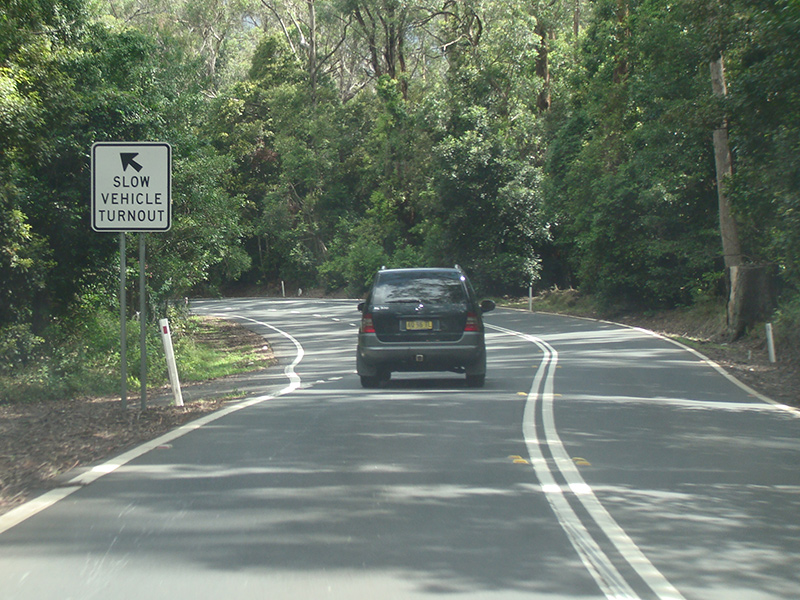 |
Slow Vehicle Turnout: A slow vehicle turnout on Illawarra Hwy (A48) along Macquarie Pass, November 2013. Image © Paul Rands |
|||
 |
Macquarie Pass: The Illawarra Hwy as it descends Macquarie Pass, November 2013. Image © Paul Rands |
|||
 |
End Trucks Must Use Low Gear: Sign for heavy vehicles at Tongarra, November 2013. Image © Paul Rands |
|||
 |
Macquarie Rivulet: Illawarra Hwy (A48) as it crosses Macquarie Rivulet at Tongarra, November 2013. Image © Paul Rands |
|||
 |
Entering Albion Park: Illawarra Hwy (A48) as it enters the town of Albion Park, November 2013. Image © Paul Rands |
|||
 |
Advance Directional Sign: AD sign approaching Russell St in Albion Park, November 2013. Image © Paul Rands |
|||
 |
Advance Directional Sign: AD sign approaching Tongarra Rd and Terry St in Albion Park, November 2013. Image © Paul Rands |
|||
 |
Tongarra Road & Terry Street: Corner of Illawarra Hwy (A48), Tongarra Rd and Terry St in Albion Park, November 2013. A48 turns left at this junction. Image © Paul Rands |
|||
 |
Reassurance Directional Sign: Distance sign at Albion Park, November 2013. Image © Paul Rands |
|||
| Click here for the continuation of A48 between Sutton Forest and Robertson | ||||
1 Roads &
Traffic Authority, Schedule of Classified Roads and State & Regional
Roads, 31 January 2011
2 Sydney Morning Herald, 17 October
1936, Page
15.
3 Parliament of New South Wales,
Hansard & Papers, Legislative Assembly, Questions, 9329
- Macquarie Pass
4 Roads and Maritime Services, Media Releases, Vehicle Activated Signs For Moss Vale Road, Macquarie Pass And Jamberoo Mountain Road, 17 July 2012
5 Roads & Maritime Services, Media Releases, Motorists encouraged to slow down on Illawarra Highway at Tullimbar, 30 October 2015
6 Roads & Maritime Services, Media Releases, Safety to be improved for motorists on Macquarie Pass, 12 July 2017
7 Roads & Maritime Services, Media Releases, Safety improvements on the way along the Illawarra Highway, 14 May 2018
Last updated: 02-Jan-2019 20:15
This site © Paul Rands. All rights reserved. Some portions © (copyright) by their respective and credited owners. Permission must be obtained before using any images from this site. For details, please email by clicking here.