|
|
|
|
|
| A36 | City Road, King Street and Princes Highway (A36) |
Statistics:
Route Numbering:


General Information:
A36 is a suburban arterial route linking the Sydney CBD with the city's inner-southern suburbs.
The route is a mix of divided and undivided multi-laned road and passes through mostly residental and commercial areas.
History:

| Kogarah to Chippendale | Chippendale to Kogarah | |||
| Preview: | Description: | Preview: | Description: | |
 |
Advance Directional Sign: AD sign on Forest Rd at Arncliffe approaching Princes Hwy (A36) and Wickham St, August 2013. Image © Paul Rands |
 |
Advance Directional Sign: AD sign at Chippendale, approaching Cleveland St, July 2013. Image © Paul Rands |
|
 |
Intersection Directional Sign: ID sign on the corner of Forest Rd, Princes Hwy (A36) and Wickham St at Arncliffe, August 2013. Image © Paul Rands |
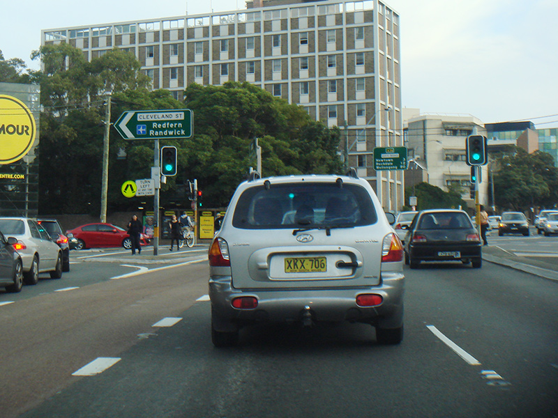 |
Cleveland Street: Corner of City Rd (A36) and Cleveland St in Chippendale, July 2013. Image © Paul Rands |
|
 |
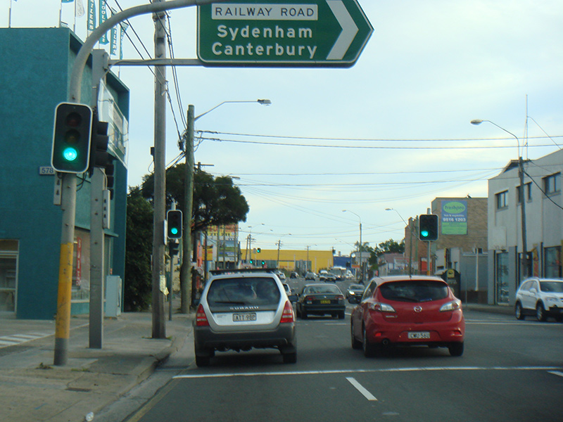
Advance Directional sign: AD sign on Railway Rd approaching Princes Hwy (A36) at Sydenham, October 2013. Image © Spenser Tan |
 |
Reassurance Directional Sign: Distance sign at Darlington, July 2013. Image © Paul Rands |
|
 |
Carillon Avenue: Corner of City Rd (A36) and Carillon Av in Darlington, July 2013. Image © Paul Rands |
|||
 |
Missenden Road: King St (A36) at the Missenden Rd junction in Newtown, July 2013. Image © Paul Rands |
|||
 |
Advance Directional Sign: AD sign on King St (A36) in Newtown approaching Enmore Rd (A34), July 2013. Image © Paul Rands |
|||
 |
Enmore Road / King Street Split: King St (A36) at the Enmore Rd (A34) intersection in Newtown, July 2013. Image © Paul Rands |
|||
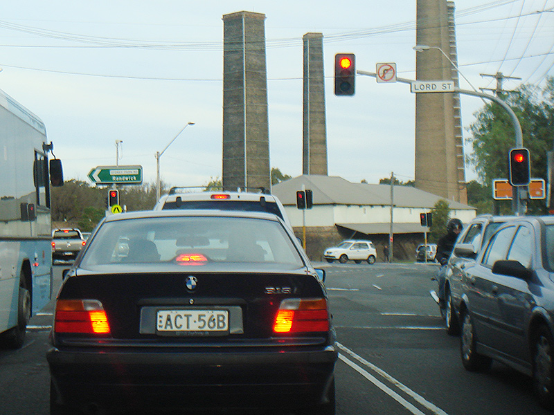 |
Lord Street & Sydney Park Road: King St (A36), Newtown with the Lord St and Sydney Park Rd junction, July 2013. A36 becomes Princes Hwy (A36) at this junction. Image © Paul Rands |
|||
 |
Advance Directional Sign: AD sign approaching May St, Alexandria, July 2013. Image © Paul Rands |
|||
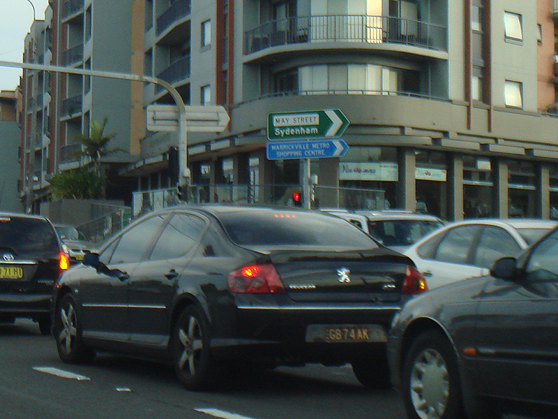 |
May Street: Corner of Princes Hwy (A36) and May St, Alexandria, July 2013. Image © Paul Rands |
|||
 |
Advance Directional Sign: AD sign at St Peters, approaching Canal Rd, July 2013. Image © Paul Rands |
|||
 |
Canal Road: Corner of Princes Hwy (A36) and Canal Rd, St Peters, July 2013. Image © Paul Rands |
|||
 |
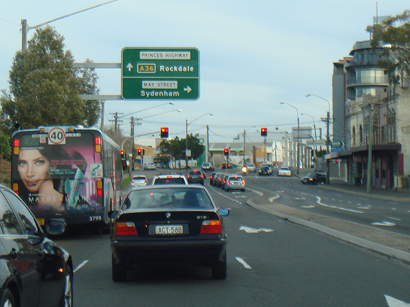
Advance Directional Sign: AD sign approaching Railway Rd in Sydnenham, July 2013. Image © Paul Rands |
|||
 |
Intersection Directional Sign: ID sign at Railway Rd in Sydnenham, July 2013. Image © Paul Rands |
|||
 |
Entering Tempe: Princes Hwy (A36) as it enters the suburb of Tempe, July 2013. Image © Paul Rands |
|||
 |
Advance Directional Sign: AD sign approaching West Botany St, Wolli Creek, August 2013. Image © Paul Rands |
|||
1 Roads & Maritime Services, Schedule of Classified Roads and Unclassified Regional Roads, August 2013.
2 Main Roads Board, Annual Report, 1925-26
3 Roads & Maritime Services
4 Main Roads Board, Annual Report, Volume 1, Number 1, September 1929.
5 Main Roads Board, Annual Report, 1929-30
6 Department of Main Roads, Annual Report, 1937-38
7 Department of Main Roads, Annual Report, 1951-52
8 Department of Main Roads, Annual Report, 1953-54
9 Department of Main Roads, Annual Report, 1959-60
10 Department of Main Roads, Annual Report, 1960-61
11 Department of Main Roads, Annual Report, 1961-62
12 Department of Main Roads, Annual Report, 1963-64
13 Department of Main Roads, Annual Report, 1969-70
14 Department of Main Roads, Annual Report, 1972-73
15 Department of Main Roads, Annual Report, 1976-77
Last updated: 02-Jan-2019 19:21
This site © Paul Rands. All rights reserved. Some portions © (copyright) by their respective and credited owners. Permission must be obtained before using any images from this site. For details, please email by clicking here.