|
|
|
|
|
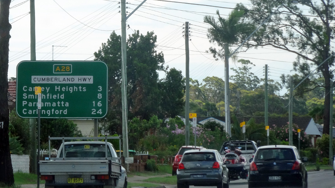
| A28 | Cumberland Highway (A28) |
Statistics:
Route Numbering:


General Information:
Cumerland Highway is a route made up of several arterial roads, linking Sydney's southwestern suburbs with the city's northern suburbs. Prior to the construction of Westlink (M7), it formed part of the primary north-south route through Sydney's west. The Cumberland Highway connects the Pacific Motorway (M1) at Wahroonga in the north with the Hume Highway (A22) at Liverpool in the south.
The route is dual carriageway for most of its length, mostly featuring 3 lanes in each direction, and passes through commercial, industrial and residential areas.
Multiplexes along the route include:
History:

| Prestons to Wahroonga | Wahroonga to Prestons | |||
| Preview: | Description: | Preview: | Description: | |
 |
Advance Directional Sign: AD sign on Camden Valley Way approaching Cumberland Hwy (A28), South Western Mwy (M5) and Westlink (M7) at Prestons, December 2015. Image © Paul Rands |
 |
Intersection Directional Sign: ID sign facing Pacific Mwy (M1) at Normanhurst, November 2013. Image © Paul Rands |
|
 |
Advance Directional Sign: AD sign on Camden Valley Way approaching Cumberland Hwy (A28), South Western Mwy (M5) and Westlink (M7) at Prestons, December 2015. Image © Paul Rands |
 |
Reassurance Directional Sign: Distance sign at Normanhurst, November 2013. Click here for a photo of this location from July 2013. Image © Paul Rands |
|
 |
Reassurance Directional Sign: Distance sign on Cumberland Hwy (A28) (Camden Valley Way) at Casula, December 2015. Image © Paul Rands |
 |
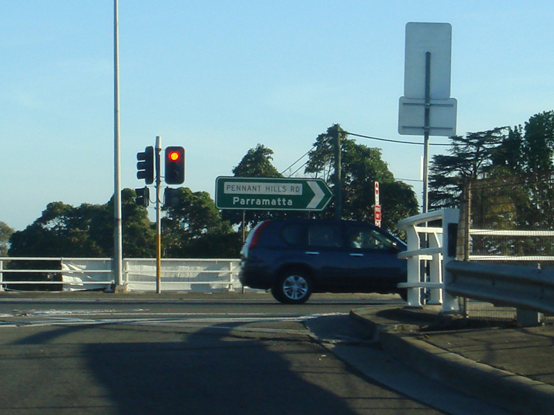
Advance Directional Sign: AD sign at Pennant Hills approaching The Crescent and Railway Street, July 2013. Image © Paul Rands |
|
 |
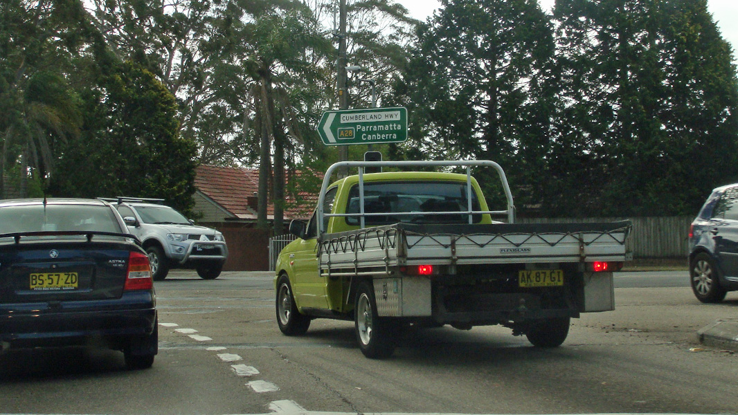
Advance Directional Sign: AD sign at Casula approaching Beech Rd, December 2015. Image © Paul Rands |
 |
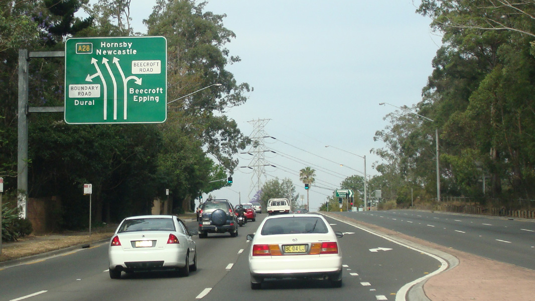
Advance Directional Sign: AD sign at Pennant Hills approaching Boundary Rd and Beecroft Rd, July 2013. Image © Paul Rands |
|
 |
Advance Directional Sign: AD sign at Casula approaching Cambelltown Rd and York St (The Crossroads), December 2015. The Crossroads was a major road junction prior to the 1980s, linking traffic to and from Sydney via Hume Highway (now Camden Valley Way) and Campbelltown Road to the NSW South Coast Image © Paul Rands |
 |
Advance Directional Sign: AD sign at Pennant Hills approaching Boundary Rd and Beecroft Rd, July 2013. Image © Paul Rands |
|
 |
The Crossroads: Cumberland Hwy (A28) at the junction with Campbelltown Rd and York St at Casula, December 2015. The local name of A28, Camden Valley Way, changes to Hume Highway at this location. Image © Paul Rands |
 |
Distance Sign: Reassurance directional sign at Pennant Hills, November 2013. Image © Paul Rands |
|
 |
Reassurance Directional Sign: Distance sign at Casula, December 2015. Image © Paul Rands |
 |
Advance Directional Sign: AD sign at West Pennant Hills approaching Cardinal Av and Castle Hill Rd, July 2013. Image © Paul Rands |
|
 |
Intersection Directional Sign: ID sign at the junction with Kurrajong Rd at Casula, December 2015. Image © Paul Rands |
 |
Advance Directional Sign: AD sign at West Pennant Hills approaching Castle Hill Rd, July 2013. Image © Paul Rands |
|
 |
Advance Directional Sign: AD sign at Casula approaching South Western Mwy (M5), December 2015. Image © Paul Rands |
 |
Distance Sign: RD sign at West Pennant Hills after Castle Hill Rd, October 2017. Click here for a photo of this location by Paul Rands from November 2013. Click here for a photo of this location from July 2013. Image © Paul Rands |
|
 |
South Western Motorway: Corner of Cumberland Hwy (A28) and the on ramp to South Western Mwy (M5) at Casula, December 2015. Image © Paul Rands |
 |
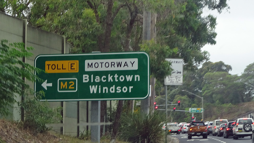
Advance Directional Sign: AD sign at West Pennant Hills approaching Hills Mwy (M2), November 2013. Click here for a photo of this location from July 2013. Image © Paul Rands |
|
 |
Reassurance Directional Sign: Distance sign at Liverpool, January 2017. Image © Spenser Tan |
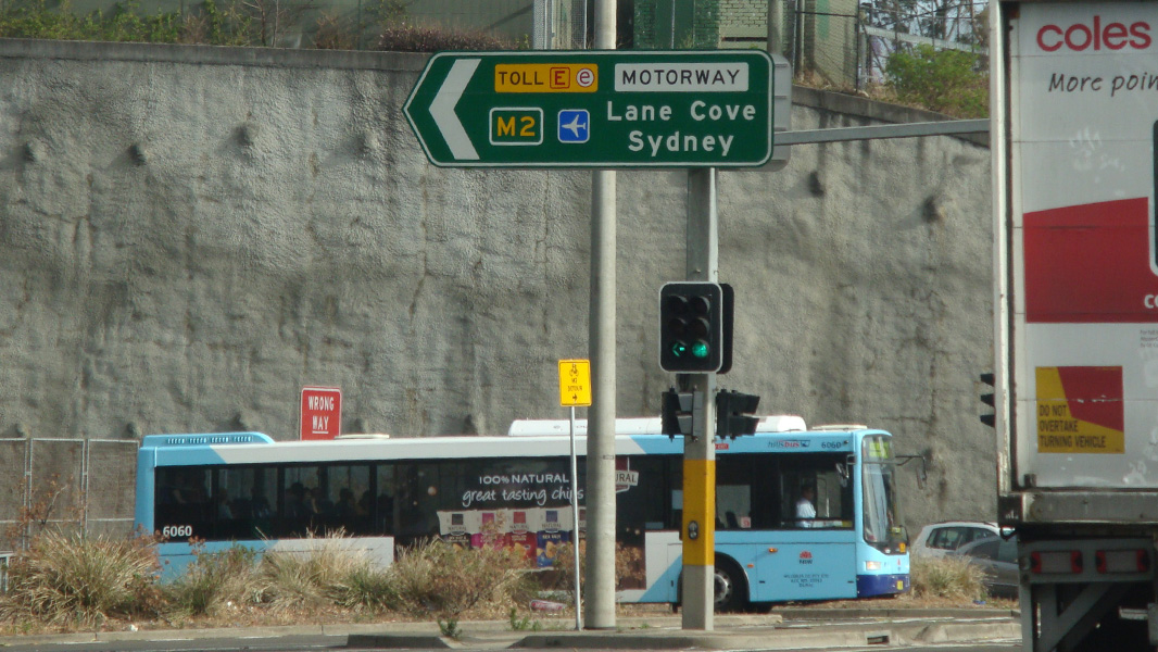 |
Intersection Directional Sign: ID sign at the Hills Mwy (M2) interchange at West Pennant Hills, November 2013. Image © Paul Rands |
|
 |
Advance Directional Sign: AD sign at Cabramatta, approaching Cabramatta Rd, January 2017. Image © Spenser Tan |
 |
Intersection Directional Sign: ID sign at the Hills Mwy (M2) interchange at West Pennant Hills, November 2013. Image © Paul Rands |
|
 |
Advance Directional Sign: AD sign at Fairfield West approaching Hamilton Rd, January 2017. Image © Spenser Tan |
 |
Advance Directional Sign: AD sign approaching North Rocks Rd, Beecroft, August 2016. Image © Paul Rands |
|
 |
Advance Directional Sign: AD sign at Fairfield West approaching Polding St, January 2017. Image © Spenser Tan |
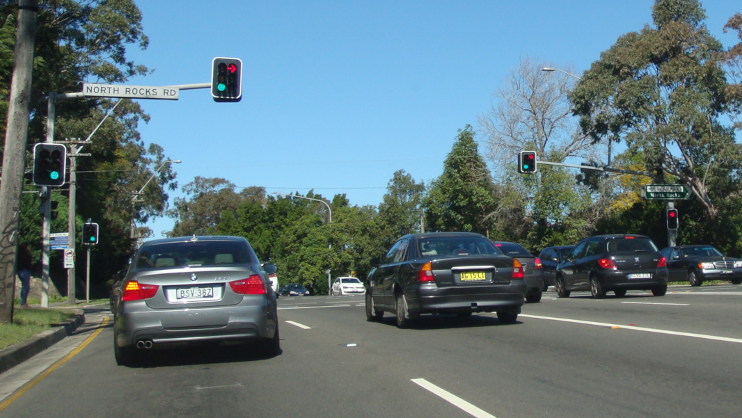 |
North Rocks Road: Corner of Cumberland Hwy (A28) and North Rocks Rd at Beecroft, August 2016. Image © Paul Rands |
|
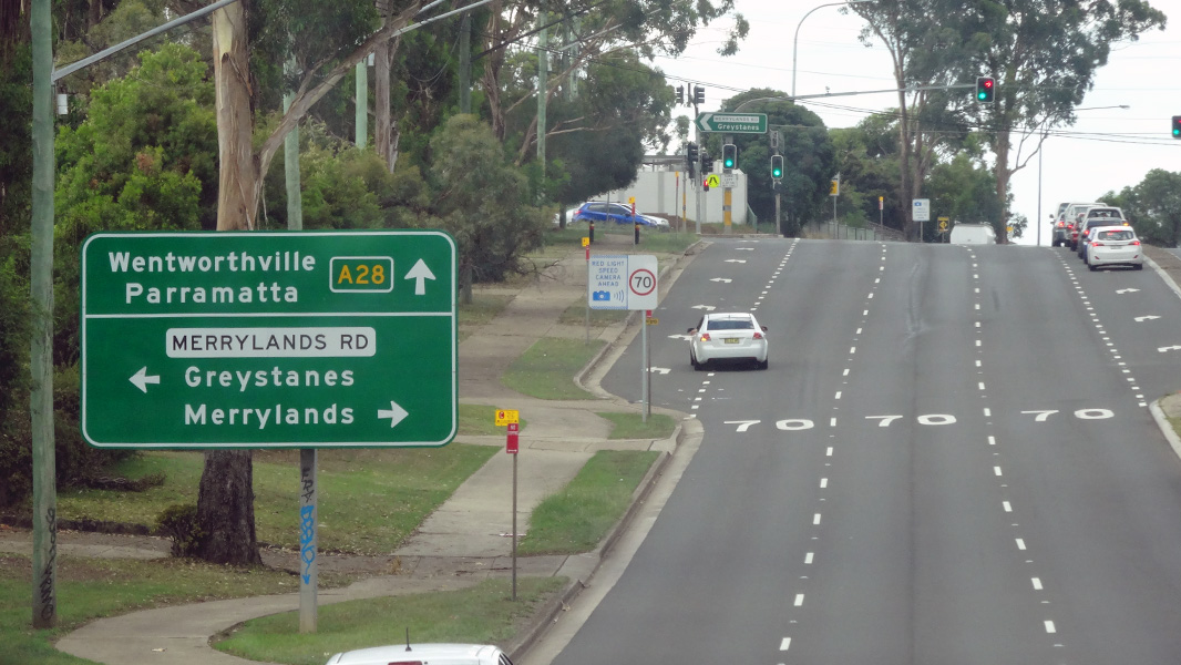 |
Advance Directional Sign: AD sign at Greystanes approaching Merrylands Rd, January 2017. Image © Spenser Tan |
 |
Distance Sign: RD sign at Carlingford, January 2017. Image © Spenser Tan |
|
 |
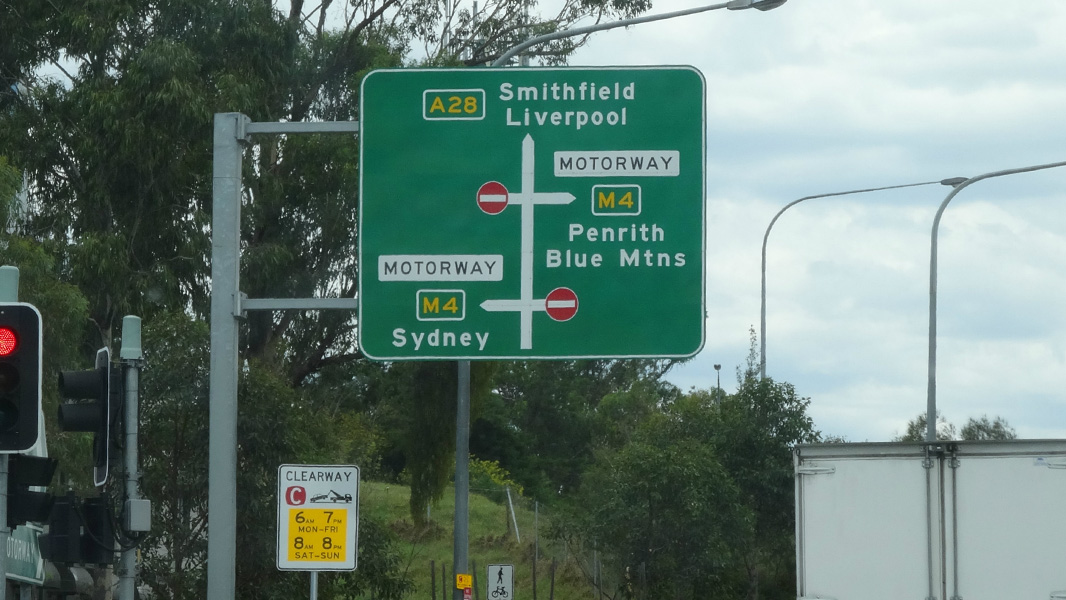
Advance Directional Sign: AD sign at South Wentworthville approaching Old Prospect Rd and Western Mwy (M4), January 2017. Image © Spenser Tan |
 |
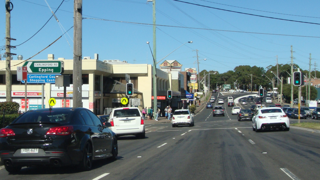
Intersection Directional Sign: ID sign on Cumberland Hwy (A28) at Carlingford at the entrance to Carlingford Court shopping centre, October 2017. Image © Paul Rands |
|
 |
Reassurance Directional Sign: Distance sign at Wentworthville after the Great Western Hwy (A44) junction, September 2013. Image © Paul Rands |
 |
Advance Directional Sign: AD sign at Carlingford approaching Marsden Rd (A6) and Carlingford Rd, August 2016. Image © Paul Rands |
|
 |
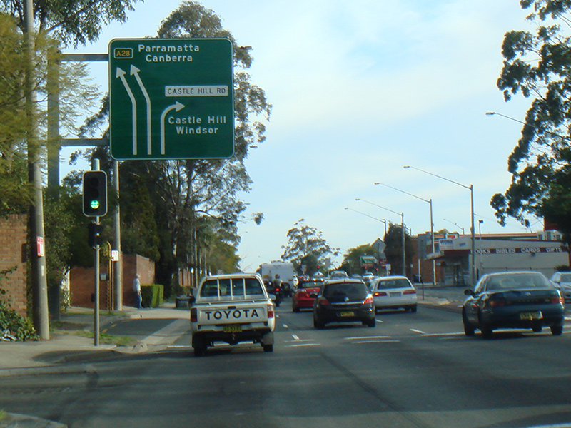
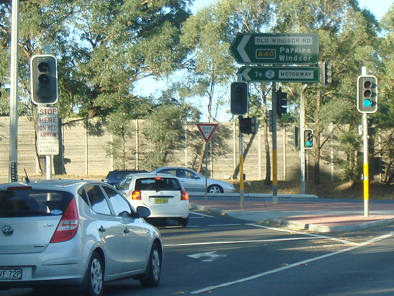
Advance Directional Sign: AD sign at Constitution Hill approaching Old Windsor Rd (A40), September 2013. The A40 duplex starts at this junction. Image © Paul Rands |
 |
Carlingford Road: Corner of Cumberland Hwy (A28) and Carlingford Rd at Carlingford, August 2016. Image © Paul Rands |
|
 |
Intersection Directional Sign: ID sign at Constitution Hill at the junction with Old Windsor Rd (A40), September 2013. The A40 duplex starts at this junction. Image © Paul Rands |
 |
Marsden Road: Corner of Cumberland Hwy (Pennant Hills Rd) (A28) and Marsden Rd (A6) at Carlingford, August 2016. Image © Paul Rands |
|
 |
Intersection Directional Sign: ID sign at Constitution Hill at the junction with Old Windsor Rd (A40), September 2013. The A40 duplex starts at this junction. Image © Paul Rands |
 |
Intersection Directional Sign: ID sign assembly at corner of Cumberland Hwy (Pennant Hills Rd) (A28) and Marsden Rd (A6) at Carlingford, October 2013. Image © Spenser Tan |
|
 |
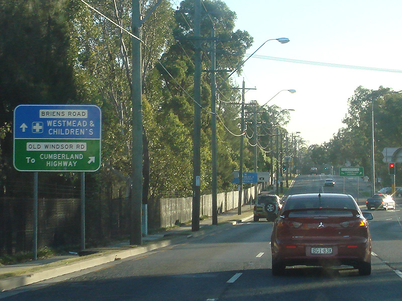
Advance Directional Sign: AD sign approaching Briens Rd, Northmead, September 2013. Image © Paul Rands |
 |
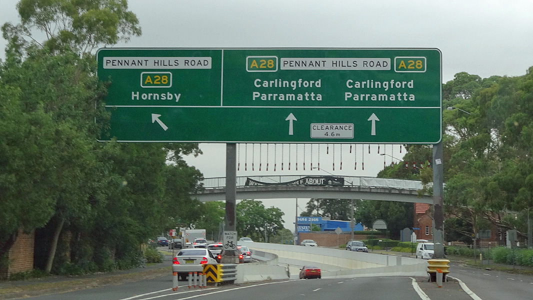
Advance Directional Sign: AD sign on Cumberland Hwy (Pennant Hills Rd) (A28) approaching the James Ruse Dr (A40) and Cumberland Hwy (A28) interchange in North Parramatta, September 2013. Image © Paul Rands |
|
 |
Briens Road: Corner of Cumberland Hwy (A28 / A40) and Briens Rd at Northmead, September 2013. Image © Paul Rands |
 |
Intersection Directional Sign: ID sign on Cumberland Hwy (Pennant Hills Rd) (A28) at the James Ruse Dr (A40) and Cumberland Hwy (A28) interchange in North Parramatta, September 2013. Image © Paul Rands |
|
 |
Advance Directional Sign: AD sign approaching Windsor Rd (unnumbered) at Northmead, September 2013. Image © Paul Rands |
 |
Advance Directional Sign: AD sign on Windsor Rd at Northmead approaching the Cumberland Hwy (A28 / A40) interchange, October 2013. Image © Spenser Tan |
|
 |
Old Windsor Road Interchange: Cumberland Hwy (A28 / A40) at the Windsor Rd interchange in Northmead, September 2013. Image © Paul Rands |
 |
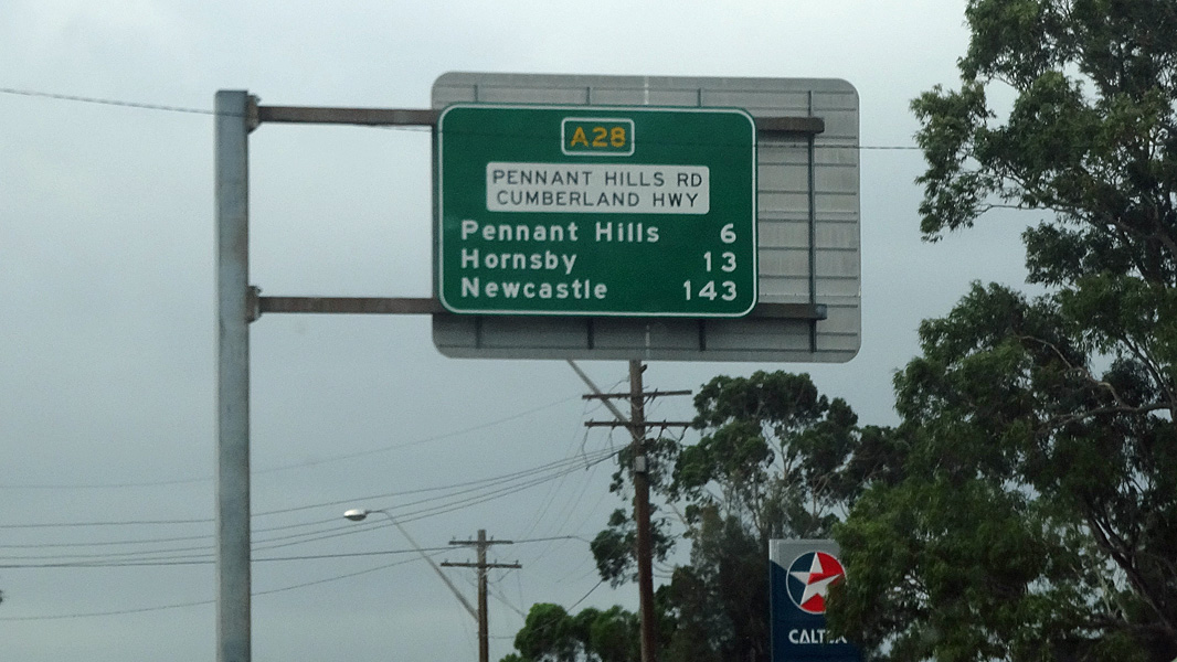
Distance Sign: RD sign at Northmead, September 2013. Image © Paul Rands |
|
 |
Old Windsor Road Interchange: Cumberland Hwy (A28 / A40) at the Windsor Rd interchange in Northmead, September 2013. Image © Paul Rands |
 |
Advance Directional Sign: AD sign approaching Briens Rd, Northmead, September 2013. Image © Paul Rands |
|
 |
Intersection Directional Sign: ID sign on Windsor Rd in North Parramatta at the Cumberland Hwy (A28 / A40) interchange, January 2014. Image © Spenser Tan |
 |
Briens Road: Corner of Cumberland Hwy (A28 / A40) and Briens Rd at Northmead, September 2013. Image © Paul Rands |
|
 |
Entering North Parramatta: Cumberland Hwy (A28 / A40) as it enters the suburb of North Parramatta, September 2013. Image © Paul Rands |
 |
Advance Directional Sign: AD sign at Northmead approaching Old Windsor Rd (A40), September 2013. The A40 duplex ends at this junction. Image © Paul Rands |
|
 |
Reassurance Directional Sign: Distance sign showing dual names at North Parramatta, September 2013. Image © Paul Rands |
 |
Intersection Directional Sign: ID sign at Northmead at the junction with Old Windsor Rd (A40), September 2013. The A40 duplex ends at this junction. Image © Paul Rands |
|
 |
Lackey Street: Cumberland Hwy at the Lackey St overpass at North Parramatta, September 2013. Image © Paul Rands |
 |
Advance Directional Sign: AD sign at Wentworthville, approaching Great Western Hwy (A44), January 2017. Image © Spenser Tan |
|
 |
Intersection Directional Sign: ID sign at the Cumberland Hwy (Pennant Hills Rd) (A28) interchange in North Parramatta, September 2013. The A40 duplex ends at this interchange and A28 veers left. Image © Paul Rands |
 |
Supplemental Directional Sign: Supplemental AD sign at Wentworthville, approaching Great Western Hwy (A44), January 2017. Image © Spenser Tan |
|
 |
Advance Directional Sign: AD sign at the Cumberland Hwy (Pennant Hills Rd) (A28) interchange in North Parramatta, September 2013. Image © Paul Rands |
 |
Intersection Directional Sign: ID sign at the junction with Great Western Hwy (A44) at Wentworthville, January 2017. Image © Spenser Tan |
|
 |
Intersection Directional Sign: ID sign at the Cumberland Hwy (Pennant Hills Rd) (A28) interchange in North Parramatta, September 2013. A28 turns left here. Image © Paul Rands |
 |
Intersection Directional Sign: ID sign at the junction with Great Western Hwy (A44) in South Wentworthville, October 2013. Image © Spenser Tan |
|
 |
Intersection Directional Sign: ID sign at the Cumberland Hwy (Pennant Hills Rd) (A28) interchange in North Parramatta, September 2013. A28 turns left here. Image © Paul Rands |
 |
Advance Directional Sign: AD sign at South Wentworthvile approaching Western Mwy (A4), January 2017. Image © Spenser Tan |
|
 |
Distance Sign: RD sign at North Parramatta, September 2013. Image © Paul Rands |
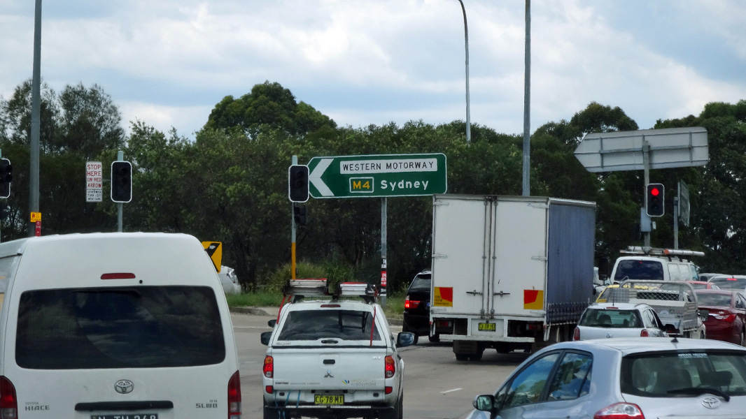 |
Western Motorway Interchange: Intersection directional sign at the Western Mwy (M4) interchange at South Wentworthville, January 2017. Image © Spenser Tan |
|
 |
Advance Directional Sign: AD sign approaching Lloyds Av, Carlingford, January 2017. Image © Spenser Tan |
 |
Western Motorway Interchange: Intersection directional sign at the Western Mwy (M4) interchange at South Wentworthville, January 2017. Image © Spenser Tan |
|
 |
Advance Directional Sign: AD sign at Carlingford approaching Marsden Rd (A6) and Carlingford Rd, January 2017. Image © Spenser Tan |
 |
Advance Directional Sign: AD sign at Merrylands, approaching Merrylands Rd, January 2017. Image © Spenser Tan |
|
 |
Reassurance Directional Sign: Distance sign at Carlingford, January 2017. Image © Spenser Tan |
 |
Distance Sign: RD sign at Greystanes, January 2017. Image © Spenser Tan |
|
 |
Advance Directional Sign: AD sign at Carlingford approaching Hills Mwy (M2), January 2017. Image © Spenser Tan |
 |
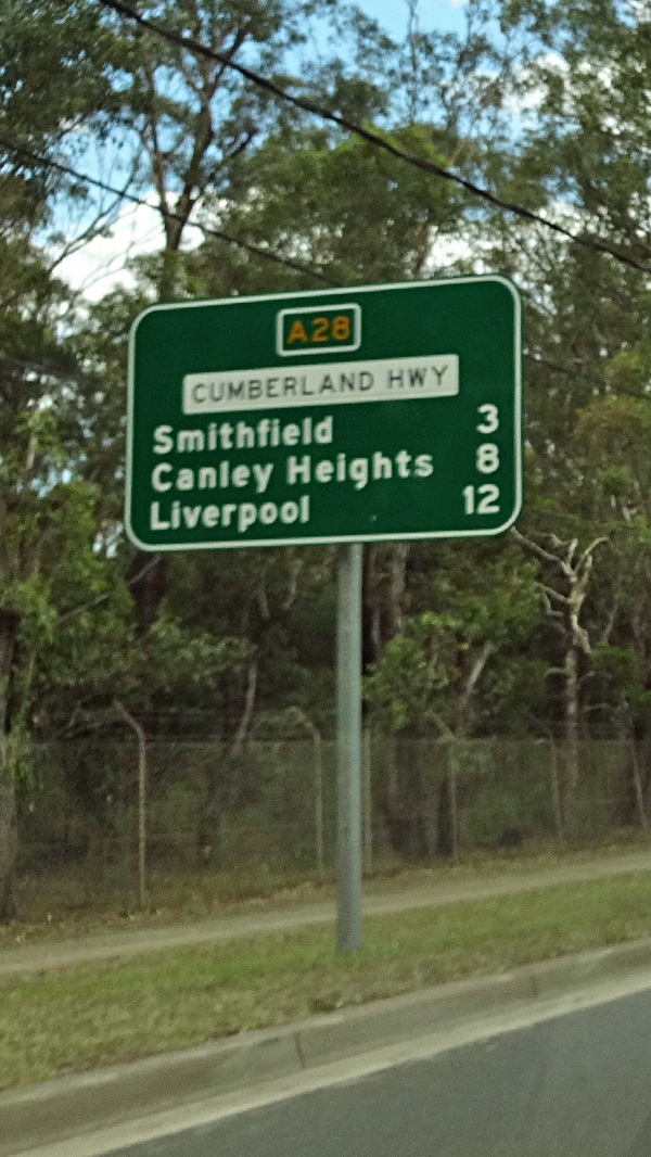
Advance Directional Sign: AD sign at Smithfield approaching Victoria St, January 2017. Image © Spenser Tan |
|
 |
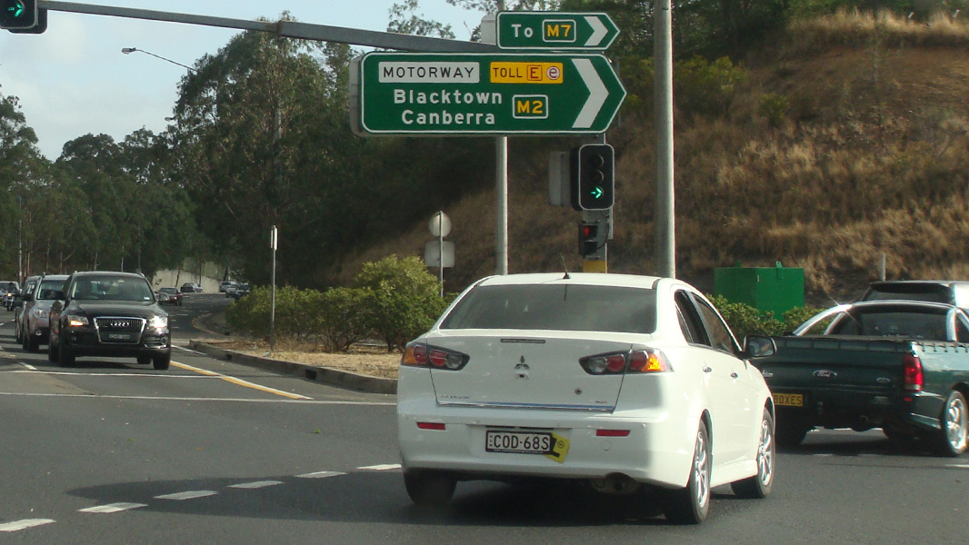
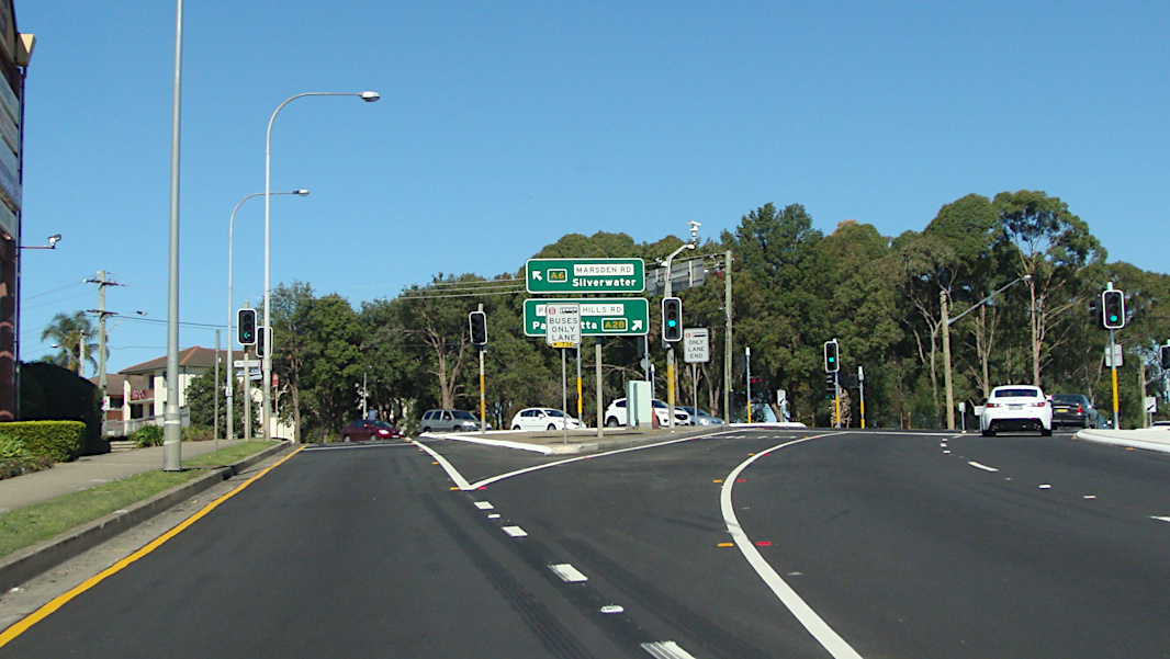
Hills Motorway: Cumberland Hwy (Pennant Hills Rd) (Cumberland Hwy) (A6) at the Hills Mwy (M2) interchange at Carlingford, January 2017. Image © Spenser Tan |
 |
Advance Directional Sign: AD sign at Smithfield approaching the Polding St interchange, January 2017. Image © Spenser Tan |
|
 |
Hills Motorway: Cumberland Hwy (Pennant Hills Rd) (Cumberland Hwy) (A6) at the Hills Mwy (M2) interchange at Carlingford, January 2017. Image © Spenser Tan |
 |
Advance Directional Sign: AD sign at Smithfield on the off ramp to the Polding St interchange, January 2017. Image © Spenser Tan |
|
 |
Advance Directional Sign: AD sign approaching Castle Hill Rd at West Pennant Hills, November 2013. Image © Paul Rands |
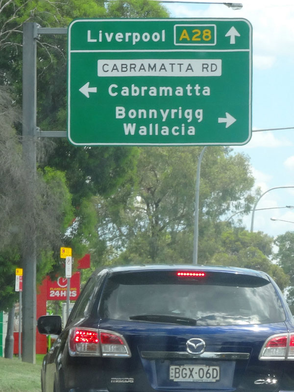 |
Advance Directional Sign: AD sign at Cabramatta approaching Cabramatta Rd, January 2017. Image © Spenser Tan |
|
 |
Advance Directional Sign: AD sign on Castle Hill Rd at West Pennant Hills approaching Cumberland Hwy (A28), January 2017. Image © Spenser Tan |
 |
Advance Directional Sign: AD sign at Warwick Farm approaching Hume Hwy (A22 / A28), January 2017. Image © Spenser Tan |
|
 |
Advance Directional Sign: AD sign on Castle Hill Rd at West Pennant Hills approaching Cumberland Hwy (A28), January 2017. Image © Spenser Tan |
 |
Hume Highway: Cumberland Hwy (A28) at the junction with Hume Hwy (A22 & A28) at Warwick Farm, January 2017. A28 turns right at this junction. Image © Spenser Tan |
|
 |
Advance Directional Sign: AD sign on Castle Hill Rd at West Pennant Hills approaching Cumberland Hwy (A28), January 2017. Image © Spenser Tan |
|||
 |
Distance Sign: RD sign at West Pennant Hills, November 2013. Image © Paul Rands |
|||
 |
Advance Directional Sign: AD sign at West Pennant Hills approaching Boundary and Beecroft Roads, November 2013. Image © Paul Rands |
|||
 |
Advance Directional Sign: AD sign approaching Boundary Rd at Pennant Hills, November 2013. Image © Paul Rands |
|||
 |
Advance Directional Sign: AD sign at Pennant Hills approaching Yarrara Rd and The Crescent, November 2013. Image © Paul Rands |
|||
 |
Advance Directional Sign: AD sign at Normanhurst approaching Jasmine Rd and Hinemoa Av, November 2013. Image © Paul Rands |
|||
 |
Advance Directional Sign: AD sign at Normanhurst approaching Pacific Mwy (M1), November 2013. Image © Paul Rands |
|||
 |
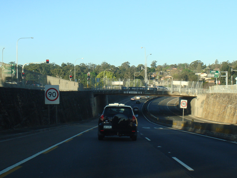
Pacific Motorway Entrance: Cumberland Hwy (Pennant Hills Rd) (A28) at the entrance to Pacific Mwy (M1) at Normanhurst, November 2013. Image © Paul Rands |
|||
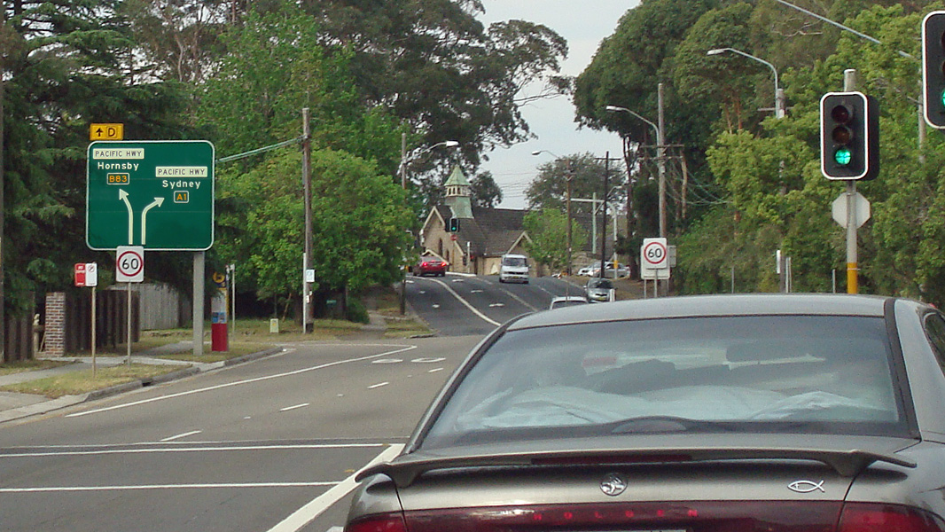 |
Advance Directional Sign: AD sign at Normanhurst approaching Thompsons Corner: Pacific Hwy (A1 and B83), November 2013. Image © Paul Rands |
|||
 |
Intersection Directional Sign: ID sign at the corner of Cumberland Hwy (Pennant Hills Rd) (A28) and Pacific Mwy (M1) at Normanhurst, November 2013. Image © Paul Rands |
|||
1 Schedule of Classified Roads and Unclassified Regional Roads, August 2013
2 Roads and Maritime Services, Projects, Building Sydney's Motorways, M2-F3, April 2004
3 Sam Laybutt (Ozroads)
4 Roads and Maritime Services, Western Sydney Better Roads, November 2010.
5 Roads and Maritime Services, Projects, Cumberland Highway, Wentworthville
6 Roads & Maritime Services, Media Releases, Cumberland Highway intersections providing traffic relief, 23 September 2016
7 Roads & Maritime Services, Media Releases, Improvement work continues on the Cumberland Highway at Cabramatta, 5 June 2017
8 Roads & Maritime Services, Intersection improvements on Cumberland Highway and Merrylands Road, Greystanes Project Update, April 2018
Last updated: 05-Jul-2020 11:38
This site © Paul Rands. All rights reserved. Some portions © (copyright) by their respective and credited owners. Permission must be obtained before using any images from this site. For details, please email by clicking here.