|
|
|
|
|
Statistics:
Route Numbering:
General Information:
Horse Park Drive is a major arterial road in the Gungahlin area, that consists of divided and undivided roadway and passes through residential, rural and parkland areas. It provides primary access to the Federal Highway and via it, the Hume Highway.
History:
This page concentrates on photos of the former alignment of Horse Park Drive
| Casey to Throsby | Throsby to Casey | |||
| Preview: | Description: | Preview: | Description: | |
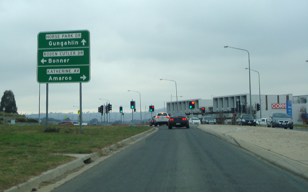 |
Advance Directional Sign: AD sign at Jacka, approaching Roden Cutler Dr and Katherine Av, June 2017. Image © Paul Rands |
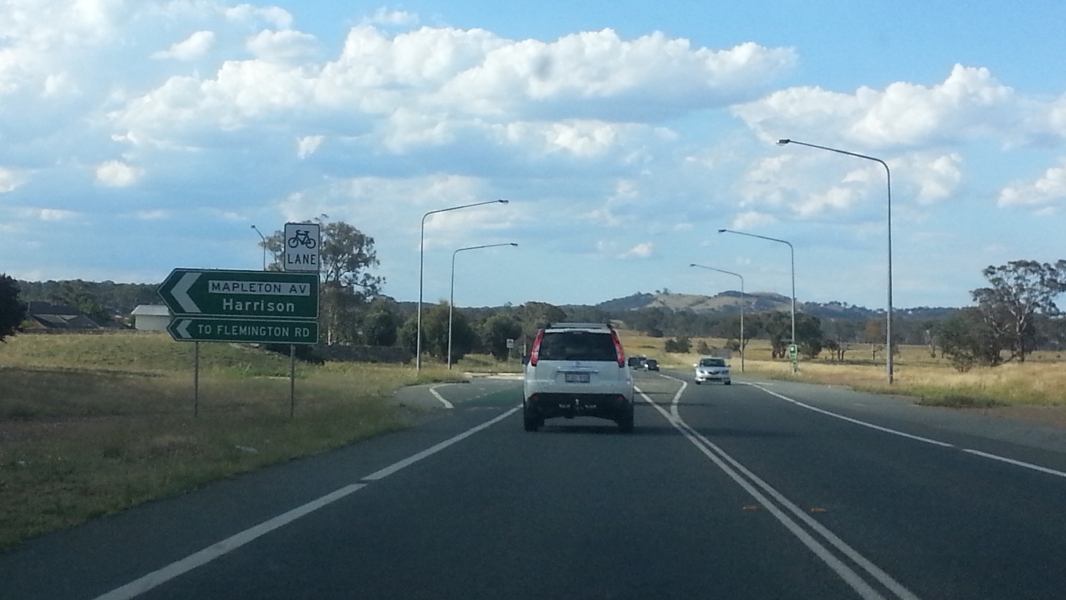 |
Mapleton Avenue : Horse Park Dr at the junction with Mapleton Av in Harrison, prior to duplication works, January 2015. Image © Paul Rands |
|
 |
Advance Directional Sign: AD sign at Bonner approaching Mulligans Flat Rd, June 2017. Image © Paul Rands |
 |
Advance Directional Sign : AD sign at Gungahlin, approaching Anthony Rolfe Av, prior to duplication, January 2015. Image © Paul Rands |
|
 |
Mulligans Flat Road: Corner of Horse Park Dr and Mulligans Flat Rd at Bonner, June 2017. Image © Paul Rands |
|||
 |
Francis Forde Boulevard: Corner of Horse Park Dr & Francis Forde Blvd at Forde, June 2017. Image © Paul Rands |
|||
 |
Advance Directional Sign: AD sign at Forde approaching David Walsh Av and Gundaroo Dr, July 2016. Image © Paul Rands |
|||
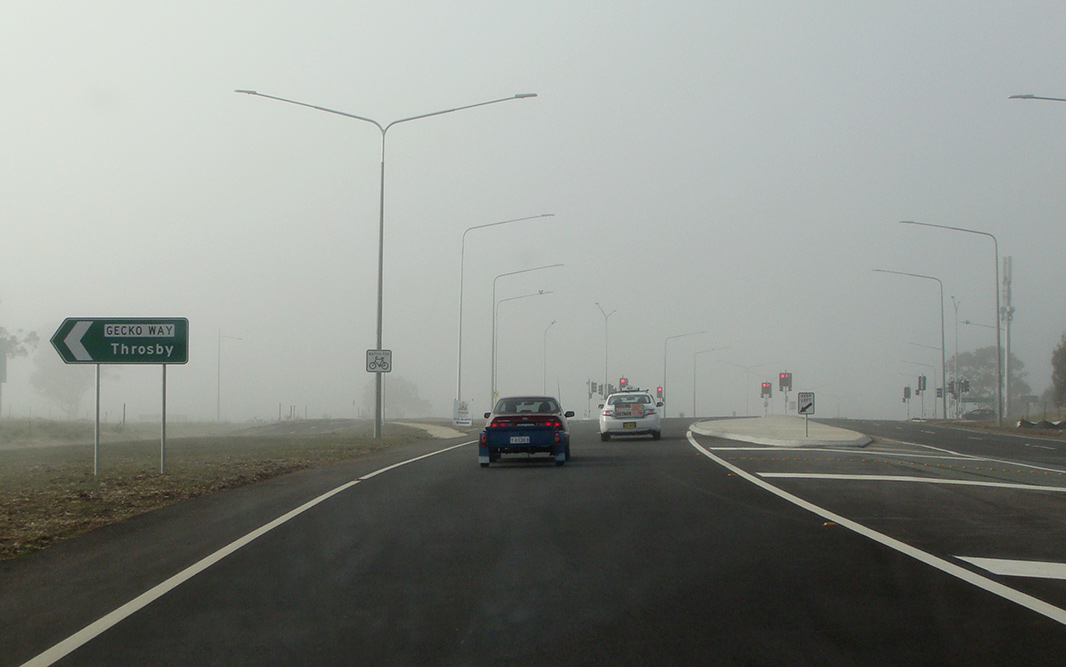 |
Gecko Way: Corner of Horse Park Dr and Gecko Way at Throsby, July 2016. Image © Paul Rands |
|||
 |
Advance Directional Sign: AD sign at Throsby approaching Well Stn Dr, July 2016. Image © Paul Rands |
|||
 |
Advance Directional Sign: AD sign at Throsby approaching Goorooyarroo Woodland Reserve, June 2017. Image © Paul Rands |
|||
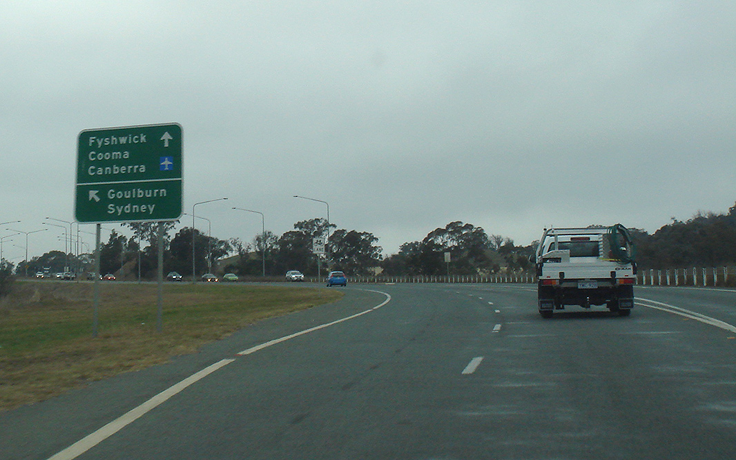 |
Advance Directional Sign: AD sign at Throsby approaching Federal Hwy (M23 / A23) and Majura Pkwy (M23), June 2017. Image © Paul Rands |
|||
1 ACT Auditor General's Office, Media Release, Performance Audit Report, Road Projects: Fairbairn Avenue Upgrade and Horse Park Drive (Gundaroo Drive to Federal Highway) Project, 24 February 2009
2 ACT Government, Media Releases, Horse Park Drive now complete, 15 July 2014
3 Land Development Agency, Horse Park Drive Upgrades
4 ACT Government, Media Releases, Horse Park Drive/Anthony Rolfe Ave intersection upgrade now complete, 7 June 2016
Last updated: 26-Jun-2020 14:17
This site © Paul Rands. All rights reserved. Some portions © (copyright) by their respective and credited owners. Permission must be obtained before using any images from this site. For details, please email by clicking here.