|
|
|
|
|
Statistics:
Route Numbering:
General Information:
Major routes Hindmarsh Drive intersects or conencts with include Tuggeranong Parkway, Yamba Drive, Jerrabomberra Avenune (former NR23), and Monaro Highway (A23).
Hindmarsh Drive is all dual carriageway, with 4 to 6 lanes for traffic and is used as a major cross city route from the Woden and Tuggeranong to connect to Queanbeyan and the eastern Canberra suburbs.
The route is named after John Hindmarsh (1782-1860), who was the first governor of South Australia, from 1836 to 1838. He was knighted in 1851. 1
History:
| Symonston to Phillip | Phillip to Symonston | |||
| Preview: | Description: | Preview: | Description: | |
 |
Symonston West: Sign announcing the suburb of Symonston West, August 2010. Image © Paul Rands |
 |
Athllon Drive & Callam Street Intersection: Intersection directional sign at the junction with Athllon Dr and Callam St in Phillip, August 2010. Image © Paul Rands |
|
 |
Advance Directional Sign: AD sign at Symonston West approaching the Jerrambomberra Avenue (former NR23) intersection, August 2010. Image © Paul Rands |
 |
Athllon Drive & Callam Street Intersection: Intersection directional sign at the junction with Athllon Dr and Callam St in Phillip, August 2010. Image © Paul Rands |
|
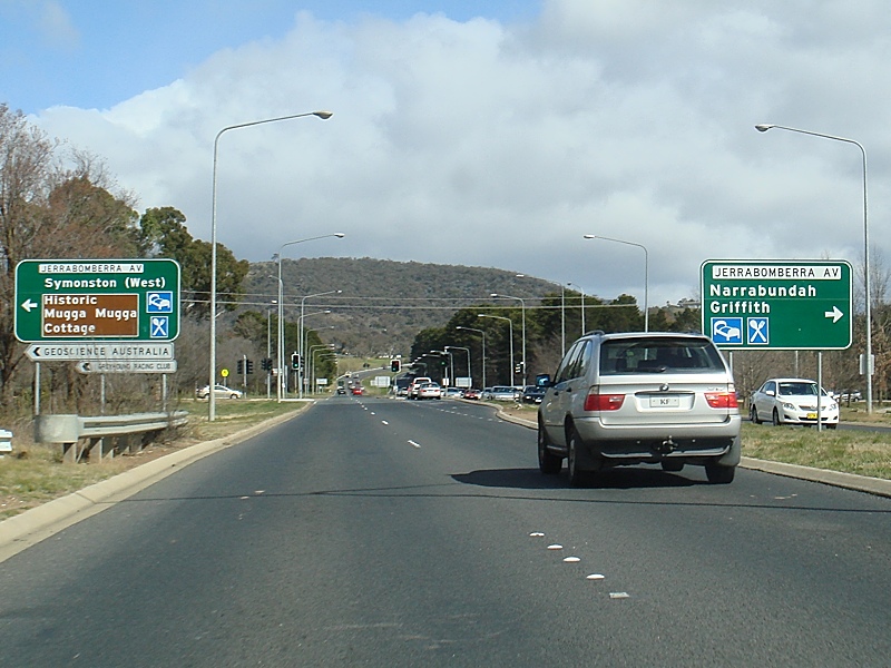 |
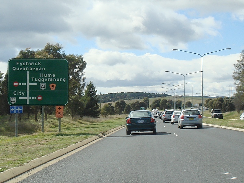
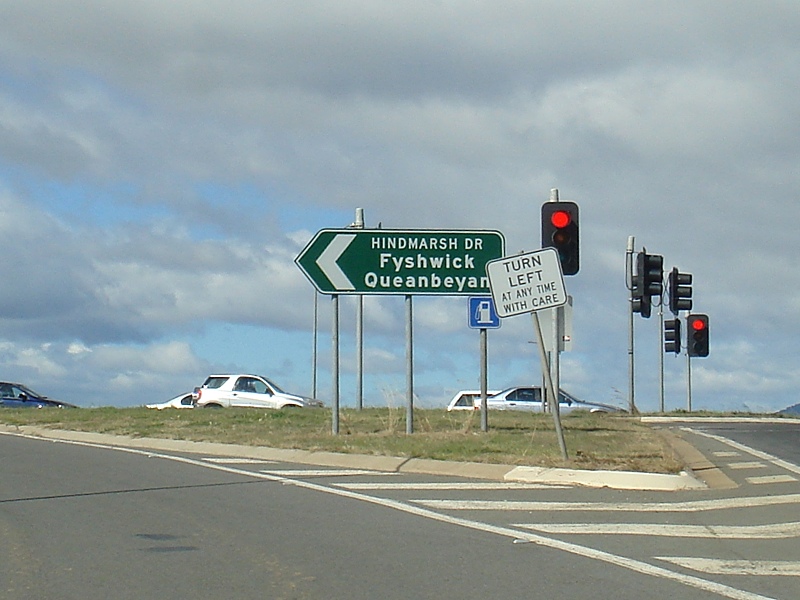
Jerrabomberra Avenue Intersection: Corner of Hindmarsh Drive and Jerrabomberra Avenue at Symonston West, August 2010. Jerrabomberra Avenue was once National Route 23, and also the eastern extremity of Hindmarsh Drive. Image © Paul Rands |
 |
Ainsworth Street: Intersection directional signs near the Ainsworth St junction in Phillip, August 2010. Image © Paul Rands |
|
 |
Advance Directional Sign: AD sign at Symonston West approaching Mugga Lane and Dalrymple Avenue, August 2010. Image © Paul Rands |
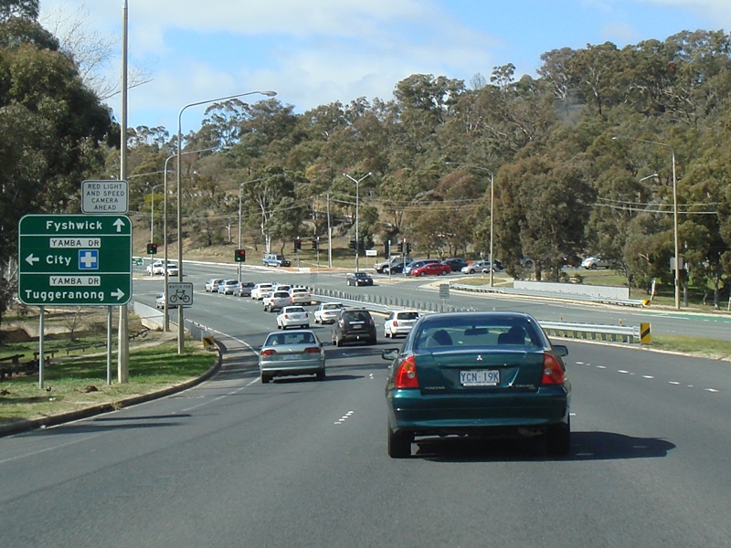 |
Advance Directional Sign: AD sign at Phillip approaching Yamba Dr, August 2010. Image © Paul Rands |
|
 |
Mugga Lane & Dalrymple Avenue Intersection: Hindmarsh Drive at Symonston West approaching Mugga Lane and Dalrymple Avenue, August 2010. Image © Paul Rands |
 |
Yamba Drive Intersection: Corner of Hindmarsh Dr & Yamba Dr at Phillip, August 2010. Image © Paul Rands |
|
 |
Symonston West: Hindmarsh Drive as it climbs between Davidson Hill and Mt Mugga Mugga, August 2010. Image © Paul Rands |
 |
Advance Directional Sign: AD sign on Yamba Dr approaching Hindmarsh Dr in Garran, July 2006. Image © Paul Rands |
|
 |
Entering Woden: Hindmarsh Dr as it enters the Woden district at O'Malley, August 2010. Phillip CBD is visible through the trees. Image © Paul Rands |
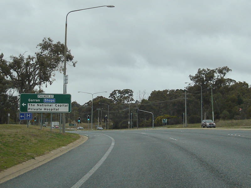 |
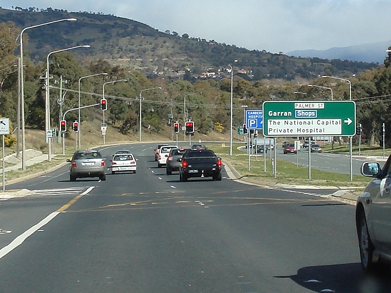
Advance Directional Sign: AD sign on Hindmarsh Dr at Garran approaching Palmer St, July 2006. Image © Paul Rands |
|
 |
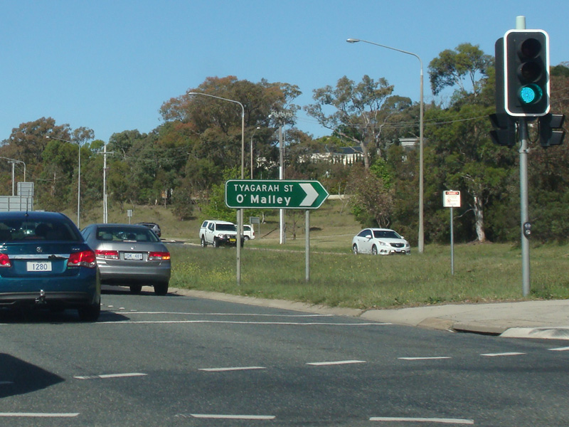
Tyagarah Street Junction: Corner of Hindmarsh Dr & Tyagarah St in O'Malley, August 2010. Image © Paul Rands |
 |
Tyagarah Street Intersection: Corner of Hindmarsh Dr & Tyagarah St in Garran, November 2013. Image © Paul Rands |
|
 |
Palmer Street Intersection: Corner of Hindmarsh Dr & Palmer St in O'Malley, August 2010. Image © Paul Rands |
 |
Climbing Red Hill: Eastbound at Garran as you head up Red Hill. July 2006. Image © Paul Rands |
|
 |
Advance Directional Sign: AD sign at O'Malley approaching Yamba Dr, August 2010. Image © Paul Rands |
 |
Speed Camera Signage: Typical ACT speed camera signage, eastbound at Garran, July 2006. Image © Paul Rands |
|
 |
Intersection Directional Sign: ID sign near Ainsworth St & Callum St at Phillip, in the locality of Swinger Hill, August 2010. Image © Paul Rands |
 |
Red Hill: Eastbound at Red Hill, at the turn off to Tamar Street which connects to Mugga Way, August 2010. Image © Paul Rands |
|
 |
Intersection Directional Sign: Image © Paul Rands |
 |
Handpainted Speed Limit Sign : Very rare handpainted speed limit sign, probably dating back to the 1970s, Red Hill, November 2013. Image © Paul Rands |
|
 |
Athllon Drive Intersection: Corner of Hindmarsh Dr & Athllon Dr at Phillip, August 2010. Image © Paul Rands |
 |
Red Hill: Hindmarsh Drive as it descends between Davidson Hill and Mt Mugga Mugga, August 2010. Image © Paul Rands |
|
 |
Advance Directional Sign: AD sign at Phillip approaching Melrose Dr, August 2010. Image © Paul Rands |
 |
Advance Directional Sign: AD sign at Red Hill approaching Dalrymple St and Mugga Ln, August 2010. Image © Paul Rands |
|
 |
Advance Directional Sign: Image © Paul Rands |
 |
Supplemental Advance Directional Sign: Supplemental AD sign at Red Hill approaching Dalrymple St and Mugga Ln, August 2010. Image © Paul Rands |
|
 |
Melrose Drive Intersection: Corner of Hindmarsh Dr & Melrose Dr at Phillip, August 2010. Image © Paul Rands |
 |
Intersection Directional Sign: ID sign at Red Hill at the junction with Dalrymple St & Mugga Ln, August 2010. Image © Paul Rands |
|
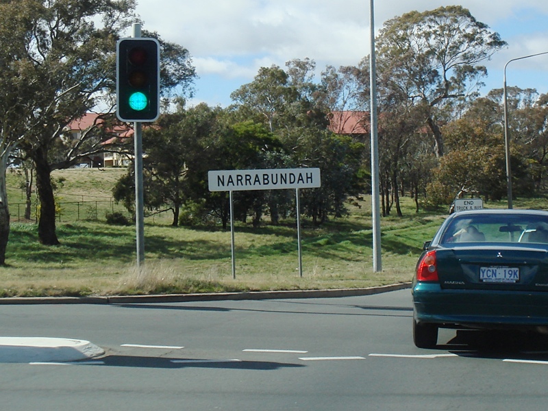 |
Entering Narrabundah: Hindmarsh Dr near Dalrymple St and Mugga Ln as it enters the suburb of Narrabundah, August 2010. Image © Paul Rands |
|||
 |
End Truck & Bus Low Gear Area: Hindmarsh Dr as the terrain flattens out at Narrabundah, August 2010. Image © Paul Rands |
|||
 |
Advance Directional Sign: AD sign approaching Jerrabomberra Av (former NR23) at Narrabundah, November 2013. Image © Paul Rands |
|||
 |
Jerrabomberra Avenue Junction: Corner of Hindmarsh Dr and Jerrabomberra Av at Narrabundah, November 2013. Image © Paul Rands |
|||
 |
Jerrabomberra Avenue Junction: Corner of Hindmarsh Dr and Jerrabomberra Av at Narrabundah, August 2010. Image © Paul Rands |
|||
 |
Advance Directional Sign: AD sign at Narrabundah approaching the Monaro Hwy (A23) interchange, August 2010. Image © Paul Rands |
|||
 |
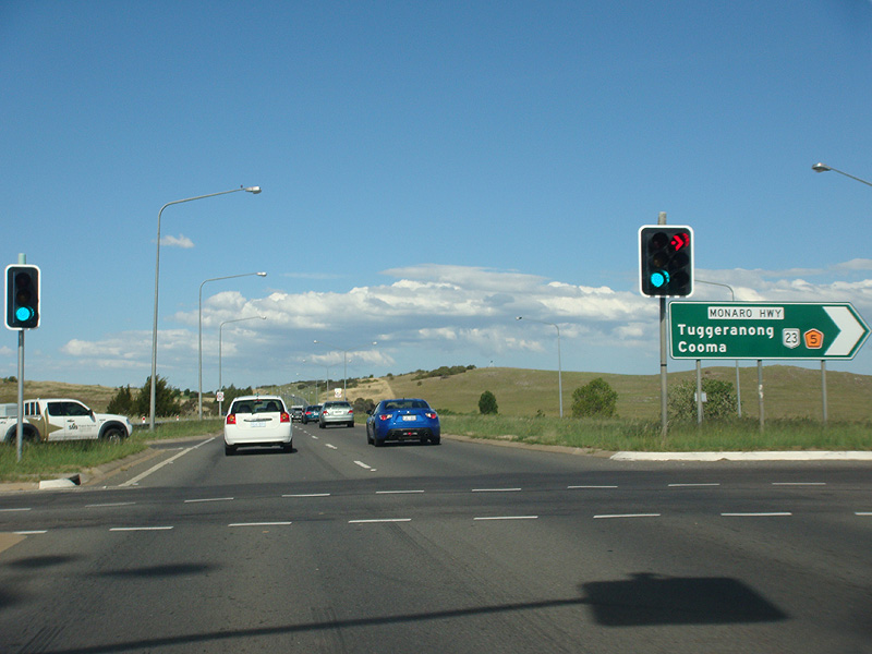
Monaro Highway Interchange: Corner of Hindmarsh Dr & Monaro Hwy (A23) at Narrabundah, August 2010. Image © Paul Rands |
|||
 |
Monaro Highway Interchange: Southbound at the corner of Hindmarsh Dr & Monaro Hwy (A23) at Symonston, August 2010. Image © Paul Rands |
|||
 |
Intersection Directional Sign : Corner of Hindmarsh Dr & Monaro Hwy (A23) at Symonston, August 2010. This is the eastern terminus of the unnumbered portion of Hindmarsh Dr. Image © Paul Rands |
|||
 |
Monaro Highway Interchange: Corner of Hindmarsh Dr & Monaro Hwy (A23) at Symonston, August 2010. This is the eastern terminus of the unnumbered portion of Hindmarsh Dr. Image © Paul Rands |
|||
| Click here for the continuation of Hindmarsh Drive between Phillip and Duffy Click here for the continuation of Hindmarsh Drive as B52 |
||||
1 ACT Planning & Land Authority, Place Name Search, Hindmarsh Drive
2 Canberra Times, Page 4, 13 December 1966
3 ACT Heritage Library, ImagesACT, Official opening of Hindmarsh Drive. Rt Hon John Douglas Anthony, 9 March 1967.
4 Canberra Times, Page 7, 5 October 1967
5 Canberra Times, Page 10, 28 March 1968
6 Canberra Times, Page 1, 4 March 1972
7 Canberra Times, Page 3, 21 November 1970
8 Canberra Times, Page 1, 3 May 1972
9 Canberra Times, Page 16, 5 July 1974
10 Canberra Times, Page 9, 6 February 1988
11 Canberra Times, Page 5, 22 November 1989
12 Chief Minister, Australian Capital Territory, Media Release, Opening of $900 000 Woden Valley On-Road Cycle Lane, 27 June 2005.
13 ACT Government, Transport Canberra and City Services, Guide Signs, Municipal Infrastructure Standards 12, April 2019
Last updated: 12-Aug-2020 23:39
This site © Paul Rands. All rights reserved. Some portions © (copyright) by their respective and credited owners. Permission must be obtained before using any images from this site. For details, please email by clicking here.