|
|
|
|
|
Statistics:
General Information:
Gungahlin Drive forms part of a major arterial route in Canberra's north, connecting the northern most suburbs with central and southern Canberra. It varies from single to dual carriageway and is one of the busier routes in the ACT. The route was built in several stages.
Gungahlin Drive from Kaleen to O'Connor was originally planned to be named John Dedman Parkway. 1
Gungahlin Drive is named after Gungahlin Homestead, built in 1862, which was sold to Edward Kendall Crace in 1877 and remained in the Crace family until it was resumed by the Commonwealth for the Federal Territory. 2
History:
This page covers Gungahlin Drive between Aranda and Palmerston, prior to duplication and amplification.
| Preview: | Description: |
 |
Belconnen Way: Caswell Drive where it becomes Gungahlin Drive at Belconnen Way at Bruce, November 2007. Image © Tim Cole |
 |
Bruce: Gungahlin Drive with 1 lane each near Bruce Stadium (now GIO Stadium) at Bruce, November 2007. Image © Tim Cole |
 |
Advance Directional Sign: AD sign at Bruce approaching Ginninderra Dr interchange, November 2007. Image © Tim Cole |
 |
Reassurance Directional Sign: Distance sign at Kaleen after the Ginninderra Dr interchange, November 2007. Image © Tim Cole |
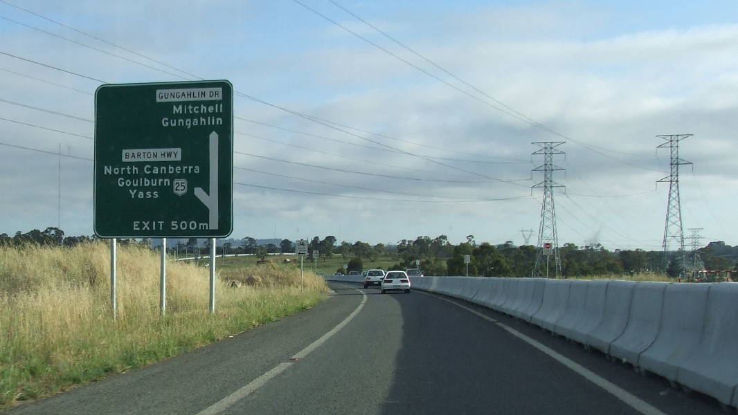 |
Advance Directional Sign: AD sign at Kaleen approaching Barton Hwy (NH25), November 2007. Note the incorrect route shield. Image © Tim Cole |
1 Legislative Assembly for the Australian Capital Territory, Proposals For the Gunghalin Drive Extension, February 2001
2 ACT Planning & Land Authority, Place Names Search, Gungahlin Drive
3 Gungahlin Drive Extension Stage 2 Website
Last updated: 19-Feb-2017 19:50
This site © Paul Rands. All rights reserved. Some portions © (copyright) by their respective and credited owners. Permission must be obtained before using any images from this site. For details, please email by clicking here.