|
|
|
|
|
Statistics:
Route Numbering:
General Information:
Belconnen Way is an arterial route links the suburbs located in the Belconnen district of the ACT with Civic.
It's a 2 to 3 lane wide road in each direction and is divided, similar to other arterial roads in the ACT.
The name for the route is derived from a name long associated with the area. It originally was the name of a pioneer's homestead and later of a rural district of the Australian Capital Territory. 1
History:

| O'Connor to Hawker | Hawker to O'Connor | |||
| Preview: | Description: | Preview: | Description: | |
 |
Intersection Directional Sign: ID sign at Belconnen Way and Barry Drive at O'Connor. November 2011. Image © Paul Rands |
 |
Intersection Directional Sign: ID sign on the roundabout of Kingsford Smith Dr and Belconnen Way at Scullin, January 2014. Image © Paul Rands |
|
 |
Kangaroo Crash Zone: Sign indicating high accident rates with cars and kangaroos, westbound at O'Connor, January 2010. Image © Paul Rands |
 |
Murranji Street: Corner of Belonnen Way and Murranji St at Scullin, January 2014. Image © Paul Rands |
|
 |
Advance Directional Sign: AD sign approaching the Gungahlin Drive / Caswell Drive interchange in Aranda, January 2010. Image © Paul Rands |
 |
Mackinolty Street: Corner of Belconnen Way and Mackinolty St at Scullin, January 2014. Image © Paul Rands |
|
 |
Intersection Directional Sign: ID sign at the Caswell Drive ramp at Aranda, January 2010. Image © Paul Rands |
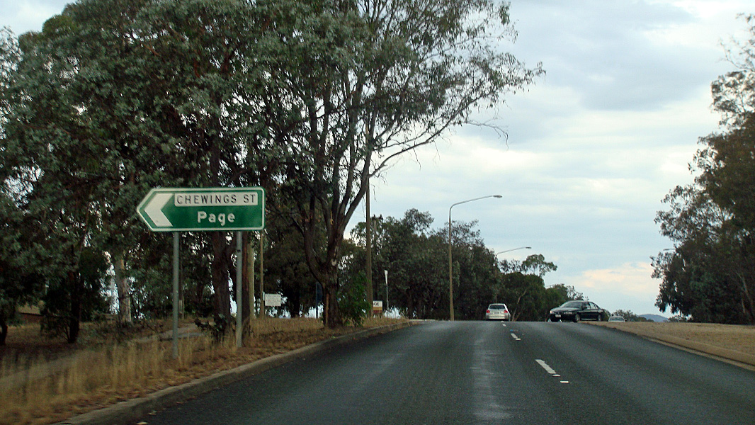 |
Chewings Street: Corner of Belconnen Way and Chewings St at Scullin, January 2014. Image © Paul Rands |
|
 |
Intersection Directional Sign: AD sign acting as an ID sign at the Caswell Drive ramp at Aranda, January 2010. Image © Paul Rands |
 |
Springvale Drive: Corner of Belconnen Way and Springvale Dr at Page, January 2014. Image © Paul Rands |
|
 |
Gungahlin Drive / Caswell Drive Interchange: Looking northwest at Aranda, January 2010. Image © Paul Rands |
 |
Shumack Street: Corner of Belconnen Way & Shumack St, Page, January 2014. Image © Paul Rands |
|
 |
Advance Directional Sign: AD sign at Aranda approaching the Haydon Drive intersection, January 2010. Image © Paul Rands |
 |
Petterd Street: Corner of Belconnen Way and Petterd St, Page, January 2014. Image © Paul Rands |
|
 |
Supplemental AD sign: Supplemental advance directional sign approaching the junction with Haydon Drive in Aranda, January 2010. Image © Paul Rands |
 |
Advance Directional Sign: AD sign approaching Coulter Dr, Page, January 2014. Image © Paul Rands |
|
 |
Haydon Drive Intersection: Intersection directional sign at the junction with Haydon Dr in Aranda, January 2010. Image © Paul Rands |
 |
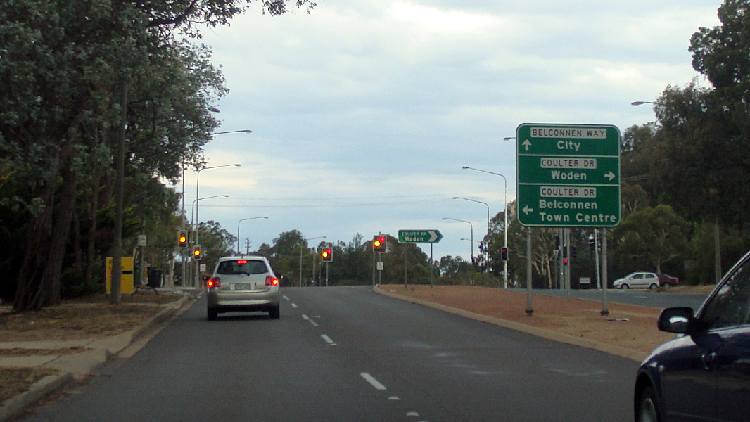
Coulter Drive: Corner of Belconnen Way and Coulter Dr, Page, January 2014. Image © Paul Rands |
|
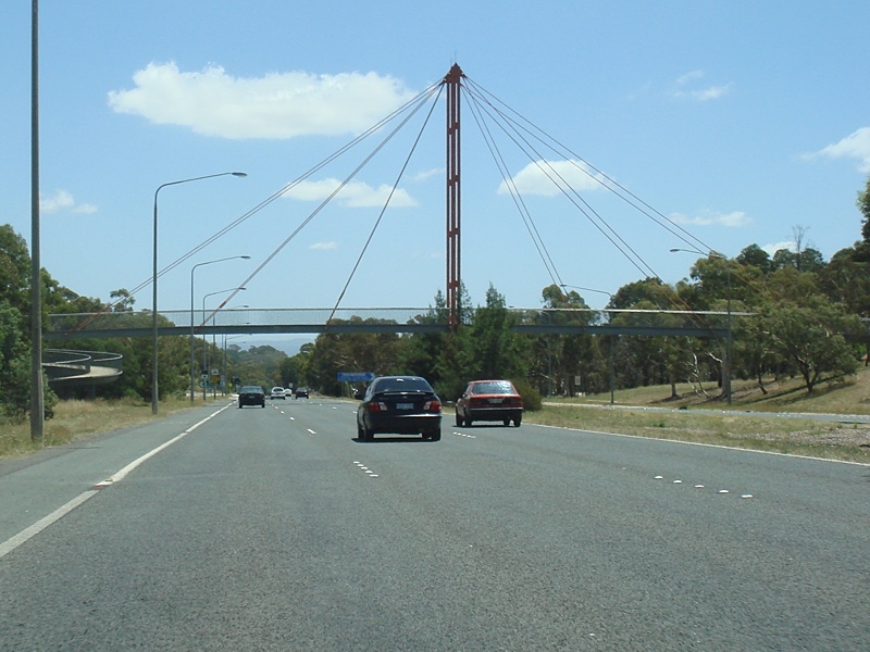 |
Suspension Footbridge: Suspension footbridge connecting Aranda playing fields with the suburb of Bruce, January 2010. Image © Paul Rands |
 |
Enterting Belconnen: Belconnen Way as it enters Belconnen, January 2014. Image © Paul Rands |
|
 |
Intersection Directional Sign: ID sign approaching Eastern Valley Way at Aranda, January 2010. Image © Paul Rands |
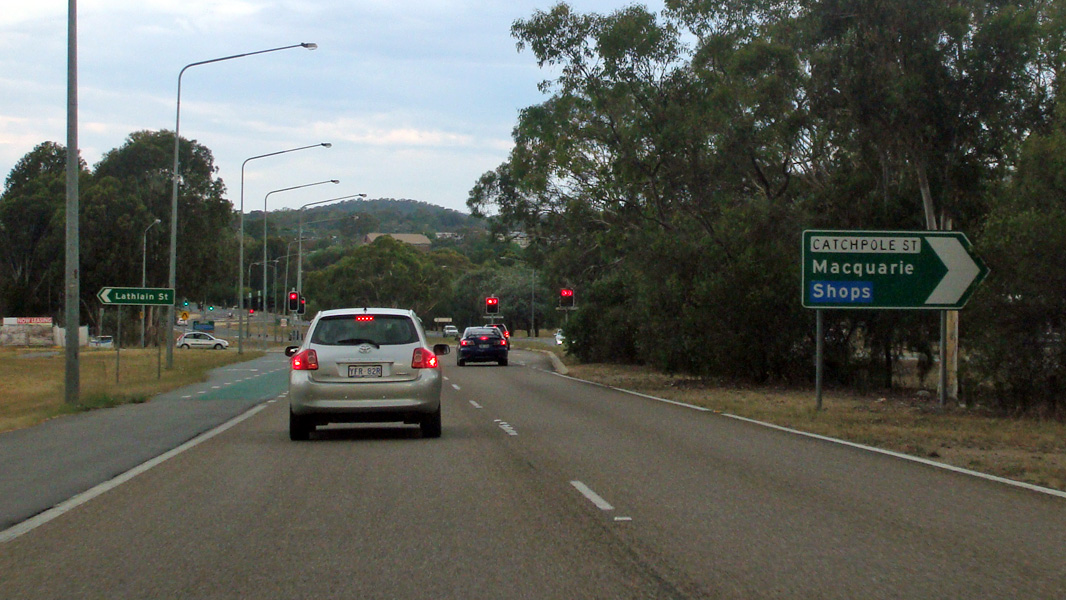 |
Lathlain St & Catchpole St: Belconnen Way at Belconnen at the junction with Lathlain and Catchpole Streets, January 2014. Image © Paul Rands |
|
 |
Intersection Directional Sign: ID sign approaching Bindubi Street at Aranda, January 2010. Image © Paul Rands |
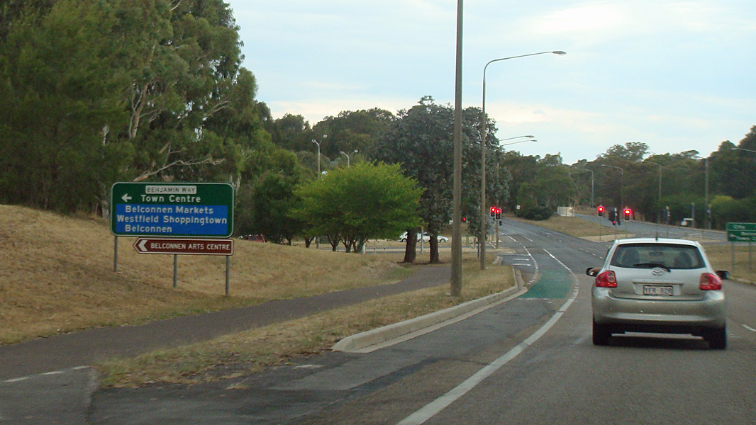 |
Advance Directional Sign: AD sign approaching Benjamin Way at Belconnen, January 2014. Image © Paul Rands |
|
 |
Intersection Directional Sign: ID sign approaching Benjamin Way at Macquarie, January 2010. Image © Paul Rands |
 |
Advance Directional Sign: AD sign approaching Eastern Valley Way & Bindubi St at Belconnen, January 2014. Image © Paul Rands |
|
 |
Benjamin Way Intersection: AD sign acting as an ID sign at the Benjamin Way intersection at Macquarie, January 2010. Image © Paul Rands |
 |
Eastern valley Way & Bindubi Street: Corner of Belconnen Way, Eastern Valley Way & Bindubi St, Belconnen, January 2014. Image © Paul Rands |
|
 |
Approaching Coulter Drive: ID sign as you enter the Coulter Drive intersection at Macquarie, January 2010. Image © Paul Rands |
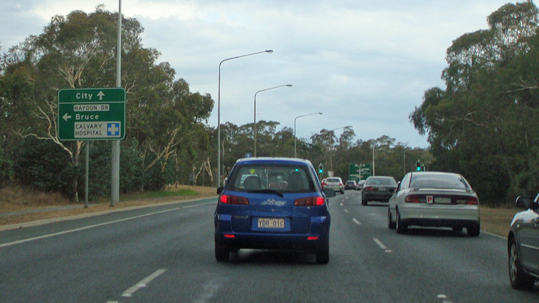 |
Advance Directional Sign: AD sign at Bruce approaching Haydon Dr, January 2014. Image © Paul Rands |
|
 |
Haydon Drive: Corner of Belconnen Way and Haydon Dr at Bruce, January 2014. Image © Paul Rands |
|||
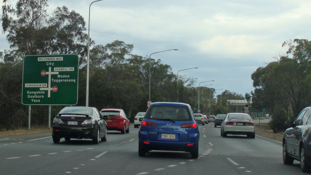 |
Advance Directional Sign: AD sign on Belconnen Way approaching Gungahlin Dr & Caswell Dr, January 2014. Image © Paul Rands |
|||
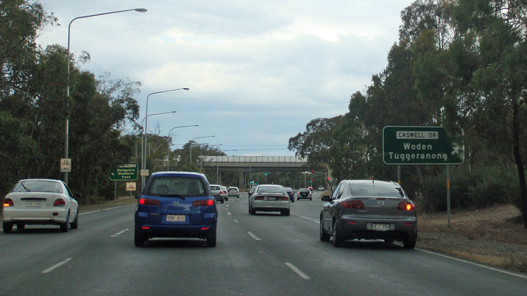 |
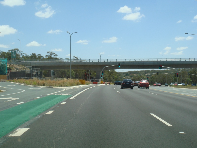
Gungahlin Drive & Caswell Drive: Belconnen Way at Bruce at the interchange with Gungahlin Dr and Caswell Dr, January 2014. Image © Paul Rands |
|||
 |
Gungahlin Drive & Caswell Drive: Belconnen Way at Bruce at the interchange with Gungahlin Dr and Caswell Dr, January 2014. Image © Paul Rands |
|||
 |
Advance Directional Sign: AD sign approaching the Barry Dr / Belconnen Way split at O'Connor, August 2010. Image © Paul Rands |
|||
 |
Barry Drive / Belconnen Way Junction: Belconnen Way as it meets Barry Drive in O'Connor, August 2010. Belconnen veers left and continues to Dryandra St and Macarthur Av. Image © Paul Rands |
|||
| Click here for the continuation of the route as Barry Drive | ||||
1 ACT Planning & Land Authority, Place Name Search, Belconnen Way
2 Legislative Assembly for the ACT, 2006 Week 9 Hansard (20 September), Page 2992
3 ACT Legislation Register, Planning Comments Invitation, 12 July 1996
4 ACT Territory & Municipal Services, Press Release, 13 November 2007, Belconnen Way Intersection - GDE Stage One Opening
Last updated: 27-Jan-2017 15:27
This site © Paul Rands. All rights reserved. Some portions © (copyright) by their respective and credited owners. Permission must be obtained before using any images from this site. For details, please email by clicking here.