|
|
|
|
|

|
Parliamentary Triangle Loop (Tourist Drive 1) (Decommissioned) |
Statistics:
Route Numbering:


General Information:
ACT Tourist Drive 1 traversed arguably some of Australia's most important buildings and icons, all featured in the Canberra's Parliamentary Triangle. Buildings and landmarks include Parliament House, ANZAC Parade leading to the Australian War Memorial, some international embassies, and much more.
The route crosses Lake Burley Griffin twice, and is based on Walter Burley Griffin's original plan (albeit modified) for the capital, tracing the land axis formed by Capital Hill, Black Mountain Vernon (City) Hill and Mount Ainslie, which is one of the most prominent features of his design. For details and sketches of the plan, click here.
History:

| Capital Hill to Campbell | Campbell to Capital Hill | |||
| Preview: | Description: | Preview: | Description: | |
 |
Advance Directional Sign: AD sign at Parkes approaching National Cct (TD5) and Queen Victoria Tce, March 2017. Image © Paul Rands |
 |
Lake Burley Griffin: Kings Av (TD1) as it crosses Kings Avenue Bridge over Lake Burley Griffin at Barton, June 2013. Image © Paul Rands |
|
 |
Advance Directional Sign: AD sign on Queen Victoria Tce approaching National Cct (TD5) and Kings Av (TD1) at Parkes, June 2013. Image © Paul Rands |
 |
Advance Directional Sign: AD sign on Kings Av (TD1) approaching Bowen Pl interchange at Barton, June 2013. Image © Paul Rands |
|
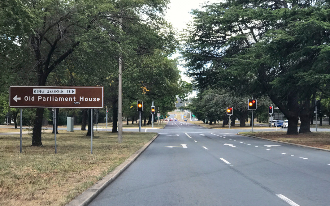 |
Advance Directional Sign: AD sign on Kings Av (TD1) at Parkes approaching King George Tce and Macquarie St, March 2017. Click here for a photo of this locaiton by Paul Rands from June 2013. Image © Paul Rands |
 |
Advance Directional Sign: AD sign on Kings Av (TD1) at Barton approaching King George Tce and Macquarie St, June 2013. Image © Paul Rands |
|
 |
Advance Directional Sign: AD sign on Kings Av (TD1) at Parkes approaching King Edward Tce (TD1) and Blackall St, March 2017. Image © Paul Rands |
 |
Advance Directional Sign: AD sign on Kings Av (TD1) approaching National Cct (TD5) and Queen Victoria Tce at Barton, June 2013. Image © Paul Rands |
|
 |
Supplemental Advance Directional Sign: Supplemental AD sign on Kings Av (TD1) at Parkes approaching King Edward Tce (TD1) and Blackall St, March 2017. TD1 travels both straight and left at this junction. Image © Paul Rands |
 |
King Edward terrace: Looking northwest on King Edward Terrace (TD1) at Parkes, near the intersection of Mall Road West, July 2006. Image © Paul Rands |
|
 |
Lake Burley Griffin: Kings Av (TD1) as it crosses Kings Avenue Bridge over Lake Burley Griffin at Parkes, June 2013. Image © Paul Rands |
 |
Advance Directional Sign: AD sign on Kings Av (TD1) at Barton, approaching State Circle (NR23), June 2013. TD1 continues straight at this intersection. Image © Paul Rands |
|
 |
Advance Directional Sign: AD sign on Kings Av (TD1) at Parkes approaching Wendouree Dr, March 2017. Image © Paul Rands |
|||
 |
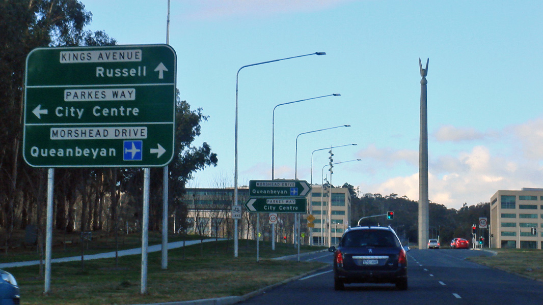
Advance Directional Sign: AD sign on Kings Av (TD1) at Parkes approaching Parkes Way, March 2017. Click here for a photo of this locaiton by Paul Rands from June 2013. Image © Paul Rands |
|||
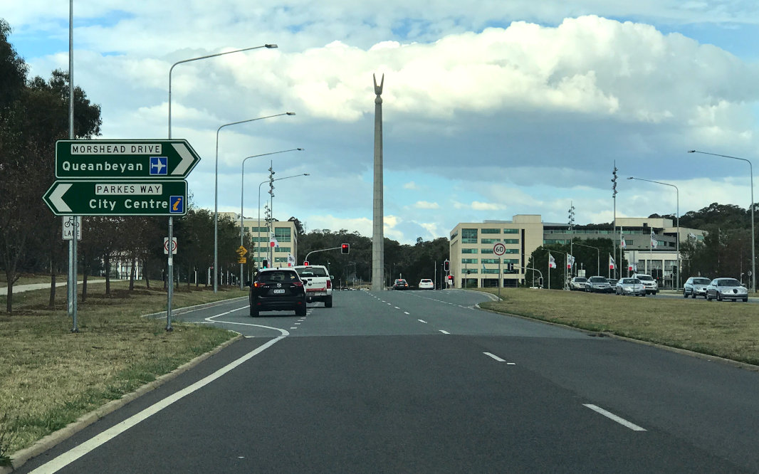 |
Parkes Way Interchange: Kings Av (TD1) at the Parkes Way interchange at Parkes, March 2017. Click here for a photo of this locaiton by Paul Rands from June 2013. Prior to the construction of the interchange, a roundabout controlled traffic at this junction. Image © Paul Rands |
|||
1 National Library of Australia
2 ACT Heritage Library
Last updated: 27-Jun-2020 0:58
This site © Paul Rands. All rights reserved. Some portions © (copyright) by their respective and credited owners. Permission must be obtained before using any images from this site. For details, please email by clicking here.